The best running trails around Laußnitzer Heide
4.4
(384)
3,249
runners
314
runs
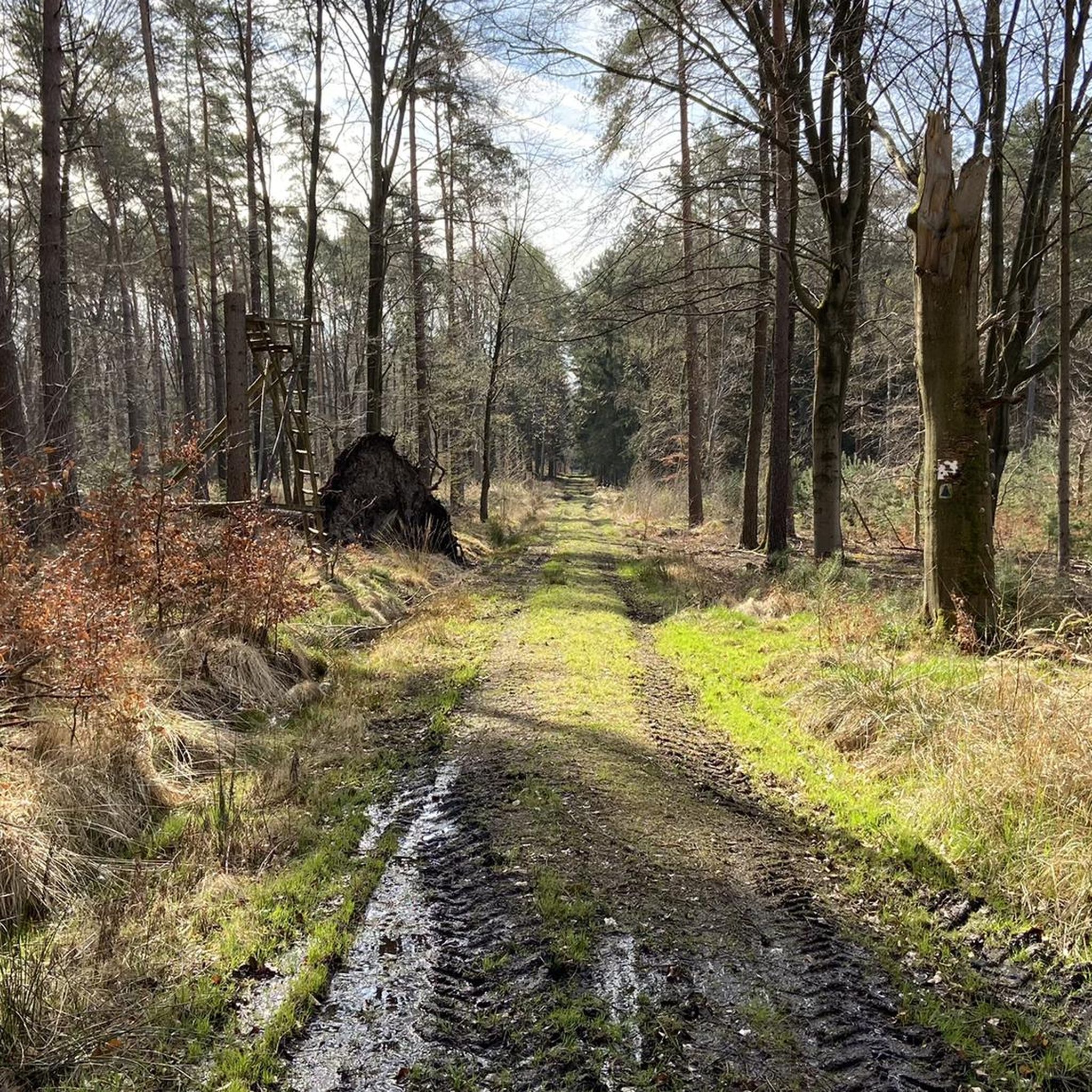
Jogging routes around Laußnitzer Heide offer diverse landscapes within this ancient forest area in Saxony. The region features varied terrain, with rolling hills characterizing the western part and predominantly flat swampland in the eastern section. Elevations range from approximately 160 meters to over 200 meters, providing options for different running preferences. The forest is composed primarily of pine, spruce, and larch, with some deciduous trees and moor areas.
Best jogging routes around Laußnitzer Heide
- The most popular jogging route is…
Last updated: June 25, 2026
7
runners
5.71km
00:35
20m
20m
Moderate run. Good fitness required. Mostly paved surfaces. Suitable for all skill levels.
5.0
(1)
4
runners
6.20km
00:39
20m
20m
Moderate run. Good fitness required. Mostly paved surfaces. Suitable for all skill levels.

Sign up for free
4.0
(1)
5
runners
6.64km
00:41
30m
30m
Moderate run. Good fitness required. Mostly paved surfaces. Suitable for all skill levels.
4
runners
5.98km
00:39
30m
30m
Moderate run. Good fitness required. Mostly paved surfaces. Suitable for all skill levels.
3
runners
Moderate run. Good fitness required. Mostly paved surfaces. Suitable for all skill levels.
Get access to more routes and recommendations from other explorers.
Sign up for free
Already have an account?
Our route recommendations are based on thousands of hikes, rides, and runs completed by other people on komoot.
Start today with a free account
Your next adventure awaits.
Login or Signup
Tips from the Community

Looks like a nice little toboggan hill. And up on the bench you could drink hot tea.
0
0

Very nice rest area with a covered hut and fireplace
0
0

Beautiful landscape impressions on the way and also a few "mountains"
1
0

Text follows from home
0
2
Always a nice run through the middle of the heath.
1
0
A beautiful, slightly mountainous path through the Laußnitzer Heide with small highlights along the way.
1
0

A wonderful place to picnic and relax.
0
0

A nice quiet resting place in the middle of the Laussnitzer Heide.
0
0
Frequently Asked Questions
How many running routes are available in Laußnitzer Heide?
Laußnitzer Heide offers a wide selection of running trails, with over 320 routes available on komoot. These range from easy paths to more challenging runs, catering to various fitness levels.
What kind of terrain can I expect when running in Laußnitzer Heide?
The terrain in Laußnitzer Heide is quite diverse. The western part features rolling hills, while the eastern section is characterized by predominantly flat swampland. Elevations vary from around 160 meters to over 200 meters, offering both challenging ascents and relaxed, flat sections. The forest consists mainly of pine, spruce, and larch, with some deciduous trees and moor areas, providing a scenic environment.
Are there easy running trails suitable for beginners or families?
Yes, Laußnitzer Heide has 41 easy running routes, perfect for beginners or families. Many trails follow well-trodden paths, such as the Running loop from Gewerbepark Laußnitz-Süd, which is a moderate 3.5-mile (5.7 km) trail that can be completed in about 35 minutes. The Walberberg Loop, mentioned in regional research, is also an easier route with minimal elevation changes.
Are there more challenging routes for experienced runners?
Absolutely. For experienced runners seeking a challenge, there are 30 difficult routes in Laußnitzer Heide. The regional research mentions the 'Buchbergweg' as the longest and most challenging route, winding through beautiful beech stands and offering detours to historical monuments and ancient trees. You can also find moderate routes like the Heide-Buchberg Loop – Bärentritt Hut loop from Ottendorf-Okrilla Nord, which covers over 12 km with significant elevation changes.
What do other runners say about the trails in Laußnitzer Heide?
The running routes in Laußnitzer Heide are highly regarded by the komoot community, with an average rating of 4.4 stars from over 350 reviews. More than 3000 runners have explored the area, often praising the peaceful forest environment, diverse landscapes, and well-maintained paths.
Are there any interesting landmarks or sights to see while jogging?
Yes, Laußnitzer Heide is rich in natural and cultural landmarks. You can encounter historical 'Wegsäulen' (way pillars) like the prominent Wolf Column and the Green Column. The 'Kulturdenkmale der Laußnitzer Heide' tour specifically guides visitors past cultural monuments. Other points of interest include the Historic Triangulation Column Buchberg and the Stone Arch Bridge Over the Mittelwasser.
Can I find circular running routes in the area?
Yes, many of the running routes in Laußnitzer Heide are circular, allowing you to start and end at the same point. Examples include the Lasberg loop from Kammergutswiesen and the Heide-Buchberg Loop loop from Gewerbepark Laußnitz-Süd. The 'Walberberg Loop' is also noted as an easier circular route.
Are the running trails in Laußnitzer Heide dog-friendly?
Laußnitzer Heide is a popular destination for outdoor activities, and many trails are suitable for dogs. As a landscape protection area, it's generally welcoming for dogs, but always ensure your dog is under control, especially near wildlife, and check for any specific local regulations or signage regarding leash requirements.
What are the options for parking near the running trails?
While specific parking areas aren't detailed in the guide, the presence of routes starting from 'Gewerbepark Laußnitz-Süd' and 'Ottendorf-Okrilla Nord' suggests designated parking facilities are available at these common trailheads. Look for signs indicating public parking areas near the main access points to the Heide.
How can I access the running routes using public transport?
The guide mentions routes starting from locations like 'Gewerbepark Laußnitz-Süd' and 'Kammergutswiesen', which are likely accessible via local public transport. For detailed information on bus or train connections to these starting points, it's best to consult local public transport schedules for the Laußnitz and Ottendorf-Okrilla areas.
What is the best time of year to go running in Laußnitzer Heide?
Laußnitzer Heide offers a great running experience year-round. Spring and autumn provide pleasant temperatures and beautiful foliage. Summer is ideal for early morning or late afternoon runs to avoid the heat, while winter can offer serene, snow-covered landscapes, though some trails might be more challenging due to conditions. The diverse forest composition ensures scenic beauty in any season.
Are there any places to stop for refreshments or accommodation near the trails?
The regional research highlights the tranquility of Laußnitzer Heide, suggesting it's less crowded. While the guide doesn't specify cafes or pubs directly on the trails, areas like Ottendorf-Okrilla and Laußnitz, where some routes begin, are likely to have local establishments for refreshments and potentially accommodation options.
Most popular routes around Laußnitzer Heide
Most popular attractions around Laußnitzer Heide

Get inspired with the komoot mobile app


Explore more
Browse the best Running Trails & Routes in other regions.
