The best running trails around Hayeswater
4.6
(45)
4,697
runners
137
runs
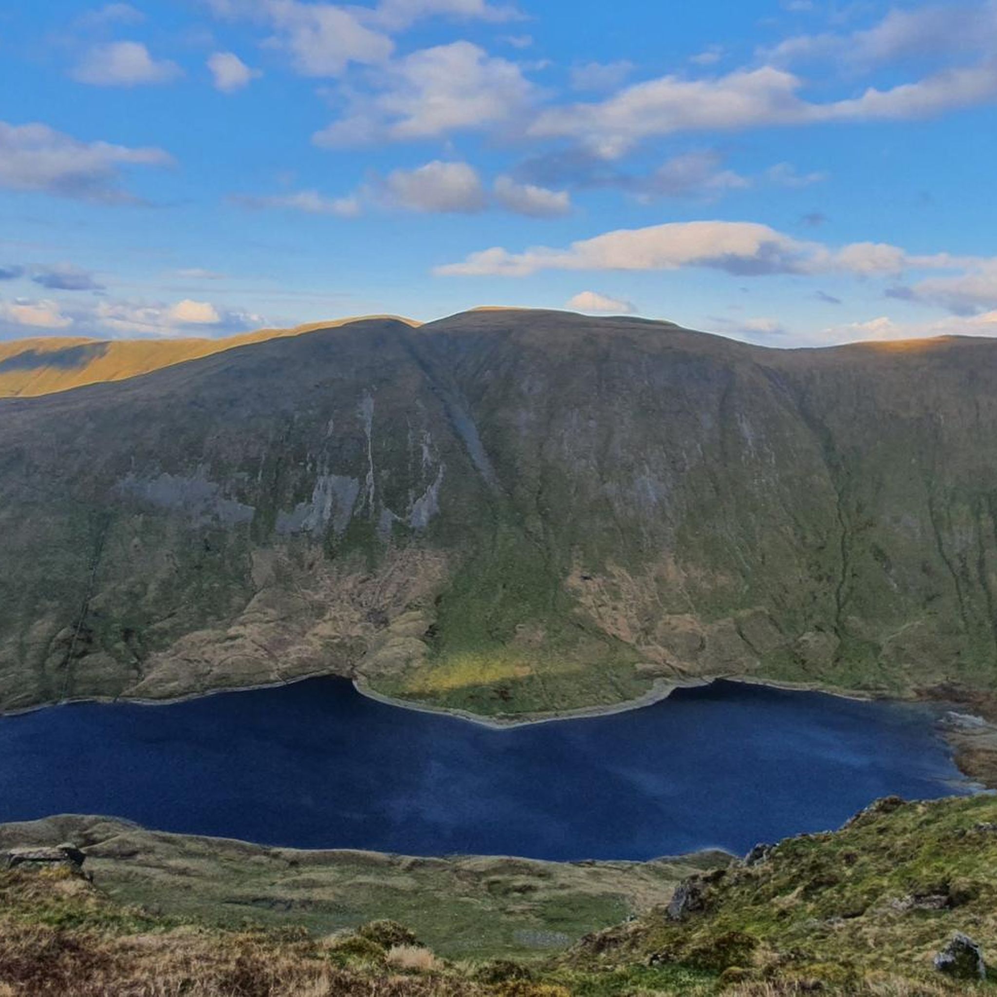
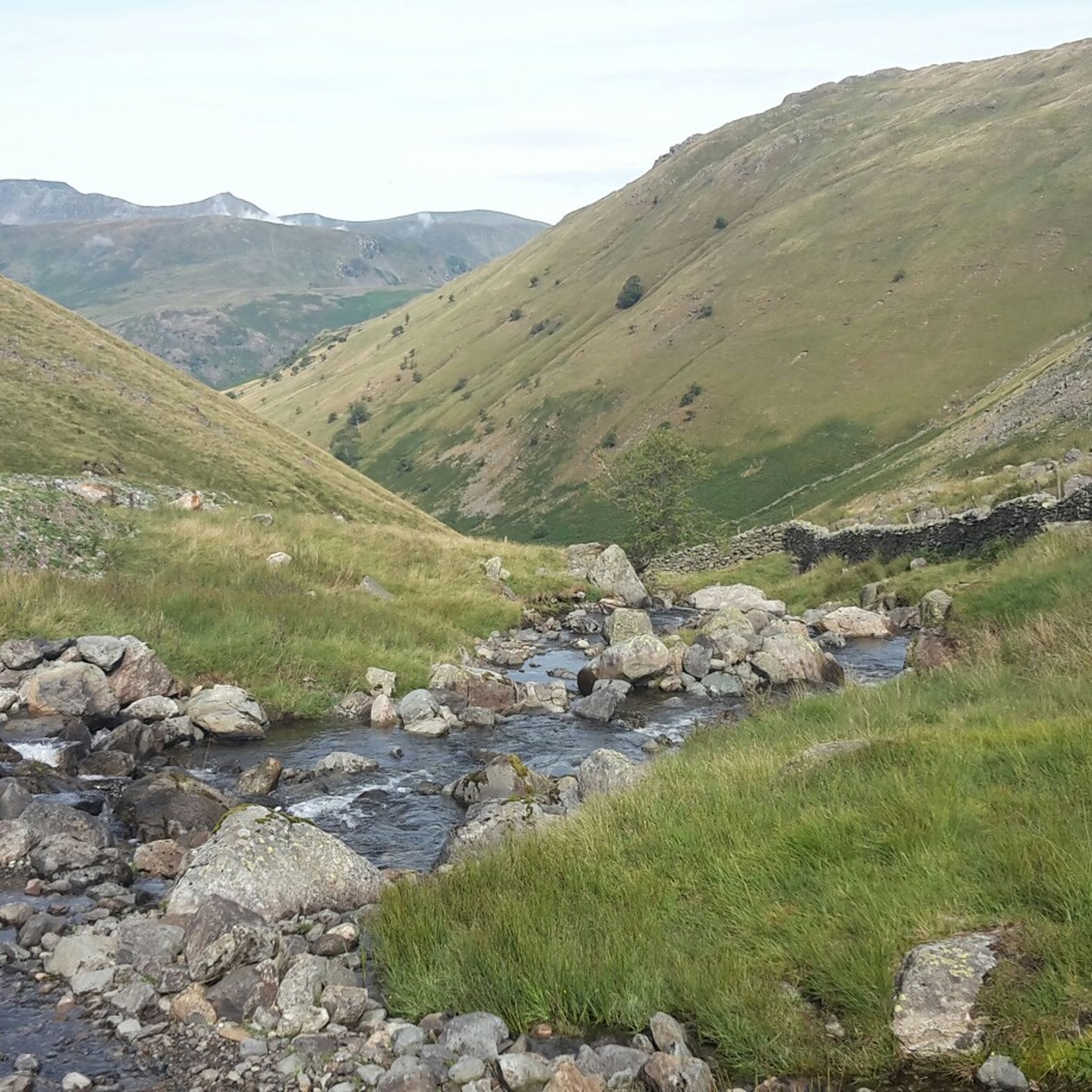
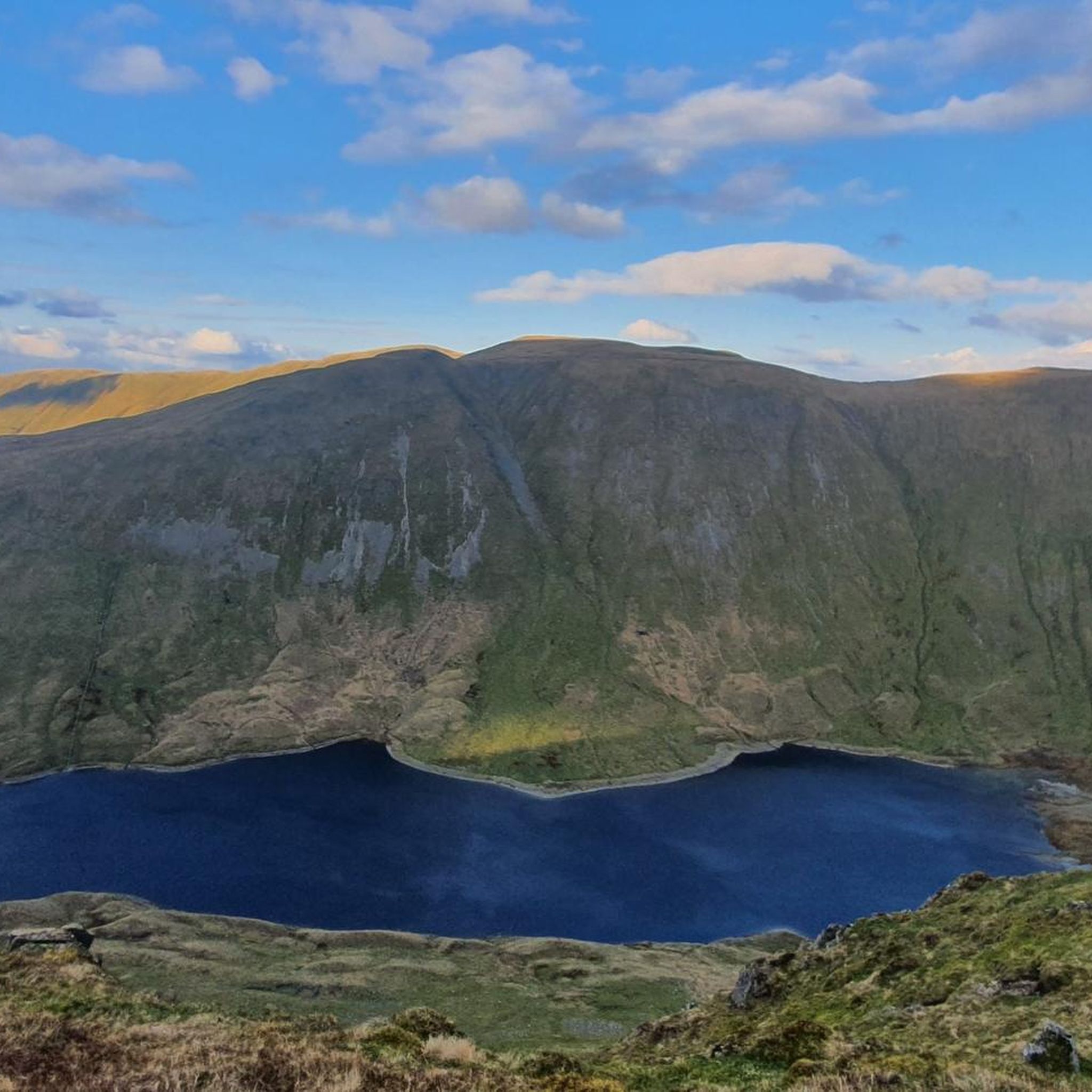
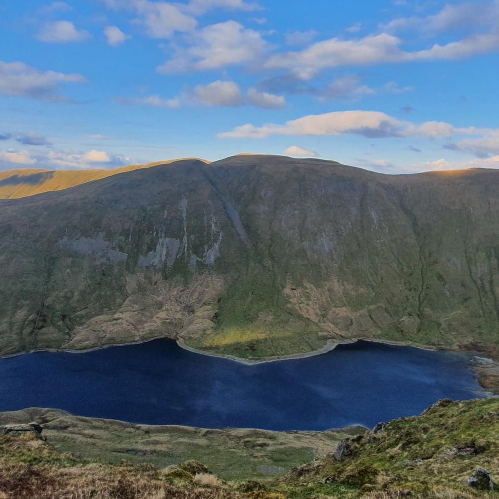
Jogging around Hayeswater offers a diverse landscape characterized by a glacial tarn, surrounding fells, and the Hayeswater Gill. The area features undulating, grass-covered moraine and significant elevation changes, providing a challenging backdrop for runners. Trails vary from gravel tracks to rugged, uneven paths and steep climbs, catering to different fitness levels. This region in the Lake District provides a blend of natural beauty and varied terrain for running.
Best jogging routes around Hayeswater
- The most popular jogging route is High…
Last updated: July 5, 2026
31
runners
Hard run. Very good fitness required. Sure-footedness, sturdy shoes and alpine experience required.
33
runners
9.82km
01:27
470m
470m
Hard run. Very good fitness required. Sure-footedness, sturdy shoes and alpine experience required.

Sign up for free
5.0
(1)
23
runners
16.6km
03:11
1,180m
1,180m
Hard run. Very good fitness required. Sure-footedness, sturdy shoes and alpine experience required.
24
runners
20.4km
03:53
1,410m
1,420m
Hard run. Very good fitness required. Sure-footedness, sturdy shoes and alpine experience required.
17
runners
8.02km
01:13
400m
400m
Hard run. Very good fitness required. Sure-footedness, sturdy shoes and alpine experience required.
Get access to more routes and recommendations from other explorers.
Sign up for free
Already have an account?
Our route recommendations are based on thousands of hikes, rides, and runs completed by other people on komoot.
Start today with a free account
Your next adventure awaits.
Login or Signup

Tips from the Community

We did the loop from Hartsop over The Knott, High Street, Thornthwaite Crag and back through the Pasture Beck valley. (12 km)
0
0

High Hartsop Dodd is not really a mountain summit. It is the tail end of a marvellous ring of Wainwrights if you have been doing the Dovedale Round. There are fine views from here across to Hartsop Dodd itself and over Brothers Water. It has a small cairn on its smooth broad summit.
0
0
Middle Dodd is a great little Wainwright, and it is really just a minor summit on the north ridge of Red Screes. It has a fine pyramidal peak when seen from Brother's Water area, and if you are coming down from Red Screes, you won't have much of a problem getting to it. There are great views down towards Patterdale and Ullswater from here.
0
0
Red Screes, at a rocky 776 meters (2,546 feet), is famous for its steep approach from Red Screes. It's a good, stiff walk and can be a bit hands-on here and there, but the trail is good and well marked. It has a trig point and a stone shelter at the summit. It is wise to be careful here in poor visibility, as the drops are severe. I would make a comment about the views, but I couldn't see much today.
0
0
Kirkstone Pass, at 454 metres (1,489 feet), is the highest mountain pass in the Lake District that is open to vehicular traffic. It is a gorgeous pass, flanked by Red Screes and St Ravens Edge. It connects Ambleside via 'The Struggle' to Patterdale. It also connects Troutbeck to Patterdale on the A592, though this is closed due to a landslide at the moment (May 2026). The pub is great and normally opens at midday on weekdays, and there is a large public car park just across the road. This can be a great starting point for a variety of treks, but you are in for a sharp, stiff ascent to start off with whichever flanking hill you decide to ascend.
0
0
Pike How sits between Stoney Cove Pike and St Ravens Edge. There is a small cairn here, and it sits along a broad but beautiful ridge that can take you from Harstop Dodd all the way to Kirkstone Pass. You have great views towards Red Screes from here too.
0
0
Dove Crag summit is quite unassuming, just a small cairn on a rocky ledge, but it offers a good vantage point with super nice expansive views over the eastern fells and back towards High Pike. It is quite a walk to get here from Ambleside; most do it as part of the Fairfield Horseshoe, but it is well worth it for the views. It is also famous for the hidden Priest Hole Cave located on its steep eastern cliff face.
0
0
Thornthwaite Crag is just the coolest Wainwright. At 784 m / 2,572 ft, it is a prominent summit in its own right, but with its massive 14-foot (4.3-metre) high stone beacon, it serves as a navigation hub connecting several major valleys and ridges. It is unmistakable for miles around and makes a good aiming point for runners and hikers alike.
0
0
Frequently Asked Questions
How many running routes are available around Hayeswater?
There are over 140 running routes around Hayeswater, offering a wide variety of options for different fitness levels and preferences. You'll find everything from easier loops to challenging fell runs.
What kind of terrain can I expect on the running trails near Hayeswater?
The terrain around Hayeswater is quite diverse, ranging from gravel tracks to more rugged, uneven paths and steep climbs. You'll encounter undulating, grass-covered moraine and significant elevation changes, providing an engaging experience for runners. The area is characterized by its glacial tarn, surrounding fells, and the Hayeswater Gill.
Are there any easy or beginner-friendly running routes in the Hayeswater area?
Yes, there are a few easier running routes available. For instance, the Running loop from Brothers Water is an easy 2.5-mile (4.0 km) trail that takes about 25 minutes to complete, offering a scenic experience around Brothers Water.
Can I find circular running routes around Hayeswater?
Many of the routes in the Hayeswater area are circular, allowing you to start and finish in the same location. A popular example is the High Street and The Beacon loop from Hartsop, which is a 6.8-mile (10.9 km) circular trail offering panoramic views.
What are some notable natural features or viewpoints I might see while running near Hayeswater?
While running around Hayeswater, you'll encounter stunning natural features like the glacial tarn itself, nestled between The Knott and Gray Crag. The Hayeswater Gill, with its waterfalls, is also a scenic highlight. From various points on the trails, you can enjoy panoramic views of the eastern Lake District, including glimpses of Brothers Water and Ullswater.
Are there any historical landmarks along the running routes?
Yes, the area has historical significance. Parts of the running routes, such as the High Street and The Beacon loop from Hartsop, follow sections of an ancient Roman road. You can also discover traces of local mining and milling history, particularly along routes leading up Hayeswater Gill from Hartsop village.
What do other runners say about the trails in Hayeswater?
The running routes in Hayeswater are highly rated by the komoot community, with an average score of 4.5 stars from over 47 reviews. Runners often praise the diverse terrain, the challenging fells, and the tranquil, picturesque environment that makes for an immersive outdoor experience.
Is public transport available to reach the starting points of these running routes?
Hartsop village, a common starting point for many runs around Hayeswater, is accessible by public transport during certain seasons. Connections are available from larger towns like Penrith and Windermere, making it possible to reach the area without a car.
Are there any challenging routes for experienced runners?
Absolutely. Many routes in Hayeswater are classified as difficult, featuring significant elevation gains and rugged paths. For example, the Angle Tarn – Calf Close loop from Hartsop is a difficult 6.1-mile (9.8 km) path that winds through the fells, offering a demanding run with substantial climbs.
What is the best time of year to go running around Hayeswater?
The Lake District offers beautiful scenery year-round. However, for running, spring and autumn often provide the most pleasant conditions with cooler temperatures and vibrant landscapes. Summer can be warm, while winter runs require appropriate gear due to potentially challenging weather and icy conditions on higher fells.
Are dogs allowed on the running trails near Hayeswater?
Generally, dogs are welcome on public footpaths and trails in the Lake District. However, it's crucial to keep dogs under close control, especially in areas with livestock, and to follow the Countryside Code. Always check specific route details or local signage for any restrictions.
What kind of wildlife might I spot while running in the Hayeswater area?
Hayeswater is home to wild brown trout and Loch Leven trout in the tarn itself. If you're lucky and observant, you might occasionally spot ospreys flying over the water. The fells and surrounding areas also host various bird species and other typical Lake District wildlife.
Most popular routes around Hayeswater

Get inspired with the komoot mobile app


Explore more
Browse the best Running Trails & Routes in other regions.
