The best road cycling routes around Palmetto
5.0
(1)
491
riders
19
rides
Road cycling around Palmetto, Florida, offers generally flat and well-paved surfaces, making for accessible rides. The region is characterized by scenic waterfronts along the Manatee River and Terra Ceia Bay, providing a backdrop of coastal hammocks, preserves, and diverse ecosystems. These features contribute to a varied landscape suitable for road cyclists seeking routes with minimal elevation gain.
Best road cycling routes around Palmetto
- The most popular road cycling route is Cochran Mill Park – Upper Wooten Gravel Trail loop from Church of Life Cemetery, a 27.6 miles (44.4 km) trail that takes 1 hour 59 minutes to complete. This route features moderate difficulty with an elevation gain of 1047 feet (319 meters).
- Another top favourite among local road cyclists is Upper Wooten Gravel Trail – Cochran Mill Park loop from Serenbe, a moderate 32.7 miles (52.6 km) path. This route offers an elevation gain of 1414 feet (431 meters) and takes approximately 2 hours 26 minutes to complete.
- Local road cyclists also love the Shamrock Park loop from CAT Scale, a 23.9 miles (38.4 km) trail leading through varied terrain, often completed in about 1 hour 53 minutes. This easy route has an elevation gain of 966 feet (294 meters).
- Road cycling around Palmetto is defined by coastal paths, river views, and natural preserves. The network offers options for different ability levels, from easy loops to more challenging routes with greater distances.
- The routes in Palmetto are highly rated by the komoot community with an average score of 5.0 stars from over 1 review. More than 400 road cyclists have used komoot to explore Palmetto's varied terrain.
Last updated: July 2, 2026
5.0
(1)
108
riders
44.4km
01:59
320m
320m
Moderate road ride. Good fitness required. Mostly well-paved surfaces and easy to ride.
89
riders
Hard road ride. Very good fitness required. Some segments of this route may be unpaved and difficult to ride.

Sign up for free
45
riders
52.6km
02:26
430m
430m
Moderate road ride. Good fitness required. Mostly well-paved surfaces and easy to ride.
35
riders
Moderate road ride. Good fitness required. Some segments of this route may be unpaved and difficult to ride.
4
riders
30.2km
01:33
250m
250m
Easy road ride. Great for any fitness level. Mostly well-paved surfaces and easy to ride.
Get access to more routes and recommendations from other explorers.
Sign up for free
Already have an account?
Our route recommendations are based on thousands of hikes, rides, and runs completed by other people on komoot.
Start today with a free account
Your next adventure awaits.
Login or Signup



Tips from the Community

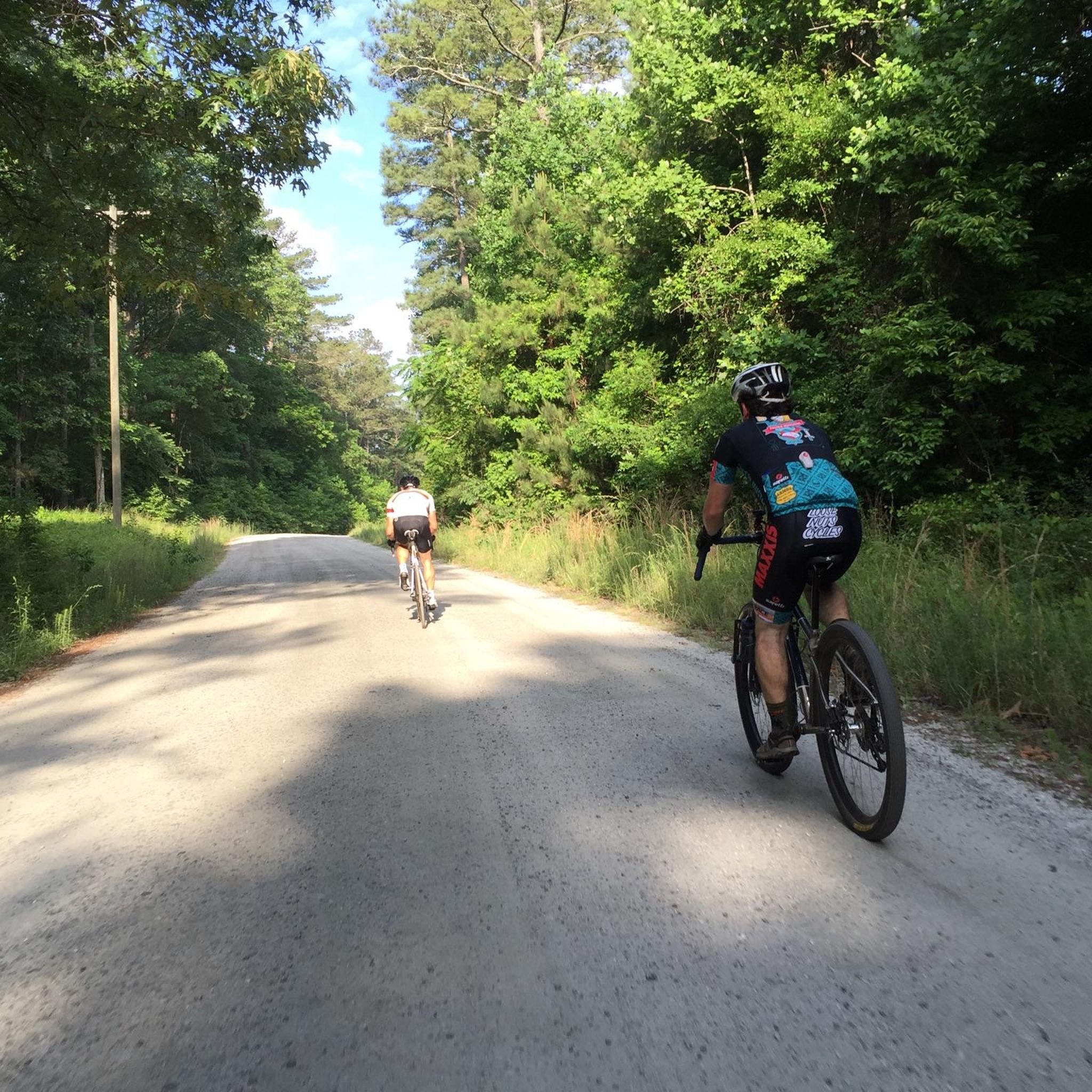
Sewell Mill Road is a lovely, forested road and pretty nice to ride. Along the road you will cross a small bridge that goes over Sewell Millpond. The pond is a good place to stop and look for birds and other wildlife. However, there is no real access to the pond because it is surrounded by private property. From the bridge you have a pretty good view of most of the pond.
0
0

Cochran Mill Park, situated in the Chattahoochee Hills, invites visitors to explore its picturesque landscape. With over 800 acres of forests, meadows, and waterfalls, it's a wonderful spot for both visitors or locals to the area.
0
0
Sewell Mill Road is a lovely, forested road and pretty nice to ride. Along the road you will cross a small bridge that goes over Sewell Millpond. The pond is a good place to stop and look for birds and other wildlife. However, there is no real access to the pond because it is surrounded by private property. From the bridge you have a pretty good view of most of the pond.
0
0

Cochran Mill Nature Center is a fantastic 800-acre natural wonderland featuring multi-use trails, waterfalls, giant boulders, wildflowers, and native azaleas. The waterfalls are a must-see, making it a perfect place for lunch and an opportunity to take some memorable photos.
0
0


Frequently Asked Questions
How many road cycling routes are available around Palmetto?
There are over 15 road cycling routes around Palmetto, offering a variety of experiences. These include 6 easy routes, 7 moderate routes, and 2 more challenging options, catering to different skill levels.
What is the best time of year for road cycling in Palmetto?
The best time for road cycling in Palmetto is typically during the cooler, drier months from late fall through spring (November to April). Summers can be very hot and humid, with a higher chance of afternoon thunderstorms, which might impact your ride comfort and safety.
Are there any family-friendly road cycling routes in Palmetto?
Yes, Palmetto offers several easy, generally flat, and well-paved routes suitable for families. The Shamrock Park loop from CAT Scale is an easy 23.9-mile (38.4 km) trail with minimal elevation gain, providing a pleasant experience for all ages. The Palmetto Riverwalk also offers a scenic and accessible option for a leisurely family ride.
What kind of terrain and elevation can I expect on Palmetto's road cycling routes?
Palmetto's road cycling routes are generally characterized by flat to gently rolling terrain, with well-paved surfaces. While some routes, like the Cochran Mill Park – Upper Wooten Gravel Trail loop from Church of Life Cemetery, have moderate elevation gains of around 1047 feet (319 meters), many coastal and preserve routes offer minimal climbing, making them accessible for various fitness levels.
What scenic views or landmarks can I see along the road cycling routes?
Palmetto's routes offer picturesque views of the Manatee River and Terra Ceia Bay. You can explore coastal hammocks, preserves, and diverse ecosystems. Notable attractions include Emerson Point Preserve, which offers views of Anna Maria Island and the Sunshine Skyway Bridge, and the historic Portavant Indian Mound. While cycling, you might also encounter natural features like Henry's Mill Falls and Bear Creek Falls.
Are there any loop road cycling routes available?
Yes, many of Palmetto's road cycling routes are designed as loops, offering convenient starting and ending points. Examples include the Upper Wooten Gravel Trail – Cochran Mill Park loop from Serenbe, a moderate 32.7-mile (52.6 km) path, and the Shamrock Park loop from CAT Scale, an easy 23.9-mile (38.4 km) option.
What do other road cyclists say about the routes in Palmetto?
The road cycling routes in Palmetto are highly rated by the komoot community, with an average score of 5.0 stars. Cyclists often praise the scenic coastal paths, river views, and the variety of natural preserves accessible by bike. The well-maintained surfaces and generally flat terrain are also frequently highlighted as positive aspects.
Are there options for longer, more challenging road cycling routes?
For cyclists seeking a greater challenge, Palmetto offers longer routes with more significant elevation gains. The Cochran Mill Nature Center – Upper Wooten Gravel Trail loop from S.E. Fairburn is a difficult 65-mile (104.5 km) route with over 3000 feet (920 meters) of elevation, providing a substantial workout. Another difficult option is the Cochran Mill Park – Upper Wooten Gravel Trail loop from Bear Creek Nature Center, spanning over 80 miles (129.2 km).
Where can I find parking facilities near the road cycling trails?
Parking is generally available at key access points for many popular trails. For instance, Robinson Preserve and Emerson Point Preserve offer dedicated parking areas. For routes starting near specific landmarks, such as the De Soto National Memorial, parking facilities are typically provided. It's advisable to check specific route details for the most convenient parking options.
Are dogs allowed on the road cycling trails in Palmetto?
Many parks and preserves in the Palmetto area, including parts of Robinson Preserve and Emerson Point Preserve, are dog-friendly, often requiring dogs to be on a leash. However, specific rules can vary by location and trail section. Always check local signage or park regulations before bringing your dog on a ride.
Are there cafes or restaurants near the road cycling routes for a stop?
Yes, several road cycling routes in Palmetto pass near or are easily accessible from areas with cafes, pubs, and restaurants. The Palmetto Riverwalk, for example, is close to dining options. Areas around Robinson Preserve and De Soto National Memorial also have nearby establishments where you can refuel or relax after your ride.
What are some less crowded road cycling routes in Palmetto?
While popular routes can see more activity, exploring some of the longer or slightly more remote loops might offer a quieter experience. Routes that venture further into areas like Terra Ceia Aquatic Preserve or the broader trail systems beyond the immediate urban areas may provide a more serene ride. Early mornings or weekdays are also good times to avoid crowds on any route.
Most popular routes around Palmetto
Most popular attractions around Palmetto

Get inspired with the komoot mobile app


Explore more
Browse the best Road cycling routes in other regions.
