The best road cycling routes around Woodstock
4.6
(8)
226
riders
40
rides
Road cycling around Woodstock offers varied terrain, from relatively flat paths to routes with significant elevation changes. The area features a mix of paved roads and scenic routes that traverse diverse landscapes. Cyclists can expect to encounter rolling hills and some challenging climbs, providing options for different fitness levels. The region's natural features contribute to a dynamic road cycling experience.
Best road cycling routes around Woodstock
- The most popular road cycling route is Noonday Creek Trail – Noonday Creek Trail…
Last updated: July 15, 2026
17
riders
93.7km
04:09
760m
760m
Moderate road ride. Good fitness required. Mostly well-paved surfaces and easy to ride.
10
riders
Moderate road ride. Good fitness required. Mostly well-paved surfaces and easy to ride.

Sign up for free
13
riders
67.2km
03:03
560m
560m
Moderate road ride. Good fitness required. Mostly well-paved surfaces and easy to ride.
10
riders
51.0km
02:59
560m
560m
Moderate road ride. Good fitness required. Some segments of this route may be unpaved and difficult to ride.
6
riders
107km
04:47
1,060m
1,060m
Hard road ride. Very good fitness required. Mostly well-paved surfaces and easy to ride.
Get access to more routes and recommendations from other explorers.
Sign up for free
Already have an account?
Our route recommendations are based on thousands of hikes, rides, and runs completed by other people on komoot.
Start today with a free account
Your next adventure awaits.
Login or Signup


Tips from the Community

The entrance fee to the national park is $5 (annual pass €40) and can be paid via app.
0
0

It’s easy to lose the path; sections are very poorly marked or not marked at all.
0
0

At the Visitor Center of the Kennesaw Mountain National Battlefield Park you can learn about the history of the former Civil War battlefield. Inside the visitor center there is a permanent exhibition, and around the center various information boards provide information about the events of 1864.
1
0

The museum is very well-kept and an excellent stopping point before the metropolis.
0
0

This park commemorates a Civil War battlefield, where Union and Confederate forces fought from mid-June to early July in 1864. The park visitor center has daily screenings of a movie that dramatically reenacts the history of this area, and there's a short, paved multi-use trail that you can ride at any time. Bikes are also allowed on Kennesaw Mountain Road, but only Monday - Friday during the week.
0
0

Kennesaw Mountain National Battlefield Park is a 2,965 acre National Battlefield that preserves a Civil War battleground of the Atlanta Campaign. Opposing forces maneuvered and fought here from June 19, 1864 until July 2, 1864. The Battle of Kennesaw Mountain was one of the more significant clashes of the Atlanta Campaign. With 'one last mountain' standing between William Sherman and Atlanta, the stakes are incredibly high. The Visitor Center of the State Park has tons of information presenting the history of the Civil War and the Atlanta Campaign in particular. A movie visualizes the bloody fights at Kennesaw Mountain back in 1864. https://www.nps.gov/kemo/index.htm
3
0

Beautiful stretch of road lined with tall woodland on both sides. The road is of a good quality and is gently undulating, allowing you to keep the speed up on your ride.
0
0
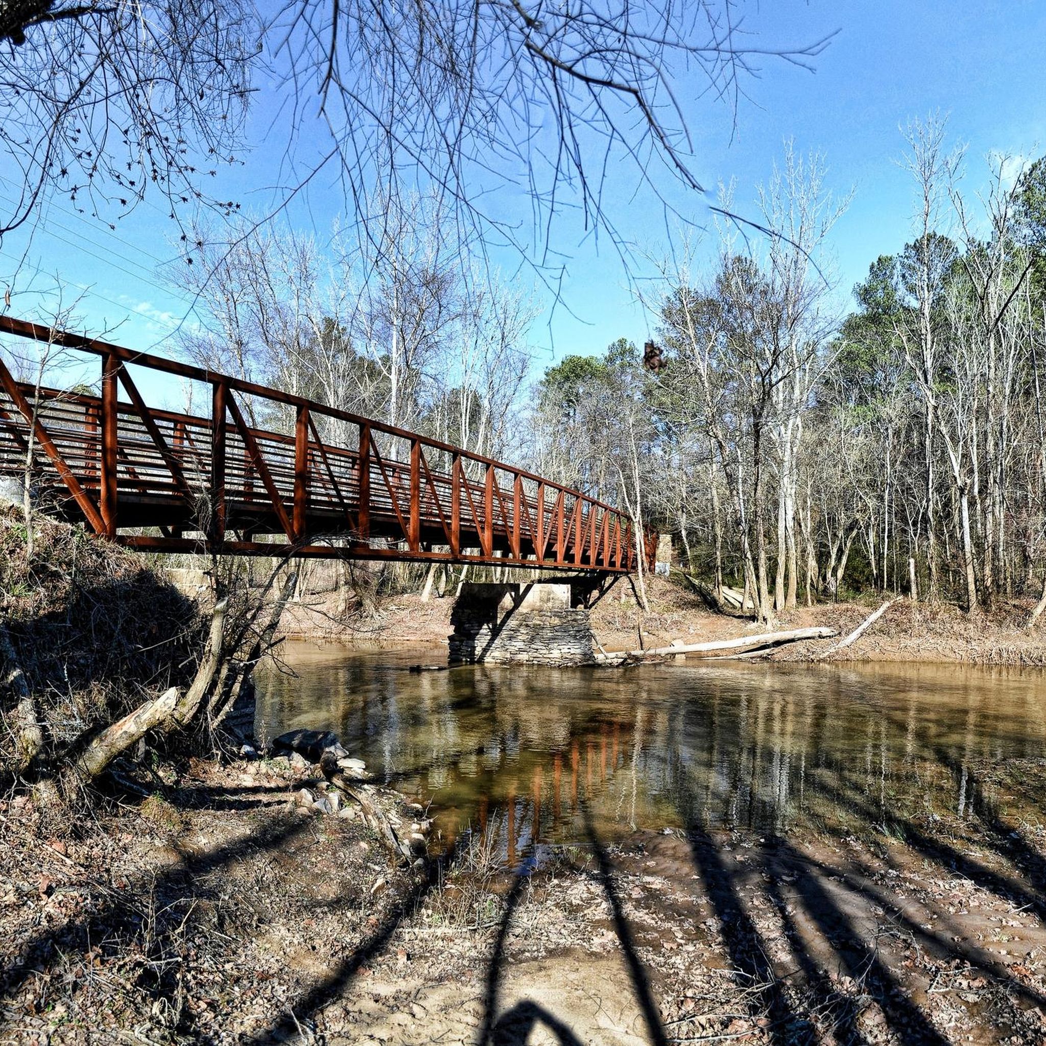
From the bridge you gain a lovely view of the boulder strewn creek below. Should you like a closer look, jump off the bike and head down the footpath on foot on the southeast side of the bridge.
0
0
Frequently Asked Questions
How many road cycling routes are available around Woodstock?
There are over 40 road cycling routes available around Woodstock, catering to various skill levels. You'll find a mix of easy, moderate, and difficult rides to explore the region's diverse landscapes.
What is the best time of year for road cycling in Woodstock?
The best time for road cycling in Woodstock is typically during spring, summer, and fall. These seasons offer pleasant weather to enjoy the picturesque landscapes, especially the vibrant foliage in autumn. Winter cycling is possible but may be limited by snow and ice conditions.
What are the general difficulty levels of road cycling routes in Woodstock?
Road cycling routes in Woodstock offer a range of difficulties. You'll find easy routes like the Noonday Creek Trail – Noonday Creek Trail loop from Fifth Third Bank Stadium, moderate rides with rolling terrain such as the Loch Highland Parkway Causeway loop from Marietta Fish Market Parking, and more difficult, long-distance options like the Dellinger Lake – Dellinger Park loop from Kennesaw State University, which includes significant elevation gain.
Are there any circular road cycling routes in Woodstock?
Yes, many road cycling routes in Woodstock are designed as loops, allowing you to start and end at the same point. For example, the Noonday Creek Trail loop from Marietta Fish Market Parking offers a moderate circular ride, and the Wiggly Lake – Hicks Lake loop from Wildwood is another popular moderate option.
What natural features can I expect to see while road cycling in Woodstock?
While road cycling in Woodstock, you can expect to encounter stunning natural features such as the Green Mountains, the winding Ottauquechee River, and rolling hills. Some routes may offer glimpses of the dramatic Quechee Gorge, often called 'Vermont's Little Grand Canyon,' known for its 165-foot depth.
Are there any historical landmarks or points of interest along the road cycling routes?
Yes, Woodstock is rich in historical landmarks. You might cycle past historic covered bridges, including the notable Russell Road Bridge Over Cherful Lake or the Between lakes bridge. The area also features picturesque villages and working farms, adding to the charm of your ride.
Can I find scenic viewpoints on road cycling routes in Woodstock?
Absolutely. Many road cycling routes in Woodstock offer scenic viewpoints, particularly those traversing the rolling hills and higher elevations. You can expect panoramic views of the Green Mountains, the Ottauquechee River valley, and charming New England villages. Hiking to the summit of Mount Tom also offers expansive views of Woodstock and Quechee.
Are there family-friendly road cycling routes in Woodstock?
Yes, Woodstock offers family-friendly road cycling routes, particularly those with easier grades and paved surfaces. The Noonday Creek Trail – Noonday Creek Trail loop from Fifth Third Bank Stadium is an easy 9.3-mile route suitable for many cyclists, including families looking for a straightforward ride.
Where can I find parking for road cycling routes in Woodstock?
Parking availability varies by route. Many routes, especially those starting from urban centers or trailheads, often have designated parking areas. For instance, the Loch Highland Parkway Causeway loop starts from Marietta Fish Market Parking, indicating available parking at the trailhead.
Is public transport an option to access road cycling trails in Woodstock?
While specific public transport options directly to trailheads may be limited, Woodstock is a well-known destination. It's advisable to check local transit services or consider driving to a suitable starting point with parking, especially for routes that begin further from the town center.
Are there bike-friendly cafes or pubs near the road cycling routes in Woodstock?
Woodstock and its surrounding charming villages are known for their hospitality. You'll find various bike-friendly cafes and pubs where you can refuel and relax after your ride. The quintessential New England village center of Woodstock itself offers several options.
What kind of terrain can I expect on road cycling routes in Woodstock?
Road cycling routes in Woodstock feature varied terrain. You'll encounter rolling hills, some significant climbs, and a mix of paved roads. While primarily road cycling, the region is also celebrated for its extensive network of scenic dirt and gravel roads, offering diverse experiences for those with appropriate bikes.
What do other road cyclists say about the routes in Woodstock?
The road cycling routes in Woodstock are highly rated by the komoot community, with an average score of 4.6 stars from over 8 reviews. Cyclists often praise the varied terrain, the mix of urban and natural settings, and the options available for different ability levels.
Most popular routes around Woodstock
Most popular attractions around Woodstock

Get inspired with the komoot mobile app


Explore more
Browse the best Road cycling routes in other regions.
