The best road cycling routes around Derryclare lough
4.3
(8)
118
riders
6
rides
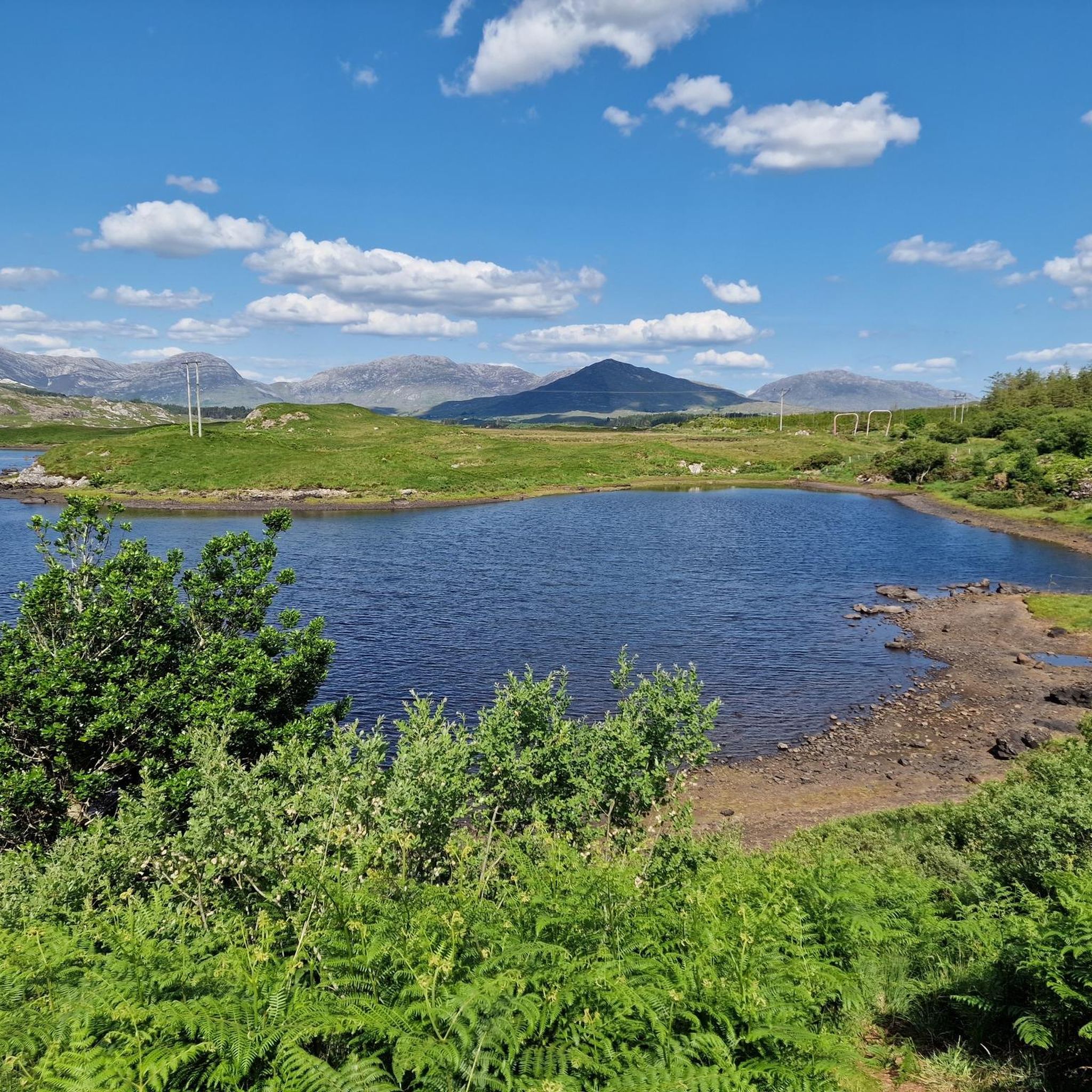
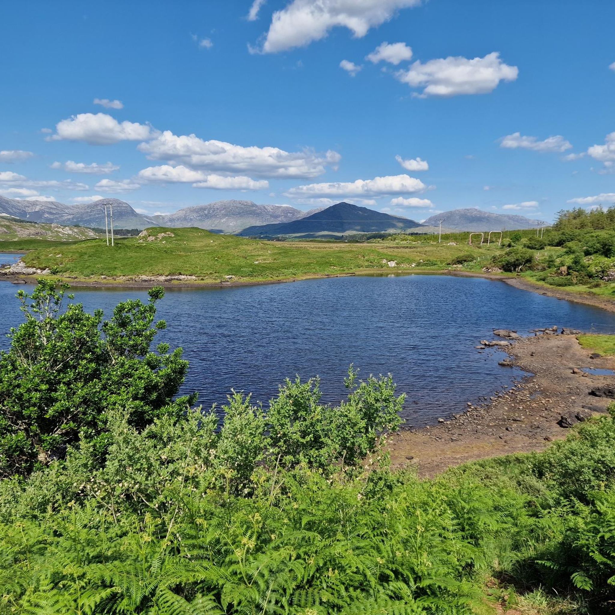
Road cycling around Derryclare lough traverses a landscape characterized by the dramatic Twelve Bens mountains and the tranquil waters of the lough. The region features a mix of well-paved surfaces, including the R344 road which borders the lough, offering scenic cycling paths. Cyclists can explore routes through craggy mountains, rugged coastlines, and boglands, with notable features like Pine Island. The terrain includes both moderate climbs and flatter sections, providing varied experiences for road cyclists.
Best road cycling routes around Derryclare…
Last updated: July 13, 2026
35
riders
94.3km
03:50
560m
550m
Moderate road ride. Good fitness required. Mostly well-paved surfaces and easy to ride.
3.7
(3)
23
riders
62.1km
02:41
390m
390m
Moderate road ride. Good fitness required. Mostly well-paved surfaces and easy to ride.

Sign up for free
3
riders
Easy road ride. Great for any fitness level. Mostly well-paved surfaces and easy to ride.
3
riders
24.3km
01:00
140m
140m
Easy road ride. Great for any fitness level. Mostly well-paved surfaces and easy to ride.
5.0
(5)
54
riders
Moderate road ride. Good fitness required. Mostly well-paved surfaces and easy to ride.
Our route recommendations are based on thousands of hikes, rides, and runs completed by other people on komoot.
Start today with a free account
Your next adventure awaits.
Login or Signup
Popular around Derryclare lough
Tips from the Community

Large parking lot with a view of the nearby pier.
3
0
One of the most beautiful beaches in the world: secluded, serene, stunning and all yours, for the afternoon. Occasionally a curragh drifts in with the tide, laden with the finest treats the sea has to offer, and then it's quiet again. A tangible reminder of the power of the sea. This enormous rusty anchor belonged to the Norwegian ship the 'Varity', which ran aground here in 1890 during a severe storm. The ship was en route from Canada to Belfast with a cargo of timber when it was wrecked near Aughris Beach. For cyclists on the Lower Sky Road, this is an impressive stop just 4 metres above sea level. As you gaze out over the white sands of Aughris Beach, you realise how untameable the Connemara coast can be.
5
0
This historic stone arch bridge marks the spectacular entrance to Clifden. From the bridge, you look down on the wild rapids of the Owenglin River, which thunders down here via a series of small waterfalls into the bay. The contrast between the crashing water, the old grey stone, and the colourful facades of the town further on is magnificent.
6
0
Viewpoint at Ballynahinch Lake (Loch Bhaile na hInse). From the R341, you look out over the mirror-smooth water of the lake, where the wooded islands and the contours of the stately Ballynahinch Castle seamlessly merge into the majestic backdrop of the Twelve Bens. The imposing peaks of Benlettery and Bengower dominate the horizon here and often reflect beautifully in the deep blue water.
7
0
The Sint-Jacobuskerk (St. James's Church) in Cashel is an architectural gem that contrasts beautifully with the rugged Connemara landscape. This 19th-century Neo-Gothic church, built from local granite, is situated in a prominent position on the R340, majestically overlooking the inlets of Bertraghboy Bay. With the iconic peaks of the Twelve Bens as a backdrop, this building forms a serene and photogenic resting point along the coastal route. Whether you stop for the tranquil atmosphere of the graveyard or to admire the impressive granite details, this place embodies the spiritual and natural beauty of the Gaeltacht.
5
0
In the sheltered waters of Kilkieran Bay lie several round aquaculture cages, used for offshore salmon farming. The cages float in a wide tidal bay with low rocky shores, islets and calm currents, typical of South Connemara. The industrial element is small and quietly present in the landscape, but forms a recognisable part of the bay: a combination of traditional fishing villages and modern mariculture. From the road and the pier, you have an open view over the cages, the rocky coast and the islands further out in the bay.
3
0
This completed section of the Connemara Greenway follows the old railway line and is a relief for cyclists. The route is completely traffic-free, flat, and asphalted. You cycle through a beautifully varied landscape of dense forests and tranquil lakes such as Athry Lough. Ideal for enjoying the rugged nature of Connemara in complete peace.
1
0

Frequently Asked Questions
How many road cycling routes are available around Derryclare Lough?
There are 8 road cycling routes around Derryclare Lough, offering a variety of experiences. These include 3 easy routes and 5 moderate routes, ensuring options for different skill levels.
What are the typical difficulty levels for road cycling routes in the Derryclare Lough area?
The road cycling routes around Derryclare Lough are primarily classified as easy or moderate. You'll find 3 easy routes, perfect for a relaxed ride, and 5 moderate routes that offer more of a challenge with varied terrain and elevation.
Are there any circular road cycling routes around Derryclare Lough?
Yes, many of the routes are circular. For example, the Pine Island, Derryclare Lough loop from Saint James Church is an easy 23.7 km loop that takes you directly around the lough and its iconic Pine Island.
What kind of landscapes can I expect to see while road cycling near Derryclare Lough?
The region offers breathtaking and diverse landscapes. You'll cycle with the dramatic backdrop of the Twelve Bens mountains, alongside the tranquil waters of Derryclare Lough, and through areas characterized by craggy mountains, rugged coastlines, and boglands. The R344 road, which borders the lough, provides particularly scenic stretches.
Are there any notable landmarks or natural features to look out for on a road cycling tour?
Absolutely. The majestic Twelve Bens mountains provide a constant, dramatic backdrop. You'll also encounter Pine Island, a distinctive tree-covered islet in Derryclare Lough, which is a popular photographic subject. The Derryclare Nature Reserve, with its old oak woodland, is another significant natural feature along the lough's shores.
What do other road cyclists say about the routes around Derryclare Lough?
The area is highly rated by the komoot community, with an average score of 4.3 stars from more than 7 reviews. Cyclists often praise the stunning views of the Twelve Bens and the lough, as well as the varied terrain that caters to different abilities.
Are there longer, more challenging road cycling routes available in the wider Connemara region?
Yes, for those seeking a longer and more challenging ride, the Pine Island, Letterfrack and Clifden loop — Connemara National Park covers 94.3 km and traverses the Connemara National Park, offering extensive views and a moderate difficulty level.
Can I find routes that offer views of other lakes besides Derryclare Lough?
Yes, you can. The View of Ballynahinch Lake – Outlandish landscape loop from Recess is a moderate 37.6 km route that provides excellent views of Ballynahinch Lake and the surrounding unique landscape.
What is the best time of year to go road cycling around Derryclare Lough?
While specific seasonal advice isn't provided, the Connemara region's weather can be variable. Generally, late spring to early autumn offers the most favorable conditions for cycling, with longer daylight hours and milder temperatures. Always check local weather forecasts before heading out.
Are there any routes that explore the unique boglands of Connemara?
Yes, the The Bog Road – Bog Road in Connemara loop from Saint James Church is a moderate 62 km route that takes you through the distinctive bogland landscapes of Connemara, offering a unique cycling experience.
Is there parking available for cyclists near Derryclare Lough?
While specific parking locations are not detailed for each route, the R344 road, which borders Derryclare Lough, often has pull-offs where you can pause and take in the views. It's advisable to research parking options near your chosen starting point, such as Recess or Saint James Church, before your ride.
Most popular routes around Derryclare lough

Get inspired with the komoot mobile app


Explore more
Browse the best Road cycling routes in other regions.
