The best running trails around Clayton
9
runners
5
runs
Jogging routes around Clayton offer challenging trails through mountainous landscapes. The region is characterized by significant elevation changes, dense forest, and scenic overlooks. Runners can expect demanding ascents and descents, providing a rigorous workout amidst natural beauty.
Best jogging routes around Clayton
- The most popular jogging route is Stonewall Creek Falls loop — Chattahoochee-Oconee National Forest, a 9.6 miles (15.5 km) trail that takes 1 hour 42 minutes to complete. This difficult route features substantial elevation gain through forested…
Last updated: June 23, 2026
3
runners
12.6km
01:36
550m
550m
The Black Rock Lake & Lookoff Mountain Overlook via Edmonds Trail loop offers a demanding jogging experience through some of North Georgia's most beautiful terrain. You'll navigate rugged, high-elevation landscapes,…
3
runners
12.1km
01:40
390m
390m
The Bartram Trail to Pinnacle Knob offers a visually rich experience, starting with lush forest and the constant sound of falling water. You'll pass impressive waterfalls like Becky Branch Falls…

Sign up for free
1
runners
11.3km
01:24
500m
500m
The James E. Edmonds Backcountry Trail offers a rugged journey through high-elevation Appalachian landscapes, showcasing diverse terrain from old roads to narrow, root-filled paths. You'll encounter picturesque cascading streams, small…
15.5km
01:42
300m
310m
Prepare for a difficult jogging experience on the Stonewall Falls and White Twister Mountain Bike Trail, covering 9.6 miles (15.5 km) with a significant 993 feet (303 metres) of elevation…
3
runners
4.74km
00:38
160m
160m
Moderate run. Good fitness required. Mostly paved surfaces. Suitable for all skill levels.
Our route recommendations are based on thousands of hikes, rides, and runs completed by other people on komoot.
Start today with a free account
Your next adventure awaits.
Login or Signup
Popular around Clayton

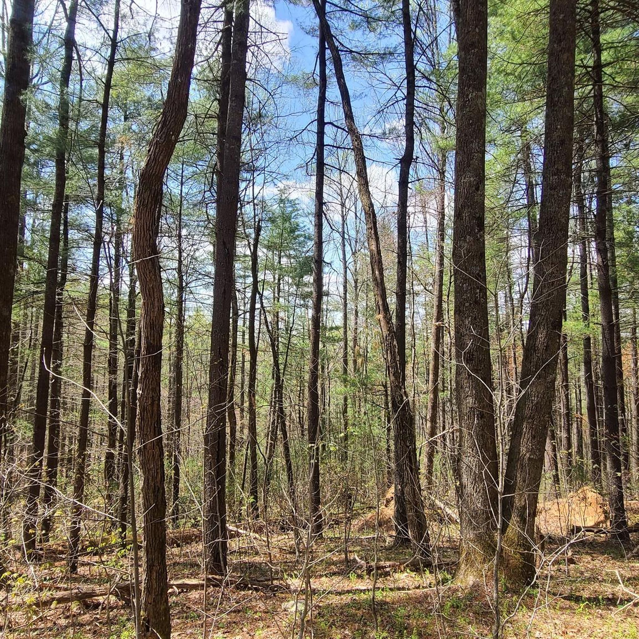
Tips from the Community

You may or may not enjoy knowing the story of how Greasey Creek got its name. According to legend, a mountain man named John Shell—once claimed as the oldest man in the world—shot a black bear, only to have the bear fall into the "Blue Hole," where the bear's body remained because Shell couldn't retrieve it. As the bear decomposed, downstream residents renamed what had been known as "Laurel Creek" as "Greasy Creek."
0
0
The Lookoff Mountain Overlook provides views of its namesake peak, which stands at just over 3,000 feet. And depending on the foliage and weather, it also affords a clear view of the taller Marsen Knob to the southeast (3,186 feet).
0
0

Black Rock Lake is a small reservoir with a rooty singletrack trail tracing its banks. Black Rock Mountain State Park makes a pretty sweet backdrop.
0
0
At an elevation of 3,141 feet, Pinnacle Knob rises up 1,000 feet over the city of Clayton. The peak can be seen from pretty much anywhere in town and is a challenge to run up. Be prepared to power-hike some near the top!
0
0
Stonewall Creek Falls is a 20-foot waterfall with a pool of water deep enough for wading at the bottom. The cascade has a few steps and is worth snapping some pictures of (or just enjoying for a moment).
0
0
Stonewall Creek Falls is a 20-foot waterfall with a pool of water deep enough for wading at the bottom. The cascade has a few steps and is worth snapping some pictures of (or just enjoying for a moment).
0
0

There are several trails leading to Pinnacle Knob, but the most common one is the Bartram Trail. After a strenuous hike to the top, you will be rewarded with fascinating views of the Black Rock Mountain and the Smoky Mountains in the far distance.
0
0
A beautiful and generally secluded falls, Stonewall Creek Falls features an impressive 20-foot cascade and a shallow, flat wading area at the bottom that will entice riders to cool their hard-working feet.
0
0
Frequently Asked Questions
How many running routes are available in Clayton?
Komoot features 4 dedicated running routes around Clayton. These routes are generally characterized by challenging mountainous terrain and significant elevation changes, offering a rigorous workout amidst natural beauty.
What kind of terrain can I expect on running trails in Clayton?
The running trails around Clayton are predominantly through mountainous landscapes and dense forests. You can expect demanding ascents and descents, with trail surfaces varying from natural forest paths to rocky sections, providing a challenging experience for runners.
Are there any scenic viewpoints or natural attractions along the running routes in Clayton?
Yes, several routes offer rewarding views and natural attractions. For instance, the Black Rock Lake & Lookoff Mountain Overlook via Edmonds Trail loop provides stunning vistas from mountain overlooks. You can also find highlights like Lookoff Mountain Overlook and Pinnacle Knob along various trails.
Are there any waterfalls I can see while jogging in Clayton?
Yes, the Stonewall Creek Falls loop is a popular route that takes you past the beautiful Stonewall Creek Falls. Another highlight in the area is the Trail next to the Greasy Creek, which also features a waterfall.
What do other runners say about the jogging routes in Clayton?
The routes in Clayton are highly regarded by the komoot community. Over 5 runners have used komoot to explore the varied and challenging terrain, often praising the demanding ascents, rewarding views, and the immersive experience of running through dense woodlands.
Are there any long-distance running options in Clayton?
While all routes are challenging, the Stonewall Creek Falls loop is the longest at 9.6 miles (15.5 km). This route offers a substantial distance with significant elevation gain, making it suitable for runners looking for a longer, strenuous workout.
Are the running routes in Clayton suitable for beginners or families?
The running routes around Clayton are generally classified as 'difficult' due to significant elevation changes and mountainous terrain. They are best suited for experienced runners seeking a challenging workout rather than beginners or families looking for easy, leisurely jogs.
Can I find circular running routes in Clayton?
Yes, all the featured running routes in Clayton are circular. Examples include the Black Rock Lake & Lookoff Mountain Overlook via Edmonds Trail loop and the Black Rock Mountain via Edmonds Trail & Tennessee Rock Trail loop, allowing you to start and finish at the same point.
What is the typical elevation gain on running routes in Clayton?
The running routes in Clayton feature significant elevation changes. For example, the Black Rock Lake & Lookoff Mountain Overlook loop has an elevation gain of over 550 meters, while the Pinnacle Knob via Bartram Trail involves nearly 390 meters of ascent. These routes provide a demanding challenge for runners.
Are there any specific trails that lead to mountain summits in the Clayton area?
Yes, for those seeking summit views, the Pinnacle Knob via Bartram Trail leads to Pinnacle Knob. Additionally, the Black Rock Mountain via Edmonds Trail & Tennessee Rock Trail loop offers access to Black Rock Mountain Summit, providing rewarding panoramic views.
Most popular routes around Clayton
Most popular attractions around Clayton

Get inspired with the komoot mobile app


Explore more
Browse the best Running Trails & Routes in other regions.
