The best walks and hikes around Rohrsee
4.5
(3611)
15,890
hikers
538
hikes
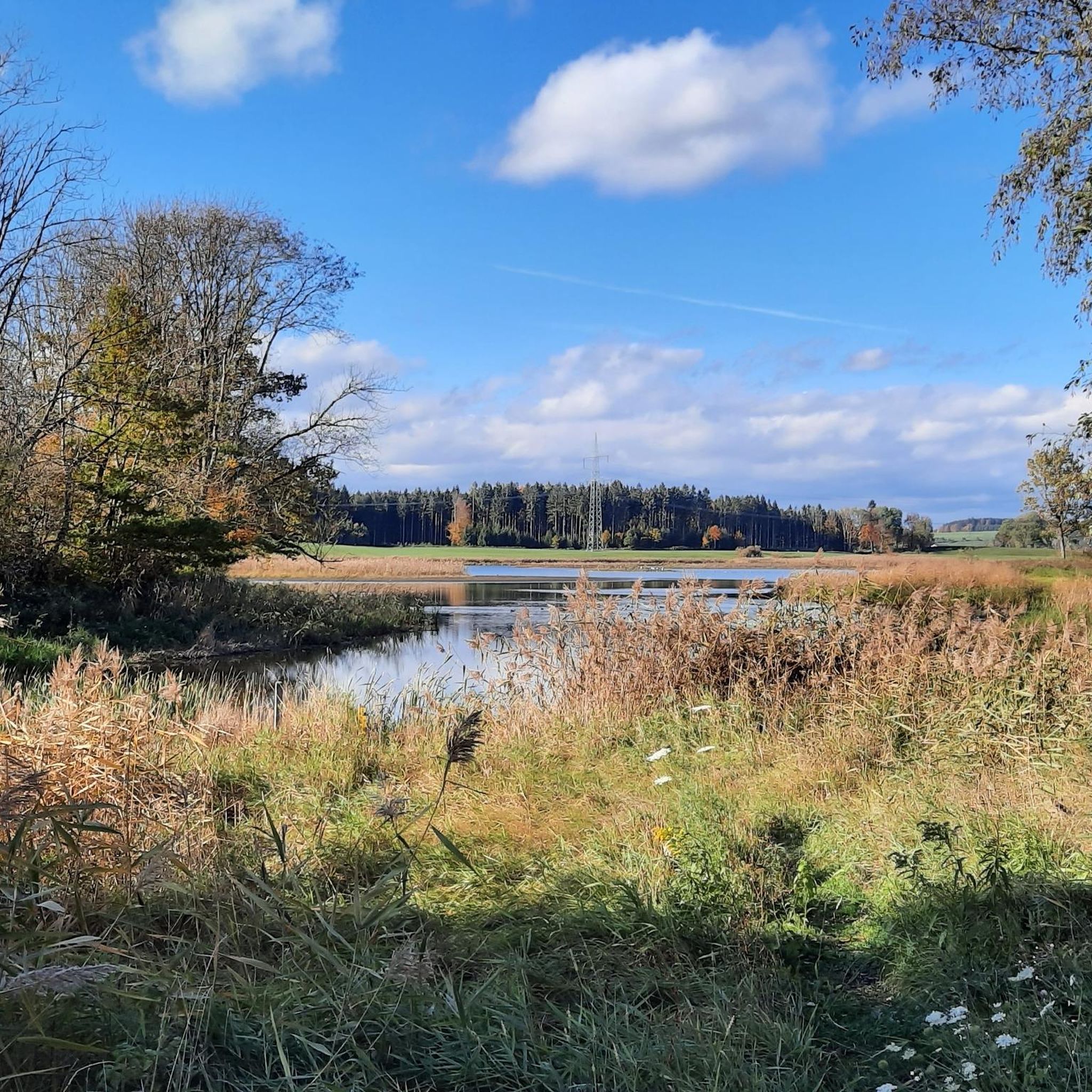
Hiking around Rohrsee offers varied terrain within a designated nature reserve and European bird sanctuary. The region is characterized by a shallow glacial lake, extensive reed beds, and surrounding moraine hills. These features create a unique ecosystem, providing diverse landscapes for outdoor activities. The area is part of the Westallgäuer Hügelland, offering both flat lakeside paths and gentle ascents on the moraine hills.
Best hiking trails around Rohrsee
- The most popular hiking route is Lake Rohrsee – Rohrsee Nature Reserve…
Last updated: July 4, 2026
5.0
(1)
7
hikers
6.59km
01:42
30m
30m
Easy hike. Great for any fitness level. Easily-accessible paths. Suitable for all skill levels.
1
hikers
3.80km
00:59
20m
20m
Easy hike. Great for any fitness level. Easily-accessible paths. Suitable for all skill levels.

Sign up for free
5.0
(1)
9
hikers
5.10km
01:21
50m
50m
Easy hike. Great for any fitness level. Easily-accessible paths. Suitable for all skill levels.
6
hikers
15.5km
04:07
160m
160m
Moderate hike. Good fitness required. Easily-accessible paths. Suitable for all skill levels.
3.0
(1)
2
hikers
21.9km
06:04
370m
370m
Hard hike. Very good fitness required. Easily-accessible paths. Suitable for all skill levels.
Get access to more routes and recommendations from other explorers.
Sign up for free
Already have an account?
Our route recommendations are based on thousands of hikes, rides, and runs completed by other people on komoot.
Start today with a free account
Your next adventure awaits.
Login or Signup



Tips from the Community


It's great that someone took the time and made it available to the public. Thank you 🙏🏼
1
0


nature conservation at the highest level
2
0

The Wolfegger Süh is also a 725m high viewing point with a cross and seating area that is easily accessible by bike. From here you can see large parts of Upper Swabia. There is also a boulder on the Süh from the Ice Age that was "left behind" by a glacier.
7
0

Since 1995, the pond has been part of the designated Young Moraine Landscape Conservation Area between Amtzell and Vogt. Due to its poor water quality, the Holzmühleweiher was included in the Tübingen Regional Council's "Action Program for the Rehabilitation of Upper Swabian Lakes." Source: Wikipedia
3
0
The church in Eintürnen was built very early on, and the Celts probably already had a sanctuary there. At the time the church was built, Eintürnen was a relatively wealthy place and, with around 100 apartments and houses, quite large. The Christianization was probably carried out by the missionary Ratpot, who also founded a parish in Kißlegg. The church was first mentioned in 1275. Source: https://www.oberschwaben-tipps.de/eintuernen-berg-barocke-kirche-in-oberschwaben/
3
0
First mentioned in 1818, the pond was about four times as large until it was partially drained in the mid-19th century, and the resulting terrain is still visible. Today, the Holzmühleweiher is a popular fishing spot. A small lido is located on its northwestern shore. Source: https://de.m.wikipedia.org/wiki/Holzm%C3%BChleweiher_(Vogt)
3
0
Frequently Asked Questions
What kind of terrain can I expect when hiking around Rohrsee?
The terrain around Rohrsee is diverse, characterized by a shallow glacial lake, extensive reed beds, and surrounding moraine hills. You'll find flat lakeside paths perfect for easy strolls, as well as gentle ascents on the moraine hills that offer scenic viewpoints. The area is part of the Westallgäuer Hügelland, providing a mix of landscapes within a designated nature reserve.
Are there many circular hiking routes available in the Rohrsee area?
Yes, many of the hiking routes around Rohrsee are designed as loops, allowing you to start and end at the same point. An excellent example is the Lake Rohrsee – Rohrsee Nature Reserve loop from Rohrsee, which circles the lake and offers continuous views of the wetlands and reed beds.
Are the hiking trails around Rohrsee suitable for families with children?
Absolutely. The Rohrsee area offers many easy, family-friendly excursions with minimal elevation gain. The focus on nature conservation and the presence of a bird sanctuary make it an engaging experience for children, offering opportunities for birdwatching and exploring undisturbed nature. Routes like the St. Martin Church Eintürnen – Langwuhr Pond loop from Eintürnen are good options for a shorter, pleasant walk.
Can I bring my dog on the hiking trails in the Rohrsee nature reserve?
As Rohrsee is a designated nature reserve and European bird sanctuary, it's important to keep dogs on a leash to protect the sensitive wildlife, especially ground-nesting birds and other animals in the wetlands. Most trails are generally accessible for dogs, provided they are kept under control.
What are the parking options for hikers visiting Rohrsee?
While specific parking lots aren't detailed, it is generally understood that parking is available near the main trailheads and access points around the Rohrsee area. Look for designated parking areas in villages or at popular starting points for the hiking routes.
Are there any public transport options to reach the Rohrsee hiking trails?
The Rohrsee area, being a nature reserve, is primarily accessible by car. Public transport options directly to the trailheads might be limited. It's advisable to check local bus schedules for connections to nearby towns like Bad Wurzach, from where you might need to arrange further transport or walk to the starting points.
Are there any waterfalls to see on hikes around Rohrsee?
While the immediate Rohrsee area is known for its lake and wetlands, some longer routes in the broader region do feature waterfalls. For instance, the challenging Weissenbronnen Waterfalls – Süh Cross Viewpoint loop from Eintürnen includes the Weissenbronnen Waterfalls as a point of interest.
What are the best times of year to hike around Rohrsee?
The Rohrsee area is beautiful year-round, but spring and autumn are particularly rewarding. Spring offers vibrant greenery and active birdlife as migratory birds return. Autumn provides stunning foliage and pleasant temperatures for hiking. Summer is also popular, but can be warmer. Winter hiking is possible, offering a serene, snow-covered landscape, though some paths might be less accessible.
What kind of natural features and landmarks can I expect to see along the trails?
Rohrsee is rich in natural beauty and unique features. You'll encounter the shallow glacial lake itself, extensive reed beds, and surrounding moraine hills that offer elevated viewpoints. The area is a biodiversity hotspot and a European bird sanctuary, making birdwatching a highlight. You might also pass by the historic St. Martin Church Eintürnen or the Holzmühleweiher, a pond within the Young Moraine Landscape Conservation Area.
How many hiking trails are there in the Rohrsee region, and what are their difficulty levels?
The Rohrsee region offers over 500 hiking routes. The majority are easy, with more than 300 trails suitable for casual walks. There are also nearly 200 moderate routes for those seeking a bit more challenge, and a smaller number of difficult trails for experienced hikers. This variety ensures options for all fitness levels.
What do other hikers say about their experiences in Rohrsee?
The hiking experiences in Rohrsee are highly rated by the komoot community, with an average score of 4.5 stars from over 3,200 reviews. Hikers often praise the tranquil nature experience, the unique glacial landscape, and the opportunities for birdwatching in this designated nature reserve. The well-maintained paths and scenic views are frequently highlighted.
Are there any cafes or restaurants near the Rohrsee hiking trails?
The Rohrsee area focuses on providing a peaceful, immersive outdoor experience away from urban hustle. While there might not be many direct amenities at the lake itself, you can find cafes and restaurants in nearby towns and villages, such as Bad Wurzach, which are a short drive away.
Most popular routes around Rohrsee

Get inspired with the komoot mobile app


Explore more
Browse the best Hikes in other regions.
