The best mountain hikes around Schwaltenweiher
4.7
(334)
2,013
hikers
49
hikes
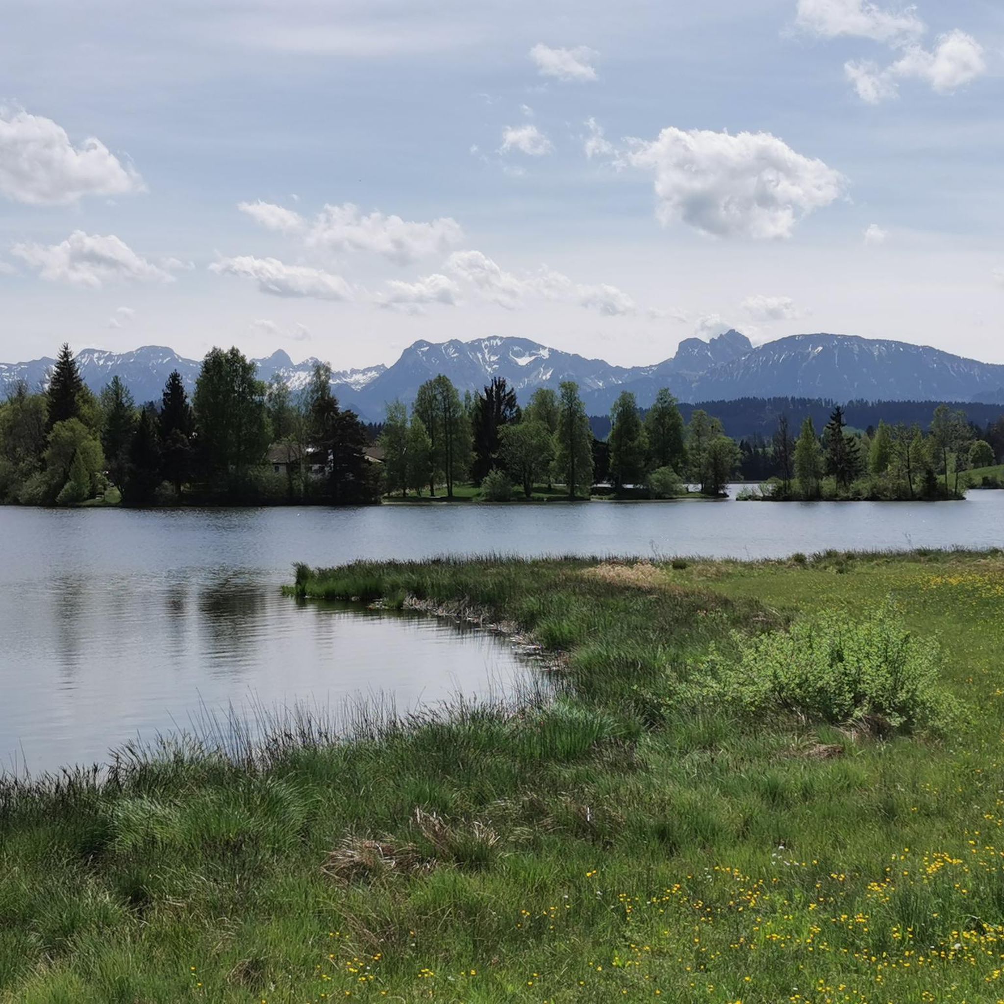
Mountaineering routes around Schwaltenweiher are set within the Ostallgäu region, characterized by rolling hills, forested slopes, and elevated viewpoints. The terrain offers a mix of ascents to prominent summits and paths through scenic valleys. This area provides diverse landscapes for mountaineering, from open alpine meadows to dense woodlands. The routes often feature panoramic vistas of the surrounding Bavarian Alps.
Best mountaineering routes around Schwaltenweiher
- The most popular mountaineering route is Kappeler Alp – Summit cross at Kappeler Alp loop from…
Last updated: October 5, 2026
4.9
(16)
109
hikers
9.42km
03:09
470m
470m
Moderate mountaineering route. Good fitness required. Mostly accessible paths. Sure-footedness required.
4.9
(9)
66
hikers
4.90km
02:24
420m
420m
Moderate mountaineering route. Good fitness required. Mostly accessible paths. Sure-footedness required.

4.7
(15)
49
hikers
13.2km
04:40
730m
730m
Moderate mountaineering route. Good fitness required. Mostly accessible paths. Sure-footedness required.
5.0
(5)
46
hikers
10.7km
04:18
710m
710m
Moderate mountaineering route. Good fitness required. Mostly accessible paths. Sure-footedness required.
5.0
(1)
24
hikers
7.19km
03:14
560m
560m
Moderate mountaineering route. Good fitness required. Mostly accessible paths. Sure-footedness required.
Get access to more routes and recommendations from other explorers.
Already have an account?
Our route recommendations are based on thousands of hikes, rides, and runs completed by other people on komoot.
Start today with a free account
Your next adventure awaits.
Tips from the Community


The summit cross is located just a few meters from the Kappeler Alp. From there, you have a wonderful view. You can also take a break there. At the Kappeler Alp, you can fortify yourself with delicious food and enjoy the view on the large terrace.
4
0

The AlpspitzKICK is a highlight in the Allgäu region. It not only offers fantastic views of the Alpine foothills, but the spectacular zipline at the Alpspitzbahn cable car in Nesselwang is something for those with a strong sense of stability: It descends a total of 1.2 kilometers in two sections on a cable. Speeds of up to 120 kilometers per hour are reached. The start is at the mountain station at approximately 1,500 meters, very close to the summit of the Alpspitze.
2
0

Simply fantastic when visibility is good
9
0
The view is simply fantastic
10
0

A very cozy and rustic hut that is vegetarian-run! The food and service are always excellent! Open until 6pm in the winter, and longer in groups if you register!
2
0

Nice resting point just before the Alpspitz
0
0

Right next to the mountain station you will find the AlpspitzKick TakOff Tower, Germany's longest zipline at 1.2 km in two sections. A few meters further on you will find the Böck sports center, where you can have a good rest or spend the night in the lodge. Hiking trails from here lead up to the Alpspitze and the neighboring Edelsberg, as well as numerous trails into the valley to Nesselwang, but also towards Jungholz and Grüntensee, for example. The view extends into the valley towards Nesselwang and Ostallgäu, to Neuschwanstein Castle, Weissensee and Forggensee, towards Vils and Reutte in the Lechtal and to Breitenberg and Aggenstein, among others. A head for heights is only necessary when using the AlpspitzKick.
2
0
Frequently Asked Questions
How many mountaineering routes are available around Schwaltenweiher?
There are over 50 mountaineering routes around Schwaltenweiher, offering a diverse range of experiences. Most of these, about 43, are considered moderate, with 11 routes rated as difficult and one easy option.
Are there any family-friendly mountaineering routes near Schwaltenweiher?
Yes, for families looking for a less strenuous option, the region offers routes like the Scenic Stream near Edelsberg – Small Waterfall loop from Kappel. This moderate 2.8-mile path features a scenic stream and a small waterfall, making it an engaging choice for a family outing.
What are the best routes for beginners in mountaineering around Schwaltenweiher?
While most routes are moderate, beginners can find suitable options. The Scenic Stream near Edelsberg – Small Waterfall loop from Kappel is a good starting point due to its shorter distance and engaging features. It's a moderate route, but manageable for those new to mountaineering.
Are there any challenging mountaineering routes for experienced hikers?
Experienced mountaineers can tackle more difficult routes, such as the Alpspitz Summit (Allgäu Alps) – Edelsberg Pavilion loop from Kappel. This route covers 8.6 miles (13.8 km) and involves significant elevation gain, offering a rewarding challenge and expansive views of the Allgäu Alps.
What kind of views can I expect on mountaineering trails around Schwaltenweiher?
Mountaineering routes in this region are known for panoramic vistas of the surrounding Bavarian Alps. Many trails lead to elevated viewpoints or summits, such as the Kappeler Alp – Summit cross at Kappeler Alp loop from Kappel, which culminates in a summit cross offering expansive views.
Are there circular mountaineering routes available?
Yes, many routes around Schwaltenweiher are designed as loops, allowing you to start and end at the same point. Examples include the Sportheim Böck – Edelsberg Summit and Pavilion loop from Kappel, which takes you through varied terrain to the Edelsberg Summit and Pavilion.
What are some interesting landmarks or attractions near the mountaineering routes?
Beyond the trails, you can explore several local attractions. The Schwalten Pond itself is a beautiful spot, and you might enjoy the Schwalterweiher Lake Bath and Beer Garden for relaxation after your hike. The Ruchholz Countryside Route also offers scenic paths.
What do other mountaineers enjoy most about the routes in Schwaltenweiher?
The area is highly rated by the komoot community, with an average score of 4.7 stars from over 300 reviews. Reviewers often praise the diverse landscapes, from open alpine meadows to dense woodlands, and the rewarding summit ascents that offer stunning panoramic views.
Are there any routes that pass by a hut or a place to stop for refreshments?
Yes, some routes incorporate stops at mountain huts or pavilions. For instance, the Edelsberg Pavilion – Hündeleskopfhütte loop from Kappel includes the Hündeleskopfhütte, which is a popular spot for a break and refreshments during your mountaineering tour.
How does mountaineering around Schwaltenweiher compare to other areas in the Allgäu region?
Mountaineering around Schwaltenweiher, situated within the Ostallgäu region, offers a distinct character with its rolling hills, forested slopes, and elevated viewpoints. While the Allgäu as a whole is known for its diverse alpine terrain, Schwaltenweiher provides a mix of moderate climbs and more challenging ascents, often with a focus on scenic valleys and panoramic vistas that are characteristic of this specific part of the region.
What is the best season for mountaineering around Schwaltenweiher?
The best season for mountaineering around Schwaltenweiher is typically from late spring to early autumn (May to October), when the weather is most stable and trails are clear of snow. During these months, you can fully enjoy the open alpine meadows and forested paths. Always check local weather conditions before heading out.
Most popular routes around Schwaltenweiher
Most popular attractions around Schwaltenweiher

Get inspired with the komoot mobile app


Explore more
Browse the best Mountain Hikes & Routes in other regions.
