The best walks and hikes around Brownsville
4.8
(19)
1,166
hikers
75
hikes
Hiking trails near Brownsville, Texas, are shaped by the Rio Grande and its proximity to the Gulf of Mexico. The landscape is characterized by resacas (oxbow lakes), which create lush wetlands, alongside coastal prairies and one of the last remaining Sabal palm forests in the United States. This semi-tropical environment provides a unique setting for hikes that combine nature with local history.
Best hiking trails around Brownsville
- The most popular hiking route is the Bayside Marketplace – Freedom Tower Miami…
Last updated: June 29, 2026
20
hikers
9.43km
02:23
10m
10m
Moderate hike. Good fitness required. Easily-accessible paths. Suitable for all skill levels.
5.0
(2)
4
hikers
Easy hike. Great for any fitness level. Easily-accessible paths. Suitable for all skill levels.

Sign up for free
5
hikers
7.60km
01:55
10m
10m
Easy hike. Great for any fitness level. Easily-accessible paths. Suitable for all skill levels.
6
hikers
10.0km
02:32
10m
10m
Moderate hike. Good fitness required. Easily-accessible paths. Suitable for all skill levels.
6
hikers
13.3km
03:21
20m
20m
Moderate hike. Good fitness required. Easily-accessible paths. Suitable for all skill levels.
Get access to more routes and recommendations from other explorers.
Sign up for free
Already have an account?
Our route recommendations are based on thousands of hikes, rides, and runs completed by other people on komoot.
Start today with a free account
Your next adventure awaits.
Login or Signup


Tips from the Community

There are very delicious baked goods.
1
0

Not far from the Bayside shopping district is Bayfront Park. A beautiful park in the heart of Miami for relaxation.
3
0
The Bayside Market in Miami is highly recommended; the setting is beautiful and there are many small shops. Bayside Market offers a stunning view of the ocean and harbor.
3
0


It's quite impressive how quickly the bridge opens and closes. Even small container ships pass through.
0
0

Completed in 1925, the tower was the headquarters of the Miami News & Metropolis newspaper and is a clear example of the Mediterranean architectural style that was widespread in the Miami area at the time. It was the tallest building in Miami at the time and, thanks to the crown added later, was 78 meters high. After the newspaper publisher left the building, the state converted it into a refugee camp. This was a sign for opponents of the communists under Fidel Castro to leave the country and flee to the USA. Source Wikipedia
2
0
Wynwood Walls is the world's largest outdoor street art museum and serves as the epicenter of creativity for Miami's Arts District.
1
0

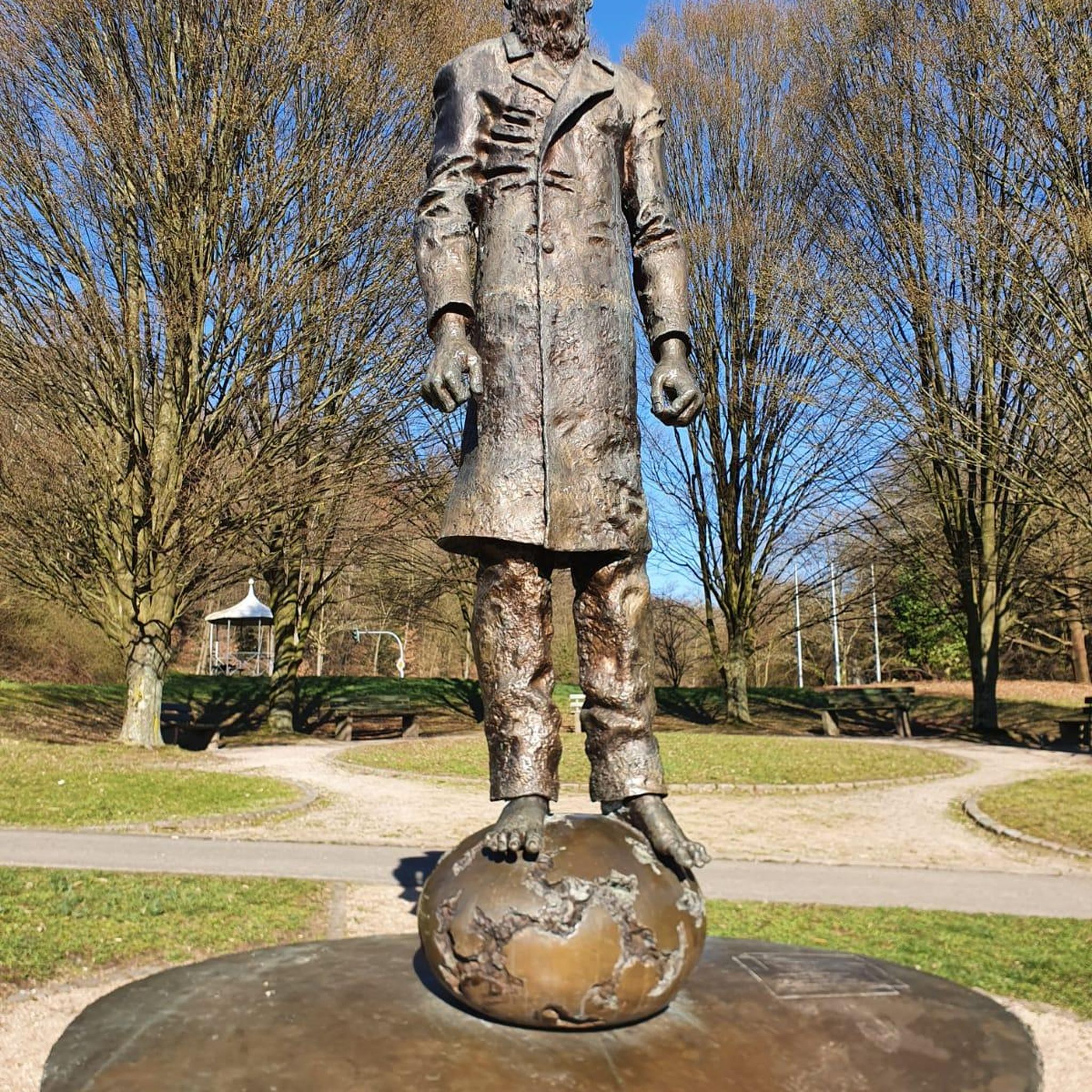
The Brickell Avenue Drawbridge is a 0.1-mile bascule bridge over the Miami River. Next to the bridge is a 53-foot bronze statue, known as The Pillar of History, honoring the Tequesta Indians.
1
0
Frequently Asked Questions
Are there any family-friendly hikes in the Brownsville area?
Yes, Brownsville offers several great options for families. The Wynwood Walls – Wynwood Walls loop from Wynwood is an easy and short walk. For a nature-focused outing, Sabal Palm Sanctuary has over three miles of scenic, easy-to-navigate trails, including boardwalks that are perfect for all ages to explore a unique palm forest.
Can I bring my dog on the hiking trails near Brownsville?
Many city parks and trails in Brownsville are dog-friendly, provided your dog is on a leash. The Historic Battlefield Trail is a popular choice for dog walkers. However, most state parks and national wildlife refuges, such as Resaca de la Palma State Park and Laguna Atascosa National Wildlife Refuge, have restrictions to protect wildlife, so pets are generally not permitted on their trails. Always check the specific park's regulations before you go.
What kind of wildlife can I expect to see while hiking?
Brownsville is a fantastic destination for wildlife viewing, especially for birdwatching, as it's on a major migratory flyway. At Resaca de la Palma State Park, you can spot a wide variety of birds from observation decks overlooking the water. Laguna Atascosa National Wildlife Refuge is home to over 417 bird species, javelinas, and is a critical habitat for the endangered ocelot. Even on city trails, it's common to see native birds and butterflies.
Are there any paved trails suitable for walking or running?
Yes, Brownsville has an excellent network of paved trails. The Historic Battlefield Trail is a nearly 10-mile paved rail-trail connecting the Palo Alto Battlefield to the city. Additionally, the Paseo de la Resaca Trail System offers 7 miles of paved hike-and-bike paths that wind through residential areas and connect several local parks.
What are some popular places for hiking around Brownsville?
Locals and visitors enjoy a variety of hiking destinations. Resaca De La Palma State Park & World Birding Center is highly regarded for its well-maintained trails and excellent birding opportunities. For a different experience, Monte Bella Trails Park offers a popular single-track course through mesquite woodland. The Historic Battlefield Trail is another favorite, providing a long, paved path rich with local history.
How difficult are the hiking trails in the Brownsville area?
The terrain around Brownsville is generally flat, so most trails are rated as easy to moderate. The challenge often comes from the length of the trail and the heat, rather than elevation gain. For example, the Downtown Miami loop from Wynwood is considered moderate due to its length. You can find more challenging single-track routes at Monte Bella Trails Park, but there are no truly difficult mountain hikes in the region.
What is the best time of year to hike in Brownsville?
The best time to hike in Brownsville is from late fall to early spring, typically from November through April. During these months, the weather is milder and more pleasant for outdoor activities. Summer hikes are possible but require careful preparation due to high heat and humidity; if hiking in summer, go early in the morning and bring plenty of water.
Are there any free hiking trails in the area?
Yes, many of Brownsville's city-managed trails are free to access. The Historic Battlefield Trail, Monte Bella Trails Park, and the Paseo de la Resaca Trail System are all excellent options that do not require an entry fee. State parks and sanctuaries like Resaca de la Palma and Sabal Palm Sanctuary typically charge a small entrance fee to help with maintenance and conservation.
How long is the Historic Battlefield Trail?
The main Historic Battlefield Trail is a nearly 10-mile paved path. It runs from the Palo Alto Battlefield National Historical Park on the north side of the city down to the Mitte Cultural District in Brownsville, offering a scenic and historic route for hiking and biking.
What do other hikers enjoy most about the trails in Brownsville?
The trails around Brownsville are highly rated by the komoot community, with an average score of 5.0 stars. Hikers often praise the unique semi-tropical landscape, the excellent opportunities for birdwatching, and the blend of natural scenery with significant historical sites. The well-maintained paved paths like the Historic Battlefield Trail are also frequently mentioned as a highlight.
Are there any coastal hiking trails near Brownsville?
While Brownsville itself is not directly on the coast, Laguna Atascosa National Wildlife Refuge offers trails that explore coastal prairie and tidal flat ecosystems near the Laguna Madre. For direct beach hiking, South Padre Island is a short drive away and provides miles of shoreline to explore on foot.
What makes hiking in Resaca de la Palma State Park unique?
Resaca de la Palma offers a quintessential Rio Grande Valley experience. Its trails wind through a 1,200-acre semi-tropical landscape shaped by an ancient channel of the Rio Grande. To preserve the habitat, you explore on foot, by bike, or via a tram service instead of a personal car. Four observation decks provide prime spots for viewing the park's abundant wildlife, especially birds.
Most popular attractions around Brownsville

Get inspired with the komoot mobile app


Explore more
Browse the best Hikes in other regions.
