The best running trails around Trinkwassertalsperre Frauenau
4.4
(111)
1,405
runners
143
runs
Jogging routes around Trinkwassertalsperre Frauenau are set within the Bavarian Forest National Park, characterized by dense, unspoiled forests and the central reservoir. The terrain features extensive meadows and moorlands, with views of prominent peaks such as Großer Rachel and Kleiner Rachel. The area is largely untouched, providing a natural environment for running.
Best jogging routes around Trinkwassertalsperre Frauenau
- The most popular jogging route is Frauenau drinking water dam – Frauenau Reservoir loop from Wildschutzgebiet Auwald, a 3.5 miles (5.7…
Last updated: July 5, 2026
4.0
(1)
32
runners
Moderate run. Good fitness required. Mostly paved surfaces. Suitable for all skill levels.
4.3
(3)
44
runners
Hard run. Very good fitness required. Sure-footedness, sturdy shoes and alpine experience required.

Sign up for free
5.0
(4)
31
runners
14.6km
02:07
680m
680m
Hard run. Very good fitness required. Sure-footedness, sturdy shoes and alpine experience required.
8
runners
Hard run. Very good fitness required. Mostly paved surfaces. Suitable for all skill levels.
13
runners
4.96km
00:35
90m
90m
Easy run. Great for any fitness level. Mostly paved surfaces. Suitable for all skill levels.
Get access to more routes and recommendations from other explorers.
Sign up for free
Already have an account?
Our route recommendations are based on thousands of hikes, rides, and runs completed by other people on komoot.
Start today with a free account
Your next adventure awaits.
Login or Signup
Popular around Trinkwassertalsperre Frauenau


Tips from the Community


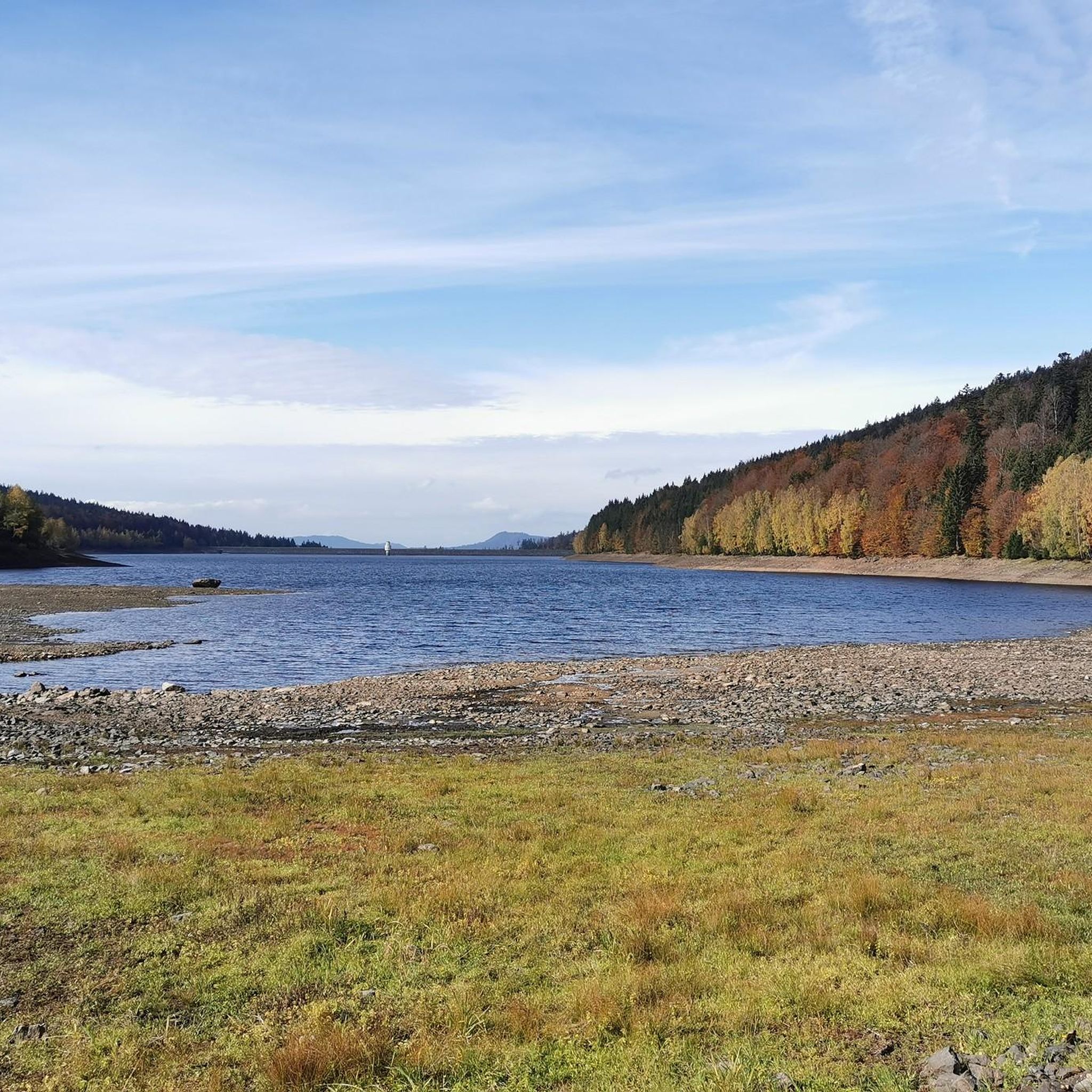
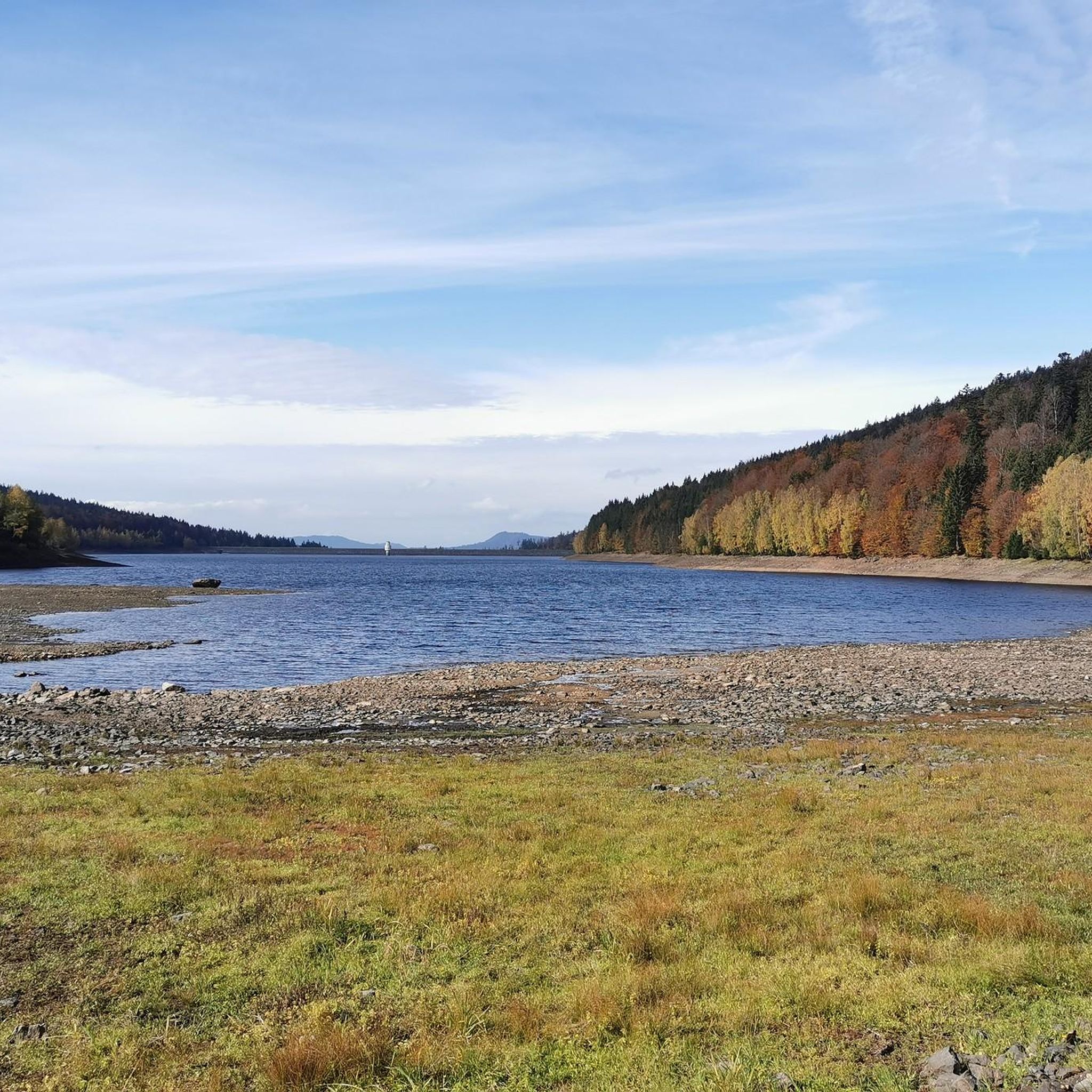
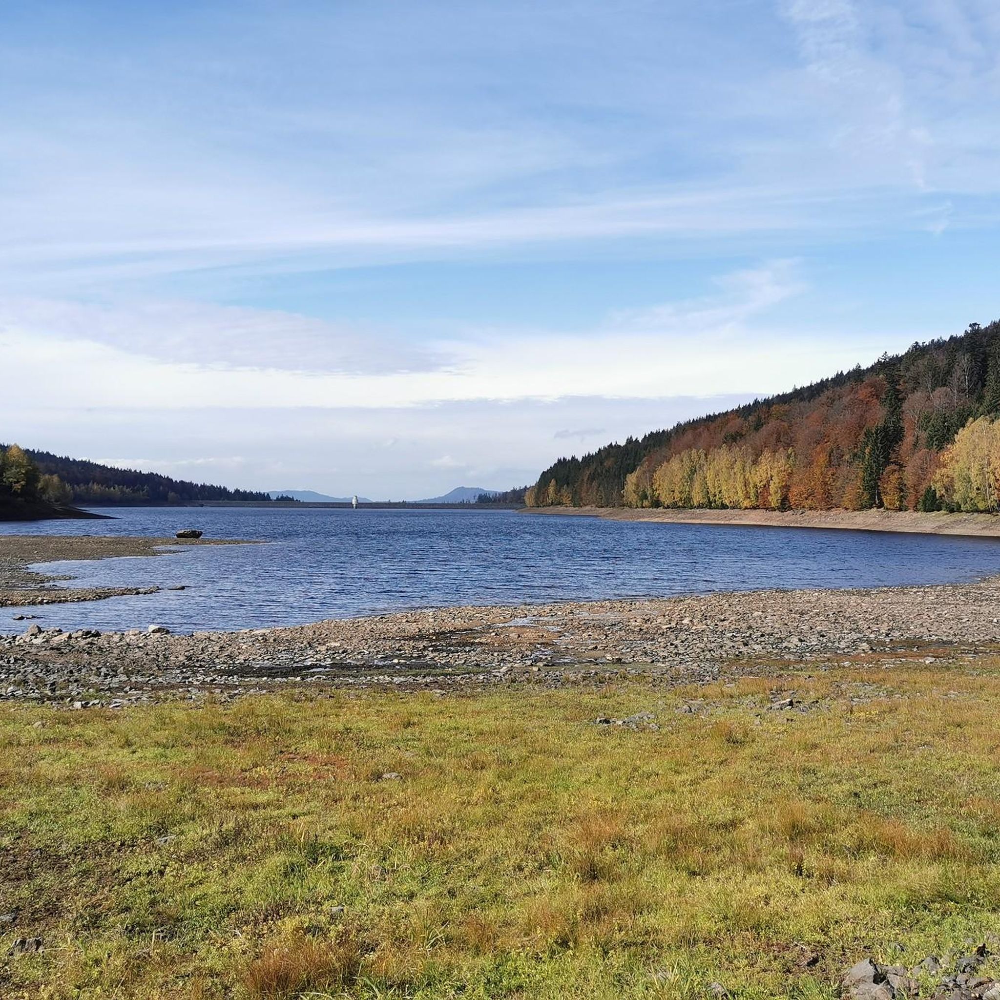
Unfortunately, the water level is now much lower.
0
0

A tour to the Schachten is particularly worthwhile in autumn. You can hike over the Hochschachten to the Latschensee. The Latschensee is a raised bog lake with no outflow.
0
0

Beautiful hiking parking lot for the start of many great tours
0
0
Great panoramic view from the big Rachel
0
0

Easy to reach from the nearby hiking car park. Next time I'll take my bike with me, because it's a good mile from the lake to get up to the Schachten. Hiking and biking definitely makes sense here.
1
0

The Frauenau drinking water dam is always worth a visit. There are numerous opportunities for hiking and biking here 👌
2
0

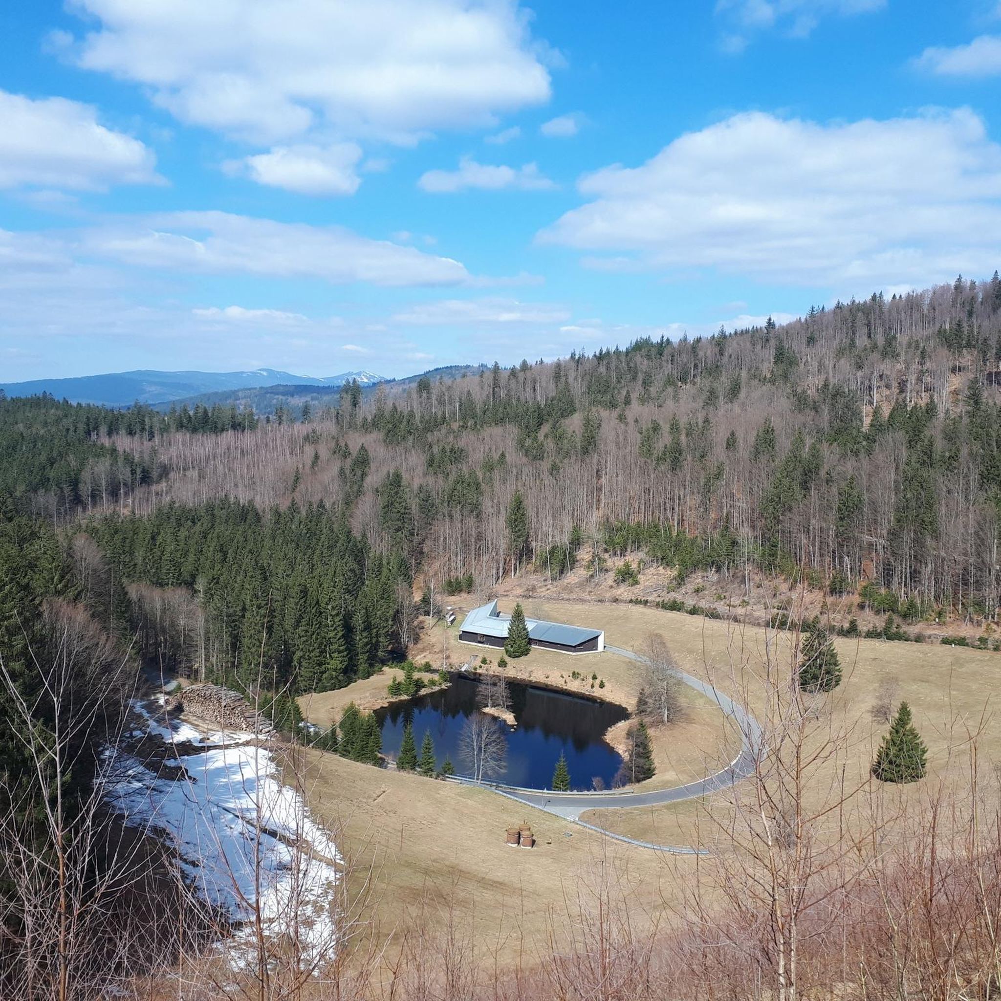
Very nice view 🤩 when the weather is nice all the way to the Alps 🤩
6
0
Frequently Asked Questions
How many running routes are available around Trinkwassertalsperre Frauenau?
There are over 100 diverse running routes around Trinkwassertalsperre Frauenau, ranging from easy loops around the reservoir to challenging ascents into the surrounding mountains. This includes 7 easy, 64 moderate, and 45 difficult trails, catering to all fitness levels.
Are there any easy or beginner-friendly running routes in the area?
Yes, absolutely! The most popular easy route is the Frauenau drinking water dam – Frauenau Reservoir loop from Wildschutzgebiet Auwald. This approximately 5.7 km circular path around the reservoir has no significant inclines, making it ideal for beginners or those seeking a relaxed run. There are 7 easy routes in total.
Can I find circular running routes around Trinkwassertalsperre Frauenau?
Yes, circular routes are a highlight of the area. The main attraction for runners is the approximately 5.5 to 7-kilometer circular path directly around the reservoir. Many other routes, such as the Frauenau drinking water dam – Frauenau Reservoir loop, are also designed as loops, offering convenient starting and ending points.
What kind of views and natural features can I expect on the running trails?
Runners can enjoy magnificent views of the entire reservoir and prominent peaks like Großer Rachel and Kleiner Rachel, as well as Kleiner Falkenstein and Großer Falkenstein. The routes wind through dense, unspoiled forests, extensive meadows, and moorlands, characteristic of the Bavarian Forest National Park. You'll experience a serene, natural environment largely untouched by human intervention.
Are there any specific points of interest or landmarks along the running routes?
Yes, several interesting points enhance your run. You can see the impressive Dam crest of the Frauenau Reservoir, which offers panoramic views. There's also a scenic Wayside Cross and Picnic Area with Views of the Frauenau Drinking Water Reservoir, perfect for a break. Information boards along the main reservoir path also provide insights into the dam's construction and function.
Are the running routes around Trinkwassertalsperre Frauenau suitable for families?
Many routes, particularly the circular path around the reservoir, are suitable for families due to their manageable length and minimal inclines. These paths offer a pleasant outdoor experience for various fitness levels. For more challenging family outings, consider some of the moderate trails.
What do other runners say about the trails in Trinkwassertalsperre Frauenau?
The running routes in Trinkwassertalsperre Frauenau are highly rated by the komoot community, with an average score of 4.5 stars from over 90 reviews. Over 1200 runners have explored the varied terrain, often praising the serene forest environment, the picturesque reservoir views, and the well-maintained paths.
Are there any challenging running routes for experienced runners?
Absolutely. For experienced runners seeking a challenge, routes like the Frauenau Drinking Water Reservoir – Großer Rachel Summit loop (20.1 km) or the Rachel Summit – Großer Rachel Summit loop (14.6 km) offer significant elevation gains and demanding ascents towards the Rachel peaks, providing expansive views and a rewarding workout.
Is there parking available near the running trails?
While specific parking locations are not detailed in the route descriptions, the area around Trinkwassertalsperre Frauenau, being a popular outdoor destination within the National Park, typically offers designated parking areas for visitors accessing trails. It's advisable to check local signage upon arrival.
Can I bring my dog on the running trails around Trinkwassertalsperre Frauenau?
The Bavarian Forest National Park generally welcomes dogs on trails, provided they are kept on a leash to protect wildlife and ensure the safety of other visitors. It's always a good idea to check specific trail regulations or local park rules for any restrictions, especially in protected areas.
What is the best season for running in Trinkwassertalsperre Frauenau?
The region offers beautiful running conditions throughout much of the year. Spring and autumn provide pleasant temperatures and stunning natural colors. Summer is also popular, though some trails might be busier. Winter running is possible, but be prepared for snow and ice, especially on higher elevation routes, and ensure you have appropriate gear.
Are there any long-distance running options that connect to other areas?
Yes, the Trinkwassertalsperre Frauenau serves as an excellent starting point for longer runs deeper into the National Park. Routes like the Frauenau Drinking Water Reservoir – Latschensee loop (22 km) or the Rachel Summit – View of Frauenau loop (21 km) extend into the wider forest landscape, offering connections towards the Rachel and Falkenstein mountains for more extensive adventures.
Most popular routes around Trinkwassertalsperre Frauenau
Most popular attractions around Trinkwassertalsperre Frauenau

Get inspired with the komoot mobile app


Explore more
Browse the best Running Trails & Routes in other regions.
