The best running trails around Silverthorne
4.9
(6)
388
runners
16
runs
Jogging around Silverthorne offers access to an extensive network of trails set against the backdrop of the Colorado Rockies. The region is characterized by the scenic Blue River, the expansive Dillon Reservoir, and the majestic Gore Range mountains. Runners can explore diverse terrains, from paved multi-use paths along the river to challenging ascents within the White River National Forest. This varied landscape provides numerous opportunities for running, with routes suitable for different fitness levels.
Best jogging routes around Silverthorne
- The…
Last updated: June 23, 2026
11
runners
19.7km
03:04
1,140m
1,140m
Challenge yourself on the difficult 12.2-mile Ptarmigan Peak Trail, gaining 3748 feet for panoramic views in White River National Forest.
7
runners
7.30km
00:59
220m
220m
Jog the moderate 4.5-mile Willow Creek Loop via Gore Range Trail, gaining 736 feet in elevation with scenic views and Willow Creek Falls.

Sign up for free
6
runners
18.8km
02:42
790m
790m
Jogging the difficult 11.7-mile Willow Lake Trail in Eagles Nest Wilderness offers stunning lake views and a challenging 2608-foot climb.
3
runners
15.6km
02:18
730m
730m
Jog the difficult 9.7-mile Salmon Lake trail in Eagles Nest Wilderness, gaining 2391 feet with stunning alpine views.
5.0
(1)
21
runners
Moderate run. Good fitness required. Mostly paved surfaces. Suitable for all skill levels.
Get access to more routes and recommendations from other explorers.
Sign up for free
Already have an account?
Our route recommendations are based on thousands of hikes, rides, and runs completed by other people on komoot.
Start today with a free account
Your next adventure awaits.
Login or Signup
Tips from the Community

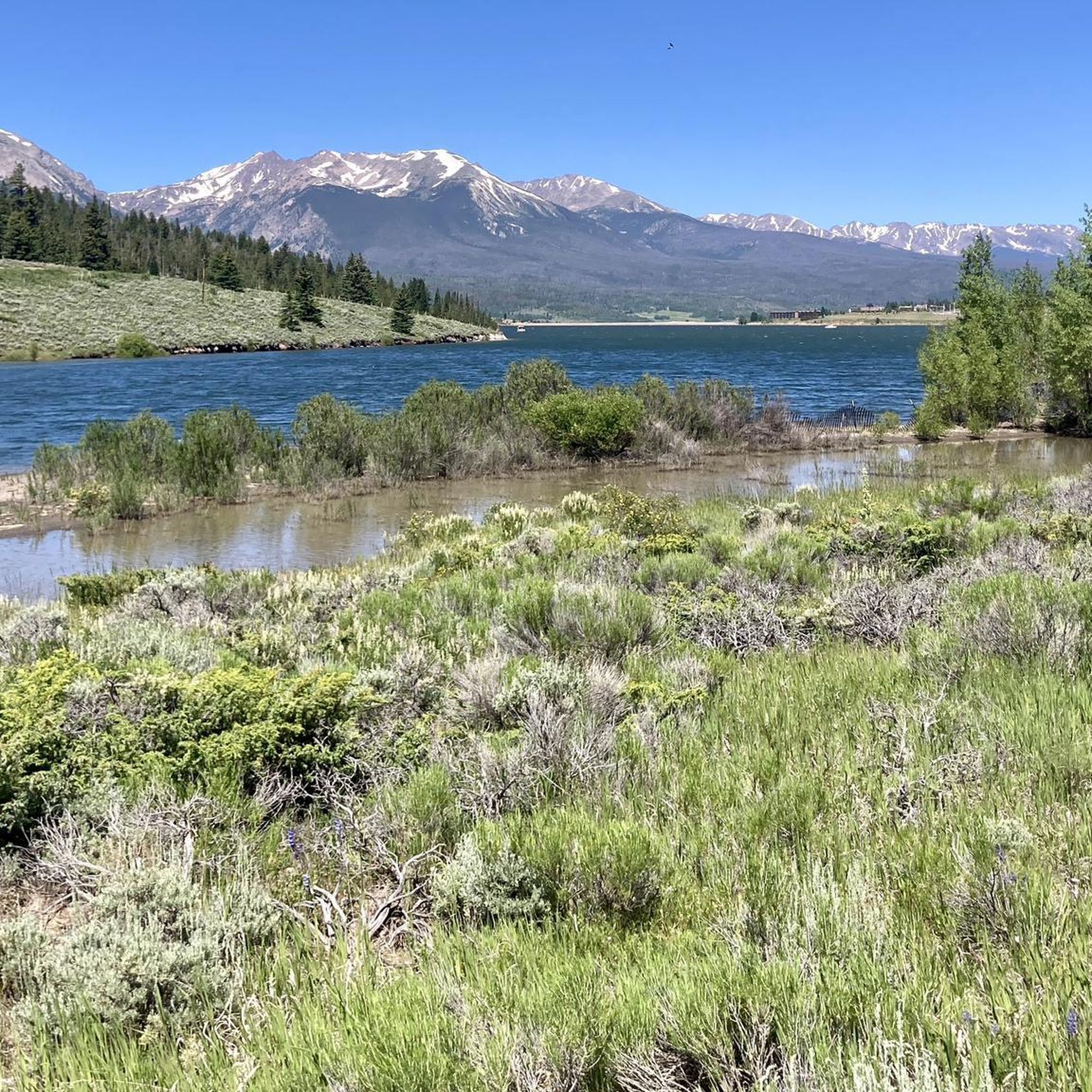
The Blue River Trail offers an easy, convenient, and scenic paved path to explore the surrounding nature. This path serves as a great corridor for people who want to ride their bikes to go shopping or nearby attractions. There’s is a pedestrian bridge crossing the river, and another small section of path on the west side.
0
0

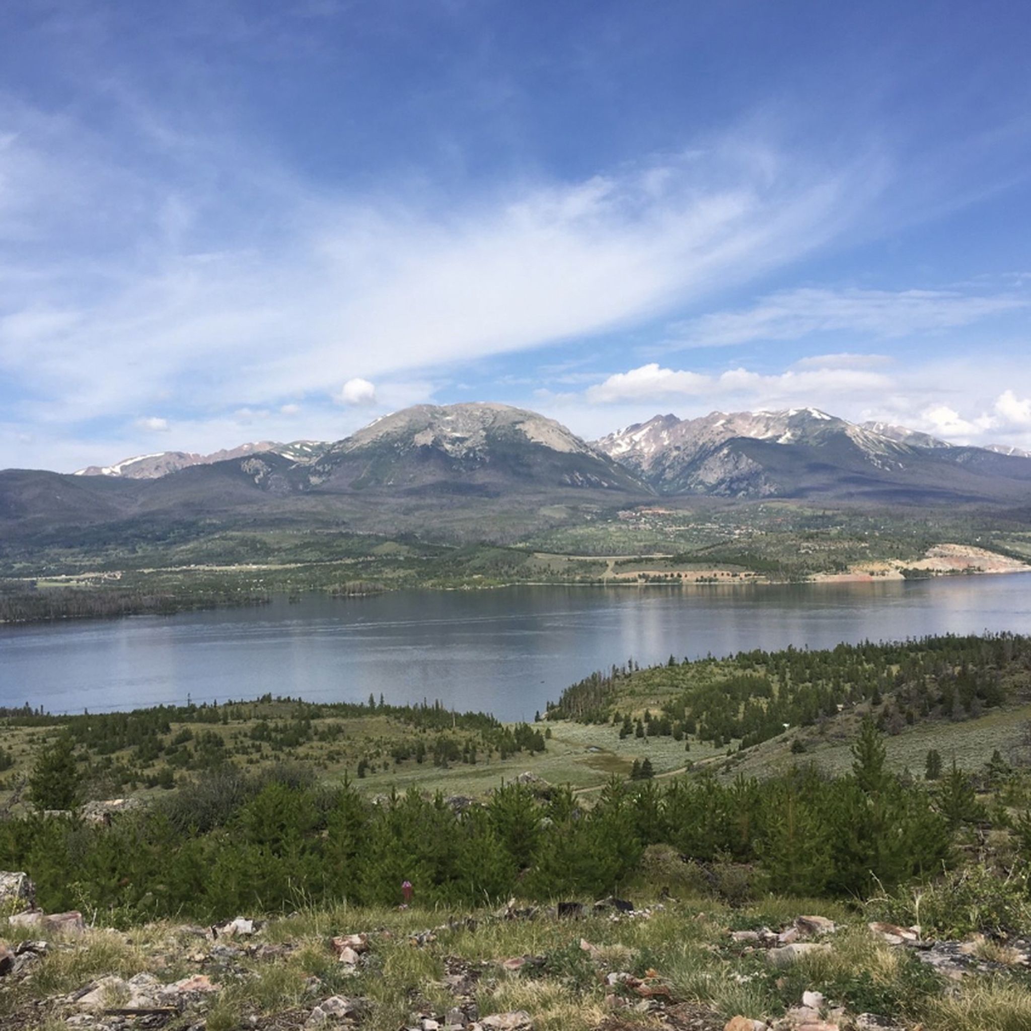
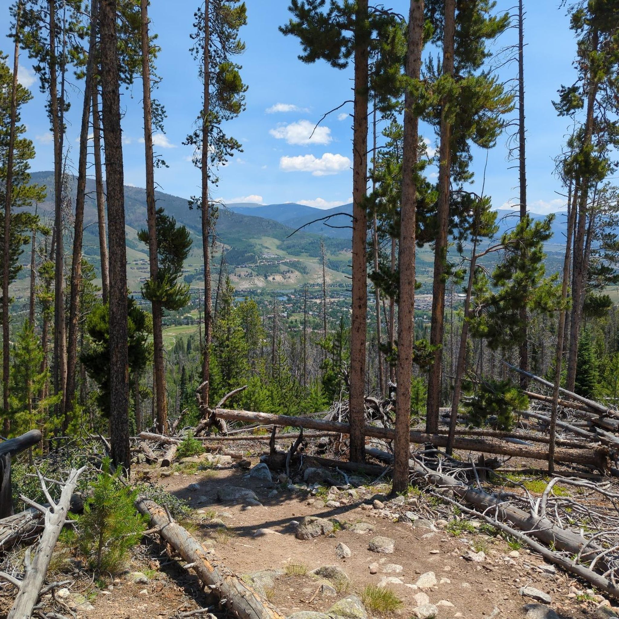
The top of the Angler Mountain Trail pops out in a meadow with a window view towards the Gore Range and the Eagles Nest Wilderness. There is an even better overlook a little further up the Ptarmigan Loop Trail.
0
0
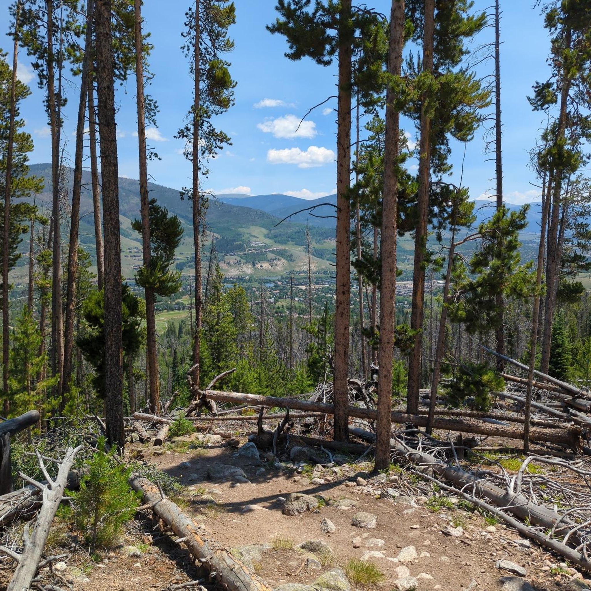
There is an awesome overlook with a bench right on the side of the trail. This picturesque overlook views out onto the Tenmile Range and part of the Eagles Nest Wilderness.
0
0
The Ptarmigan Loop Trail and Ptarmigan Peak Trail intersect in an open meadow near treeline. This also marks the Ptarmigan Peak Wilderness boundary, and no bikes are allowed to climb further up the trail. There are two ways down the mountain from here with the Ptarmigan Peak Trail being steeper and more advanced.
0
0
Ptarmigan Peak is the local looming mountain for Silverthorne, Colorado. The mountain's summit rises to 12,498 feet, almost 1,000 feet above treeline. This offers expansive views of various 13,000 and 14,000 foot peaks around the area along with small mountain towns.
0
0
The South Willow Creek Trail travels through a constant riparian environment with a creek running next to the trail the majority of the time. You dive in and out of aspen groves, meadows, and pine forests as you move along this trail.
0
0
The popular fishing holes of Willow Lakes draw more attention than the nearby Salmon Lake. Salmon Lake is a high alpine lake just north of Red Peak. The lake is beautiful any time of year, but the trail to the water is hard to navigate before the snow melts out in June.
0
0
Tucked away in an alpine basin at the base of Red Peak's northern slopes is a group of high elevation lakes known as Willow Lakes. The most popular approach to the Lakes involves taking the Gore Range Trail from either the north or the south and tying that into the Willow Lakes Trail. Other adventurers drop into the Willow Lake basin from the peaks and ridges towering above.
0
0
Frequently Asked Questions
How many running routes are available in Silverthorne?
Silverthorne offers a diverse network of over 15 running routes, catering to various fitness levels and preferences. These trails range from easy, paved paths along the Blue River to challenging mountain ascents within the White River National Forest.
Are there any easy jogging paths suitable for beginners or families in Silverthorne?
Yes, for an easy and scenic run, consider the Blue River Trail loop from North Pond Park. This 6.2-mile (10.0 km) route follows riverside terrain and is generally flat. The Blue River Trail (also known as the Silverthorne Bike Path) itself is a paved multi-use path offering a convenient off-road experience, perfect for leisurely jogs. North Pond Park also features walking trails ideal for a relaxed pace.
What are some challenging running trails in Silverthorne for experienced runners?
For those seeking a more strenuous workout, the Ptarmigan Peak Trail is a difficult 12.2-mile (19.7 km) route with significant elevation gain, offering panoramic mountain views. Another demanding option is the Willow Lake Trail, which spans 11.6 miles (18.8 km) and features substantial climbing through alpine terrain.
Are there any running routes that offer great viewpoints or natural landmarks?
Absolutely. Many routes in Silverthorne provide stunning vistas. The Ptarmigan Peak Trail leads to incredible mountain panoramas. The Dillon Reservoir Recpath, while not a specific route in our guide, offers breathtaking views of Dillon Dam and Reservoir and the surrounding peaks. The Salt Lick Trail system, which includes an ascent to Lily Pad Lake, provides rewarding views of Lake Dillon, Buffalo Mountain, and Peak One.
Can I find circular jogging routes in the Silverthorne area?
Yes, Silverthorne offers several excellent loop options. A popular choice is the Blue River Trail loop from North Pond Park, which is a moderate 6.2-mile (10.0 km) path. Another scenic loop is the Willow Creek Loop via Gore Range Trail, a moderate 4.5-mile (7.3 km) route winding through forested areas.
What do other runners think about the jogging trails in Silverthorne?
The running routes in Silverthorne are highly regarded by the komoot community, boasting an impressive average rating of 4.9 stars from over 6 reviews. Runners frequently praise the diverse terrain, from riverside paths to challenging mountain trails, and the stunning Colorado Rockies backdrop that accompanies many of the routes.
Are there any trails suitable for trail running with significant elevation gain?
For runners looking for significant elevation challenges, the Ptarmigan Peak Trail features over 1,100 meters of ascent. The Salmon Lake trail run is another difficult option with over 700 meters of elevation gain, offering a rewarding workout amidst the mountain scenery.
What kind of terrain can I expect on Silverthorne's running routes?
Silverthorne's running routes offer a wide variety of terrain. You'll find paved multi-use paths like the Blue River Trail, ideal for smooth, easy runs. Other trails, such as those in the Salt Lick Trail system or leading to Lily Pad Lake, wind through lodgepole pine and aspen groves, offering a more natural, unpaved surface. Higher elevation trails, like those in the White River National Forest, can feature rocky, uneven ground typical of alpine environments.
Are there any specific attractions or points of interest near the running trails?
Beyond the trails themselves, Silverthorne is rich with natural attractions. Many routes offer views of Dillon Dam and Reservoir. You can also find highlights like Willow Creek Falls and the majestic Buffalo Mountain. The Lily Pad Lake is a popular destination accessible via the Salt Lick Trail system, offering a serene natural setting.
What are the best times of year for jogging in Silverthorne?
The warmer months, typically late spring through early fall, are ideal for jogging in Silverthorne when most trails are clear of snow. During winter, many summer hiking trails transform into routes suitable for snowshoeing or cross-country skiing. The Silverthorne Recreation Center also offers an indoor track, providing an alternative for runners during inclement weather or colder months.
Are there any dog-friendly running trails in Silverthorne?
While specific trail regulations can vary, many areas in Silverthorne are dog-friendly. Maryland Creek Park features an off-leash dog park and trails suitable for running with your canine companion. It's always recommended to check local signage and regulations for specific trails, especially within the White River National Forest or designated wilderness areas, to ensure dogs are permitted and to understand leash requirements.
Is parking available at the trailheads for these running routes?
Yes, many popular trailheads in Silverthorne, such as those for the Blue River Trail and access points to the Salt Lick Trail system, typically offer designated parking areas. For routes like the Blue River Trail loop from North Pond Park, parking is available directly at North Pond Park.
Most popular routes around Silverthorne
Most popular attractions around Silverthorne

Get inspired with the komoot mobile app


Explore more
Browse the best Running Trails & Routes in other regions.
