The best running trails around Blue River
5.0
(2)
568
runners
57
runs
Jogging around Blue River offers diverse terrain for runners of all levels. The region is characterized by significant elevation changes, with routes ascending into mountainous areas and others traversing more moderate hills. Many running routes follow natural features like creeks and lead to scenic lakes, providing varied landscapes for outdoor activity. The area's trails are well-suited for those seeking both challenging ascents and more gentle running paths.
Best jogging routes around Blue River
- The most popular jogging route is Quandary…
Last updated: October 10, 2026
70
runners
10.2km
02:26
980m
980m
Hard run. Very good fitness required. Sure-footedness, sturdy shoes and alpine experience required.
5.0
(1)
8
runners
5.07km
00:37
170m
170m
Moderate run. Good fitness required. Mostly paved surfaces. Suitable for all skill levels.

7
runners
13.3km
01:58
620m
620m
Hard run. Very good fitness required. Mostly paved surfaces. Suitable for all skill levels.
5
runners
10.5km
01:11
260m
260m
Moderate run. Good fitness required. Mostly paved surfaces. Suitable for all skill levels.
1
runners
14.6km
02:45
1,010m
1,010m
Hard run. Very good fitness required. Sure-footedness, sturdy shoes and alpine experience required.
Get access to more routes and recommendations from other explorers.
Already have an account?
Our route recommendations are based on thousands of hikes, rides, and runs completed by other people on komoot.
Start today with a free account
Your next adventure awaits.

Tips from the Community

Here the water does not "fall" quite as "deep" as at the lower waterfall, but you can get right up to the cool water; the detour is definitely worth it!
0
0
Climb a few meters up behind the dilapidated hut and you will have wonderful views of the Lower Waterfall (and that in August!)
1
0

Sometimes shady, sometimes sunny and always varied, you will be on the Baker's Tank Trail. It takes you to the historic Baker's Tank, from where you can hike back to the starting point on the Boreas Pass Road.
1
0

Boreas Pass via Baker's Tank Trail is a shaded trail with exposed sections sprinkled throughout. If you ride to the end (or you can just drive there via Boreas Pass Road) you will be rewarded with the Baker's Tank historic site.
0
0

Historic water refill station for the steam trains on their way up Boreas Pass
0
0

More than anything, Baker's Tank serves as a historical spot that pays memory to the trains that used to travel through the area and had to fill their water tanks here. There is a huge water tank with an informational sign at the trail/road intersection.
0
0
Baker's Tank Trail is a super popular trail traveling from the main trailhead near the bottom of Boreas Pass Road to Baker's Tank 2.7 miles away. It breaks in and out of the trees while it climbs steadily and intersects a number of other trails and roads.
0
0
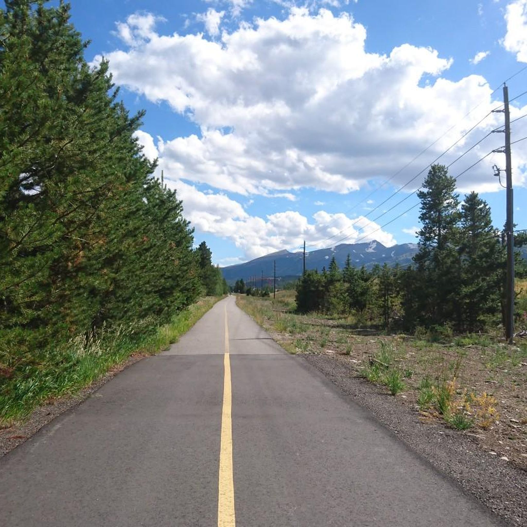
Boreas Pass Road is a super popular road for driving, biking, running, and hiking. There are a number of singletrack trails that pop out on the road, which follows an old railroad route on a dirt and gravel road. This is a quicker route than many of the trails that run parallel to it. If you are looking for a long uphill (and then a long downhill) on a smooth, runnable dirt road, it doesn't get much better than Boreas Pass Road. Summit County does a great job of maintaining the road, which just follows an old rail bed at a moderate 3-5% grade, making this is a popular long run and workout spot.
0
0
Frequently Asked Questions
How many running routes are available in the Blue River region?
The Blue River area offers a wide selection of running routes, with over 45 trails to explore. These range from moderate paths to more challenging ascents, catering to various fitness levels.
Are there any easy or beginner-friendly jogging trails in Blue River?
Yes, for those seeking a gentler pace, Blue River has a couple of easy running routes. While specific names aren't highlighted as 'easy' in the top routes, many moderate trails offer less strenuous options. For example, the Burro Trail is a moderate 3.2-mile (5.1 km) path with moderate elevation changes, often completed in about 36 minutes, making it suitable for many beginners.
Can I find circular running routes in Blue River?
Absolutely. Many runners prefer loop trails for their convenience. The Spruce Creek Loop is a great example, offering a moderate 4.4-mile (7.1 km) experience with varied terrain.
What kind of scenery can I expect on the running routes around Blue River?
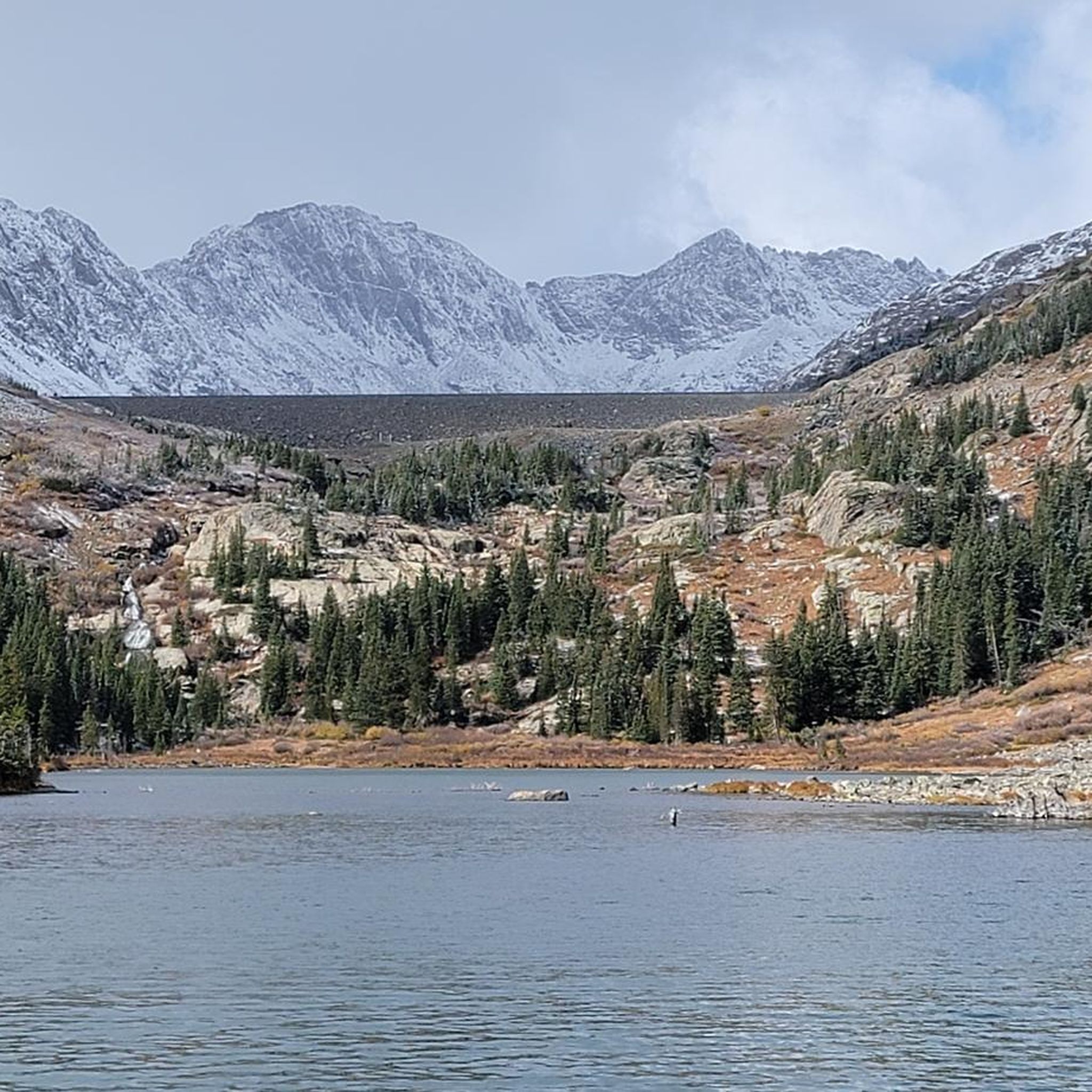
Jogging in Blue River provides diverse and stunning scenery. You'll encounter mountainous ascents, dense forested paths, and routes that follow alongside picturesque creeks and lead to scenic lakes. Trails like Spruce Creek and Mohawk Lakes Trail wind through forests and past beautiful lakes, offering rewarding views.
Are there any specific viewpoints or natural landmarks to look out for on the trails?
Yes, the region is rich with natural beauty. While running, you might encounter stunning mountain peaks such as Peak Eight Summit or the iconic Summit of Quandary Peak. The Blue Lakes (Quandary Peak) are also a notable natural monument in the area, offering breathtaking views.
What do other runners say about the trails in Blue River?
The running routes in Blue River are highly regarded by the komoot community, boasting an impressive average score of 5.0 stars from over 1 review. More than 330 runners have explored the varied terrain, often praising the challenging ascents and the beautiful natural landscapes.
Are the running trails in Blue River suitable for families?
While many routes in Blue River feature significant elevation changes and can be challenging, there are options suitable for families looking for a more moderate experience. Look for trails described as 'moderate' in difficulty, which often have less extreme ascents and descents.
What is the best time of year for running in Blue River?
The best time for running in Blue River generally depends on your preference for weather and trail conditions. Spring and fall offer cooler temperatures and vibrant scenery, while summer provides warmer weather ideal for high-altitude trails. Winter running is possible but requires appropriate gear and awareness of snow and ice conditions.
Are there any longer, more challenging running routes for experienced runners?
Experienced runners will find plenty of challenging options. For instance, the Quandary Peak Trail is a difficult 6.3-mile (10.2 km) route with substantial elevation gain, leading to high-altitude views. Another demanding option is the Baker's Tank Trail and Boreas Pass Loop, a moderate 6.5-mile (10.5 km) trail that offers a good workout.
Is parking available near the running trailheads in Blue River?
Parking availability varies by trailhead. Many popular trailheads in the Blue River area, especially those leading to well-known routes, typically have designated parking areas. It's always advisable to check specific route details on komoot for information regarding parking facilities before you go.
Can I reach any of the running routes using public transport?
Public transport options in the Blue River region can be limited, especially for trailheads located in more remote mountainous areas. While some main towns might have bus services, direct access to many running routes often requires personal transportation. It's recommended to research local transport schedules and trailhead accessibility for your chosen route.
Most popular attractions around Blue River

Get inspired with the komoot mobile app


Explore more
Browse the best Running Trails & Routes in other regions.
