The best walks and hikes around Wawona
4.8
(368)
5,280
hikers
34
hikes
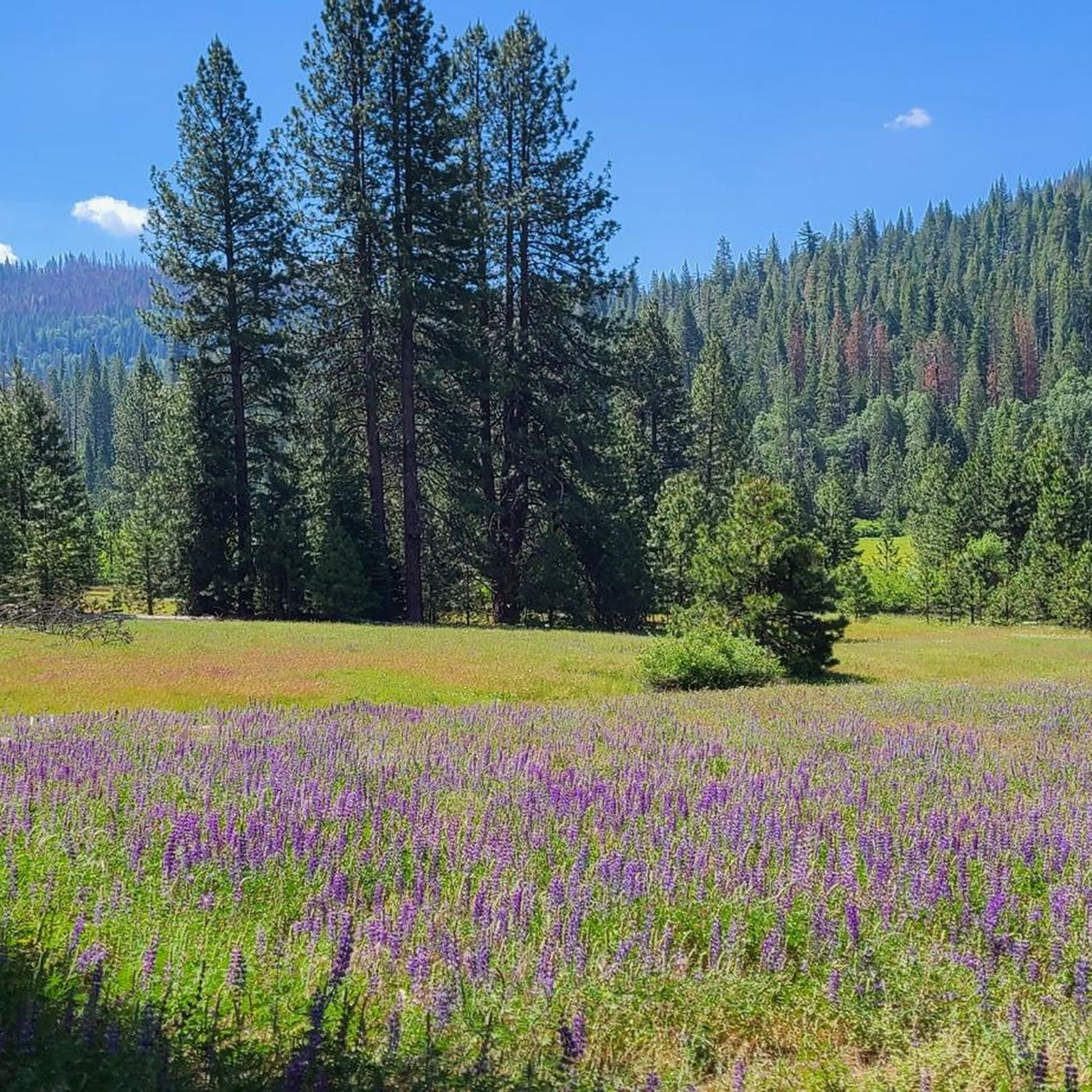
Hikes around Wawona explore the southern region of Yosemite National Park. The area's terrain is characterized by granite domes, large meadows, and the South Fork of the Merced River. This part of the park provides a network of trails that are often quieter than those in Yosemite Valley, with routes ranging from level meadow walks to more strenuous climbs to waterfalls.
Best hiking trails around Wawona
- The most popular hiking route is Chilnualna Falls — Yosemite National Park, a 7.3 mile (11.7 km) trail that takes around 3 hours 55 minutes to complete. The route involves a significant climb of 2,067 feet (630 m) to a series of cascades on Chilnualna Creek.
- Another top favourite among local hiking enthusiasts is Wawona Meadow Loop Trail — Yosemite National Park, an easy 4.0 mile (6.5 km) path. This is one of the best hikes near Wawona for families, following a mostly flat fire road around one of the largest meadows in the High Sierra.
- Local hiking enthusiasts also love the Washburn Trail to Mariposa Grove — Yosemite National Park, a 4.2 mile (6.7 km) trail leading through forest to the Mariposa Grove of Giant Sequoias, often completed in about 1 hour 55 minutes.
- Hiking around Wawona is defined by its giant sequoia groves, expansive meadows, and granite-lined river canyons. The trail network offers options for different ability levels, from easy loops to challenging ascents.
- The routes in Wawona are highly rated by the komoot community with an average score of 4.8 stars from over 400 reviews. More than 5,000 hikers have used komoot to explore Wawona's varied terrain.
Last updated: October 11, 2026
4.9
(14)
403
hikers
6.70km
01:55
160m
160m
Hike the easy 4.2-mile Washburn Trail in Yosemite National Park, gaining 527 feet with views of Mariposa Grove.
1
hikers
24.7km
07:08
600m
600m
Embark on the Alder Creek Loop Trail, a difficult 15.4-mile (24.7 km) hiking route that promises a true backcountry experience. You will navigate varied terrain, traversing dense woodlands and crossing refreshing snowmelt streams, often encountering steep, rocky sections. The journey involves a significant climb of 1984 feet (605 metres) and typically takes around 7 hours and 8 minutes to complete. Keep an eye out for the hidden 100-foot Alder Creek Falls, a spectacular visual landmark along the way, and enjoy expansive views of the Chowchilla Mountains.
Careful preparation is key before you set out on this challenging loop. This primitive route is largely unmarked, so you should always carry a reliable trail GPS for safe navigation. Given the wilderness environment, be aware of potential wildlife encounters. It is wise to consider bringing bear bells and bear spray as a safety precaution. Plan to start early in the day to allow ample time for completion, especially considering the trail's length and difficulty.
This route offers more than just a physical challenge; it provides a deep dive into a wild landscape. Parts of the trail follow an old railroad bed, where you might discover remnants of its historical past, adding a unique layer to your adventure. The Alder Creek Loop Trail is best suited for experienced hikers seeking a demanding and immersive journey away from more crowded paths.

2.32km
00:40
50m
50m
Hike the easy 1.4-mile Guardians Loop Trail in Yosemite's Mariposa Grove, featuring towering giant sequoias and 178 feet of elevation gain.
1.03km
00:16
10m
10m
Embark on an easy hike along the Swinging Bridge Trail, a short 0.6-mile (1.0 km) route with a gentle 21 feet (6 metres) of elevation gain. This pleasant walk takes you directly to the iconic Swinging Bridge, offering a unique perspective over the Merced River. You can expect to complete this trail in about 16 minutes, making it a perfect quick outing to enjoy the natural beauty and sounds of the river.
When planning your visit, be aware that parking near the trailhead can fill up quickly, especially during busy times. To secure a spot more easily, consider starting your hike early in the morning or later in the afternoon. Always check the current park conditions and any potential road closures before you head out, particularly if you are visiting during the winter months.
The Swinging Bridge Trail is notable for its direct access to stunning views of Yosemite Valley, including glimpses of Yosemite Falls and Sentinel Rock from the bridge itself. This accessible route provides a wonderful opportunity to experience some of Yosemite's most famous landmarks without a strenuous effort. It stands out as a family-friendly option for those looking to immerse themselves in the valley's grandeur.
5.0
(22)
190
hikers
11.7km
03:55
630m
630m
Embark on the Chilnualna Falls Trail, a moderate hike that takes you through mixed pine and oak forests with varied terrain. You will encounter winding switchbacks and some steep granite steps as you ascend. The highlight is Chilnualna Falls itself, a stunning series of five cascades, including a dramatic 240-foot main fall. This rewarding route covers 7.3 miles (11.7 km) with a significant elevation gain of 2067 feet (630 metres), typically taking about 3 hours and 55 minutes to complete.
This trail is situated in the Wawona area of Yosemite National Park, making it a convenient option if you are staying in the southern part of the park. When planning your visit, be aware that in early spring, you might encounter potential stream crossings. However, log crossings are often available to assist you across these sections.
What sets this route apart is its reputation as a hidden gem within Yosemite, offering a more secluded experience compared to the park's more crowded trails. As you hike, you will also be treated to panoramic views of the majestic Sierra Nevada Range and the scenic Wawona Valley. This makes it an excellent choice if you are seeking a quieter adventure away from the main tourist hubs.
Get access to more routes and recommendations from other explorers.
Already have an account?
Our route recommendations are based on thousands of hikes, rides, and runs completed by other people on komoot.
Start today with a free account
Your next adventure awaits.
Popular around Wawona

Tips from the Community

A shuttle bus takes you here every 15 to 20 minutes from the main parking lot. It is particularly important to note that you now need to register for Yosemite NP because the park is designed to protect against crowds. This must be done online in advance. The entrance reservation can be made here: https://www.nps.gov/yose/planyourvisit/reservations.htm#:~:text=A%20reservation%20is%20required%20to,August%2017%20through%20October%2027.
1
0

Chilnualna Falls is a 690-foot series of waterfalls, which consist of five tiers ranging from 30 to 300 feet.
0
0

If you don't want to take the bus, you can also walk to Mariposa Grove and the other highlights via the Washburn Trail
0
0


Super shuttle service from the parking lot to the trees. Several hiking trails of different lengths offer something for everyone. At the entrance there is a water extraction point, be sure to fill up the supplies before the hike. It's even FREE!!!
1
1

Delightful way. A stop is mandatory here
1
0

The most popular trails here are those near the General Grant tree, also known as the "Nation's Christmas tree," as President Calvin Coolidge once called it - because Yule has been celebrated around the base of the tree every year since 1926. And there is plenty of space here for celebrations: the Goliath has a circumference of 33 meters at this point! If you can't imagine that, try this: If you put the General Grant on a multi-lane highway, it would block more than three lanes alone. A half-kilometer paved loop trail leads around the tree and to neighboring giants, including the Fallen Monarch, a fallen hollow sequoia. A very impressive fallen giant. https://www.visitcalifornia.com/de/attraction/grant-grove
2
2
Mariposa Grove is a one square kilometer patch of forest where around 500 mature giant sequoias stand. Only found on the western slopes of the Sierra Nevada, these giant trees, which can live up to 3,000 years, are the largest organisms in the world. They owe their longevity largely to their fireproof bark, as summer and fall wildfires are not uncommon in the Sierra Nevada. The fireproof and up to 60 cm thick bark protects very effectively against forest fires. Last but not least, the so-called Sequoias owe their extraordinarily long lifespan to their great resistance to enemies of all kinds (the tree bark has a high tannic acid content and thus keeps insects and fungi away) and its amazing ability to regenerate. https://www.california-tour.de/grove.htm
2
1
Frequently Asked Questions
Are there any easy, family-friendly hikes in Wawona?
Yes, Wawona is great for families. The Wawona Meadow Loop Trail is an excellent choice. It's a mostly flat, 4.0-mile (6.5 km) walk around one of the largest meadows in the High Sierra, making it suitable for all ages.
Can I bring my dog on hikes in Wawona?
Most trails in Yosemite National Park do not permit dogs. However, the Wawona Meadow Loop follows a paved and dirt fire road where leashed pets are allowed, making it a rare exception and a great option for hiking with your dog.
What's a good hike for seeing waterfalls?
For a rewarding challenge with impressive waterfalls, the Chilnualna Falls trail is the top choice. This 7.3-mile (11.7 km) hike is strenuous, involving a significant climb, but leads to a series of beautiful cascades on Chilnualna Creek. The falls are most impressive in spring and early summer.
How do the Wawona Meadow Loop and Chilnualna Falls trail compare in difficulty?
There is a significant difference. The Wawona Meadow Loop is an easy, mostly flat 4.0-mile (6.5 km) walk with minimal elevation change, perfect for a leisurely outing. In contrast, the Chilnualna Falls trail is a strenuous 7.3-mile (11.7 km) hike with over 2,000 feet (600 m) of elevation gain, requiring good fitness.
What's the best way to hike to the Mariposa Grove of Giant Sequoias?
A great option is the Washburn Trail. This 4.2-mile (6.7 km) round-trip hike takes you through a pleasant forest directly to the Grove, which is home to over 500 mature giant sequoias. It's a more immersive approach than taking the shuttle.
Are there any hikes that lead to good swimming spots?
Yes, the Swinging Bridge loop is a family-friendly trail that leads to a picturesque swinging bridge over the South Fork of the Merced River. The area around the bridge has several inviting swimming holes, perfect for cooling off on a warm day.
When is the best time of year to hike in Wawona?
Wawona offers great hiking from spring through autumn. Spring is ideal for seeing wildflowers, especially in the meadows, and for powerful waterfalls like Chilnualna Falls. Summer is warm and perfect for enjoying the river's swimming holes. Autumn provides pleasant temperatures and beautiful fall colors.
Are there any good circular or loop trails?
Yes, Wawona has several excellent loop trails. Besides the easy Wawona Meadow Loop, you can explore the Grizzly Giant Loop Trail. This moderate 7-mile (11.3 km) hike takes you through the famous Mariposa Grove, allowing you to see some of the world's largest trees on a continuous circuit.
What do other hikers enjoy most about the trails in Wawona?
The trails around Wawona are highly regarded by the komoot community. Reviewers often praise the area's tranquility compared to Yosemite Valley, the stunning giant sequoia groves, and the variety of trails that cater to different fitness levels, from easy meadow walks to challenging ascents.
How many hiking trails are in the Wawona area?
You can explore over 25 different hiking routes around Wawona. The network includes 15 easy trails, 11 moderate routes, and one difficult trail, offering a wide range of options for every type of hiker.
What river flows through Wawona?
The South Fork of the Merced River runs through Wawona. Several trails, such as the Swinging Bridge Loop, follow or cross the river, providing scenic water views and opportunities for summer swimming.
Most popular routes around Wawona
Most popular attractions around Wawona

Get inspired with the komoot mobile app


Explore more
Browse the best Hikes in other regions.
