The best walks and hikes around Toro Canyon
4.7
(52)
973
hikers
65
hikes
Hiking around Toro Canyon, located in Santa Barbara County, offers diverse landscapes characterized by rugged canyon environments and rolling foothills. The area features oak-filled canyons, chaparral, and scrub oak vegetation. Elevated points provide expansive views of the Pacific Ocean, the Carpinteria plain, and the Santa Ynez Mountains. This natural setting provides a tranquil atmosphere for outdoor activities.
Best hiking trails around Toro Canyon
- The most popular hiking route is McMenemy Trail, a 4.5 miles (7.3 km) trail that takes 2 hours 25 minutes to complete. This moderate route features varied terrain and elevation changes.
- Another top favourite among local hikers is Frank's Bench via Franklin Trail — Carpinteria, an easy 3.9 miles (6.3 km) path. It offers views of the surrounding landscape with a manageable incline.
- Local hikers also love the Tar Pits & Carpinteria Bluffs Trail — Carpinteria State Beach, a 2.7 miles (4.4 km) trail leading through coastal bluffs, often completed in about 1 hour 10 minutes.
- Hiking around Toro Canyon is defined by oak-filled canyons, coastal views, and rolling foothills. The network offers options for different ability levels, from easy walks to more challenging ascents.
- The routes in Toro Canyon are highly rated by the komoot community with an average score of 4.6 stars from over 40 reviews. More than 700 hikers have used komoot to explore Toro Canyon's varied terrain.
Last updated: October 10, 2026
5.0
(2)
16
hikers
5.46km
01:49
300m
230m
Embark on the San Ysidro, McMenemy, and Girard Trail Loop, a moderate hike that takes you through a diverse landscape of eucalyptus forests, chaparral, and grassy mountainsides. This 3.4-mile (5.5 km) route involves a steady climb of 996 feet (304 metres), typically completed in about 1 hour and 49 minutes. As you hike, you'll discover expansive views over Montecito and the Pacific Ocean, with the Channel Islands often visible on clear days. Make sure to pause at the McMenemy bench for truly panoramic vistas. You'll also encounter picturesque small waterfalls and pools within the San Ysidro Canyon section, including the impressive 60-foot San Ysidro Falls.
This popular loop is open year-round, making it accessible for hiking in any season you choose. You can generally find parking conveniently located near the trailhead in Montecito, though specific fees or permits are not usually required. The trail welcomes your leashed canine companion, so feel free to bring your dog along for the adventure. Consider starting your hike earlier in the day to enjoy cooler temperatures and potentially fewer crowds, especially during peak seasons. Always check local conditions before heading out.
Located within the Los Padres National Forest, this trail offers a rewarding experience in the Santa Ynez Mountains. The varied terrain and elevation changes provide a good workout while immersing you in the natural beauty of the region. It's a great option if you're looking for a trail that combines physical activity with stunning coastal and mountain scenery, offering a different perspective than many other local routes.
5.0
(1)
1
hikers
3.20km
01:09
320m
0m
Embark on a moderate hike along the San Ysidro Trail, a 2.0-mile (3.2 km) route that winds through lush coastal woodlands and past ancient oak trees. You will gain 1057 feet (322 metres) in elevation, a journey that typically takes about 1 hour and 9 minutes to complete. As you follow the gurgling San Ysidro Creek, the path leads you into impressive narrows carved from Coldwater and Matilija Sandstone. Keep an eye out for the numerous small waterfalls and cascades that dot the landscape. The highlight of your adventure is the beautiful San Ysidro Falls, especially vibrant after a good rain.
Planning your visit to the San Ysidro Trail is straightforward, as it is generally accessible throughout the year. You can find parking conveniently located near the trailhead on East Mountain Road. While the initial sections of the route are suitable for families, be aware that the path leading to the base of the falls can become slippery, particularly following rainfall. Always wear appropriate footwear and exercise caution on wet surfaces to ensure a safe and enjoyable experience.
This trail offers a rewarding experience for those seeking a relatively short yet scenic outing within the Los Padres National Forest. The diverse landscape, transitioning from dense woodlands to unique sandstone formations, showcases the natural beauty of the region. The presence of the San Ysidro Creek and its numerous waterfalls makes this route a popular choice for nature lovers. It provides a perfect opportunity to immerse yourself in the local environment and enjoy the tranquility of the outdoors.

1
hikers
1.83km
00:30
40m
10m
The Ennisbrook Trail offers a serene and easy hike through Montecito's lush landscape, perfect for a quick nature fix. You'll wander through ancient oak forests, some dating back to the 1840s, and follow the gentle meander of San Ysidro Creek, crossing charming historic stone bridges. This easy 1.1-mile (1.8 km) route features a minimal 142 feet (43 metres) of elevation gain and takes about 30 minutes, making it an ideal choice for a relaxing outing.
Planning your visit is straightforward; the trailhead is marked by a distinctive white picket fence, welcoming you into this tranquil preserve. The dense oak canopy provides excellent shade, making it a comfortable walk even on sunny days, and spring brings a vibrant display of wildflowers. It's a dog-friendly trail, though keeping your pet on a leash is advised, and it's suitable for families and beginners looking for a peaceful stroll.
Part of the 44-acre Ennisbrook Preserve, this trail is also known as the San Ysidro Oak Woodland and is maintained in consultation with the Land Trust for Santa Barbara County. It offers a quiet alternative to more crowded paths, and you can easily connect it with other local routes, such as the Coffin Family Trail or Reservoir Trail, if you're seeking a longer hiking experience.
2.28km
00:35
0m
30m
The Summerland Beach from Lookout Park trail offers a delightful, easy stroll along the California coast, perfect for a relaxing day out. Starting from Lookout Park, you'll descend to the sandy shores of Summerland Beach, enjoying expansive views of the Pacific Ocean, the Channel Islands, and the rugged Santa Ynez peaks. This 1.4-mile (2.3 km) hike involves a minimal 4 feet (1 metre) of elevation gain and takes about 35 minutes, making it an accessible option for nearly everyone.
Planning your visit is straightforward, as Lookout Park provides free parking, restrooms, and picnic areas right at the trailhead. This beach walk is highly tide-dependent; for the easiest and most enjoyable experience, especially when navigating around Fernando Point, aim to go at low tide. It's also a fantastic spot for dog owners, as Summerland Beach is known for being very dog-friendly.
Beyond its natural beauty, Summerland holds a unique history, once being a hub for spiritualists and home to the first offshore oil platform in the Western Hemisphere. The trail itself can be extended to explore nearby Fernald Point Beach or even further to Butterfly Beach, offering options for a longer coastal adventure. It's a great choice for those seeking a short, scenic, and family-friendly hike in the Santa Barbara area.
38.0km
14:06
2,140m
1,640m
Hike the challenging 23.6-mile Franklin Trail in Los Padres National Forest, gaining 7015 feet with stunning views of the Channel Islands.
Get access to more routes and recommendations from other explorers.
Already have an account?
Our route recommendations are based on thousands of hikes, rides, and runs completed by other people on komoot.
Start today with a free account
Your next adventure awaits.



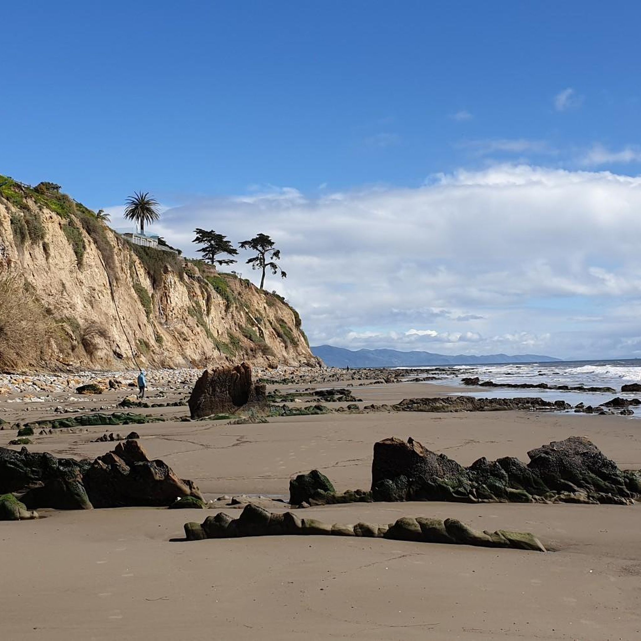
Tips from the Community

Frank's Bench is a peaceful spot to take in stunning ocean and mountain views. Nestled along Franklin Trail, it's a perfect place for a break after a hike through the scenic foothills. Whether you're watching the sunset or soaking in the coastal breeze, this overlook is a lovely escape above town.
0
0

Plenty of switch back practice here. No real berms, just a nice natural trail.
0
0
Frequently Asked Questions
How many hiking trails are available in Toro Canyon?
Toro Canyon offers a wide variety of hiking experiences, with over 35 routes available. These trails cater to different skill levels, from easy walks to more challenging ascents, ensuring there's something for everyone.
What kind of landscapes can I expect to see while hiking in Toro Canyon?
Hiking in Toro Canyon provides a diverse natural experience. You'll encounter rugged canyon environments, rolling foothills, and oak-filled canyons. The vegetation includes chaparral and scrub oak, and from elevated points, you can enjoy expansive views of the Pacific Ocean, the Carpinteria plain, Montecito, and the Santa Ynez Mountains.
What do other hikers say about the trails in Toro Canyon?
The trails in Toro Canyon are highly regarded by the komoot community, boasting an average rating of 4.6 stars from over 40 reviews. Hikers frequently praise the stunning ocean views, the tranquil atmosphere, and the well-maintained paths that offer a peaceful escape.
Are there family-friendly hiking options in Toro Canyon?
Yes, Toro Canyon is a great destination for families. The Frank's Bench via Franklin Trail — Carpinteria is an easy 3.9-mile path with a manageable incline, suitable for most families. Within Toro Canyon County Park, the main Toro Canyon Park Trail is also considered excellent for families and kids due to its short length and relatively easy 200-foot elevation gain.
Are dogs allowed on the hiking trails in Toro Canyon?
Yes, Toro Canyon County Park is dog-friendly. Dogs are welcome on-leash throughout the park and on its trails. Additionally, there's a fenced off-leash dog meadow near the park entrance, providing a dedicated space for your canine companions to play freely.
Is there parking available at Toro Canyon Park?
Yes, Toro Canyon County Park provides ample parking facilities for visitors. The park is easily accessible by car, and the drive itself offers scenic views of the shimmering sea and surrounding landscape.
Can I reach Toro Canyon Park using public transport?
While Toro Canyon Park is primarily accessed by car, public transport options to the immediate vicinity are limited. It's recommended to check local Santa Barbara County transit schedules for the closest bus stops, but a personal vehicle or ride-share service will likely be necessary for direct access to the park entrance.
What is the best time of year to go hiking in Toro Canyon?
Toro Canyon offers pleasant hiking conditions for much of the year. The area generally experiences mild weather. For the most comfortable experience and clear views, spring and fall are ideal, avoiding the hotter summer months and potential winter rains. However, the diverse vegetation and ocean views are enjoyable in any season.
Which trails offer the best views of the Pacific Ocean and surrounding areas?
For stunning vistas, the Toro Canyon Park Trail leads to a scenic gazebo with ocean views peeking through layers of mountains. The McMenemy Trail also offers varied terrain and elevation changes that provide excellent viewpoints. Additionally, the Toro Canyon Ridge Trail, though less traveled, is known for incredible views of the coastline and Carpinteria.
Are there any loop trails in the Toro Canyon area?
Yes, for those seeking a loop experience, the San Ysidro Creek & East Fork Cold Springs Trails loop — Los Padres National Forest is a challenging 10.9-mile route that offers a comprehensive exploration of the area's natural beauty.
Are there any interesting natural attractions or landmarks near the hiking trails?
Absolutely! Near Toro Canyon, you can explore several natural attractions. Consider visiting the Carpinteria Bluffs Nature Preserve for coastal views, or the unique Tar Pits Park. For a more adventurous experience, the Montecito Hot Springs and Tangerine Falls offer natural wonders to discover.
Are there trails suitable for beginner hikers in Toro Canyon?
Yes, Toro Canyon has several trails perfect for beginners. The Frank's Bench via Franklin Trail — Carpinteria is an easy 3.9-mile path, and the Tar Pits & Carpinteria Bluffs Trail — Carpinteria State Beach is another easy 2.7-mile option, both offering gentle inclines and scenic surroundings.
Most popular attractions around Toro Canyon

Get inspired with the komoot mobile app


Explore more
Browse the best Hikes in other regions.
