The best walks and hikes around Lake Hughes
5.0
(1)
47
hikers
10
hikes
If you've ever tried to plan hiking around Lake Hughes, you know how quickly the options can feel overwhelming. With so many trails crisscrossing the Sierra Pelona Mountains, it's tough to know which routes are genuinely worth your time and effort, and which are just filler. We get it — nobody wants to spend their precious weekend guessing. That's why we've done the legwork for you. Our komoot community has mapped, walked, and reviewed these routes, so this guide is your curated shortcut to the very best, saving you the guesswork.
Hiking around Lake Hughes offers a unique blend of mountainous high desert and the rugged beauty of the Angeles National Forest. Expect a landscape defined by shady oak groves, sweeping valleys, and dramatic rocky outcrops, with elevations reaching up to 4,000 feet. It’s a place where you can find everything from easy strolls to challenging mountain ascents. For a truly special experience, we highly recommend visiting in spring when the seasonal wildflowers, especially the California poppies, transform the landscape into a vibrant spectacle.
If you're looking for a rewarding day out, we'd start with the Antelope Loop Trail. At 10.8 miles (17.4 km), it's a moderate route that's consistently rated as one of the most popular for its diverse scenery. For those seeking a more challenging adventure with significant elevation gain and stunning views, the Grass Mountain Loop via PCT and Firebreak is a fantastic choice, covering 9.7 miles (15.6 km). Ready to explore? More than 30 hikers have already used komoot to discover the best of Lake Hughes, and you can too.
Last updated: June 4, 2026
6
hikers
7.33km
02:24
350m
350m
The Grass Mountain via San Francisquito Canyon Road trail offers a varied and engaging hiking experience, leading you through diverse terrain from well-maintained roads to sections of the Pacific Crest Trail. You'll traverse areas with low-lying shrubs, dry grasses, and towering yucca, eventually reaching the summit of Grass Mountain where panoramic views of Green Valley, Leona Valley, and the high desert await. This moderate 4.6-mile (7.3 km) route involves 1147 feet (350 metres) of elevation gain, with the final mile being particularly steep and challenging, making it a rewarding climb for those seeking expansive vistas.
To plan your visit, access the trailhead from San Francisquito Canyon Road, following Forest Route 6N04 and then 6N05. Given the exposed sections of the trail, especially in the Angeles National Forest, it's crucial to carry plenty of water, particularly during warmer months, and consider the best season for Grass Mountain hike to avoid extreme heat. While some parts are suitable for all ages, the steep final push to the summit means this trail is best enjoyed by hikers with good stamina and appropriate footwear.
This trail is notable for its accessibility and its connection to the Pacific Crest Trail, allowing you to experience a segment of this famous long-distance route. The broader San Francisquito Canyon area also holds historical significance, including remnants related to the 1928 St. Francis Dam disaster. Keep an eye out for wildlife sightings, as bobcat kittens have been reported, adding another layer of interest to your adventure in this scenic part of Los Angeles County.
3
hikers
15.6km
04:47
550m
540m
The Grass Mountain Loop via PCT and Firebreak offers a diverse and rewarding hiking experience in the Angeles National Forest. You'll traverse varied terrain, from singletrack through small pine groves to open ridgelines near the summit of Grass Mountain, where the vegetation shifts to manzanita and chamise. The route provides panoramic views of Green Valley, Jupiter Mountain, and the Antelope Valley, making the 9.7-mile (15.6 km) journey feel like a true adventure.
Planning your visit is straightforward, with the trailhead located off San Francisquito Canyon Road, offering convenient parking. This moderate hike involves a significant 1799 feet (548 metres) of elevation gain, so be sure to bring plenty of water, especially during warmer months. The estimated duration is around 4 hours and 47 minutes, making it a solid half-day outing, and dogs are permitted on leash.
One of the most notable aspects of this trail is its integration with the Pacific Crest Trail, allowing you to experience a segment of this famous long-distance route. The loop also incorporates fire roads and utility roads, providing different perspectives and challenges. It's a favorite for local perspectives of the Antelope Valley and offers a good workout for those seeking a challenging hike with expansive views.

2
hikers
17.4km
04:44
260m
260m
The Antelope Loop Trail offers a truly immersive experience into California's vibrant spring landscape, especially when the poppies are in full bloom. You'll traverse hard-packed dirt paths over gentle rolling hills, with the highlight being the panoramic views of the Antelope Valley and the stunning wildflower carpets, particularly around the Antelope Buttes. This moderate 10.8-mile (17.4 km) hike, with 844 feet (257 metres) of elevation gain, provides a good workout and takes around 4 hours and 44 minutes to complete.
To make the most of your visit, aim for the peak wildflower season, typically March to April. Be aware that there is generally no shade along the route, so come prepared with plenty of water and sun protection. Dogs are usually not allowed on the trail, which helps preserve the fragile natural environment.
This trail is most notable for its spectacular superblooms, transforming the south-facing slopes into a solid expanse of orange poppies and other wildflowers. It's a popular destination for nature photographers and families seeking to witness one of California's most iconic natural phenomena. The reserve provides a unique opportunity to connect with the region's unique ecosystem.
1
hikers
5.06km
01:28
150m
100m
This easy 3.1-mile (5.1 km) section of the Pacific Crest Trail, known as San Francisquito Canyon South, is a fantastic way to experience a piece of the famous long-distance route. You'll gain 485 feet (148 metres) over about 1 hour and 28 minutes, traversing soft dirt paths and some loose rock. The trail winds through chaparral, pines, and oak trees, offering expansive views of rolling hills and the high desert, including the Green Valley and Antelope Valley areas.
Accessing the trail is straightforward from the San Francisquito Canyon Road trailhead. While no permits are mentioned, it's always wise to check local regulations before you go. This area can get warm, so bring plenty of water, especially if you're hiking during the sunnier parts of the day. Green Valley is also nearby, serving as a resupply point for PCT thru-hikers.
Beyond its natural beauty, this trail holds historical significance as part of early routes between Los Angeles and the San Joaquin Valley, including the El Camino Viejo and the Butterfield Overland Mail route. It's a unique opportunity to walk in the footsteps of history while enjoying the diverse landscapes of the Angeles National Forest.
5.16km
01:34
270m
20m
This easy section of the Pacific Crest Trail near Lake Hughes offers a classic Southern California desert hiking experience, winding through arid hillsides and offering expansive views. You'll traverse rugged terrain, passing the Canyon Creek wash, as the trail climbs steadily to reveal impressive panoramas from the Hughes Canyon Overlook.
Starting from the Lake Hughes Rd trailhead, this 3.2-mile (5.2 km) hike involves 900 feet (274 metres) of elevation gain and takes approximately 1 hour and 34 minutes. Parking is available at the trailhead, and it's advisable to hike in the cooler months or early mornings to avoid the desert heat.
This segment provides a perfect introduction to the Pacific Crest Trail's diverse landscapes, showcasing the transition from the dry, windy deserts into the foothills of the San Gabriel and Liebre ranges. It's an excellent option for those seeking a family-friendly Pacific Crest Trail section or a quick, rewarding outing with scenic viewpoints.
Get access to more routes and recommendations from other explorers.
Already have an account?
Our route recommendations are based on thousands of hikes, rides, and runs completed by other people on komoot.
Start today with a free account
Your next adventure awaits.
Popular around Lake Hughes
Tips from the Community

Grass Mountain is a short, peaceful summit just off the PCT. You will most-likely get to enjoy the summit in solitude, taking in sweeping views of the Antelope Valley and western edge of the Mojave desert in peace.
0
0

San Francisquito Canyon South via Pacific Crest Trail is a 6.5 mile return trail located near Santa Clarita, California that offers the chance to see wildlife and is rated as moderate. The trail is primarily used for hiking, walking, running, and nature trips.
0
2

State park parking is $15 per car. Parking on the main street is free, it takes about 2 x 10 minutes longer walk. Most flowers can be seen in spring from March to April. Otherwise you have a fantastic view over the country.
1
0

All along the descending switchbacks the views range down the long Hughes valley toward the lake.
2
0
After crossing the slope near the spring, the trail stays along the contours below the ridge, while this seasonal contributor to San Franciscquito Creek cuts a canyon downhill.
2
0
The PCT and the Forest Route continue parallel along the ridge to the west, whereas Joey Road drops to the North at Elisabeth Lake, and to the South to a paved road.
2
0
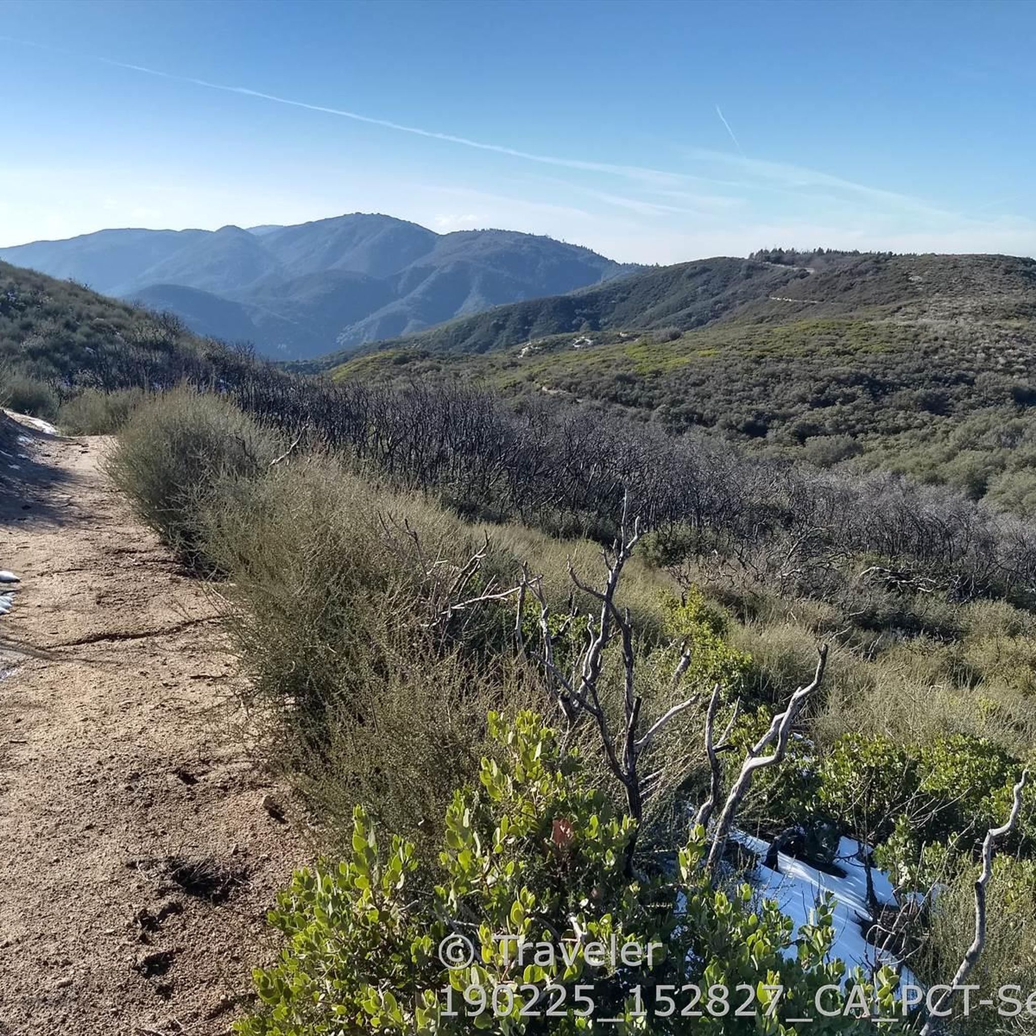
Beautiful views across the surprisingly forested hills to the desert in the north.
4
0
Excellent views into the far distance from the PCT cutting along the northern slope below Grass Mountain.
1
0
Frequently Asked Questions
How many hiking trails are available around Lake Hughes?
There are over 5 hiking trails around Lake Hughes, offering a range of experiences from easy strolls to more challenging ascents. The komoot community has rated these routes highly, with an average score of 5.0 stars.
Are there any family-friendly hiking options in the Lake Hughes area?
Yes, Lake Hughes offers several easy trails suitable for families. For instance, the Hiking loop from Antelope Valley California Poppy Preserve is an easy 3.7 km route with minimal elevation gain, perfect for a leisurely outing. Another great option is the Hiking loop from Visitor Center, which is 5.1 km and also rated easy.
What kind of landscapes can I expect to see while hiking around Lake Hughes?
The Lake Hughes region boasts diverse and scenic landscapes. You'll encounter shady oak groves, sweeping valleys, and rugged rocky outcrops. Many trails feature riverbed walks, and after winter rains, you might even discover seasonal waterfalls like Castaic Falls. Elevations can reach up to 4,000 feet, providing fantastic scenic views of the towering San Gabriel Mountains.
Are there any trails that lead to waterfalls in the area?
Yes, the Castaic Falls Trail is a notable route that leads to a seasonal waterfall. This moderately challenging hike takes you through diverse scenery, often involving walking in the riverbed and multiple water crossings. The falls are most active after winter rains.
Can I hike a section of the Pacific Crest Trail near Lake Hughes?
Absolutely. Lake Hughes is a significant point along the renowned Pacific Crest Trail (PCT). Popular segments like Sawmill Mountain, Liebre Mountain, and Burnt Peak are accessible from the area. You can experience a part of this iconic trail on routes such as the Grass Mountain loop via the PCT — Angles National Forest, which offers scenic views and substantial elevation gain.
Are there any circular hiking routes around Lake Hughes?
Yes, there are several circular routes available. For example, the Antelope Loop Trail — Antelope Valley California Poppy Preserve is a 9.2 km loop that takes you through diverse scenery including oak groves and valleys. Another option is the Grass Mountain loop via the PCT — Angles National Forest, a moderate 7.4 km path.
What are some interesting landmarks or points of interest to look out for on the trails?
Beyond the natural beauty, you can find several points of interest. The Lake Hughes Rd - PCT Trailhead & water cache is a key spot for PCT hikers. You might also encounter the historic San Francisquito Canyon Road, which was once part of the original wagon road between Northern and Southern California. For those looking to extend their stay, Sawmill Campground offers amenities like picnic benches and fire pits.
What is the best time of year to go hiking in Lake Hughes?
The Lake Hughes area is enjoyable for hiking throughout much of the year. Seasonal waterfalls, like Castaic Falls, are most active after winter rains, making spring an excellent time to visit if you want to see them at their fullest. The diverse landscapes, from shady oak groves to higher elevations, offer pleasant conditions across different seasons, though summer can be hot.
Are there any challenging hikes for experienced trekkers?
Yes, for experienced hikers seeking a challenge, the Lake Hughes area offers more demanding routes. The Grass Mountain from Hughes Canyon via the PCT — Angeles National Forest is a difficult 20.9 km trail that leads through the towering San Gabriel Mountains, typically taking over 6 hours to complete and featuring significant elevation gain.
What do other hikers enjoy most about the trails around Lake Hughes?
The trails around Lake Hughes are highly rated by the komoot community, with an average score of 5.0 stars. Reviewers often praise the diverse scenery, from shady oak groves and sweeping valleys to rocky outcrops, and the rewarding views from higher elevations. The opportunity to experience sections of the Pacific Crest Trail is also a significant draw for many.
Is there parking available at the trailheads in Lake Hughes?
While specific parking details vary by trailhead, areas like the Lake Hughes Rd - PCT Trailhead typically offer parking options. It's always a good idea to check specific route information or local signage for the most accurate parking availability at your chosen starting point.
Most popular routes around Lake Hughes
Most popular attractions around Lake Hughes

Get inspired with the komoot mobile app


Explore more
Browse the best Hikes in other regions.
