The best walks and hikes around Johnsville
5.0
(4)
149
hikers
18
hikes
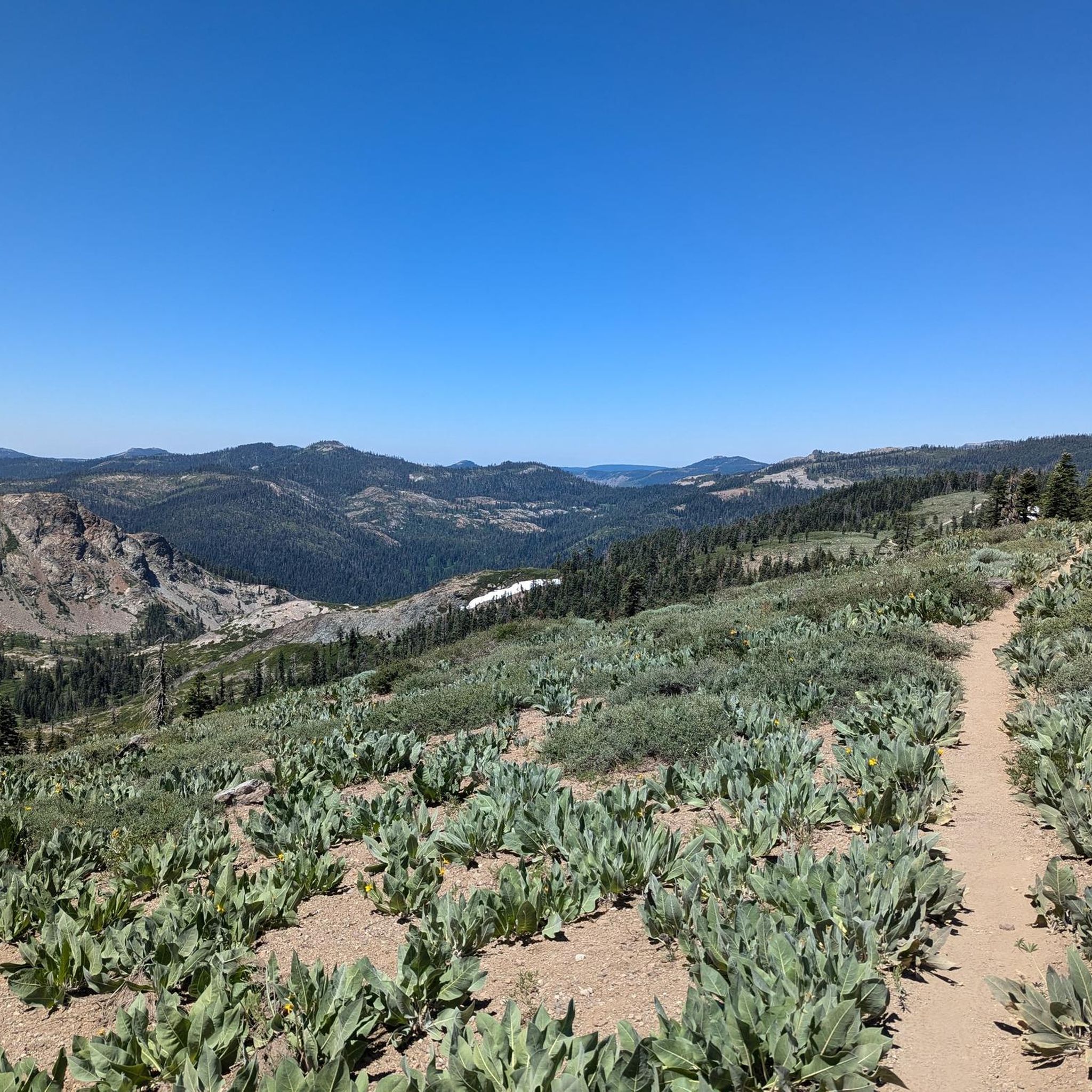
Hiking around Johnsville offers routes through the Sierra Nevada mountains, primarily within Plumas-Eureka State Park. The region features dense pine and fir forests, alpine lakes, and varied mountain terrain. Elevations in the park range up to 7,447 feet (2,270 m) at Eureka Peak, providing diverse landscapes for exploration. The area includes trails suitable for all ability levels, from gentle meadow walks to challenging ascents.
Best hiking trails around Johnsville
- The most popular hiking route is Jamison Creek Trail, a 6.1 miles (9.8 km) trail that takes about 3 hours 10 minutes to complete. The path follows Jamison Creek uphill to a high mountain lake.
- Another top favourite among local hikers is Eureka Peak Trail, a moderate 3.5 miles (5.7 km) path. This route involves a steady ascent with an elevation gain of 1,172 feet (357 m).
- Local hikers also love the Bear Lakes, Silver Lake, and Round Lake loop, a 4.1 miles (6.6 km) trail leading through Plumas National Forest, often completed in about 1 hour 50 minutes.
- Hiking around Johnsville is defined by its alpine lakes, dense pine forests, and mountain ascents. The network of Plumas-Eureka State Park hiking trails provides options for different ability levels.
- The routes in Johnsville are highly rated by the komoot community with an average score of 5.0 stars from a small number of reviews. More than 90 hikers have used komoot to explore Johnsville's varied terrain.
Last updated: September 27, 2026
11
hikers
7.84km
02:30
350m
270m
Embark on the Long Lake Loop Trail, a moderate hiking route spanning 4.9 miles (7.8 km) within Plumas National Forest. You will experience an alpine environment, with the path winding around the clear waters of Long Lake and climbing past Mud Lake. Expect to gain 1132 feet (345 metres) in elevation, offering sweeping views of granite hillsides, all completed in an estimated 2 hours and 29 minutes.
When planning your visit, be aware that the trail includes some short but steep climbs over loose rock, so sturdy hiking shoes are highly recommended for your comfort and safety. To enjoy a more solitary experience on this popular route, consider starting your hike in the mornings or visiting on weekdays. This approach helps you avoid peak times and fully immerse yourself in the natural surroundings.
The Long Lake Loop Trail provides a true high-country feel without being overly strenuous, making it an accessible adventure for many. In early summer, the area comes alive with vibrant wildflowers, and the lake often presents mirror-like reflections, adding to the scenic beauty. This route stands out for its blend of challenging sections and rewarding views within a pristine alpine setting.
2
hikers
3.59km
01:09
250m
10m
The Long Lake Trail in Plumas County offers a delightful high-country experience, winding around the clear waters of Long Lake and climbing past Mud Lake. You'll be treated to sweeping views of granite-strewn hillsides, and in early summer, the trail bursts with vibrant wildflowers. Despite its easy difficulty rating, be prepared for some short, steep sections over loose rock, which add a bit of challenge to this otherwise serene 2.2-mile (3.6 km) loop.
This trail is a fantastic option for a half-day outing within the Lakes Basin Recreation Area, near Clio, CA. While there's no specific information on parking at Long Lake Trail trailhead, it's wise to arrive early during busy periods. The best time to hike Long Lake Trail is definitely early summer to witness the full bloom of wildflowers and enjoy the stunning lake reflections; sturdy shoes are highly recommended for the rocky sections.
What makes this trail special is its ability to deliver a true high-country feel without the strenuous effort often associated with such landscapes. It's a satisfying adventure that packs 809 feet (246 metres) of elevation gain into just over an hour of hiking, making it accessible for many. The mirror-like reflections on Long Lake are a particular highlight, offering peaceful moments amidst the rugged beauty of the granite hillsides.

2
hikers
8.88km
02:33
200m
210m
Embark on the Grassy Lake to Long Lake to Bear Lakes Loop, a moderate hike that guides you through the scenic Lakes Basin Recreation Area. This 5.5-mile (8.9 km) route features an elevation gain of 668 feet (203 metres) and typically takes about 2 hours and 32 minutes to complete. You will experience a diverse landscape of spectacular alpine lakes, dense pine forests, and granite ridgelines. The well-maintained trails meander along forested granite hillsides, offering sweeping views and vistas, with highlights including the impressive Long Lake and the stunning Big Bear Lake, known for its distinctive white-covered granite shelf backdrop. You will find low rocky cliffs adding to the dramatic scenery as you make your way around the loop. The atmosphere is one of serene natural beauty, perfect for a rewarding outdoor experience.
Planning your visit to this loop is best done between May and October, when the weather is most favorable for hiking. While the trail is accessible during winter, it transforms into an opportunity for snowshoeing. Many of the trails within the Bear Lakes area are dog-friendly, so you are welcome to bring your canine companion along for the adventure. Parking is generally available at various trailheads throughout the Lakes Basin Recreation Area, making access straightforward. Always check local conditions before heading out, especially during shoulder seasons, to ensure a smooth trip.
This loop offers a quintessential experience within the Plumas National Forest, showcasing the unique geology and natural beauty of the region. The area is characterized by its dramatic granite formations and numerous alpine lakes, creating a distinct ecosystem. The presence of Big Bear Lake, with its notable white-covered granite shelf, makes this particular route stand out among the many options in the area. It provides a wonderful opportunity to immerse yourself in the natural environment and appreciate the pristine wilderness of the Lakes Basin. The trail is a great way to explore the diverse landscapes that define this part of California.
5.0
(1)
14
hikers
9.84km
03:09
320m
320m
The Jamison Creek Trail offers a challenging yet incredibly scenic hike through Red Fir forests and past a string of beautiful alpine lakes like Grass Lake, Rock Lake, and Jamison Lake. Expect a moderate 6.1-mile (9.8 km) journey with 1039 feet (317 metres) of elevation gain, taking about 3 hours and 9 minutes. The terrain is notably rocky and technical in places, including a section known as "The Stairway to Heaven," making it best suited for hikers with good fitness and sure-footedness who appreciate a rewarding climb.
Accessing the trail is straightforward, with the trailhead situated near the historic Jamison Mine Site, where you'll find parking. Dogs are permitted to join you on this adventure, provided they remain on a leash, particularly within Plumas-Eureka State Park boundaries. The trail is particularly stunning during seasons when wildflowers bloom or Aspen trees turn golden, so plan your visit accordingly to enjoy the vibrant natural displays.
Beyond its natural beauty, the Jamison Creek Trail boasts historical significance, starting at the remnants of 19th-century gold mining operations. It also serves as a gateway to a broader network of paths, including connections to the Smith Lake Trail and even potential links to the Pacific Crest Trail. The abundance of pristine alpine lakes along this 6.1-mile (9.8 km) route, with its 1039 feet (317 metres) of climbing over roughly 3 hours and 9 minutes, makes it a popular spot for fishing and swimming, adding to its appeal as a moderate but memorable outing.
4
hikers
5.47km
01:36
150m
150m
The Smith Lake Trail near Graeagle, California, offers a dynamic hiking experience with awesome views of Smith Lake and the surrounding valleys. You'll navigate varied terrain, including challenging rock waterfalls on the initial climb and steep descents with large steps and rock drops after leaving the lake. The lake itself provides picturesque spots for relaxation, making the effort worthwhile for its scenic beauty and engaging trail conditions.
This 3.4-mile (5.5 km) hiking route, rated easy, involves 489 feet (149 metres) of elevation gain and typically takes about 1 hour and 35 minutes. It's generally accessible in summer and fall, providing the best conditions for exploring. Dogs are welcome on the trail, making it a good choice for those looking for dog friendly hikes near Graeagle. Plan to arrive early, especially on weekends, to secure parking and enjoy the trail at a comfortable pace.
This trail connects to a network of other routes leading to Grass Lake, Rock Lake, and Jamison Lake, and even offers an intersection for the trail up Mount Elwell, providing options for longer adventures. The Smith Lake Trail has seen recent rebuilds, enhancing the experience while maintaining its technical character. It's a popular choice for those seeking both a workout and stunning viewpoints in the Plumas County area.
Get access to more routes and recommendations from other explorers.
Already have an account?
Our route recommendations are based on thousands of hikes, rides, and runs completed by other people on komoot.
Start today with a free account
Your next adventure awaits.



Tips from the Community

These two incredible alpine lakes were carved by glaciers thousands of years ago. A perfect place for lunch or a picnic, don't forget to climb up the shores a bit and take in the magnificent views of the Lakes Basin area.
0
0
Find your way past structures leftover from the Jamison Mine. Built towards the end of the 19th century to mine for gold, the Jamison Mine was in operation until the 1940s. There are still multiple cabins, a blacksmith shop, warehouse, and old mining equipment in the area. Be aware you are not allowed inside any of the structures.
0
0
Nestled right below Mount Washington, Grass Lake is one of the many lakes carved by a glacier in the Lakes Basin Area. Be sure to take in the view of the surrounding valley!
0
0
Smith Lake offers solitude and rewards you with amazing views of the surrounding valley. The views are earned by walking up along the ridge on the northern side of the lake. Be prepared to cross small streams during the wetter months.
0
0
Don't let the "Little" in Little Bear lake let you think it's any lesser than its Big counterpart. Little Bear Lake offers you the tranquility and seclusion of a private alpine lake. A perfect spot for a quick break or picnic while hiking.
1
0

This is a gorgeous and technically challenging trail offering excellent views of Long Lake.
1
0
Frequently Asked Questions
Are there any easy, family-friendly hikes in the Johnsville area?
Yes, the area offers several gentle trails perfect for families. For a straightforward and scenic walk, consider the Smith Lake Trail loop. It's a relatively flat 3.4-mile (5.5 km) route that's great for all ages. Many trails in Plumas-Eureka State Park, like the one around Madora Lake, are also well-suited for a family outing.
Can I bring my dog on the hiking trails around Johnsville?
Dogs are permitted on many trails within the Plumas National Forest, but they must be on a leash. However, within Plumas-Eureka State Park boundaries, dogs are generally restricted to paved roads and campgrounds. They are not allowed on most trails or in backcountry areas. Always check the specific regulations for your planned route before you go.
What are the parking options for hiking in Plumas-Eureka State Park?
There are several designated parking areas within Plumas-Eureka State Park, typically located near major trailheads, the museum, and campgrounds. The park may charge a day-use fee for vehicle entry. It's a good idea to arrive early on weekends and holidays as lots can fill up.
Are there any circular or loop trails available?
Yes, there are several loop trails that allow you to enjoy a varied hike without backtracking. A great option is the Eureka Peak Loop, a moderate 3.5-mile (5.6 km) hike that offers fantastic views as you circle the mountain. Many trails around the region's lakes also form natural loops.
What kind of scenery can I expect on hikes near Johnsville?
The landscape is classic Sierra Nevada. Expect to hike through dense forests of pine and fir, past pristine alpine lakes like Eureka Lake and Jamison Lake, and along scenic creeks. For panoramic views of the surrounding mountain ranges, trails that climb towards Eureka Peak are your best bet.
Are there any hikes with waterfalls near Johnsville?
While the area is more known for its alpine lakes and creeks, you can find small cascades and waterfalls along Jamison Creek, especially during the spring and early summer when snowmelt is at its peak. The trails following the creek offer the best chance to see them.
How many hiking trails are there around Johnsville?
You can explore over 15 different hiking routes around Johnsville. The trails cater to a range of abilities, with 5 classified as easy, 9 as moderate, and 1 as difficult, ensuring there's a path for every type of hiker.
What is the best time of year for hiking in Johnsville?
Late spring through fall is the ideal time for hiking. Spring and early summer offer vibrant wildflowers and flowing creeks. Summer provides warm weather perfect for enjoying the alpine lakes, while fall brings stunning colors from the aspens and willows, particularly along Jamison Creek.
Can I go hiking in the winter?
Yes, but your options will be different. While higher elevation trails become inaccessible due to snow, the area transforms into a great destination for snowshoeing and cross-country skiing. Lower elevation trails may remain hikable, but you should always be prepared for icy and snowy conditions.
Are there any challenging hikes for experienced hikers?
For those seeking a challenge, the ascent to the summit of Eureka Peak at 7,447 feet (2,270 m) is the most strenuous option. This hike involves significant elevation gain and rewards you with panoramic views of the entire region.
What do other hikers think of the trails around Johnsville?
The trails in this region are highly rated by the komoot community. Hikers often praise the pristine natural beauty, the well-maintained paths within Plumas-Eureka State Park, and the variety of scenery, from tranquil alpine lakes to rewarding mountain summits.
Where can I find an official trail map for Plumas-Eureka State Park?
You can usually obtain a physical map at the park's museum or visitor center upon arrival. For official park information, including alerts and digital maps, it's best to check the official California Department of Parks and Recreation website before your visit.
Most popular routes around Johnsville
Most popular attractions around Johnsville

Get inspired with the komoot mobile app


Explore more
Browse the best Hikes in other regions.
