The best road cycling routes around Fruitridge Pocket
4.6
(43)
1,889
riders
78
rides
Road cycling routes around Fruitridge Pocket are primarily characterized by flat terrain and riverfront paths, offering accessible cycling experiences. The region features routes that often follow the Sacramento River and utilize dedicated bike paths like the Yolo Causeway Bike Path. Elevation gains are minimal, making the area suitable for various road cycling abilities.
Best road cycling routes around Fruitridge Pocket
- The most popular road cycling route is Tower Bridge – Tower Bridge loop from 4th Avenue/Wayne Hultgren, a 23.6…
Last updated: July 8, 2026
5.0
(3)
196
riders
Easy road ride. Great for any fitness level. Mostly well-paved surfaces and easy to ride.
4.0
(1)
74
riders
38.3km
01:37
70m
70m
Easy road ride. Great for any fitness level. Mostly well-paved surfaces and easy to ride.

Sign up for free
5.0
(2)
140
riders
93.3km
03:53
240m
240m
Moderate road ride. Good fitness required. Some segments of this route may be unpaved and difficult to ride.
63
riders
32.4km
01:26
50m
50m
Moderate road ride. Great for any fitness level. Some segments of this route may be unpaved and difficult to ride.
5.0
(1)
37
riders
66.8km
02:55
80m
80m
Moderate road ride. Good fitness required. Mostly well-paved surfaces and easy to ride.
Get access to more routes and recommendations from other explorers.
Sign up for free
Already have an account?
Our route recommendations are based on thousands of hikes, rides, and runs completed by other people on komoot.
Start today with a free account
Your next adventure awaits.
Login or Signup
Popular around Fruitridge Pocket

Tips from the Community

This paved trail winds between Old Sacramento and Folsom — 32 miles in all — linking you up with lots of parks along the way. Plus some gorgeous views of the river it more or less parallels!
0
0

Hagan Community Park offers direct access to the American River Bike Trail, a 32-mile scenic route ideal for cycling, walking, and running. The park has ball fields, playgrounds, picnic areas, and a dog park.
0
0

The Jedidiah Smith Memorial Trail, also known as the American River Bike Trail, is a 32-mile paved multi-use trail that runs from Discovery Park to Folsom Lake's Beal's Point. It parallels the American River and offers some awesome waterside views.
0
0
Folsom Historic District is a small area of town that is representative of some of the cultural history of Folsom, dating back to the 1850s. This spot has hundreds of businesses and tons of historical landmarks discussing gold prospectors, the Pony Express, and other notable notches on the city's timeline.
0
0

The trail is fixed. No restrictions anymore on Lake Natoma loop.
0
0

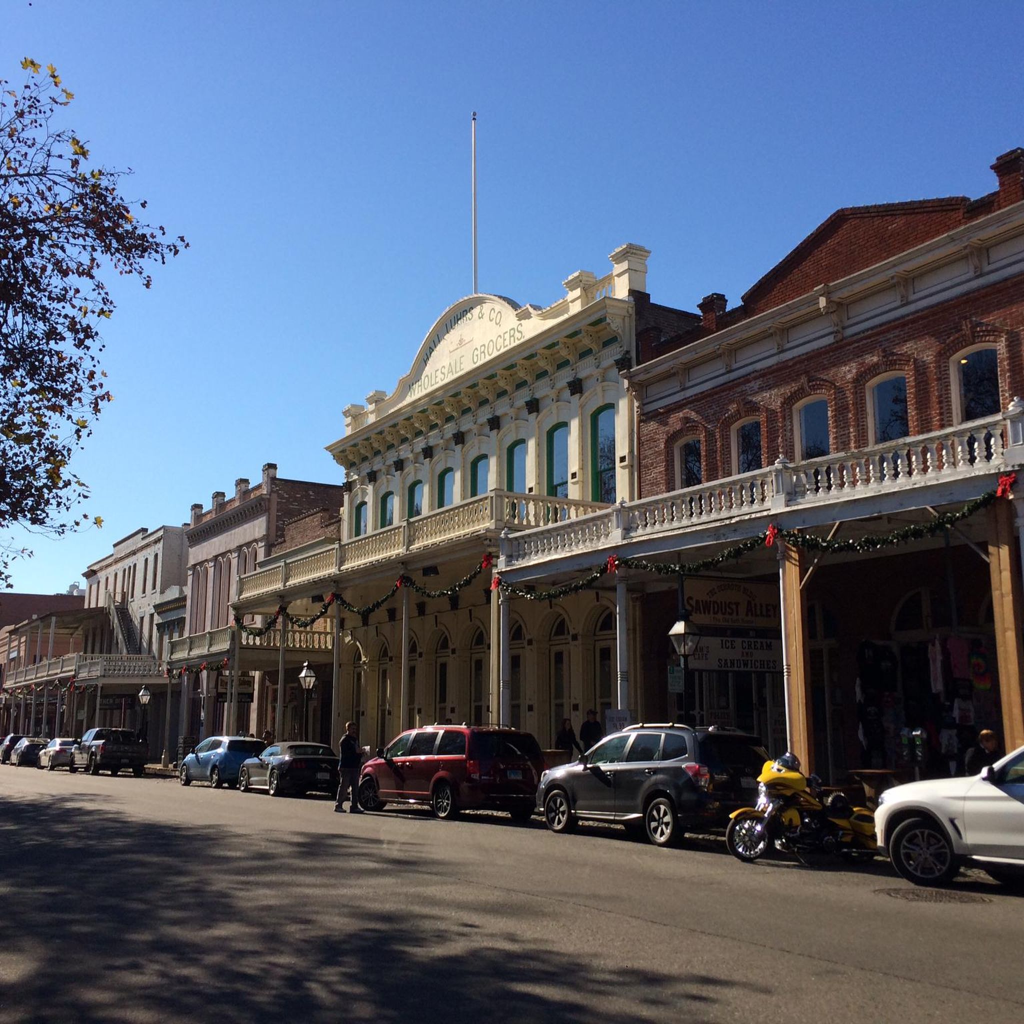
Founded in 1885, the Crocker Art Museum is the oldest public art museum in the Western United States. It was established thanks to the generosity of Judge Edwin B. Crocker and his wife, Margaret, who donated their extensive art collection to the city of Sacramento.
1
0

Little tip-outs on both sides to safely pull over & take pics; the north side (upriver) is deep & boaters fish there. the south side faces down river & the myriad of rapids there. This bridge is one of many along the Jedediah Smith Memorial Bike Trail; a 32 mile, 2 lane multi-use paved path (bikes, peds, equestrian) that runs twix Discovery Park & Granite Bay. IT IS IN ESSENCE OUR BIKE SUPERHIGHWAY..... No Vehicles Allowed. the Jededia is patrolled by red-shirted volunteers, Sac Sheriff & Rangers. there's also Emergency Call Boxes all along it & water spigots too (but only a few! 🤣😆)
0
0

The Harold Richey Memorial Bicycle Bridge, named after county commissioner Harold M. Richey and dedicated to him in 1987, is popular with families and cyclists, especially on weekends. The bridge does not allow cars, with rules on the bridge deck that outline right-of-way guidelines for pedestrians, equestrians, and cyclists.
1
0
Frequently Asked Questions
What kind of terrain can I expect on road cycling routes in Fruitridge Pocket?
Road cycling routes around Fruitridge Pocket are primarily characterized by flat terrain and riverfront paths. Many routes follow the Sacramento River and utilize dedicated bike paths like the Yolo Causeway Bike Path, offering minimal elevation gain and accessible cycling experiences.
Are there many easy road cycling routes suitable for beginners in Fruitridge Pocket?
Yes, Fruitridge Pocket offers a good selection of easy routes. Out of 65 total routes, 30 are classified as easy. An excellent option for beginners is the Tower Bridge – Tower Bridge loop from 4th Avenue/Wayne Hultgren, which is 23.6 miles long and features river views and urban landscapes.
How long are the road cycling routes in Fruitridge Pocket typically?
Route lengths vary, but many popular options are in the 20-40 mile range. For example, the Tower Bridge – Sacramento River Gateway loop from 4th Avenue/Wayne Hultgren is 24.4 miles, while the Yolo Causeway Bike Path – Tower Bridge loop from 59th Street extends to 42.3 miles.
Are there any advanced road cycling routes for experienced riders in Fruitridge Pocket?
While the region is known for its flat terrain, there are a few routes that offer longer distances or slightly more challenging sections. The area has 3 routes classified as difficult, and 32 as moderate, providing options for those looking for a longer ride. Routes like the Courtland Public Library – Courtland loop from 47th Avenue, at 40.7 miles, offer a good moderate challenge.
What are some family-friendly road cycling options in Fruitridge Pocket?
The flat terrain and dedicated bike paths make many routes in Fruitridge Pocket suitable for families. Look for the 'easy' classified routes, which often follow riverfront paths away from heavy traffic, providing a safe and enjoyable experience for all ages.
Are there loop road bike trails available in Fruitridge Pocket?
Yes, many of the most popular road cycling routes in Fruitridge Pocket are loops. Examples include the Tower Bridge – Tower Bridge loop and the Yolo Causeway Bike Path – Tower Bridge loop, which are great for starting and ending at the same point.
What can I see along the road cycling routes in Fruitridge Pocket?
Many routes offer scenic views of the Sacramento River and urban landscapes. You can also pass by notable landmarks such as the historic Tower Bridge, the Guy West Bridge, and Discovery Park. The California State Capitol is also accessible from some routes.
What do other road cyclists enjoy most about road cycling in Fruitridge Pocket?
The area is highly rated by the komoot community, with an average score of 4.0 stars from over 30 reviews. Reviewers often praise the consistent flat riding, scenic river views, and the accessibility of dedicated bike paths like the Yolo Causeway Bike Path.
How many road cycling routes are there in Fruitridge Pocket?
There are over 65 road cycling routes available around Fruitridge Pocket, offering a wide range of options for different abilities and preferences.
Are there routes that offer a mix of urban and open areas?
Yes, routes like the Yolo Causeway Bike Path – Tower Bridge loop from 59th Street lead through open areas along the causeway while also connecting to urban landscapes near Tower Bridge, providing a diverse cycling experience.
What is the best time of year for road biking in Fruitridge Pocket?
Given the generally mild climate of the Sacramento area, road biking is enjoyable for much of the year. Spring and fall offer pleasant temperatures, while summer can be hot, making early morning or late afternoon rides preferable. Winter typically brings cooler, wetter conditions, but many days are still suitable for cycling.
Are there any routes that follow the Sacramento River for extended periods?
Absolutely. Many routes are designed to follow the Sacramento River, offering consistent flat riding and picturesque views. The Tower Bridge – Sacramento River Gateway loop from 4th Avenue/Wayne Hultgren is a prime example, offering extensive riverfront cycling.
Most popular routes around Fruitridge Pocket
Most popular attractions around Fruitridge Pocket

Get inspired with the komoot mobile app


Explore more
Browse the best Road cycling routes in other regions.
