The best walks and hikes around Riedensee
4.5
(5703)
31,579
hikers
373
hikes
Hiking around Riedensee is characterized by its proximity to the Baltic Sea coast and the lake itself. The landscape features flat terrain, often leading through coastal areas, beaches, and open fields. Routes frequently offer views of the sea and nearby lighthouses, with minimal elevation changes. This region provides accessible walking opportunities for various skill levels.
Best hiking trails around Riedensee
- The most popular hiking route is View of Bastorf Lighthouse – Bastorf Lighthouse and Fields loop from Riedensee, a…
Last updated: October 11, 2026
4.5
(56)
249
hikers
6.45km
01:39
30m
30m
Easy hike. Great for any fitness level. Easily-accessible paths. Suitable for all skill levels.
4.6
(32)
165
hikers
11.1km
02:48
20m
20m
Moderate hike. Good fitness required. Easily-accessible paths. Suitable for all skill levels.

4.6
(33)
121
hikers
Easy hike. Great for any fitness level. Easily-accessible paths. Suitable for all skill levels.
4.3
(12)
56
hikers
3.49km
00:53
0m
0m
Easy hike. Great for any fitness level. Easily-accessible paths. Suitable for all skill levels.
4.6
(182)
796
hikers
Moderate hike. Good fitness required. Easily-accessible paths. Suitable for all skill levels.
Get access to more routes and recommendations from other explorers.
Already have an account?
Our route recommendations are based on thousands of hikes, rides, and runs completed by other people on komoot.
Start today with a free account
Your next adventure awaits.

Tips from the Community

A manor with a long history, today there are holiday apartments in the building.
0
0

"Natural beach" – no name, no special feature. But when a 26k super-liker leaves their like, even anonymous sand automatically becomes a tourist attraction.
0
0

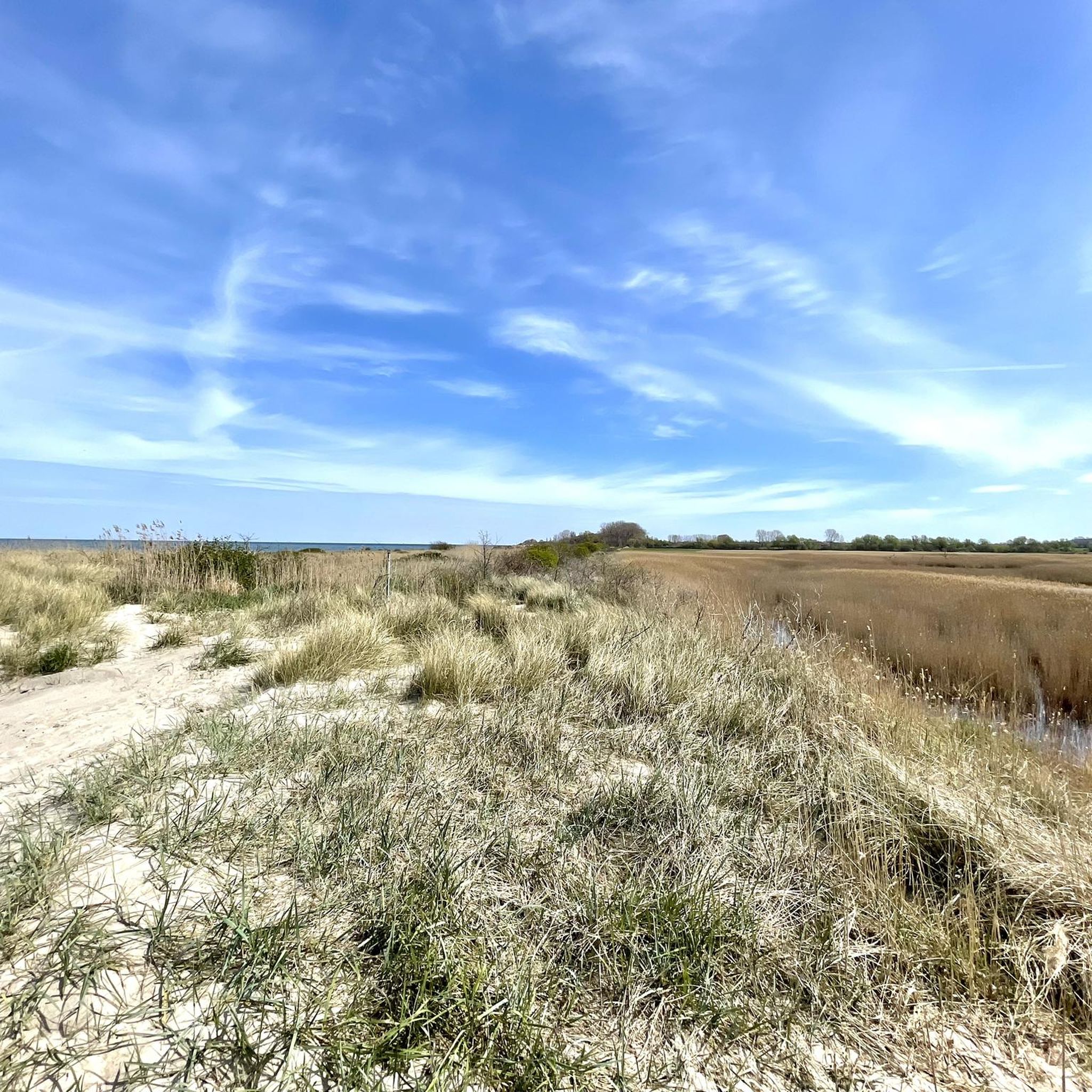
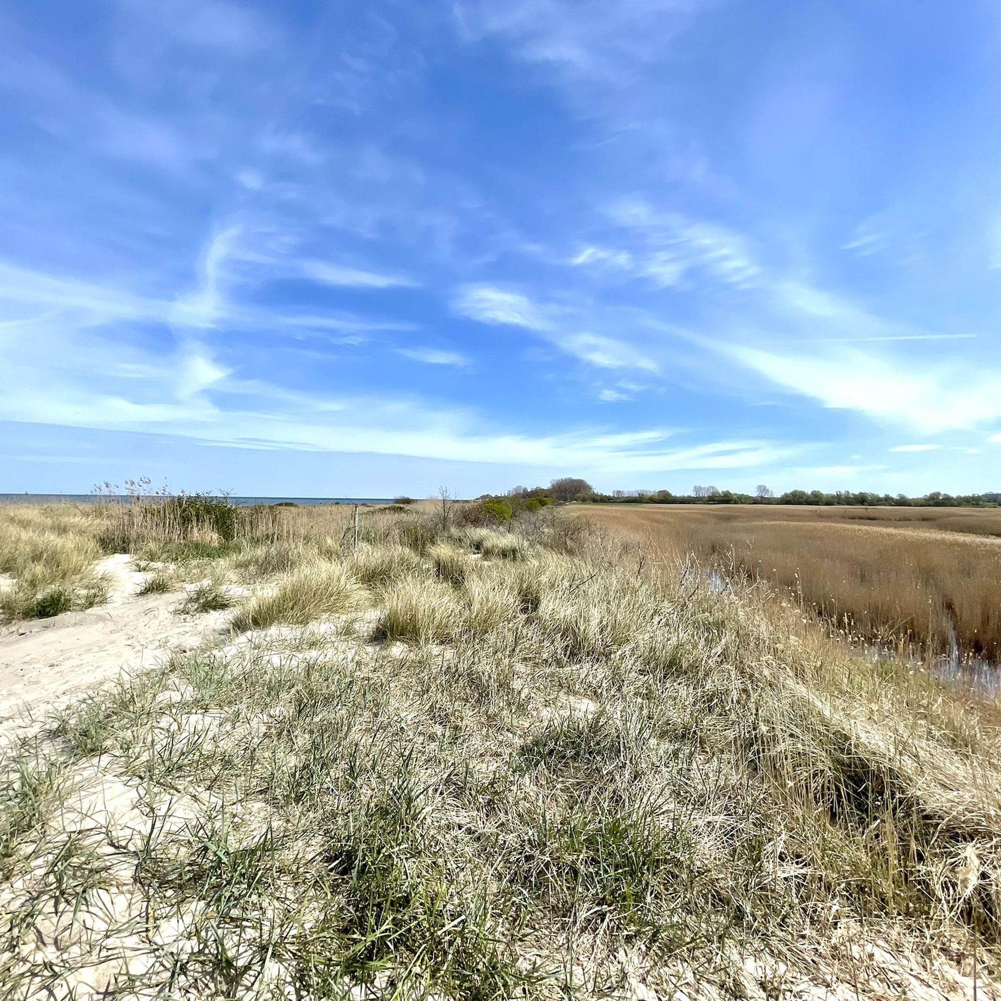
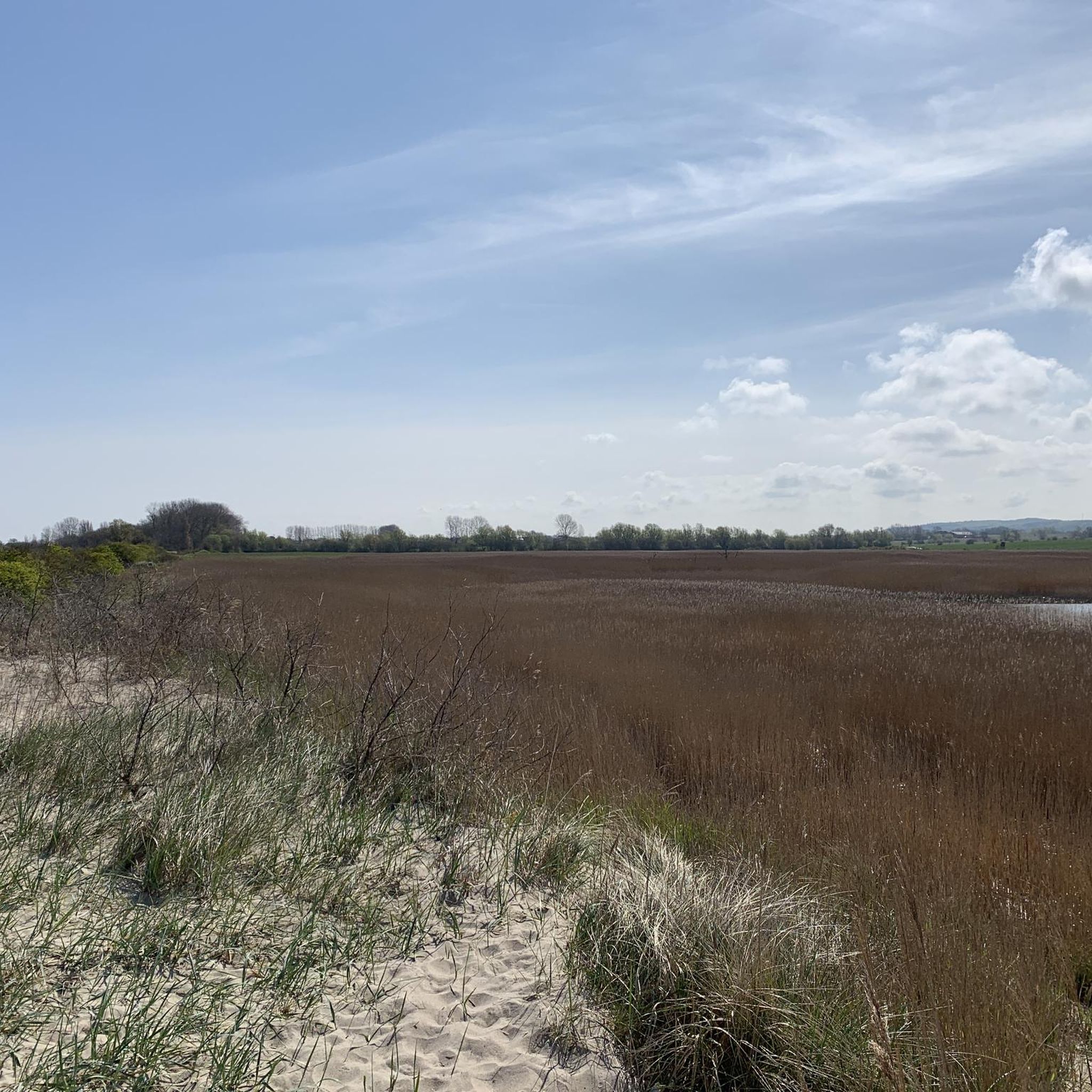
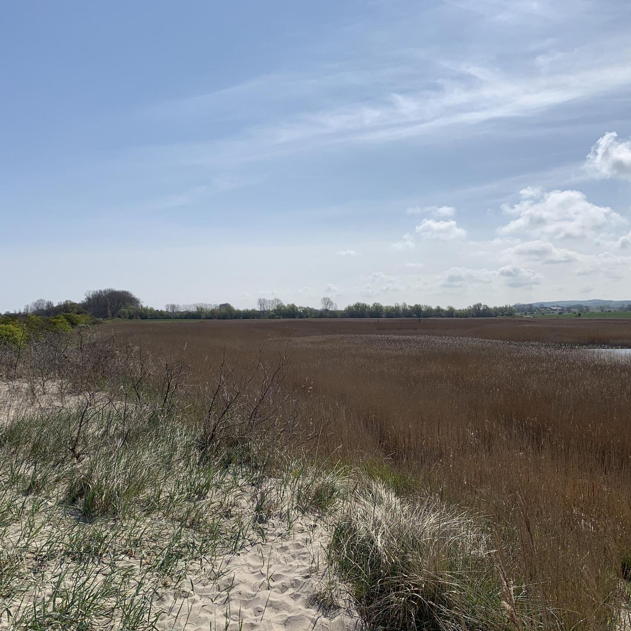
From the Signalberg, you can enjoy an impressive view over Lake Riedensee and the Baltic Sea. Perched high above the coast, a sweeping panorama opens up: In the foreground lies the serenely shimmering Lake Riedensee, framed by dunes and reed beds, and beyond it stretches the vast, blue Baltic Sea. On a clear day, you can see as far as the Wustrow peninsula and far along the coast. The Signalberg is a popular vantage point for walkers and nature lovers who enjoy the tranquility, the fresh sea breeze, and the unique view over the protected landscape.
3
0
At Riedensee, several viewing platforms invite you to experience the impressive natural beauty of the Baltic Sea coast up close. From here, you have a sweeping view of the lake, the dune landscape, and the sea. Nature lovers and photographers especially appreciate the platforms, as they offer ideal observation points for migratory birds and other animal species. Even at sunrise or sunset, a fascinating panorama unfolds from there, impressively highlighting the tranquil beauty of the nature reserve surrounding Riedensee.
2
0
The Kühlungsborn beach promenade is one of the longest and most beautiful on the German Baltic coast. It stretches approximately four kilometers along the fine sandy beach and connects the districts of Kühlungsborn East and Kühlungsborn West. As you stroll, a fresh sea breeze blows, seagulls circle above the waves, and the sound of the Baltic Sea accompanies every step.
2
1

Beautiful beach promenade with many places to stop for refreshments
2
1

The first piers were built around 1895; they were the forerunners of the landing stages in Brunshaupten and Arendsee. Since the simple wooden structures could not withstand the strong ice drift in winter, they had to be replaced frequently. The first larger piers were built in 1901, enabling sailboat trips. Steamers could dock at the piers built in 1906, eliminating the cumbersome disembarkation process. A pier was built in 1929, but like the piers, it too did not withstand the weather. The last pier was destroyed in the winter of 1941/42. Beneath the colonnades are 18 attractive shops. From ice cream parlors to pizzerias, from fashion boutiques to home design. The colonnades are a magnet for young and old. Beneath the colonnades – that also means sea views, beach, and sun. Just a few meters from the water.
0
0
Frequently Asked Questions
How many hiking trails are available around Riedensee?
There are over 350 hiking routes around Riedensee, offering a wide range of options for different preferences and fitness levels. The majority are easy to moderate, with a few more challenging trails available.
Are there easy and beginner-friendly hikes around Riedensee?
Yes, Riedensee is known for its accessible, flat terrain, making it ideal for easy and beginner-friendly hikes. Over 230 of the routes are classified as easy. A great option is the Riedensee Beach loop from Riedensee, which is a gentle 3.9 km walk along the coast.
What are the typical lengths of hikes around Riedensee?
Hikes around Riedensee vary in length, but many popular routes are between 4 km and 13 km. For example, the View of Bastorf Lighthouse – Bastorf Lighthouse and Fields loop from Riedensee is 4.8 km, while the Meschendorf Beach – Rerik Coastal Trail loop from Riedensee extends to 13.1 km.
Are there family-friendly hiking trails in Riedensee?
Absolutely. The generally flat terrain and scenic coastal paths make many routes around Riedensee suitable for families. Look for the 'easy' classified routes, which often feature gentle gradients and interesting sights like the beach or lighthouse views, perfect for all ages.
Are dogs allowed on the hiking trails around Riedensee?
Many trails around Riedensee are dog-friendly, especially those through open fields and along the coast. However, it's always recommended to keep dogs on a leash, particularly in nature reserve areas like the Riedensee itself, and to check local signage for any specific restrictions.
What is the best time of year to hike around Riedensee?
The best time to hike around Riedensee is typically from spring through autumn (April to October), when the weather is mild and the coastal scenery is at its most vibrant. Summer offers pleasant temperatures for beach walks, while spring and autumn provide fewer crowds and beautiful natural colors.
Can I hike around Riedensee in winter?
Yes, hiking around Riedensee is possible in winter, offering a different, often serene experience. The flat paths are generally accessible, though some coastal sections might be exposed to strong winds. Dress warmly and be prepared for potentially icy conditions, especially near the lake or on shaded paths.
Are there circular hiking routes around Riedensee?
Yes, many of the trails around Riedensee are designed as circular routes, allowing you to start and end at the same point. Examples include the View of Bastorf Lighthouse – Bastorf Lighthouse and Fields loop from Riedensee and the View of Kühlungsborn West – Riedensee Beach loop from Bastorf.
What are the best viewpoints or scenic spots on hikes around Riedensee?
Hikes around Riedensee offer numerous scenic spots, primarily featuring views of the Baltic Sea, the lake itself, and the iconic Bastorf Lighthouse. The Meschendorf Beach – View of the Baltic Sea loop from Riedensee is particularly noted for its coastal vistas.
Where can I park for hiking trails around Riedensee?
Parking is generally available at various access points to the hiking trails, especially near popular starting locations in towns like Bastorf or Kühlungsborn. Look for designated parking areas near the coast or trailheads, though some may require a fee.
Are there cafes or places to eat near the hiking trails?
Yes, given the proximity to coastal towns like Kühlungsborn and other smaller villages, you'll find cafes and restaurants within reasonable distance of many hiking trails. These offer opportunities for refreshments and meals before or after your hike.
What do other hikers enjoy the most about hiking in Riedensee?
The area is highly rated by the komoot community, with an average score of 4.5 stars. Reviewers often praise the diverse coastal scenery, the tranquil lake views, and the well-maintained, accessible paths that cater to all skill levels.
Most popular routes around Riedensee

Get inspired with the komoot mobile app


Explore more
Browse the best Hikes in other regions.
