The best running trails around Camino Tassajara
4.5
(5)
627
runners
93
runs
Jogging around Camino Tassajara offers routes through varied terrain, characterized by rolling hills, open valleys, and established trail systems. The region provides opportunities for runners to explore both challenging ascents and more level paths. Many routes traverse natural landscapes, including ridges and areas near Mount Diablo.
Best jogging routes around Camino Tassajara
- The most popular jogging route is Summit Trail – Mount Diablo Summit loop from Camino Tassajara & Tassajara Village, a 20.9 miles (33.6 km) trail that takes…
Last updated: July 8, 2026
4.0
(1)
10
runners
33.7km
04:19
1,160m
1,160m
Hard run. Very good fitness required. Mostly accessible paths. Some sure footedness required.
8
runners
Hard run. Very good fitness required. Mostly paved surfaces. Suitable for all skill levels.

Sign up for free
7
runners
12.1km
01:29
300m
300m
Hard run. Very good fitness required. Mostly paved surfaces. Suitable for all skill levels.
4
runners
8.71km
00:55
120m
120m
Moderate run. Good fitness required. Mostly paved surfaces. Suitable for all skill levels.
4
runners
9.90km
01:11
170m
170m
Moderate run. Good fitness required. Mostly paved surfaces. Suitable for all skill levels.
Get access to more routes and recommendations from other explorers.
Sign up for free
Already have an account?
Our route recommendations are based on thousands of hikes, rides, and runs completed by other people on komoot.
Start today with a free account
Your next adventure awaits.
Login or Signup
Tips from the Community

Mount Diablo, is the Bay Area second-highest peak at 1173m (3849ft). The challenging climb features constantly fluctuating gradients averaging 8%, with tough sections up to 18% and a brutal 23% finish in the last 200m. The equally demanding descent requires good bike handling due to tight corners, potholes, and strong winds. The road to the top is open daily from 8 AM till sunset.
0
0

The Iron Horse Trail, open from 5 a.m. to 10 p.m., stretches 32 miles between Concord and Pleasanton, following the former Southern Pacific Railroad. The latest segment, connecting Pleasanton/Dublin BART to Santa Rita Road, opened in 2014 after nearly 30 years of planning. This multi-use trail links residential areas, schools, parks, and public transportation, providing a trail to the local community. This paved trail crosses roads but is a safe way of getting around away from traffic.
0
0


One of the few working water spigots on Diablo. Always tastes cold and fresh.
0
0

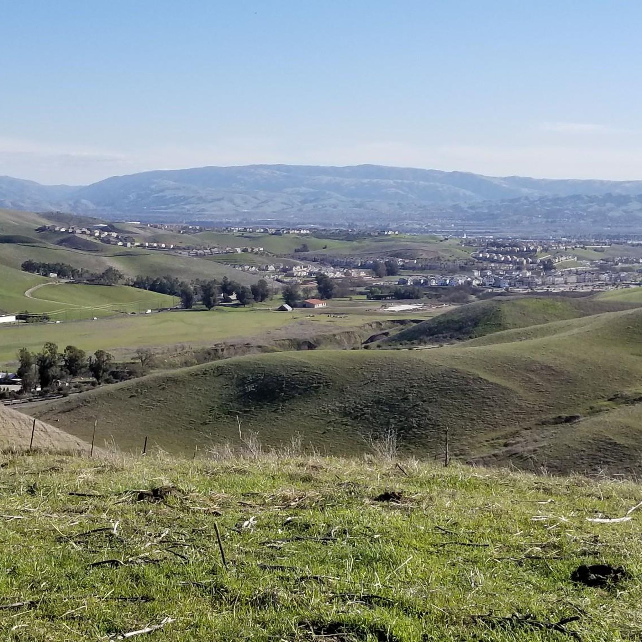
Nestled within Mount Diablo State Park, the Summit Trail unveils its beauty, particularly in late winter and spring, when lush greenery blankets the landscape like a scene from a fairytale. Offering a dirt path with gentle ascents, it promises a serene hiking experience amidst picturesque surroundings.
0
0

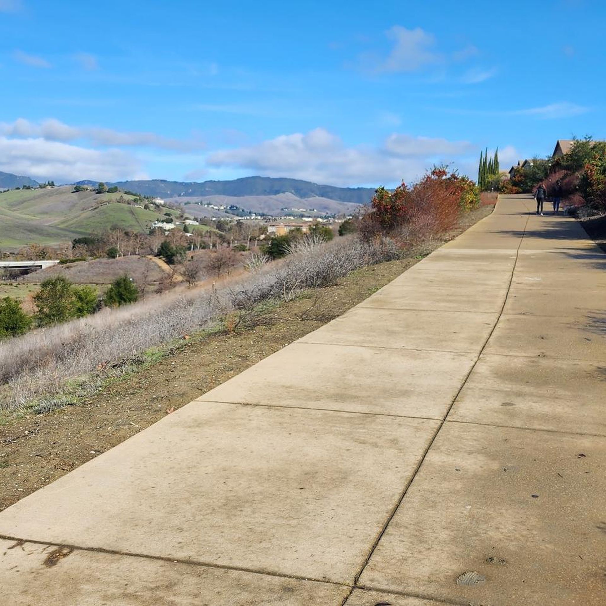
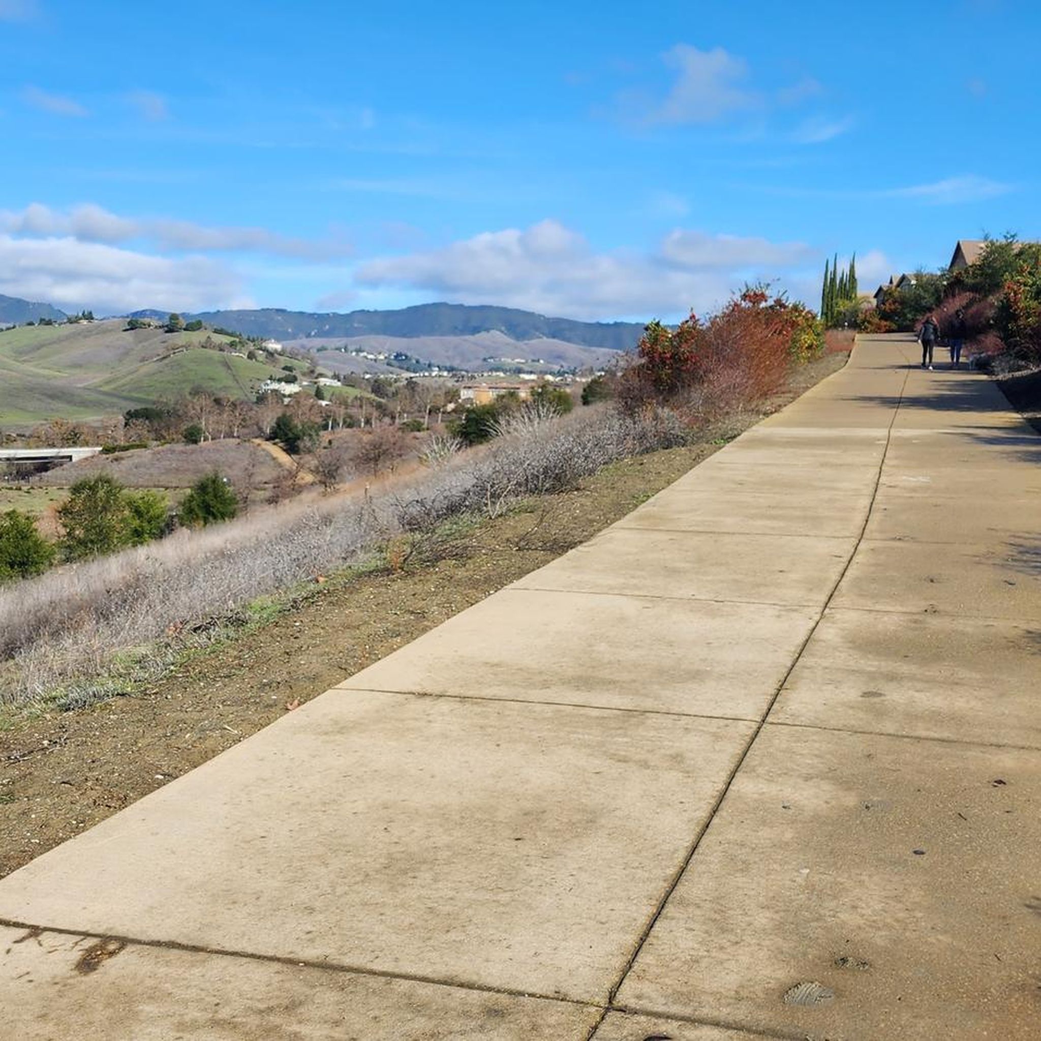
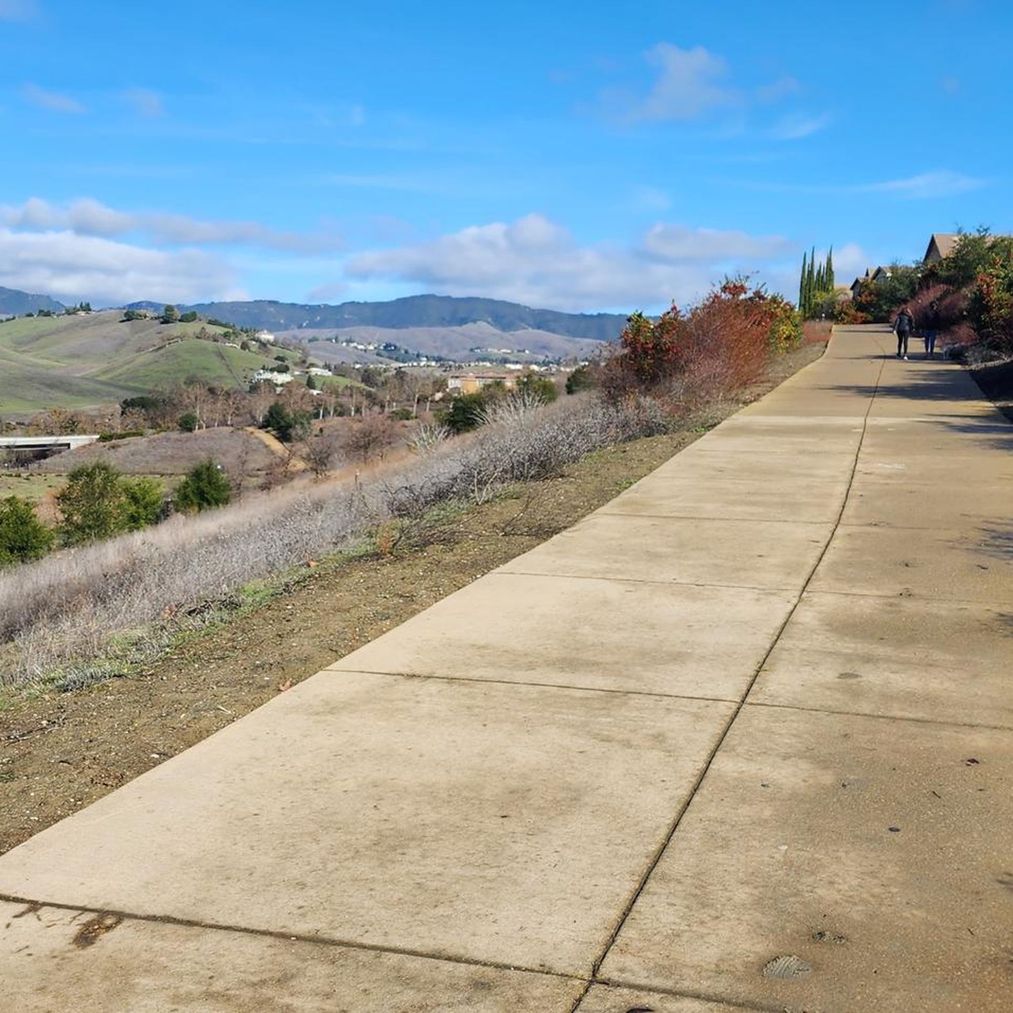
This multi-use trail skirts around the southern portion of San Ramon and is popular for walkers, runners, and cyclists, with views including Camp Parks, the valley's rolling hills and various wildlife, including jackrabbits. The trail is a mix of paved and singletrack trails, with some moderate ups and downs in elevation. You can access the trail from several points within the Stonehenge Way and Holborn Way neighborhoods.
0
0

While hiking along the Staircase Trail in Mount Diablo State Park, you will encounter the name-giving staircase that ascends the grassy hill.
0
0
One of the fiercest peaks in the Bay. Always worth the effort. It’s often much cooler on the summit than the rest of the trails — there is a water spigot up there to fill up bottles. Also a store is open at some times. Don’t bank on it.
0
0
Frequently Asked Questions
How many running routes are available in Camino Tassajara?
The Camino Tassajara area offers a wide selection of running routes, with over 95 trails recorded on komoot. These routes cater to various fitness levels, from easy jogs to challenging runs.
Are there easy running routes suitable for beginners in Camino Tassajara?
Yes, Camino Tassajara has several easy running routes perfect for beginners or those looking for a relaxed jog. There are 10 easy routes available, offering gentler terrain and shorter distances. One example is a Running loop from Dougherty Valley High School, which is 3.1 miles (5 km) long.
Can I find circular running routes in the Camino Tassajara area?
Many of the running trails in Camino Tassajara are designed as loops, allowing you to start and finish at the same point. For instance, the Running loop from Dougherty Valley High School is a moderate 4.7 miles (7.5 km) option, and the Tassajara Ridge Trail loop from Dougherty Valley High School offers a more challenging 7.5 miles (12.1 km) experience.
What are the typical lengths and durations of running trails in Camino Tassajara?
Running trails in Camino Tassajara vary significantly in length and duration. You can find shorter loops like the 3.1 miles (5 km) Running loop from Dougherty Valley High School, which takes about 33 minutes, up to much longer and more strenuous routes such as the Summit Trail – Mount Diablo Summit loop, which is 20.9 miles (33.6 km) and can take over 4 hours.
Are there any dog-friendly running trails in Camino Tassajara?
Many trails in the Camino Tassajara region, particularly within regional parks and open spaces, are dog-friendly, often requiring dogs to be on a leash. It's always best to check specific park regulations or route details on komoot before heading out with your canine companion to ensure a pleasant experience for everyone.
What kind of scenery can I expect while running in Camino Tassajara?
Runners in Camino Tassajara can expect diverse scenery, including rolling hills, open valleys, and established trail systems. Many routes offer views of the surrounding hills and Mount Diablo. You'll traverse natural landscapes, ridge trails, and valley paths, providing a mix of challenging ascents and more level sections.
Are there any interesting landmarks or attractions along the running routes?
Yes, several routes pass by notable landmarks. For instance, the Summit Trail – Mount Diablo Summit loop takes you towards the impressive Mount Diablo Summit. Other routes might lead you near the Iron Horse Trail or the Coyote Creek bridge, offering varied points of interest.
What do other runners enjoy most about jogging in Camino Tassajara?
The running routes in Camino Tassajara are highly rated by the komoot community, with an average score of 4.7 stars. Runners often praise the varied terrain, the scenic views of the surrounding hills, and the well-maintained trails that cater to different fitness levels, from easy jogs to challenging climbs towards Mount Diablo.
Are there any running routes that offer views of Mount Diablo?
Absolutely. Many routes in the Camino Tassajara area provide stunning views of Mount Diablo, and some even lead directly to its summit. The Summit Trail – Mount Diablo Summit loop is a prime example, offering significant elevation gain and panoramic vistas from the top.
Is parking readily available near the running trailheads in Camino Tassajara?
Parking availability varies by trailhead. Many routes, particularly those starting from community areas or regional parks, offer designated parking lots. For routes originating from places like Dougherty Valley High School, parking is generally accessible. It's advisable to check the specific route details on komoot for parking information before your run.
What is the best time of year for running in Camino Tassajara?
The best time for running in Camino Tassajara is typically during the spring and fall when temperatures are milder. Spring brings lush green hills and wildflowers, while fall offers cooler weather. Summer can be hot, especially midday, so early morning or late afternoon runs are recommended. Winter can be pleasant, but trails might be muddy after rain.
Are there any family-friendly running options in Camino Tassajara?
For families looking to enjoy a run together, the Camino Tassajara area offers several easier, shorter routes with less elevation gain. These trails are generally well-maintained and provide a pleasant experience for all ages. Look for routes marked as 'easy' on komoot for suitable options.
Most popular routes around Camino Tassajara
Most popular attractions around Camino Tassajara

Get inspired with the komoot mobile app


Explore more
Browse the best Running Trails & Routes in other regions.
