The best MTB trails around San Dimas
4.5
(7)
201
riders
18
rides
Mountain biking around San Dimas offers diverse landscapes, from rolling hills to chaparral-covered terrain. The region is characterized by its proximity to the San Gabriel Mountains and features prominent natural attractions like Frank G. Bonelli Regional Park and Puddingstone Reservoir. Trails often traverse woodlands and canyons, providing varied riding experiences.
Best mountain bike trails around San Dimas
- The most popular mountain bike trail is Puddingstone Reservoir Dam loop from Frank G. Bonelli Regional Park, a 7.7 miles (12.4 km)…
Last updated: October 16, 2026
29
riders
22.3km
02:38
820m
820m
Moderate mountain bike ride. Good fitness required. Suitable for all skill levels.
5.0
(2)
23
riders
Easy mountain bike ride. Great for any fitness level. Suitable for all skill levels.

13
riders
25.9km
02:34
640m
640m
Moderate mountain bike ride. Good fitness required. Suitable for all skill levels.
5.0
(1)
13
riders
31.0km
03:16
840m
840m
Moderate mountain bike ride. Good fitness required. Suitable for all skill levels.
12
riders
Moderate mountain bike ride. Good fitness required. Suitable for all skill levels.
Get access to more routes and recommendations from other explorers.
Already have an account?
Our route recommendations are based on thousands of hikes, rides, and runs completed by other people on komoot.
Start today with a free account
Your next adventure awaits.


Tips from the Community

Sometimes there's a good-sized pool of water in this basin; most of the time, though, it's a boggy sort of wetland. Either way it's home to an interesting riparian, sage scrub and southern oak habitat.
0
0

You can cycle across the top of the dam, which was constructed in 1928 to help control flooding in the region. It stands at 147 feet high, and today supports a myriad of outdoor recreation activities on the reservoir.
0
0

The Palmer Evey Trail is a straightforward trail in the San Bernadino Mountains. If you want to get up to Potato Peak, there is a short spur trail to take you to the peak.
0
0

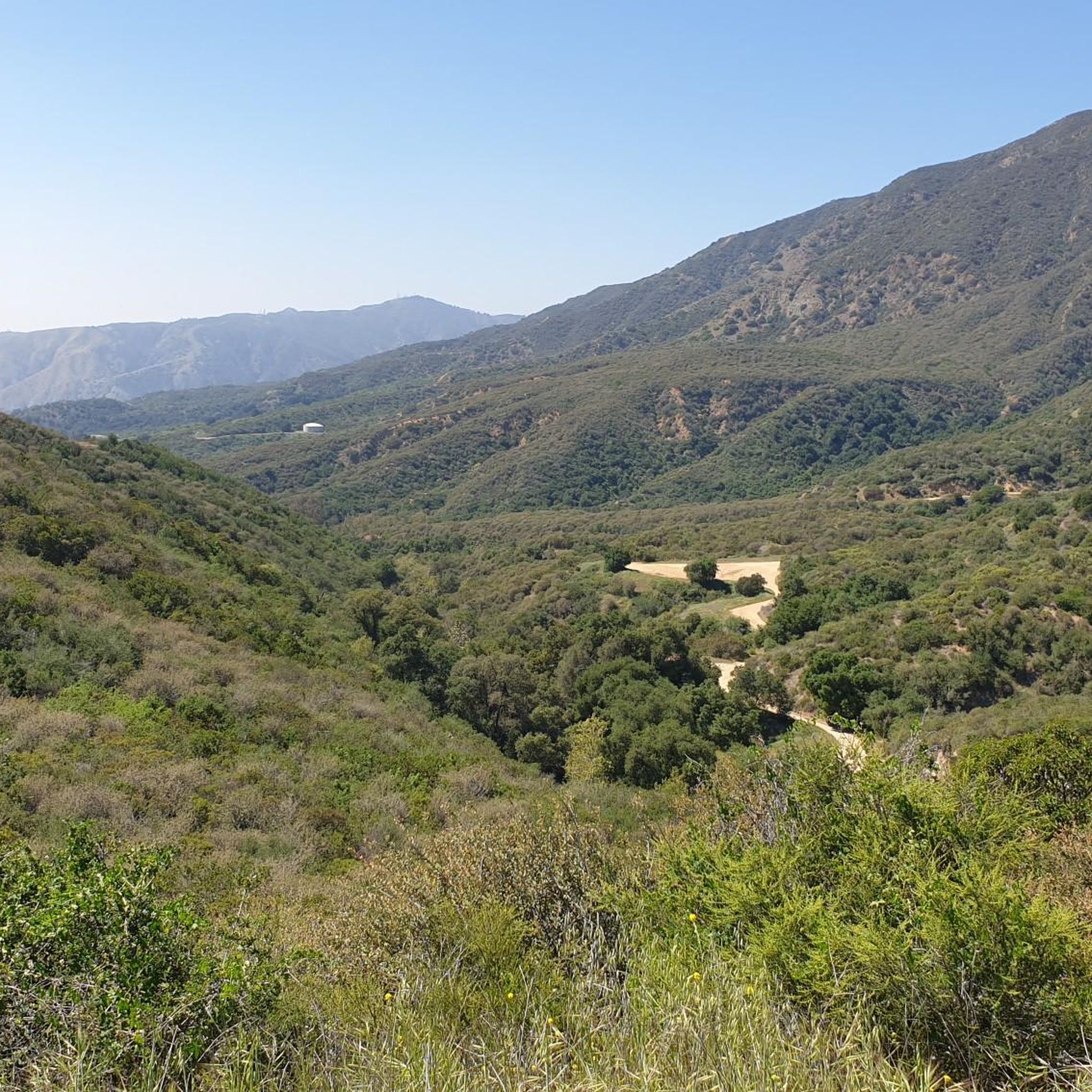
The Lower Monroe Truck Trail has a mix of terrain, starting with a flat, rocky doubletrack section that transitions into a gradual, twisty eight-mile climb up to Glendora Mountain Road. It starts with a 1.7-mile rock garden creek section; the trail features intermittent tree cover and narrows to singletrack in spots. After a sharp right turn, the trail climbs steadily for 6.2 miles, mostly exposed, with great views of the San Gabriel Valley at the 3.3-mile plateau, a popular rest point. At the top, a gate marks the turnaround for the fast-paced, twisting descent. Riders navigate rocky and rutted sections with trail-hugging vegetation, so gloves and water are essential. Be ready for the occasional pedestrian encounters, a cowbell comes in handy.
0
0
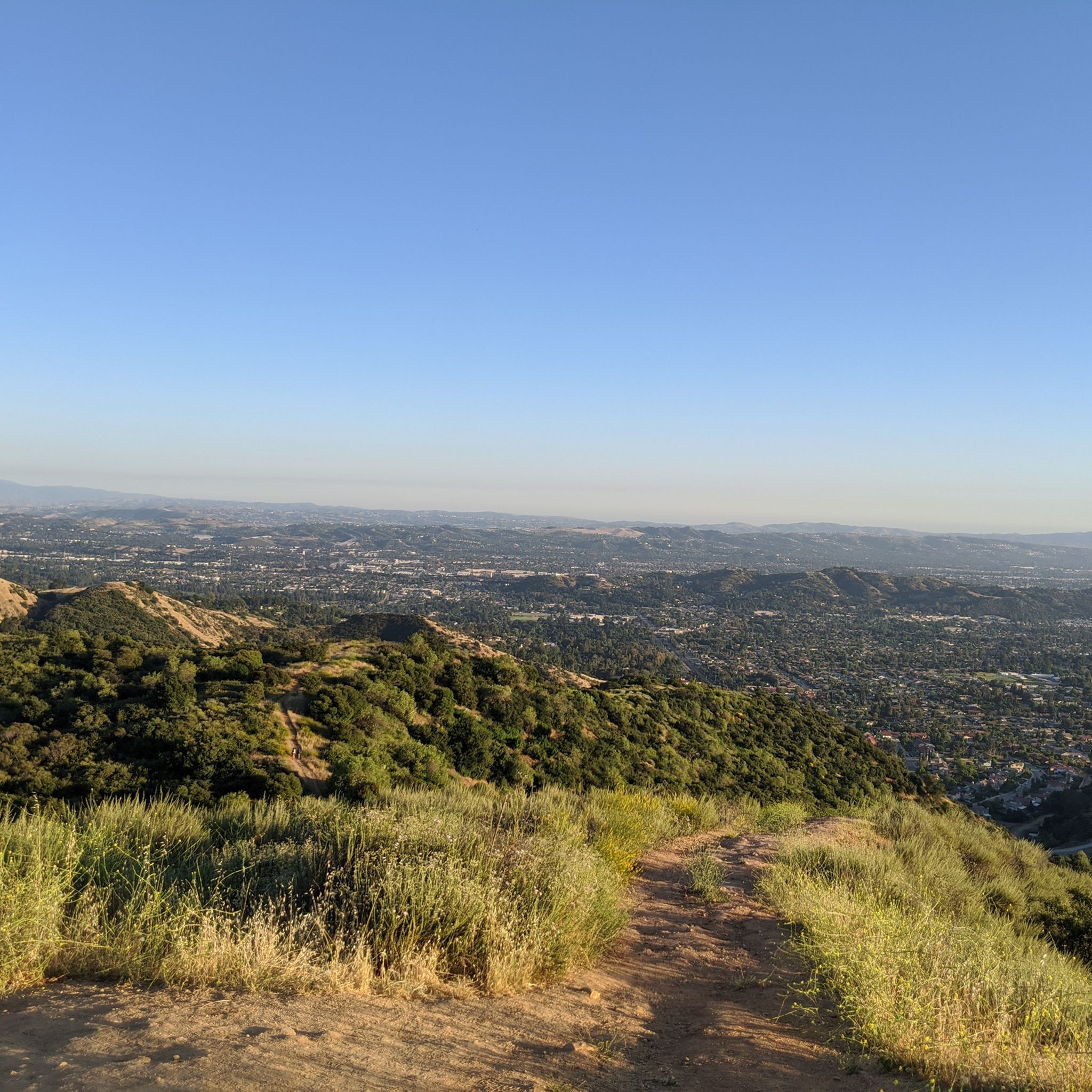
At the junction of Lower Monroe Trail, Mystic Canyon Trail, and Lower Monroe Truck Trail is a great view over Glendora down in the south below.
0
0
Great view of the Puddingstone Reservoir, a 250-acre man-made body of water. There is a road that runs along the perimeter of the reservoir and there is a spot to pull off the road to get a close up view of the water.
0
0

The Marshall Canyon Trail is in La Verne, CA, starts at Oak Mesa Park and features 1,310 feet of climbing, reaching a max elevation of 2,424 feet. Known for its oak tree cover and lush terrain, it’s often referred to as "Sherwood Forest" due to its green, shady environment. The lower section is relatively flat, with more climbing occurring deeper into the canyon. For mountain bikers, there are many variations off the main trail that can add both milage and elevation to your ride. Adding the Claremont Loop, for example, can extend the ride by 4-5 miles and 800 vertical feet. The trail and surrounding area provides a refreshing NorCal feel, with shaded trails and a creek, contrasting with the typically hot and dry surrounding hills.
0
0

Dedicated trail-goers will take a potato to the summit to leave as an offering to the potato gods. Check out the summit book, and the echo beneath the metal plate on the top of the tank!
0
0
Frequently Asked Questions
How many mountain bike trails are available around San Dimas?
There are 19 mountain bike trails around San Dimas, offering a range of experiences from easy loops to more challenging routes. You'll find options suitable for various skill levels.
What kind of terrain can I expect on mountain bike trails in San Dimas?
The trails in San Dimas offer diverse terrain, including chaparral-covered hillsides, woodlands, and routes that wind around the Puddingstone Reservoir. Many trails also feature canyons and occasional stream crossings, all set against the backdrop of the San Gabriel Mountains.
Are there easy mountain bike trails suitable for beginners in San Dimas?
Yes, San Dimas has several easy mountain bike trails. For instance, the Puddingstone Reservoir Dam loop from Frank G. Bonelli Regional Park is an easy 7.7-mile route offering scenic views. Another accessible option is the Brackett Field Airport – View of Puddingstone Reservoir loop from University of La Verne, which is also rated as easy.
Where can I find mountain bike trails with scenic views in San Dimas?
Many trails offer scenic views, especially those around the Puddingstone Reservoir within Frank G. Bonelli Regional Park. The Puddingstone Reservoir Dam loop from Frank G. Bonelli Regional Park provides picturesque water views. Trails in areas like Marshall Canyon and Claremont Hills Wilderness Park also offer expansive vistas of the surrounding hills and mountains.
Are there any loop trails for mountain biking in San Dimas?
Yes, many mountain bike trails in San Dimas are designed as loops. Popular options include the Puddingstone Reservoir Dam loop from Life Pacific University, which is a moderate 15.3-mile circuit, and the Marshall Canyon Trail loop from Damien High School, a 16.1-mile route through chaparral and canyons.
What attractions or landmarks can I see along the mountain bike trails?
While mountain biking, you can enjoy natural features like the View of Puddingstone Reservoir, which is a prominent feature in the area. Other points of interest include the Marshall Canyon Trail itself, known for its scenic beauty, and various viewpoints offering glimpses of the San Gabriel Mountains.
What do other mountain bikers enjoy most about mountain biking in San Dimas?
The mountain biking routes in San Dimas are highly rated by the komoot community, with an average score of 4.5 stars from over 11 reviews. Riders often praise the diverse terrain, the scenic views around the Puddingstone Reservoir, and the variety of trails that cater to different skill levels.
Are there any family-friendly mountain biking options in San Dimas?
For families looking for an easier ride, the trails within Frank G. Bonelli Regional Park, particularly those around the Puddingstone Reservoir, are generally suitable. The Puddingstone Reservoir Dam loop from Frank G. Bonelli Regional Park is an easy route that offers pleasant scenery without significant technical challenges.
What is the best time of year to go mountain biking in San Dimas?
San Dimas offers good mountain biking conditions for much of the year. Spring and fall generally provide the most comfortable temperatures. While winter riding is possible, it's always advisable to check local weather conditions, as some trails may be affected by rain.
Are there advanced mountain biking trails for experienced riders?
Yes, experienced riders can find more challenging routes. While many trails are moderate, some sections and longer loops, such as the Marshall Canyon Trail – Potato Mountain Peak loop from Damien High School, offer significant elevation gain and more demanding terrain, providing a good workout and technical challenge.
Is parking available at the trailheads in San Dimas?
Parking is generally available at popular access points for mountain bike trails, particularly within Frank G. Bonelli Regional Park and near other established trailheads. It's always recommended to check specific parking details for your chosen route before heading out.
Most popular attractions around San Dimas

Get inspired with the komoot mobile app


Explore more
Browse the best MTB trails in other regions.
