The best walks and hikes around Irvine
4.7
(373)
4,626
hikers
63
hikes
Hiking around Irvine offers access to an extensive network of open spaces and natural parklands. The terrain features rolling hills, canyons, and ridges, providing varied elevation changes. These areas are characterized by native vegetation, including coastal sage scrub, chaparral, and oak woodlands. The city's commitment to preserving natural habitats provides opportunities for recreation within a developed urban environment.
Best hiking trails around Irvine
- The most popular hiking route is Bosque Canyon Outer Loop, a 2.0 miles (3.2 km) trail that takes 49 minutes to complete. This loop path offers accessible hiking through local open spaces with minimal elevation gain.
- Another top favourite among local hikers is Little Sycamore Canyon, Serrano Ridge, and West Canyon Loop, a moderate 4.4 miles (7.1 km) path. This route traverses canyons and ridges, offering varied terrain and views.
- Local hikers also love the Serrano Ridge and West Canyon Loop, a 10.4 miles (16.7 km) trail leading through open space preserves and canyons, often completed in about 4 hours 38 minutes.
- Hiking around Irvine is defined by open space preserves, canyons, and rolling hills, offering a range of experiences from easy walks to more challenging ascents. The network offers options for different ability levels, from easy family-friendly hikes to moderate routes.
- The routes in Irvine are highly rated by the komoot community with an average score of 4.7 stars from over 90 reviews. More than 1300 hikers have used komoot to explore Irvine's varied terrain.
Last updated: October 11, 2026
5.0
(1)
9
hikers
16.7km
04:38
340m
240m
Embark on the Serrano Ridge and West Canyon Loop, a moderate hike spanning 10.4 miles (16.7 km) with an elevation gain of 1105 feet (337 metres). You can expect to complete this route in about 4 hours and 38 minutes. As you hike, you will move through diverse landscapes, from open coastal chaparral to rolling hills and shaded sections under mature oak trees. From Serrano Ridge, you can often see distant mountains and the Pacific Ocean on clear days. The interior portions of Laguna Coast Wilderness Park offer a pleasant escape, especially if your path takes you through Little Sycamore Canyon, where thick underbrush and buzzing flowers create a vibrant scene.
When planning your visit, you will typically find parking available near the Nix Nature Center. A $3 fee is required to park there, and restrooms are on-site for your convenience. Be prepared for sun exposure, as some sections of the trail are unshaded. While the route offers a sense of wilderness, you might notice some traffic noise in certain areas due to its proximity to nearby roadways. Consider starting early to avoid the midday sun and enjoy the quieter moments on the trail.
This loop is notable for its varied ecosystems within Laguna Coast Wilderness Park, transitioning from open, sun-drenched ridges to cooler, shaded canyons. The park itself is a significant natural preserve, protecting a diverse range of plant and animal life unique to the coastal chaparral environment. The trail offers a good opportunity to experience the distinct character of Southern California's natural landscape, providing both expansive vistas and intimate canyon passages.
8
hikers
2.02km
00:31
10m
0m
Embark on an easy hike along the North Lake Trail, a tranquil path offering pleasant views of North Lake. This route provides a gentle experience with its flat, natural terrain, perfect for a leisurely stroll. You will cover 1.3 miles (2.0 km) with a minimal elevation gain of just 18 feet (5 metres), making it an accessible option for everyone. Keep an eye out for local wildlife as you enjoy the serene atmosphere around the water; the entire loop typically takes about 30 minutes to complete.
Located within North Lake Park in Irvine, California, this trail is easily accessible for a quick outdoor escape. Parking is generally available nearby, which makes starting your hike straightforward. The route is family friendly and particularly suitable for beginners looking for an easy walk without any strenuous climbs. You can visit at any time of day for a refreshing break.
The North Lake Trail offers a peaceful setting right within Irvine, providing a natural escape from the city bustle. It includes sections of the Woodbridge North Lake Path, contributing to its well-maintained and enjoyable surface. This trail stands out as a convenient option for those seeking a short, relaxing walk amidst natural features, ideal for unwinding and connecting with nature.

6
hikers
7.11km
02:01
160m
160m
Embark on the Little Sycamore Canyon, Serrano Ridge, and West Canyon Loop, a moderate hiking route spanning 4.4 miles (7.1 km) with an elevation gain of 524 feet (160 metres). You can expect to complete this diverse loop in about 2 hours and 1 minute. The trail guides you through a mix of landscapes, from the unique sandstone walls of Little Sycamore Canyon to shady oak groves and coastal chaparral. As you ascend to Serrano Ridge, you will be treated to expansive inland views stretching towards the Santa Ana Mountains.
To begin your hike, head to the trailhead often found near the Nix Nature Center, which offers convenient restrooms and park information. Be aware that parking at the trailhead typically requires a small fee, so plan accordingly. This loop is accessible year-round, but early mornings are ideal to avoid the midday sun and enjoy cooler temperatures, especially during warmer months. Always check local park advisories before you go.
This route stands out for its varied terrain within Laguna Coast Wilderness Park, showcasing a rich ecosystem. Beyond the scenic views, the trail offers a chance to observe diverse flora and fauna native to the region's coastal chaparral and canyon environments. It provides a comprehensive experience of the park's natural beauty, making it a popular choice for those looking to explore the area's unique geological features and panoramic vistas.
6
hikers
3.17km
00:49
10m
20m
Embark on an easy 2.0-mile (3.2 km) hike along the Bosque Canyon Outer Loop, a route that offers a serene escape into nature. You will gain a gentle 41 feet (13 metres) in elevation, making this a perfect option for a quick 48-minute outdoor adventure. As you walk, you will find yourself surrounded by a beautiful cottonwood forest, which changes its colors with the seasons. Look out for views of the Rio Grande River and the distant Sandia Mountains, especially as the sun begins to set. Keep an eye out for diverse wildlife and plants along the way.
This easy route is suitable for all skill levels, including families and those hiking with dogs. Parking is generally available, making your access to the trailhead straightforward. Be aware that some parts of the trail may not have much shade, so it is a good idea to plan your visit during cooler times of the day. Alternatively, remember to bring sun protection if you are hiking when the sun is strong.
The Bosque Canyon Outer Loop is located within the expansive Great Park, offering a pleasant outdoor experience for many. You will pass by the Bosque Canyon Bike Path, a notable feature that runs alongside the hiking route. This area provides a chance to connect with nature, observe local flora and fauna, and enjoy the scenic landscape of the Rio Grande Valley.
2
hikers
4.29km
01:06
20m
20m
Embark on the Great Park Loop, an easy hiking route spanning 2.7 miles (4.3 km) with a gentle elevation gain of just 67 feet (20 metres). You can complete this scenic walk in about 1 hour and 6 minutes, making it perfect for a quick outdoor escape. The paths wind through natural open spaces, showcasing a dynamic Southern California native landscape that changes with the seasons. In spring, you'll discover abundant growth and blooming flowers, while summer paints the scenery in warm brown and tan hues. As you hike, you can explore the unique Farm + Food Lab, which features a charming butterfly garden. This trail offers a gentle experience suitable for all skill levels.
The Great Park Loop is designed for easy access, ensuring a smooth start to your hike. You will find convenient connections to nearby streets, and the route features lighted paths for evening strolls. Three trail undercrossings ensure continuous movement, so you won't need to cross busy roads during your journey. The park also provides essential amenities like restrooms and drinking fountains, making it a comfortable and family-friendly destination for everyone.
This trail stands out for its commitment to preserving and showcasing Southern California's native environment. The landscape shifts throughout the year, offering a fresh perspective with each visit, from vibrant spring blooms to the golden tones of summer. The thoughtful inclusion of shaded benches along the way provides perfect spots for rest and reflection. It's a notable route for those seeking an accessible outdoor experience that connects you with local flora and fauna.
Get access to more routes and recommendations from other explorers.
Already have an account?
Our route recommendations are based on thousands of hikes, rides, and runs completed by other people on komoot.
Start today with a free account
Your next adventure awaits.


Tips from the Community

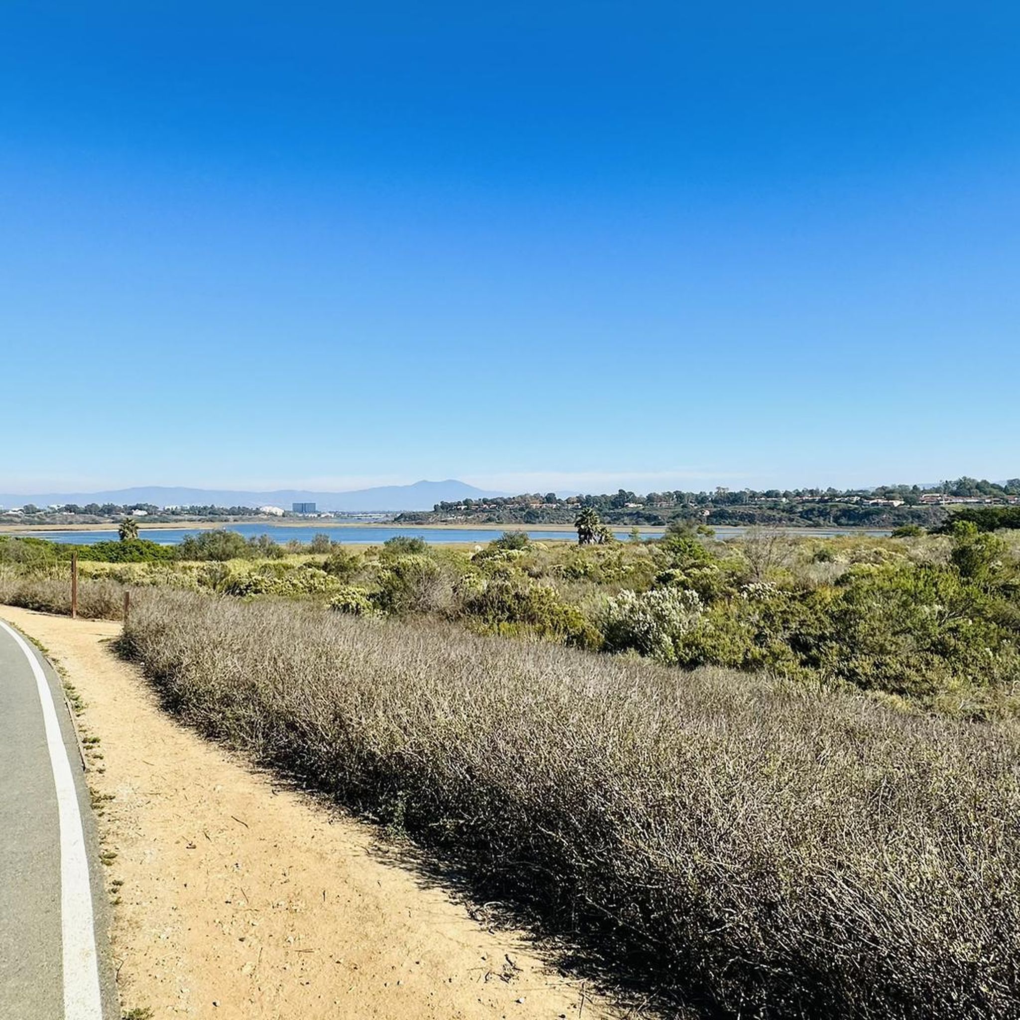
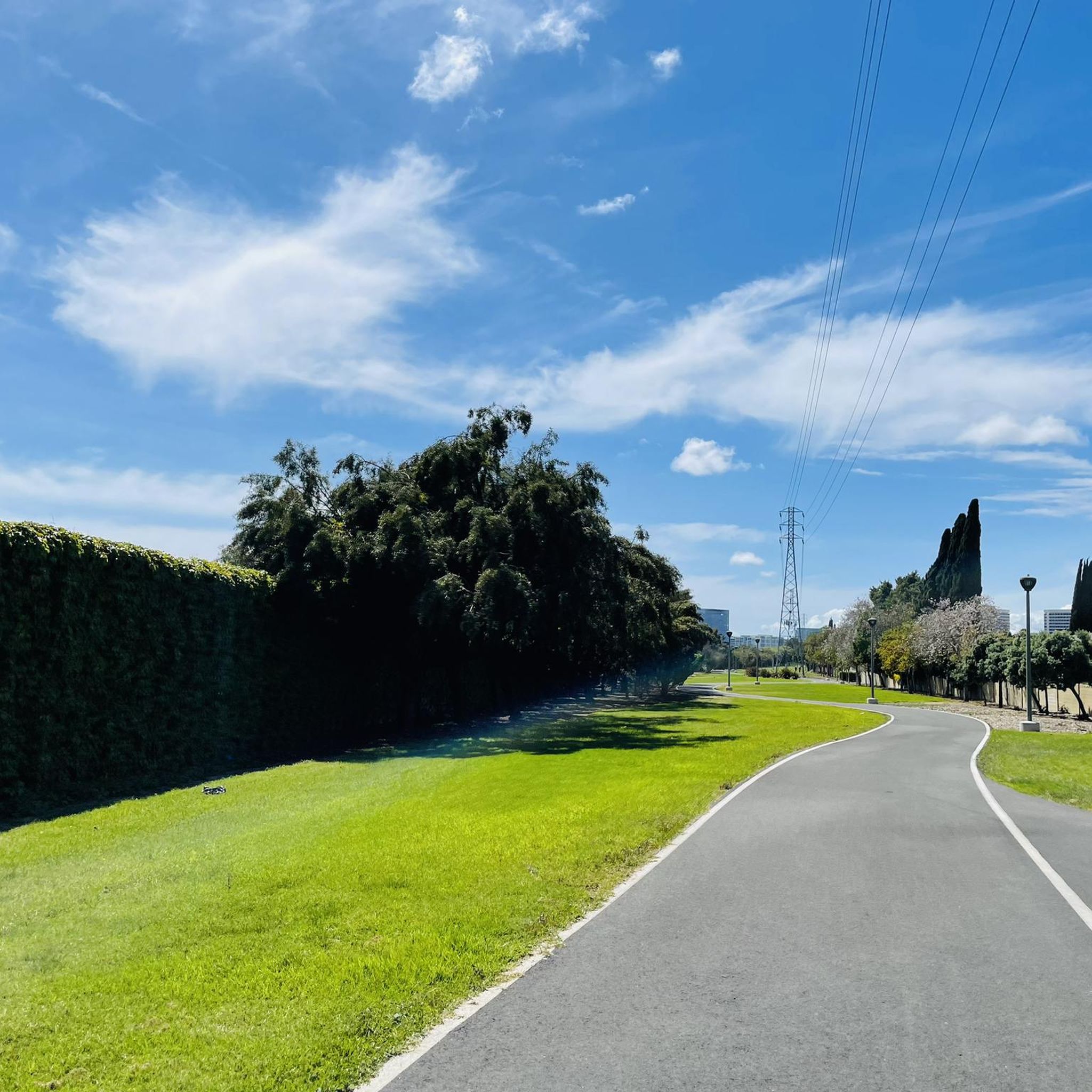
A network of paved paths pass through Bosque Canyon and provide access to the other nearby commuter trails. There are mile markers and signs at a lot of the intersections.
0
0

The park has paved paths that wind along the edge of the beautiful cerulean lake, past tennis courts, the beach club, and the bridge over North Lake Island.
0
0

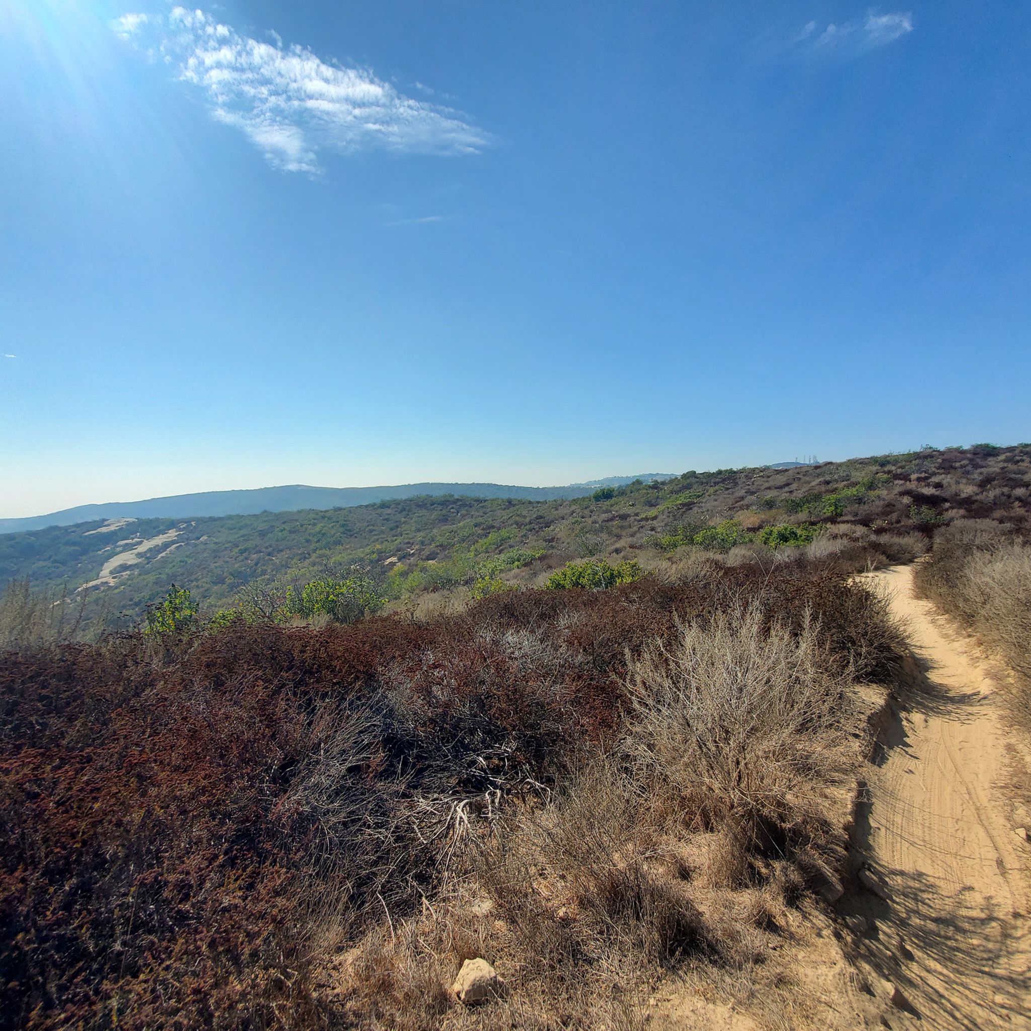
Serrano Ridge Trail offers 360 degree views as you walk across the top of the ridge. In the east you can see the peaks of the San Mateo Wilderness, and in the west is the entirety of Shady Canyon Open Space Preserve.
0
0

This viewpoint on the Serrano Ridge Trail certainly rewards you for climbing up the hill! Look to the west where you will see the Shady Canyon Open Space Preserve and to the east is the Veeh Creek Open Space. This trail is a mixture of double track and single track so wider tyres are recommended.
1
0
Serrano Ridge Trail offers 360 degree views as you walk across the top of the ridge. In the east you can see the peaks of the San Mateo Wilderness, and in the west is the entirety of Shady Canyon Open Space Preserve.
0
0

Cycleway alongside the North Lake and through the neighborhood in Woodbridge. Crosses Barranca Parkway over a bridge.
0
0
Bike path from Irvine Blvd all the way to the Great Park. Relaxed atmosphere, nice surroundings.
0
0

Serrano Ridge is an excellent trail that links Irvine to Laguna Canyon. Parking is super convenient and plentiful at the Quail Hill Community Center. The first hill (from the Center) is tough! Must be in excellent physical shape. Serrano Ridge is a nice ride of up and down hills with excellent views of Great Park and Shady Canyon. From Laguna Canyon, you can ride to the beach by linking to other trails in the Laguna Canyon trail system.
0
0
Frequently Asked Questions
What kind of terrain can I expect on hiking trails in Irvine?
Hiking around Irvine features rolling hills, canyons, and ridges. The trails are generally well-maintained and offer varied elevation changes, providing a range of experiences from easy walks to more challenging ascents within open space preserves and natural parklands.
Are there hiking trails suitable for families or beginners in Irvine?
Yes, Irvine offers a good selection of trails suitable for families and beginners. Out of nearly 50 routes, 32 are classified as easy. An example of an accessible path is the Quail Loop Trail, which is 1.8 miles long and takes about 47 minutes to complete.
Can I bring my dog on the hiking trails in Irvine?
While many open spaces in Irvine are dog-friendly, specific regulations can vary by preserve or trail. It's always best to check the local signage or the official website for the specific trail you plan to visit to confirm their pet policies before heading out.
What are some notable natural features or landmarks I might see on a hike in Irvine?
Irvine's hiking areas offer access to several natural features. You might encounter canyons like Red Rock Canyon or Laurel Canyon. There's also Black Star Falls, a waterfall, and the Red Rock Trail — Whiting Ranch Wilderness Park, which is a natural monument.
Are there any loop trails available for hiking in Irvine?
Yes, Irvine features several loop trails. A popular option is the Turtle Ridge Trail to Bommer Meadow loop — Bommer Canyon Open Space Preserve, a moderate 5.3-mile route traversing ridges and meadows.
What is the best time of year to go hiking in Irvine?
Given Irvine's climate, hiking is generally pleasant year-round. However, to avoid the hottest temperatures, especially on exposed trails, spring and fall are often ideal. Early mornings in summer can also be a good option.
How many hiking trails are there in Irvine?
There are nearly 50 hiking routes available in Irvine, catering to various skill levels. This includes 32 easy, 13 moderate, and 3 difficult trails, offering plenty of options for exploration.
What do other hikers say about the trails in Irvine?
The hiking routes in Irvine are highly regarded by the komoot community, holding an average rating of 4.7 stars from over 80 reviews. Hikers often praise the well-maintained paths and the diverse landscapes found within the open space preserves.
Are there any trails with good views in Irvine?
Many trails in Irvine offer scenic views, particularly those that traverse ridges and higher elevations within the open space preserves. For coastal views, the Pelican Point Viewpoint is a notable spot.
Do I need permits for hiking in Irvine, and what about parking and public transport?
Permit requirements can vary for specific preserves or trails within Irvine, so it's advisable to check the relevant park or open space authority's website before your visit. Information regarding parking availability is often found at trailheads, but public transport options to specific trail access points may be limited, making personal vehicles often the most convenient way to reach many hiking areas.
What is a good moderate hiking trail in Irvine?
For a moderate challenge, the Turtle Rock Trail is a great option. It's 4.2 miles long, takes about 2 hours to complete, and leads through varied terrain around Turtle Rock.
Are there any long-distance hiking options in Irvine?
While many trails are shorter, routes like Serrano Ridge to Fox Run via Quail Trail — Shady Canyon Open Space Preserve offer a longer experience, covering over 8 miles (13.3 km) with significant elevation changes, suitable for those looking for a more extended hike.
Most popular routes around Irvine
Most popular attractions around Irvine

Get inspired with the komoot mobile app


Explore more
Browse the best Hikes in other regions.
