The best walks and hikes around Westlake Village
4.6
(113)
1,428
hikers
144
hikes
If you've ever tried to plan hiking around Westlake Village, you know how quickly the options can become overwhelming. With so many trails crisscrossing the landscape, it's tough to tell which routes are genuinely worth your time and effort, and which are just filler. That's where we come in. Our komoot community has mapped, walked, and reviewed countless routes here, and we've distilled all that local knowledge into a curated shortlist, saving you the guesswork.
Hiking around Westlake Village means exploring a unique landscape nestled between the Santa Monica Mountains and the Simi Hills. Expect rugged terrain, rolling hills, and dramatic rock formations, with trails winding through oak woodlands, chaparral, and striking sandstone outcroppings. The Mediterranean-like climate means you can enjoy these trails year-round, from easy strolls to more demanding climbs.
For a fantastic introduction to the area, we'd start with the Pentachaeta and Westlake Vista Loop. This easy 3.9 miles (6.2 km) route is perfect for a first visit, showcasing beautiful oak woodlands and native grasslands. If you're looking for something a bit more challenging with rewarding views, the moderate Triunfo Park Conejo Crest Loop Trail, at 6.0 miles (9.6 km) with a steady climb of 968 feet (295 m), offers a great workout and panoramic vistas. With over 1,400 hikers having explored these trails with komoot, you're in good company. Dive in and discover your next favorite route!
Last updated: May 10, 2026
2
hikers
9.61km
02:53
300m
300m
The Triunfo Park Conejo Crest Loop Trail offers a fantastic journey through varied landscapes, from shaded oak woodlands to open ridge lines. You'll experience sweeping views of the Conejo Valley and the Santa Monica Mountains, with glimpses of the Pacific Ocean on clear days. The path transitions from natural surfaces to a fire road, providing a mix of terrain underfoot, and in spring, wildflowers add a splash of color to the scenery.
This moderate 6.0-mile (9.6 km) loop involves a respectable 969 feet (295 metres) of elevation gain, typically taking around 2 hours and 52 minutes. The trailhead is easily accessible from Triunfo Park, which has restrooms and a playground. While no permits are required, it's wise to start early to secure parking and enjoy the cooler morning temperatures, especially if you're planning to hike in the warmer months.
Part of a larger interconnected open space system, this trail is popular not just with hikers but also with bikers and equestrians. The route offers a good workout and is an excellent choice if you're looking for a longer, more immersive experience in the Conejo Valley. Keep an eye out for local wildlife like deer, and enjoy the expansive vistas from the Conejo Ridge Open Space.
2.01km
00:38
100m
10m
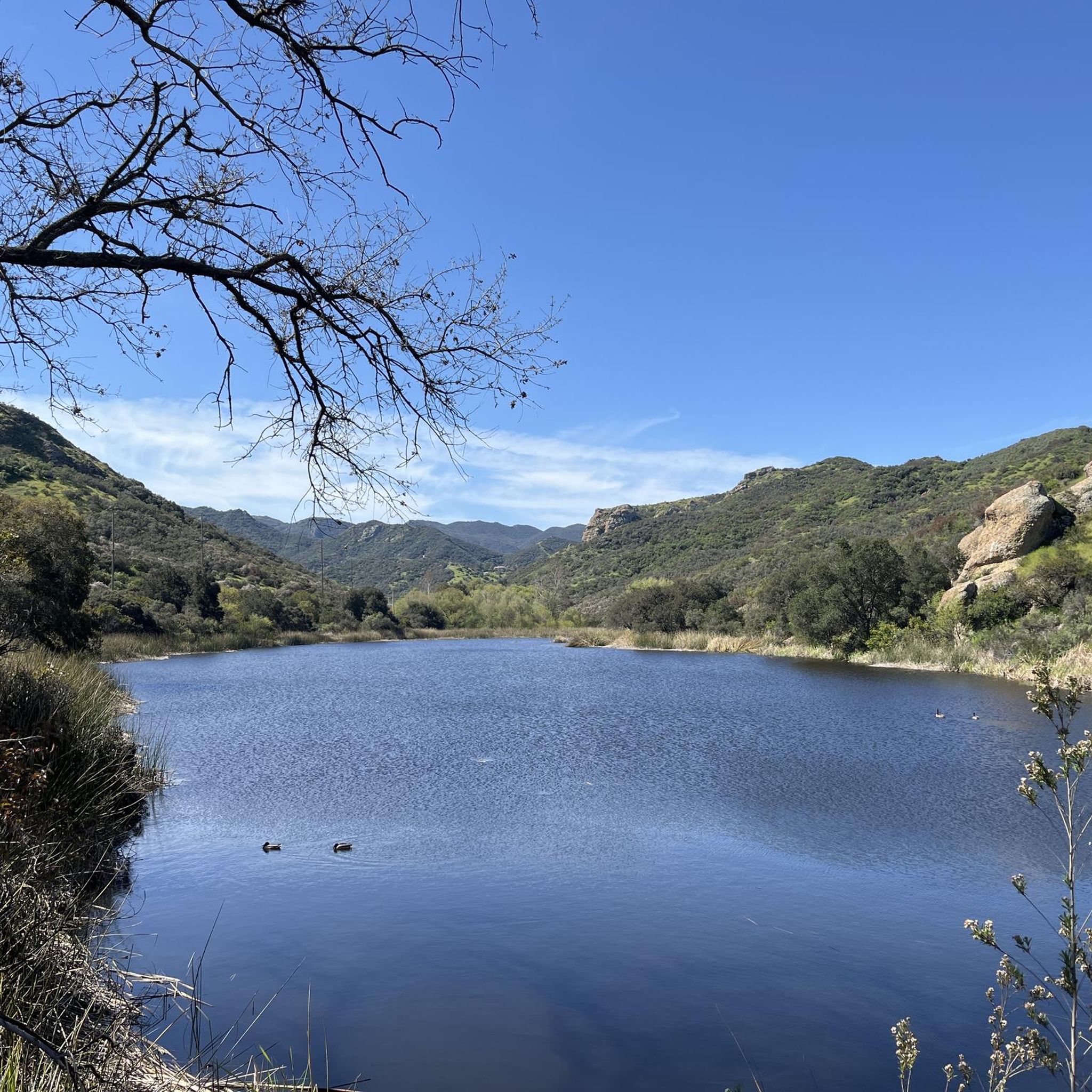
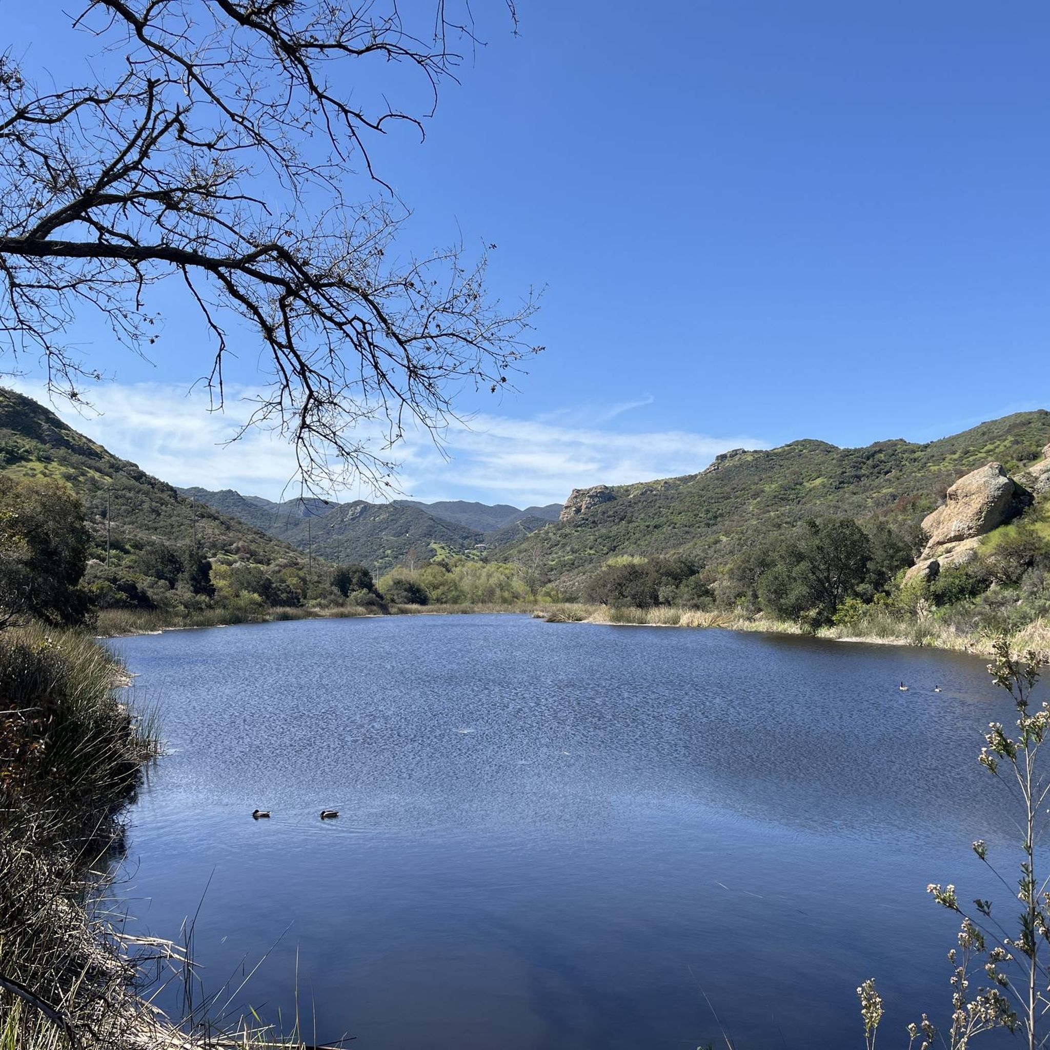
The Lake Eleanor Open Space Trail offers a fantastic, easy hiking experience, packing panoramic views into a short 1.2-mile (2.0 km) out-and-back route. As you ascend its 340 feet (104 metres) of elevation gain, you'll find yourself on a ridge overlooking both the tranquil Lake Eleanor and the vast Las Virgenes Reservoir. The singletrack path winds through oak woodland and coastal sage scrub, with wildflowers adding splashes of color in spring, making for a rewarding 37-minute journey.
This trail is generally considered easy, though you should be ready for some loose rocks and short, slightly steep sections. It's a great option for a quick outdoor escape, but robust off-road strollers are likely the only ones that might manage the terrain. There are no permits required for hiking, and it's best enjoyed on a clear day for optimal visibility of the surrounding Thousand Oaks landscape.
What makes this trail stand out is its consistently great views from the ridge, providing a unique dual perspective of the two bodies of water. Lake Eleanor itself is designated a City of Thousand Oaks Historical Landmark, though it's fenced off to protect its wildlife. This peaceful route is also a segment of the Conejo Open Space Challenge, offering a quiet natural experience close to urban amenities.

1.75km
00:37
160m
0m
The Bowfield Trail offers a dynamic hiking experience on singletrack paths that weave through rolling, dry grassy hills, providing a sense of open space and solitude. As you ascend, the expansive views of the Conejo Valley unfold, culminating in a rewarding panoramic vista from the bench at the trail's highest point. This route is a fantastic way to immerse yourself in the local landscape without a huge time commitment. You'll find the terrain underfoot to be mostly firm, though some steeper sections can have loose rocks, adding a bit of challenge.
This easy 1.1-mile (1.8 km) hike, with its 535 feet (163 metres) of elevation gain, can be completed in about 37 minutes, making it ideal for a quick outing. Dogs are welcome on leash, and you'll often find the trail isn't overly crowded, allowing for a peaceful walk. It's a great choice if you're looking for a short but effective conditioning hike, offering significant elevation gain for its length.
While the main Bowfield Trail is a straightforward climb, it's part of a larger system, connecting to routes like the Saddle Pass Trail and Aqiwo Trail, which can extend your adventure to three peaks for a more challenging 4.6-mile workout with approximately 950 feet of cumulative climbing. In April, you might even catch masses of poppies blooming on the Aqiwo Trail, adding a splash of color to the landscape and enhancing the natural features of the area.
4.03km
01:12
170m
50m
The Bridgegate and White Horse Trail in Thousand Oaks, California, offers a varied hiking experience, combining wide fire road sections with more technical, rocky stretches. As you walk, you'll pass through areas with scrub, aspen trees, and large pines, providing a pleasant natural backdrop. This easy 2.5-mile (4.0 km) route involves 560 feet (171 metres) of elevation gain and typically takes around 1 hour and 12 minutes to complete, making it a good option for a relatively quick outing.
To plan your visit, head to the trailhead in Thousand Oaks. Parking is usually available, but arriving earlier in the day is a good idea to ensure you find a spot. Given the trail's mixed terrain, wearing sturdy shoes is advisable for comfort and stability. Always bring enough water, especially if you're hiking during warmer periods, to stay hydrated throughout your journey.
This trail is a combination of two distinct local paths, offering a glimpse into the diverse landscapes of Ventura County. While some sections are wide and straightforward, others, particularly the Bridgegate portion, are known for loose rocks and uneven surfaces, adding a bit of challenge to an otherwise easy hike. It's a great way to explore the local environment without committing to a full-day excursion.
4.6
(5)
19
hikers
6.21km
01:56
220m
220m
The Pentachaeta and Westlake Vista Loop offers a delightful escape into nature, winding through deep oak woodlands, native grasslands, and meadows that explode with wildflowers in spring. You'll enjoy expansive views of Westlake Lake and the Santa Monica Mountains from the Westlake Vista section, making for a scenic and varied experience. This easy 3.9-mile (6.2 km) hike, with 726 feet (221 metres) of elevation gain, is a perfect choice for a quick, rewarding outing that takes about 1 hour and 55 minutes to complete. It's a great option for those seeking a family-friendly hike with diverse terrain and notable natural features.
To plan your visit, head to Triunfo Creek Park near Westlake Village, where you'll find the trailhead and an informational kiosk. The trail is dog-friendly, allowing you to bring your furry companions along. While generally accessible, be mindful of rattlesnakes and poison oak, and always stick to the marked trails. Spring is the best time to hike the Pentachaeta and Westlake Vista Loop to witness the vibrant wildflower displays, but it's enjoyable year-round. Parking is available, but consider an early start on busy days.
What truly sets this trail apart is the presence of the endangered Pentachaeta lyonii, a yellow, daisy-like flower that blooms between April and June, giving the route its unique name. Beyond this rare bloom, you might also spot other unusual wildflowers like the Chocolate Lily and White Globe Lily. The trail's blend of forest, grassland, and panoramic viewpoints, including towards the Las Virgenes Reservoir, makes it a standout among popular trails and routes in the Westlake Village area, offering a chance to see local wildlife in a beautiful setting.
Get access to more routes and recommendations from other explorers.
Already have an account?
Our route recommendations are based on thousands of hikes, rides, and runs completed by other people on komoot.
Start today with a free account
Your next adventure awaits.
Tips from the Community

Triunfo Creek Park is owned and maintained by the Santa Monica Mountains Conservancy. This is a lush 600-acre park in Westlake Village and provides deep oak woodland, native grasslands and blankets of wildflowers in the springtime.
0
0

Triunfo Creek Park provides deep oak woodland, native grasslands, and wildflowers in the springtime. A main attraction of this park is the Pentachaeta lyonii, a federally-listed endangered flower.
0
0
Conejo Ridge Open Space includes relatively undisturbed chaparral, oak woodlands, and coastal sage scrub. The open space provides important habitat for deer, mountain lions, bobcats, and other wildlife.
0
0
Frequently Asked Questions
How many hiking trails are there in Westlake Village?
Westlake Village offers an extensive network of over 95 hiking trails, catering to a wide range of abilities. You'll find options from easy strolls to more challenging routes, all set amidst the beautiful landscapes between the Santa Monica Mountains and the Simi Hills.
Are there easy hiking trails suitable for beginners in Westlake Village?
Yes, Westlake Village has plenty of easy trails perfect for beginners or those looking for a relaxed walk. Over 50 of the routes are rated as easy. A great option is the Pentachaeta Trail to Dean's Lobo Ridge loop — Triunfo Creek Park, which winds through oak woodlands and native grasslands. Another accessible choice is the Triunfo Canyon Trail loop — South Ranch Open Space, a well-maintained singletrack route.
What kind of natural features can I expect to see on hikes in Westlake Village?
The region is rich in diverse natural features. You'll encounter rugged terrain, undulating hills, and dramatic rock formations, including captivating rock canyons like White Stallion Canyons and Sycamore Canyon. Trails often traverse oak woodlands, chaparral-covered meadows, coastal sage scrub, and native grasslands. In spring, the landscape comes alive with vibrant wildflowers, including California poppies.
Are there any trails with waterfalls in Westlake Village?
Yes, a local favorite is the Paradise Falls Trail, a moderate 2.5-mile route that culminates at a mesmerizing 40-foot waterfall. Additionally, you can find Sycamore Falls listed as a natural monument in the area, offering another beautiful cascade to discover.
Are there family-friendly hiking options in Westlake Village?
Absolutely. Many of the easy trails are suitable for families. The Pentachaeta Trail to Dean's Lobo Ridge loop in Triunfo Creek Park is an excellent choice, offering an easy walk through scenic landscapes. The Wishbone Trail Loop is also rated as easy and is known for its spring wildflower blooms, making it a pleasant outing for all ages.
Can I bring my dog on the hiking trails in Westlake Village?
Many trails in Westlake Village and the surrounding open spaces are dog-friendly, but regulations can vary by park or specific trail. It's always best to check the specific rules for the park you plan to visit. Generally, dogs are required to be on a leash. For example, Triunfo Creek Park and Oakbrook Regional Park often welcome leashed dogs.
Are there any loop hikes in Westlake Village?
Yes, Westlake Village offers several enjoyable loop hikes. The Sandstone Hills Trail loop — Oakbrook Regional Park is a popular choice, featuring striking rock formations. Another great option is the Triunfo Canyon Trail loop — South Ranch Open Space, known for its well-maintained path and native wildflowers.
What are some notable landmarks or viewpoints along the trails?
Hikers can enjoy numerous landmarks and viewpoints. Simi Peak offers panoramic views of the Santa Monica Mountains National Recreation Area. The Westlake Vista Trail provides awe-inspiring vistas of Westlake Village itself. You can also find the Inspiration Point, offering scenic overlooks, and the Coba Arch, a unique rock formation accessible via the Hidden Meadows Trail.
What do other hikers enjoy most about hiking in Westlake Village?
The hiking experience in Westlake Village is highly rated by the komoot community, with an average score of 4.7 stars from over 100 reviews. Hikers frequently praise the diverse landscapes, from oak woodlands to chaparral, the stunning panoramic views, and the well-maintained trails that cater to various skill levels. The chance to spot local wildlife and the beautiful spring wildflower displays are also often highlighted.
Is parking available at Westlake Village trailheads?
Parking is generally available at most major trailheads and parks in and around Westlake Village, such as Triunfo Creek Park, Oakbrook Regional Park, and access points to the Santa Monica Mountains National Recreation Area. It's advisable to check specific park websites or trail descriptions for detailed parking information, especially during peak hiking seasons.
What is the best time of year to hike in Westlake Village?
Westlake Village offers pleasant hiking conditions for much of the year. Spring is particularly beautiful, with wildflowers blooming across the landscape. Fall and winter also provide cooler temperatures, making for comfortable hiking. Summers can be hot, so early morning or late afternoon hikes are recommended during those months.
Are there any long-distance hiking trails near Westlake Village?
While many trails are shorter, you can combine routes or explore longer segments within the Santa Monica Mountains National Recreation Area. For example, the China Flat & Simi Peak route offers a moderate 7.5-mile path with significant elevation gain, providing a more extended experience. The extensive network allows for custom longer routes.
Most popular attractions around Westlake Village

Get inspired with the komoot mobile app


Explore more
Browse the best Hikes in other regions.
