Routes

Planner

Features

Updates

App

Login or Signup

Get the App

Login or Signup

Routes
Hikes
United States
California
Los Angeles County

Burbank

The best walks and hikes around Burbank

4.6

(841)

9,883

hikers

13

hikes

If you've ever tried to plan hiking around Burbank, you know how overwhelming the options can be. With so many trails crisscrossing the Verdugo Mountains, it's tough to tell which routes are genuinely worth your time and effort. We get it β€” nobody wants to spend their precious outdoor hours on a trail that doesn't deliver. That's why we've tapped into komoot's community, who have mapped, walked, and reviewed these routes, to bring you a curated shortlist of the very best.

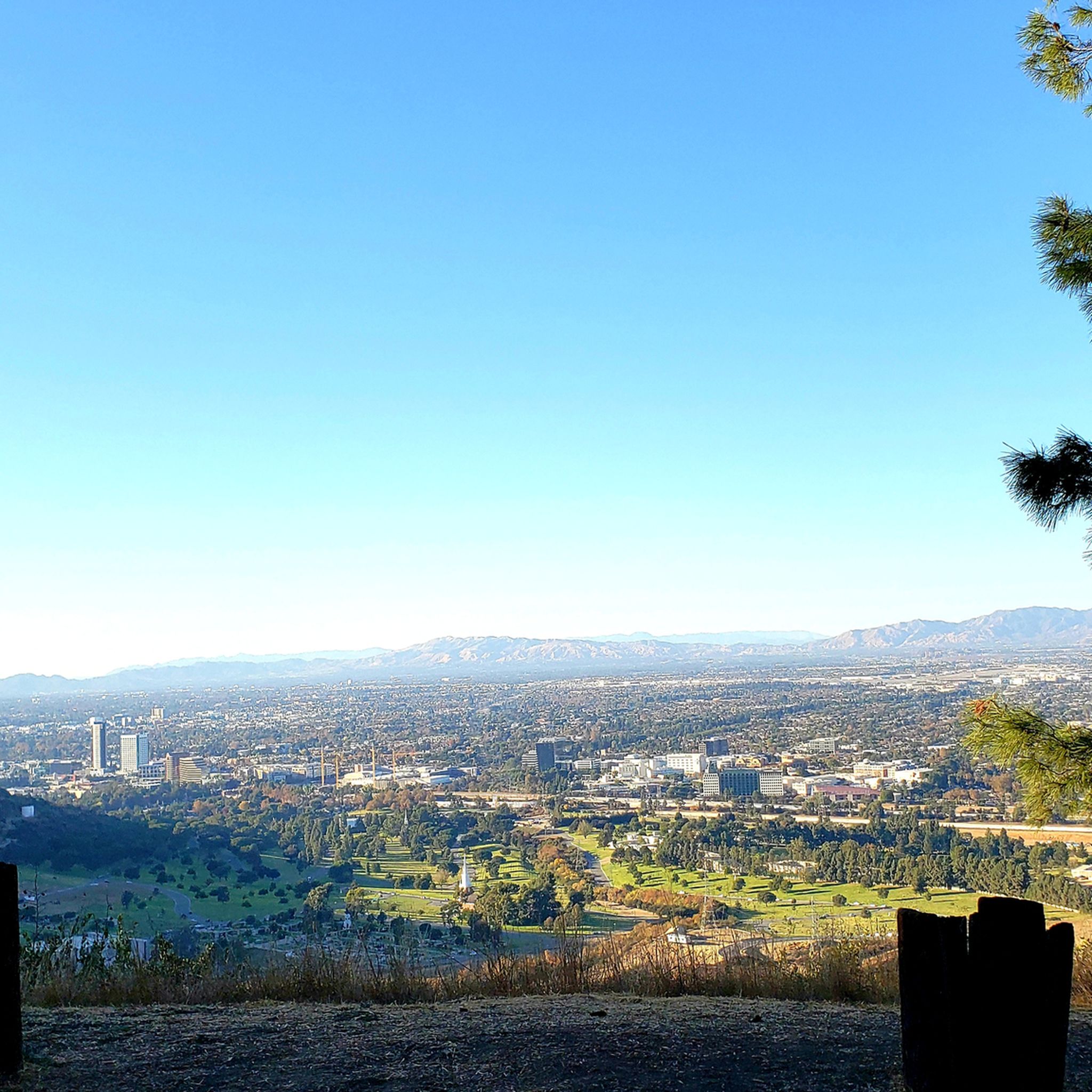
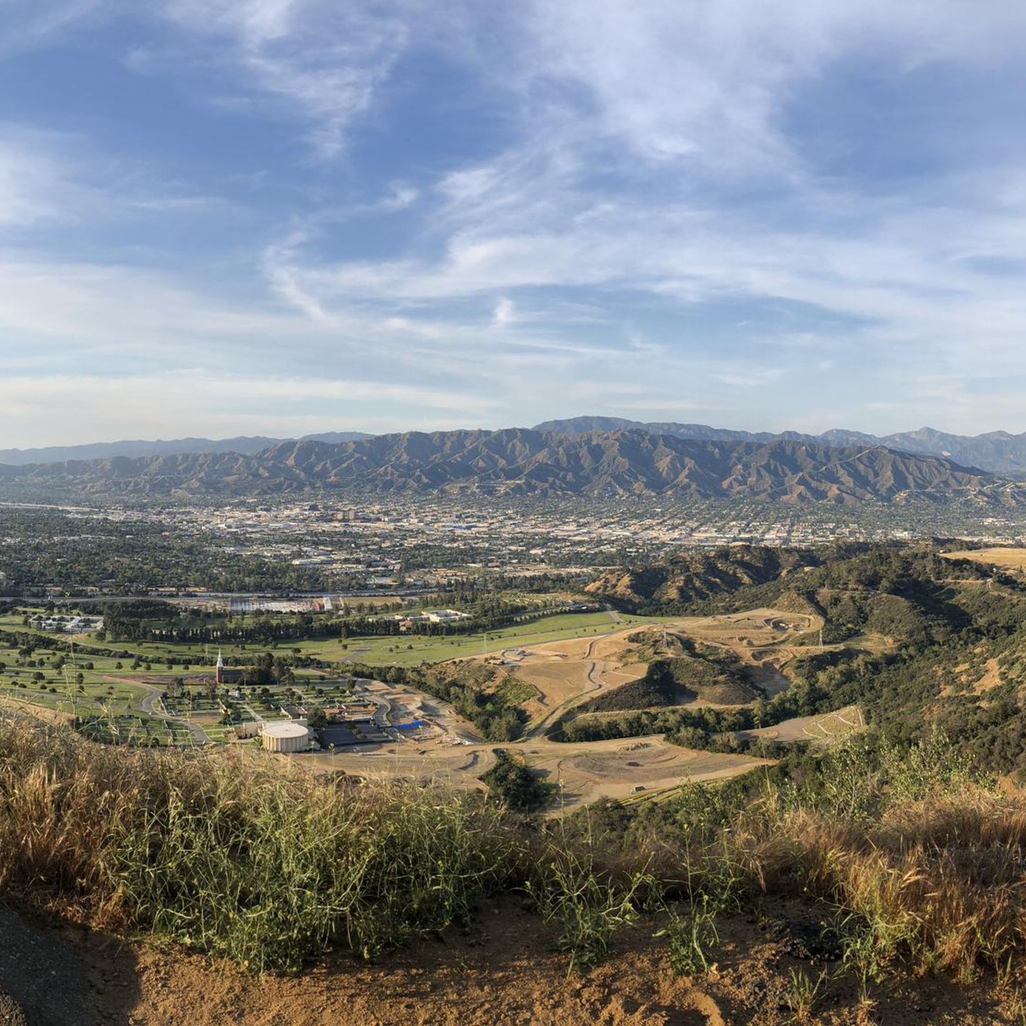
Hiking in Burbank is all about the Verdugo Mountains, which rise dramatically behind the city. Expect a mix of rugged terrain, wide fire roads, and narrower trails winding through native chaparral and oak woodlands. The reward? Incredible panoramic views of the San Fernando Valley and the greater Los Angeles area. From easy strolls to more sustained climbs, there's a route for almost every energy level here.

If you only do one hike, we'd point you towards the Vital Link and Stough Canyon Loop, a moderate 7.0 miles (11.2 km) route that gives you a fantastic taste of the Verdugo Mountains. For a quicker, family-friendly option, the Stough Canyon Loop Trail at 1.0 miles (1.7 km) is a perfect easy win. With more than 11,000 hikers having explored Burbank with komoot, you can trust these routes to be worth your legs.

Last updated: May 10, 2026

5.0

(1)

16

hikers

#1.

Vital Link and Stough Canyon Loop

11.2km

03:51

590m

570m

The Vital Link and Stough Canyon Loop offers a diverse hiking experience, blending challenging ascents with expansive views across the San Fernando Valley and the Santa Monica Mountains. You'll navigate a steep singletrack on the Vital Link Trail, where the terrain can be unstable with slippery decomposing granite, before transitioning to the more forgiving, wide trails of Stough Canyon, which feature ingenious stonework designed to manage rainwater. Keep an eye out for gnarled trees and unusual plants that give parts of the landscape an almost alien feel, especially as you gain elevation and the panoramic vistas unfold.

To tackle this 7.0-mile (11.2 km) hike with 1948 feet (594 metres) of elevation gain, plan for about 3 hours and 51 minutes on the trail. Many hikers begin their journey at the Stough Canyon Nature Center, which provides a convenient starting point and parking. While the overall difficulty is moderate, the Vital Link section is quite strenuous, so bring plenty of water, especially on warmer days. Starting early in the morning is advisable to avoid the midday sun and to secure parking, as this is one of the popular trails routes in the area.

This loop is notable for its dramatic change in character, from the

Navigate with device

Send to Phone

Save

Moderate

5

hikers

The Stough Canyon Loop Trail offers a delightful escape into the Verdugo Mountains, providing expansive views over the San Fernando Valley and beyond. You'll traverse well-maintained paths of packed earth and loose gravel, with some moderate inclines that give you a good stretch without being overly strenuous. Look for native chaparral and wildflowers along the way, and keep an eye out for local wildlife like birds and lizards. The highlight is undoubtedly "The View Point," which delivers breathtaking vistas of Burbank, Glendale, and even downtown Los Angeles.

Planning your visit is straightforward, as the trail begins at the Stough Canyon Nature Center, where parking is available. While generally less crowded than other area trails, an early start is always recommended to secure a spot and enjoy the cooler morning air. This easy 1.0-mile (1.7 km) hike with 252 feet (77 metres) of elevation gain typically takes around 31 minutes, making it a perfect quick outing.

Beyond the natural beauty, the Stough Canyon Loop Trail also holds a unique historical element with the ruins of an abandoned Boy Scout camp along the route. This adds an interesting layer to your hike, blending natural scenery with a touch of local history. It's a fantastic option for families or anyone looking for a rewarding, easy hike with great views and a bit of character.

Easy
guide_signup
Let us show you the way with the komoot mobile app
With aΒ free komoot account, you can easily find, customize, and navigate endless outdoor adventures.

Sign up for free

The Stough Canyon Trail to Verdugo Peak offers a rewarding journey through the Verdugo Mountains, starting with a steep climb from the Stough Canyon Nature Center. As you ascend the dirt and gravel fire road, the landscape transforms, revealing expansive views of the San Fernando Valley, the Los Angeles skyline, and the majestic San Gabriel Mountains. You'll pass by the ruins of an old youth camp and eventually reach Verdugo Peak, where the panoramic vistas are truly spectacular, making the moderate 4.1-mile (6.7 km) hike with 1559 feet (475 metres) of elevation gain well worth the effort.

Planning your visit to this popular trail means preparing for a workout; the initial section is particularly strenuous. The route is an out-and-back, typically taking around 2 hours and 10 minutes to complete. Always carry ample water, especially during warmer months, and wear appropriate footwear for the varied terrain, which can include sandy and slippery patches. Parking is available at the Stough Canyon Nature Center, which serves as the main access point for this trail.

This trail is part of the larger Verdugo Mountainway Trail System, connecting various communities across the Verdugo Mountains. Beyond the stunning viewpoints, you might spot local wildlife or observe passenger jets taking off from Bob Hope Airport in the distance. The Stough Canyon Nature Center itself is a hub for outdoor activities, offering various programs and acting as a gateway to this moderately challenging yet highly scenic hiking experience.

Moderate

2

hikers

The Verdugo Peak via Skyline Motorway trail offers a unique blend of urban proximity and rugged terrain, making it a standout in the Verdugo Mountains. You'll navigate an old fire road that has largely reverted to a single-track path, with uneven ground and steep sections, including a notable washed-out area. As you climb, the chaparral-lined route reveals increasingly expansive views over downtown Los Angeles, Glendale, and the San Gabriel Mountains, culminating in panoramic 360-degree vistas from higher points.

This moderate hike packs a punch with 2016 feet (614 metres) of elevation gain over 4.0 miles (6.4 km), typically taking around 2 hours and 24 minutes. Given the limited shade, it's best tackled during cooler months. The trailhead can be a bit tricky to find, but once you're on your way, no permits or fees are required, and leashed dogs are welcome.

What sets this trail apart is its evolution from a motor route to a natural hiking path, providing a strenuous workout with constant, breathtaking skyline views. It serves as a key access point into the Verdugo Mountains, offering connections to other routes once you reach the broader Verdugo Fire Road. On clear days, you might even catch a glimpse of the Pacific Ocean.

Moderate

2

hikers

1.75km

00:34

90m

50m

The Wildwood Little Loop offers a delightful, easy hike through Burbank's Wildwood Park, providing a quick nature fix with impressive vistas. As you navigate the 1.1-mile (1.8 km) path, you'll gain about 300 feet (92 metres) in elevation, leading to beautiful mountain views and panoramas of Los Angeles and Burbank. It's a perfect, short escape that takes only about 34 minutes, ideal for a refreshing walk or a family-friendly adventure.

To make the most of your visit, consider hiking in the early morning or late evening, especially during warmer months, as the trail has limited shade. Parking is generally available at Wildwood Park, offering convenient access to the trailhead. Always carry water, even for this brief outing, to stay hydrated.

Wildwood Park is known for its efforts to preserve natural foliage and offers a chance to spot local wildlife like deer and coyotes. This loop is a fantastic choice for those new to hiking or anyone looking for a quick, scenic workout without the commitment of a longer, more challenging trail.

Easy
Sign up for free to see 9 more hikes around Burbank.

Get access to more routes and recommendations from other explorers.

Sign up for free

Already have an account?

Our route recommendations are based on thousands of hikes, rides, and runs completed by other people on komoot.

Start today with a free account

Your next adventure awaits.

Login or Signup
Popular around Burbank

Road Cycling Routes around Burbank

Cycling around Burbank

Running Trails around Burbank

MTB Trails around Burbank

Gravel biking around Burbank

Tips from the Community

Lisa
September 28, 2024, Verdugo Peak

You can approach this 3,124-foot peak from several directions, but the multi-use Verdugo Motorway is the most common uphill option.

0

0

Jamie S.
August 7, 2023, Verdugo Peak

Verdugo Peak stands at 1835 feet and is a remote feeling summit off of the Verdugo Motorway. This sunny summit grants you fantastic views across the Verdugo Mountains and the valley below. In the spring there are often wildflowers along the motorway.

0

0

Kit P
May 24, 2022, Verdugo Peak

The Verdugos is a mountain range offering a fantastic array of adventures away from the urban sprawl in every direction. Mountain biking and gravel riding are particularly great, because you can follow quiet tracks to epic viewpoints just like this one.

0

0

Frequently Asked Questions

Are there many hiking trails to choose from around Burbank?

Yes, there is a wide variety of trails. You can find over 200 routes in the area, ranging from easy strolls to challenging mountain climbs, primarily centered around the Verdugo Mountains.

What do other hikers think of the trails in Burbank?

The trails are highly regarded by the komoot community, with an average rating of 4.7 stars. Hikers often praise the stunning panoramic views of the San Fernando Valley and the well-maintained fire roads that make up many of the routes.

Are there any easy, family-friendly hikes in the Burbank area?

Yes, the Brand Park loop is a great option for a less strenuous outing. It's a moderate 2.3-mile (3.7 km) walk with about 700 feet of elevation gain, making it suitable for families and those new to hiking in the area.

I'm looking for a challenging hike. What do you recommend?

For a more strenuous workout with significant elevation, consider the Seven Trees Overlook – Top of Switchbacks loop. This difficult hike covers 7.2 miles (11.6 km) and climbs over 2,000 feet (615 m), rewarding you with expansive views from the ridgeline.

Are dogs allowed on the hiking trails near Burbank?

Most trails in the Verdugo Mountains and surrounding parks are dog-friendly, but they must be kept on a leash. The terrain can be steep and exposed with little shade, so always carry plenty of water for both yourself and your dog, especially on warm days.

Where can I find the best scenic views while hiking?

Many trails in the Verdugo Mountains offer spectacular vistas. For some of the best panoramic views, the climb to Verdugo Peak is unmatched, as it's the highest point in the range. On a clear day, you can see across the San Fernando Valley to the Los Angeles skyline.

Are there any hikes with waterfalls near Burbank?

While the immediate Burbank trails in the Verdugo Mountains are quite dry, you can find waterfalls in the nearby San Gabriel Mountains. The trail to Switzer Falls is a popular option, involving some creek crossings to reach a scenic, multi-tiered waterfall in a gorge.

What are the trail conditions like in the Verdugo Mountains?

The trails are typically wide, hard-packed fire roads with some single-track paths. They are very exposed with little tree cover, so it's essential to bring sun protection and plenty of water. The terrain is rugged and steep in many sections.

What's the difference between hiking from Wildwood Canyon Park versus Stough Canyon?

Both parks are excellent gateways to the Verdugo Mountains. Wildwood Canyon Park is known for its direct and steep trails like the Vital Link Trail. Stough Canyon offers access to similar trails but also features the Stough Canyon Nature Center at its base, which provides maps, exhibits on local wildlife, and guided hikes.

Where is a good place to park for a hike?

The main trailheads have dedicated parking areas. Both Wildwood Canyon Park and the Stough Canyon Nature Center offer free public parking, but they can fill up quickly, especially on weekends. Arriving early is recommended to secure a spot.

Are there any circular or loop trails available?

Yes, there are several loop options that allow you to enjoy different scenery on your return. The Tongva Peak and Mount Thom via the Verdugo Crest loop is a popular 4.3-mile (6.9 km) circuit that takes you over two different peaks.

Most popular routes around Burbank

Easy hikes around Burbank

Most popular attractions around Burbank

Places to see

Store rating

Get inspired with the komoot mobile app

With aΒ free komoot account, you can easily find, customize, and navigate endless outdoor adventures.

or

Join komoot Now

Store rating

Explore more

Browse the best Hikes in other regions.

Los AngelesSan Gabriel MountainsAngeles National ForestSan Gabriel Mountains National MonumentSanta Monica MountainsSanta Monica Mountains National Recreation AreaPasadenaTopanga State ParkCovinaLong BeachSanta ClaritaVincentMalibuWest CovinaCalabasasNorwalkDowneyBradburyErnest E. Debs Regional ParkEast Los AngelesSan DimasLa MiradaFond Wilderness PreserveRancho Palos VerdesClaremontTopangaGlendaleDiamond BarMichael D. Antonovich Regional Park At Joughin RanchLancasterLomitaMonroviaStetson Ranch ParkEast PasadenaAltadenaAgua DulceActonElizabeth LakeEast WhittierSanta Fe SpringsMalibu Creek State ParkVerdugo Mountains Open Space PreserveUniversitΓ© Pepperdine Stevenson RanchRosemeadSouth PasadenaSan GabrielLakewoodBellflowerMaywoodLadyface Mountain Open SpaceLeona ValleyView Park-Windsor HillsGreen ValleyPalmdaleBriar Summit Open Space PreserveAlhambraLa Crescenta-MontroseSan FernandoSouth San GabrielBaldwin ParkCarsonCitrusWest CarsonCerritosRolling HillsSignal HillPomonaCommercePalos Verdes EstatesCharter OakVernonLadera HeightsWalnutRio De Los Angeles State Park State Recreational AreaLake HughesWestlake VillageHidden HillsLa CaΓ±ada FlintridgeAgoura HillsSan PasqualPico RiveraMontebelloAvocado HeightsSierra MadreRolling Hills EstatesLeo Carrillo State ParkTorranceArtesiaSanta MonicaAvalonWestmontParamountAntonovich Open Space PreserveTemple CityLawndaleWhittierCharmlee Wilderness ParkIrwindaleMonterey ParkHawaiian GardensAzusaGardenaEl SegundoWest Puente ValleyLa VerneEl MonteGlendoraWest AthensSouth San Jose HillsSouth Hills Wilderness AreaWest Whittier-Los NietosLa Habra HeightsSan MarinoHuntington ParkSouth El MonteCastaicArcadiaDuarteBell GardensWest Rancho DominguezClaremont Hills Wilderness ParkMayflower VillageNorth El MonteSouth Monrovia IslandWestridge-Canyonback Wilderness ParkManhattan BeachInglewoodRose HillsSouth WhittierRedondo BeachAlondra ParkSouth GateEast San GabrielBeverly HillsCulver CityWest HollywoodLa PuenteFlorence-GrahamQuartz HillIndustryValindaRowland HeightsDel AireComptonEast ComptonBellWalnut ParkHacienda HeightsHawthorneSaint Francis Dam National MonumentHermosa BeachLennoxVal VerdeHasley CanyonMarina Del ReyArthur B. Ripley Desert Woodland State Park

Nearby adventure guides

Things to Do in Fond Wilderness Preserve

background

Get ready to conquer new peaks

Sign up for Free

Explore
RoutesRoute plannerFeaturesHikesMTB TrailsRoad cycling routesBikepackingSitemap
Download the app
Follow Us on Socials

Β© komoot GmbH

Privacy Policy