The best road cycling routes around West Covina
4.3
(43)
3,810
riders
91
rides
Road cycling around West Covina offers diverse terrain, from flat river paths to challenging climbs with significant elevation gain. The region features well-paved roads, canyons, and reservoirs, providing varied landscapes for cyclists. Key natural features include the San Gabriel River, Glendora Ridge Road, and Frank G. Bonelli Regional Park. This topography supports a range of road cycling experiences for different fitness levels.
Best road cycling routes around West Covina
- The most popular road cycling route is Glendora Ridge Road – Little Dalton Debris Basin loop from Covina, a 63.9 miles (102.9 km) trail that takes 6 hours 40 minutes to complete. This difficult route features substantial elevation gain on well-paved surfaces.
- Another top favourite among local road cyclists is Santa Fe Flood Control Basin loop from Irwindale, a moderate 19.2 miles (30.9 km) path. This route offers picturesque views and is accessible from the San Gabriel River Greenway.
- Local road cyclists also love the View of Puddingstone Reservoir – View of Puddingstone Reservoir loop from Covina, a 23.7 miles (38.1 km) trail leading through Frank G. Bonelli Regional Park, often completed in about 2 hours 20 minutes.
- Road cycling around West Covina is defined by diverse topography, including river trails, canyons, and routes around reservoirs. The network offers options for different ability levels, from easy scenic paths to advanced routes with significant climbs.
- The routes in West Covina are highly rated by the komoot community with an average score of 4.3 stars from more than 50 reviews. More than 3000 road cyclists have used komoot to explore West Covina's varied terrain.
Last updated: October 13, 2026
5.0
(3)
327
riders
103km
06:40
2,260m
2,260m
Hard road ride. Very good fitness required. Mostly well-paved surfaces and easy to ride.
92
riders
70.3km
03:31
140m
140m
Moderate road ride. Good fitness required. Some segments of this route may be unpaved and difficult to ride.

5.0
(3)
26
riders
80.9km
03:59
1,040m
1,040m
Hard road ride. Very good fitness required. Some segments of this route may be unpaved and difficult to ride.
3.0
(1)
24
riders
49.7km
03:08
610m
610m
Moderate road ride. Good fitness required. Mostly well-paved surfaces and easy to ride.
3.0
(1)
11
riders
140km
06:35
550m
550m
Hard road ride. Very good fitness required. Some segments of this route may be unpaved and difficult to ride.
Get access to more routes and recommendations from other explorers.
Already have an account?
Our route recommendations are based on thousands of hikes, rides, and runs completed by other people on komoot.
Start today with a free account
Your next adventure awaits.

Tips from the Community


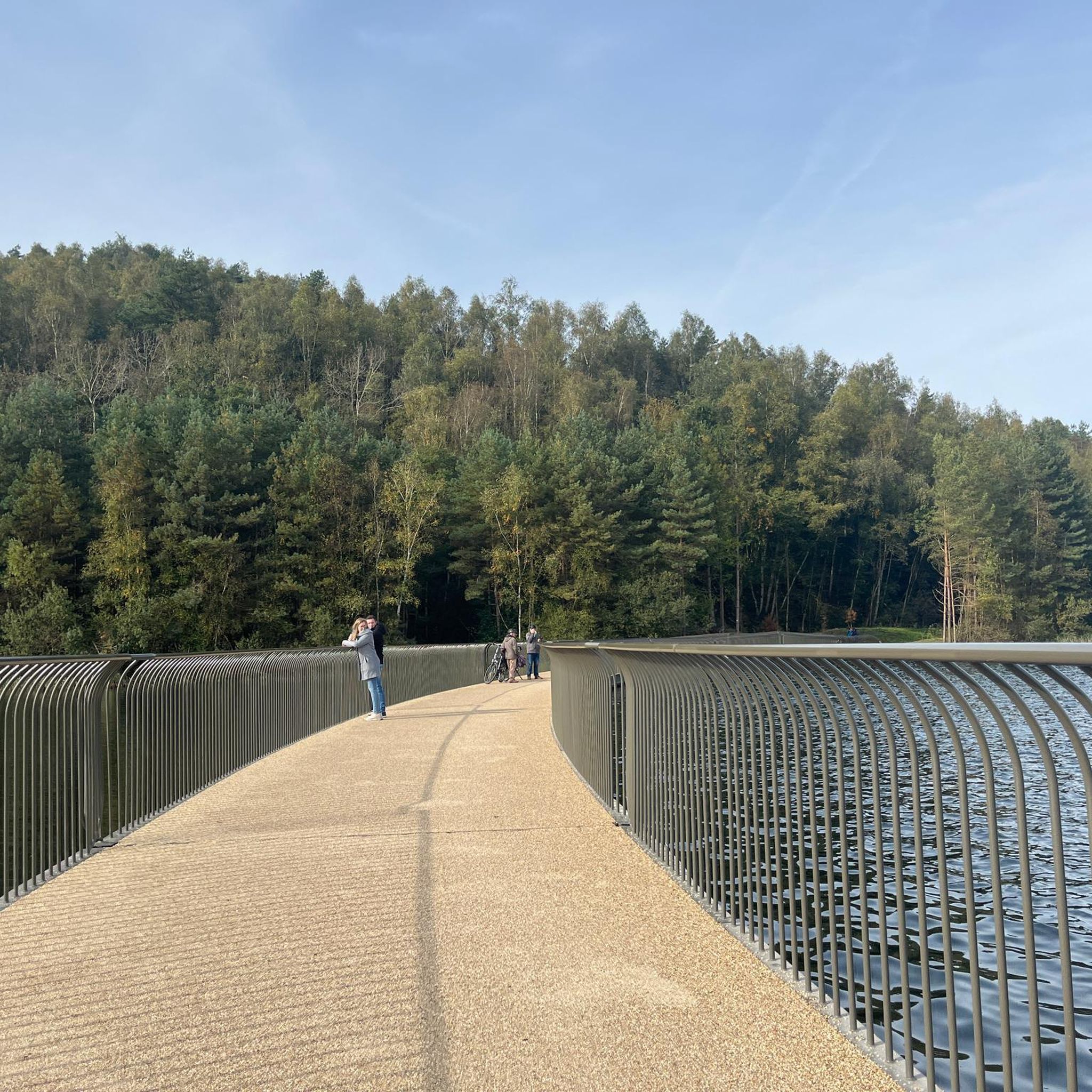
You can cycle across the top of the dam, which was constructed in 1928 to help control flooding in the region. It stands at 147 feet high, and today supports a myriad of outdoor recreation activities on the reservoir.
0
0

The Rio Hondo Greenway is a beautiful bike lane that follows the river that gives the trail its name. It is fully paved and flat, so it is not a challenging trail.
0
0
The San Gabriel Dam is a rock‑fill structure completed in 1939 on the San Gabriel River and is used for flood control.
0
0

Mount Baldy Village & ski resort towers above the San Gabriel Valley & Los Angeles suburbs and is a lovely alpine community with a wonderful restaurant and a pub. It's a great place to stop, take in the incredible scenery, and refuel during your ride.
0
0

Limited cars use the roads so it is nice to get away from traffic
0
0
Not a bad trail. Super smooth and free of cars and gravel
0
0

Bike along the Santa Ana River Trail for a fantastic view of Angel Stadium’s iconic “Big A” sign, a 230-foot-tall landmark that originally served as the stadium's scoreboard. The halo atop the sign lights up after every Angels victory, glowing even brighter for home wins. Be sure to avoid the surrounding streets on game days, as the area can get crowded.
1
0
Frequently Asked Questions
How many road cycling routes are available around West Covina?
There are over 80 road cycling routes available around West Covina, offering diverse experiences for cyclists of all levels. These routes are highly rated by the komoot community, with an average score of 4.3 stars.
Are there challenging road cycling routes with significant elevation gain in the West Covina area?
Yes, the region offers challenging routes with substantial elevation gain. For instance, the Glendora Ridge Road – Little Dalton Debris Basin loop from Covina is a difficult route featuring over 2,200 meters of elevation gain on well-paved surfaces. Nearby Turnbull Canyon also provides a rigorous climb with panoramic views.
What are some easy and scenic road cycling paths near West Covina?
For an easier and scenic ride, the San Gabriel River Trail is an excellent choice. This 35.4-mile paved, multi-use path parallels the San Gabriel River, offering picturesque views and a relatively flat terrain suitable for various fitness levels. The Santa Fe Flood Control Basin loop from Irwindale is another moderate option accessible from the San Gabriel River Greenway.
Are there any family-friendly road cycling routes in West Covina?
While many road cycling routes are designed for experienced riders, the paved sections of the San Gabriel River Trail offer a safer and more continuous route with fewer traffic interruptions, making them suitable for families. Frank G. Bonelli Regional Park also features trails around Puddingstone Reservoir that can be enjoyed by those with good fitness, and the park offers bicycle rentals.
What natural features can I expect to see along road cycling routes in West Covina?
Road cycling routes in West Covina showcase diverse natural features. You can ride along the San Gabriel River, explore the scenic Glendora Ridge Road, or cycle around the Puddingstone Reservoir within Frank G. Bonelli Regional Park. The Santa Fe Flood Control Basin also offers picturesque views, particularly of the San Gabriel Mountains.
Are there any notable landmarks or viewpoints along the road cycling routes?
Yes, several routes offer interesting landmarks and viewpoints. The San Gabriel River Trail provides views of Angel Stadium's "Big A" sign and allows cyclists to cross the historic 1928 dam. Nearby Turnbull Canyon offers stunning panoramic views of Los Angeles County. You can also find scenic spots like the View of Puddingstone Reservoir.
Are there loop road cycling routes available around West Covina?
Yes, many road cycling routes around West Covina are designed as loops. Examples include the challenging Glendora Ridge Road – Little Dalton Debris Basin loop from Covina, the moderate Santa Fe Flood Control Basin loop from Irwindale, and the View of Puddingstone Reservoir – View of Puddingstone Reservoir loop from Covina.
What is the best time of year for road cycling in West Covina?
West Covina generally offers good cycling conditions year-round due to its mild climate. However, spring and fall often provide the most comfortable temperatures for longer rides. Summers can be hot, especially in the middle of the day, so early morning or late afternoon rides are recommended then. Winters are typically mild and pleasant for cycling.
Where can I find parking for road cycling trails in West Covina?
Many regional parks and trailheads offer dedicated parking facilities. For routes accessing the San Gabriel River Trail, various access points along the trail have parking. Frank G. Bonelli Regional Park, which includes Puddingstone Reservoir, also provides ample parking for visitors.
What do other road cyclists enjoy most about road cycling in West Covina?
The area is highly rated by the komoot community, with an average score of 4.3 stars from over 50 reviews. Cyclists often praise the diverse topography, which allows for both challenging climbs and relaxed scenic rides, as well as the well-paved surfaces and access to significant natural attractions like the San Gabriel River and Glendora Ridge Road.
Are there any road cycling routes that connect to other parks or trails?
Yes, the cycling infrastructure in West Covina offers good connectivity. The San Gabriel River Greenway, for example, provides access to the Santa Fe Flood Control Basin recreation area. Additionally, Carbon Canyon Regional Park, which can be accessed via routes like the Carbon Canyon Regional Park loop from Covina, connects to Chino Hills State Park, offering extended riding opportunities.
Most popular attractions around West Covina

Get inspired with the komoot mobile app


Explore more
Browse the best Road cycling routes in other regions.
