The best MTB trails around Glendora
4.5
(8)
210
riders
17
rides
Mountain biking around Glendora is characterized by its diverse landscapes at the base of the San Gabriel Mountains. The region features rugged terrain, extensive trail networks, and significant wilderness areas like the Big Dalton and South Hills Wilderness Areas, offering varied challenges. Hilly terrain, oak tree cover, and rivers contribute to the natural environment, providing a range of mountain biking experiences.
Best mountain bike trails around Glendora
- The most popular mountain bike trail is Glendora Mountain Road and Lower Monroe Truck Trail, a 24.2 miles (38.9 km) trail that takes 3 hours 35 minutes to complete. This difficult route offers a sustained climb and a long descent, with sections of flat, rocky doubletrack and singletrack, providing views of the San Gabriel Valley.
- Another top favourite among local mountain bikers is Lower Monroe Truck Trail, a moderate 13.9 miles (22.3 km) path. This trail features a mix of flat, rocky doubletrack and gradual climbs, winding through varied terrain.
- Local mountain bikers also love the Puddingstone Reservoir Dam loop from Life Pacific University, a 15.3 miles (24.7 km) trail leading through varied landscapes, often completed in about 1 hour 52 minutes.
- Mountain biking around Glendora is defined by the San Gabriel Mountains, extensive wilderness areas, and oak tree cover. The network offers options for easy, moderate, and difficult ability levels.
- The routes in Glendora are highly rated by the komoot community with an average score of 4.4 stars from more than 10 reviews. More than 200 mountain bikers have used komoot to explore Glendora's varied terrain.
Last updated: August 20, 2026
4.5
(2)
18
riders
38.9km
03:36
1,190m
1,550m
Tackle the difficult 24.2-mile Glendora Mountain Road and Lower Monroe Truck Trail mountain bike route, featuring challenging climbs and exp
31
riders
22.3km
02:38
820m
820m
Experience a moderate 13.9-mile mountain bike ride on the Lower Monroe Truck Trail, known for its sustained climb and long descent.

Sign up for free
13
riders
25.9km
02:34
640m
640m
Moderate mountain bike ride. Good fitness required. Suitable for all skill levels.
5.0
(1)
14
riders
31.0km
03:16
840m
840m
Moderate mountain bike ride. Good fitness required. Suitable for all skill levels.
12
riders
Moderate mountain bike ride. Good fitness required. Suitable for all skill levels.
Get access to more routes and recommendations from other explorers.
Sign up for free
Already have an account?
Our route recommendations are based on thousands of hikes, rides, and runs completed by other people on komoot.
Start today with a free account
Your next adventure awaits.
Login or Signup


Other adventures around Glendora

Tips from the Community

Sometimes there's a good-sized pool of water in this basin; most of the time, though, it's a boggy sort of wetland. Either way it's home to an interesting riparian, sage scrub and southern oak habitat.
0
0

The Palmer Evey Trail is a straightforward trail in the San Bernadino Mountains. If you want to get up to Potato Peak, there is a short spur trail to take you to the peak.
0
0

The Lower Monroe Truck Trail has a mix of terrain, starting with a flat, rocky doubletrack section that transitions into a gradual, twisty eight-mile climb up to Glendora Mountain Road. It starts with a 1.7-mile rock garden creek section; the trail features intermittent tree cover and narrows to singletrack in spots. After a sharp right turn, the trail climbs steadily for 6.2 miles, mostly exposed, with great views of the San Gabriel Valley at the 3.3-mile plateau, a popular rest point. At the top, a gate marks the turnaround for the fast-paced, twisting descent. Riders navigate rocky and rutted sections with trail-hugging vegetation, so gloves and water are essential. Be ready for the occasional pedestrian encounters, a cowbell comes in handy.
0
0
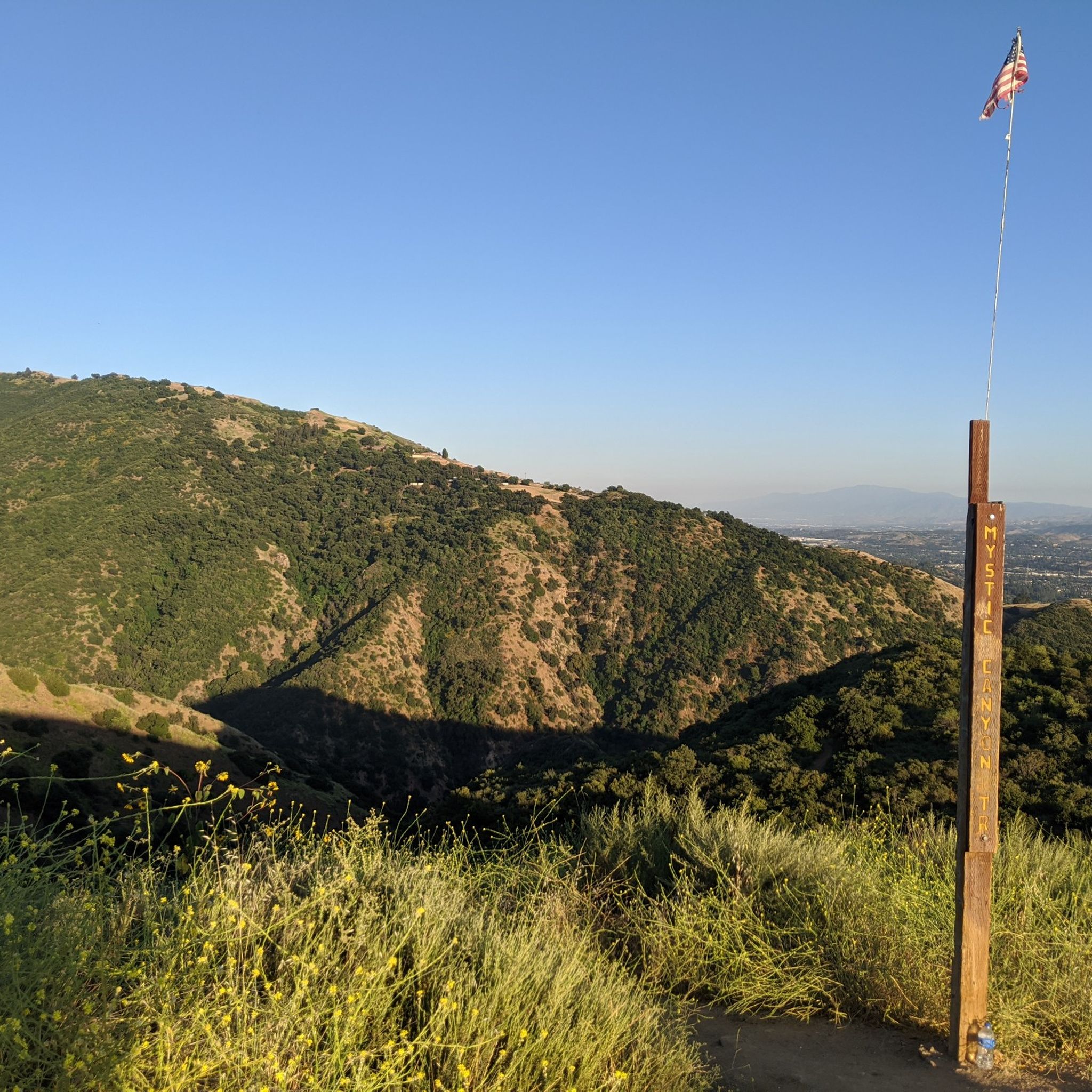
At the junction of Lower Monroe Trail, Mystic Canyon Trail, and Lower Monroe Truck Trail is a great view over Glendora down in the south below.
0
0

The Marshall Canyon Trail is in La Verne, CA, starts at Oak Mesa Park and features 1,310 feet of climbing, reaching a max elevation of 2,424 feet. Known for its oak tree cover and lush terrain, it’s often referred to as "Sherwood Forest" due to its green, shady environment. The lower section is relatively flat, with more climbing occurring deeper into the canyon. For mountain bikers, there are many variations off the main trail that can add both milage and elevation to your ride. Adding the Claremont Loop, for example, can extend the ride by 4-5 miles and 800 vertical feet. The trail and surrounding area provides a refreshing NorCal feel, with shaded trails and a creek, contrasting with the typically hot and dry surrounding hills.
0
0

Dedicated trail-goers will take a potato to the summit to leave as an offering to the potato gods. Check out the summit book, and the echo beneath the metal plate on the top of the tank!
0
0
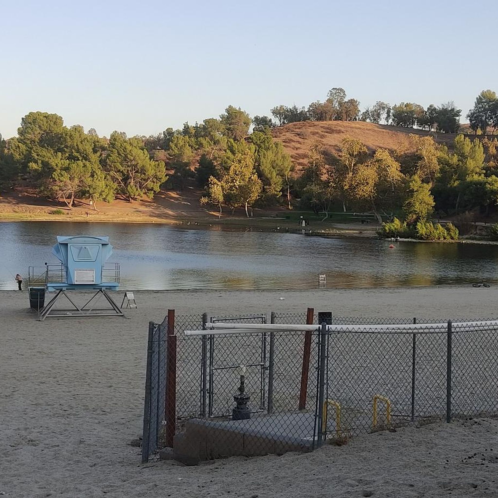
Little Dalton Debris Basin is a small, man-made collecting pond in Big Dalton Canyon Wilderness Park. It is just off Big Dalton Canyon Road and Glendora Mountain road, which are both popular, challenging roads for biking.
0
0

Newman Point is an awesome overlook area with a large parking lot off the side of Glendora Mountain Road. The overlook peers down at Morris Reservoir and West Covina off in the distance.
0
0
Frequently Asked Questions
How many mountain bike trails are available in Glendora?
Glendora offers a network of over 18 mountain bike trails, catering to various skill levels. You'll find a mix of easy, moderate, and difficult routes to explore.
What is the best time of year to go mountain biking in Glendora?
Spring is an excellent time to visit, as many trails feature beautiful wildflower displays. The oak tree cover along routes like the Marshall Canyon Trail also provides pleasant shade, making rides enjoyable throughout much of the year. Always check local weather conditions before heading out, especially during summer months when temperatures can be high.
Are there mountain bike trails suitable for beginners or families in Glendora?
Yes, Glendora offers several options for less experienced riders and families. The city is actively developing a bike park within the South Hills Wilderness Area with features for all skill levels. For a more relaxed, paved experience, the XYZ Bike Path provides a scenic and family-friendly route through picturesque parks.
What kind of terrain and difficulty can I expect on Glendora's mountain bike trails?
Glendora's trails, nestled at the base of the San Gabriel Mountains, offer diverse terrain. You'll encounter rugged sections, extensive trail networks, and significant wilderness areas. Difficulty ranges from easy (6 routes) to moderate (11 routes) and difficult (1 route), featuring everything from flat, rocky doubletrack to gradual climbs and challenging singletrack sections. The Glendora Mountain Road and Lower Monroe Truck Trail, for instance, includes a sustained climb and a long descent.
Are there any loop trails for mountain biking in Glendora?
Yes, there are several excellent loop trails. A popular choice is the Puddingstone Reservoir Dam loop from Life Pacific University, which is about 15.3 miles long. Another great option is the Marshall Canyon Trail loop from Damien High School, known for its oak tree cover.
What are some notable landmarks or natural features I might see along the trails?
You'll be riding amidst the stunning San Gabriel Mountains, with many trails offering breathtaking views of the San Gabriel Valley. The region also features the Big Dalton and South Hills Wilderness Areas. Along some routes, you might encounter rivers, such as in Big Dalton Canyon, and areas with lush oak tree cover. For specific viewpoints, consider visiting View of Puddingstone Reservoir or San Gabriel Canyon Road Scenic View.
What do other mountain bikers say about the trails in Glendora?
The mountain biking routes in Glendora are highly rated by the komoot community, with an average score of 4.4 stars from over 10 reviews. More than 200 mountain bikers have used komoot to explore the varied terrain, often praising the diverse landscapes, extensive trail networks, and the challenging yet rewarding rides offered by the San Gabriel Mountains.
Are there any trails that are particularly good for an adrenaline-pumping experience?
For an adrenaline-pumping experience, the PQR Trail is highlighted for its challenging terrain and rewarding views. Additionally, the Glendora Mountain Road and Lower Monroe Truck Trail offers a sustained climb and a long descent with varied sections, providing a thrilling ride.
Are dogs allowed on Glendora's mountain bike trails?
While many multi-use trails in the Glendora area are generally dog-friendly, it's always best to check specific trail regulations before you go. Ensure your dog is on a leash and that you carry waste bags to maintain the cleanliness and enjoyment of the trails for everyone.
What are the parking and public transport options for accessing Glendora's mountain bike trails?
Parking is typically available at various trailheads and nearby parks that serve as access points to the mountain bike trails, such as those near Damien High School for the Marshall Canyon trails. Public transport options directly to remote trailheads may be limited, so driving is often the most convenient way to reach many of the mountain biking areas. Always check local city or park websites for specific parking information and any potential fees.
Are there any permits required for mountain biking in Glendora?
Generally, permits are not required for mountain biking on the public trails within Glendora's wilderness areas and trail networks. However, it's always a good practice to verify with the Glendora Trails Council or relevant park authorities for any specific regulations or temporary closures that might be in effect.
Can I find cafes or places to eat near the mountain bike trails in Glendora?
Glendora is a developed city, so you'll find various cafes, restaurants, and eateries within a short drive from most trail access points. While there might not be establishments directly on the trails themselves, heading into the city center or nearby commercial areas will offer plenty of options for a post-ride meal or coffee.
Most popular attractions around Glendora

Get inspired with the komoot mobile app


Explore more
Browse the best MTB trails in other regions.
