The best road cycling routes around San Buenaventura (Ventura)
4.8
(65)
1,727
riders
33
rides
Road cycling around San Buenaventura (Ventura) offers a diverse landscape for cyclists, ranging from flat coastal paths to challenging inland routes with significant elevation gains. The region features extensive networks of bicycle paths and lanes along the Pacific Coast, connecting beaches and the Ventura Pier. Inland, routes extend through valleys, alongside old train tracks, and into rolling hills and canyons, providing varied terrain for all fitness levels.
Best road cycling routes around San Buenaventura (Ventura)
- The most popular road cycling route is Ojai Loop, a 49.2 miles (79.2 km) trail that takes 3 hours 30 minutes to complete. This route samples both the coast and inland valleys, offering scenic views.
- Another top favourite among local road cyclists is Ventura Waterfront loop, an easy 10.6 miles (17.0 km) path. This route provides continuous exploration along the oceanfront, passing the Ventura Pier.
- Local road cyclists also love the Ojai-Ventura Bike Path – Ventura Beach and Pier loop from Ventura, a 34.7 miles (55.9 km) trail leading through fields and tree-lined corridors, often completed in about 2 hours 28 minutes.
- Road cycling around San Buenaventura (Ventura) is defined by coastal paths, inland valleys, and rolling hills. The network offers options for different ability levels, from easy waterfront rides to more demanding loops with elevation.
- The routes in San Buenaventura (Ventura) are highly rated by the komoot community with an average score of 4.8 stars from over 40 reviews. More than 1200 road cyclists have used komoot to explore San Buenaventura (Ventura)'s varied terrain.
Last updated: May 27, 2026
4.7
(3)
59
riders
79.2km
03:30
620m
620m
Moderate road ride. Good fitness required. Mostly well-paved surfaces and easy to ride.
5.0
(1)
3
riders
17.0km
00:56
30m
30m
Easy road ride. Great for any fitness level. Mostly well-paved surfaces and easy to ride.

4.5
(2)
99
riders
124km
05:51
1,340m
1,340m
Hard road ride. Very good fitness required. Mostly well-paved surfaces and easy to ride.
4.7
(3)
293
riders
89.8km
03:45
430m
430m
Moderate road ride. Good fitness required. Mostly well-paved surfaces and easy to ride.
4.7
(3)
72
riders
78.6km
03:29
710m
710m
Moderate road ride. Good fitness required. Mostly well-paved surfaces and easy to ride.
Get access to more routes and recommendations from other explorers.
Already have an account?
Our route recommendations are based on thousands of hikes, rides, and runs completed by other people on komoot.
Start today with a free account
Your next adventure awaits.
Tips from the Community

This museum is one of four branches in Ventura and nearby Santa Paula; it's very community- and experience-focused, with virtual exhibits available if you don't want to stop your bike ride to go in. Admission currently costs $10 for adults, free for those under 18, and half-price admission for seniors and students.
0
0

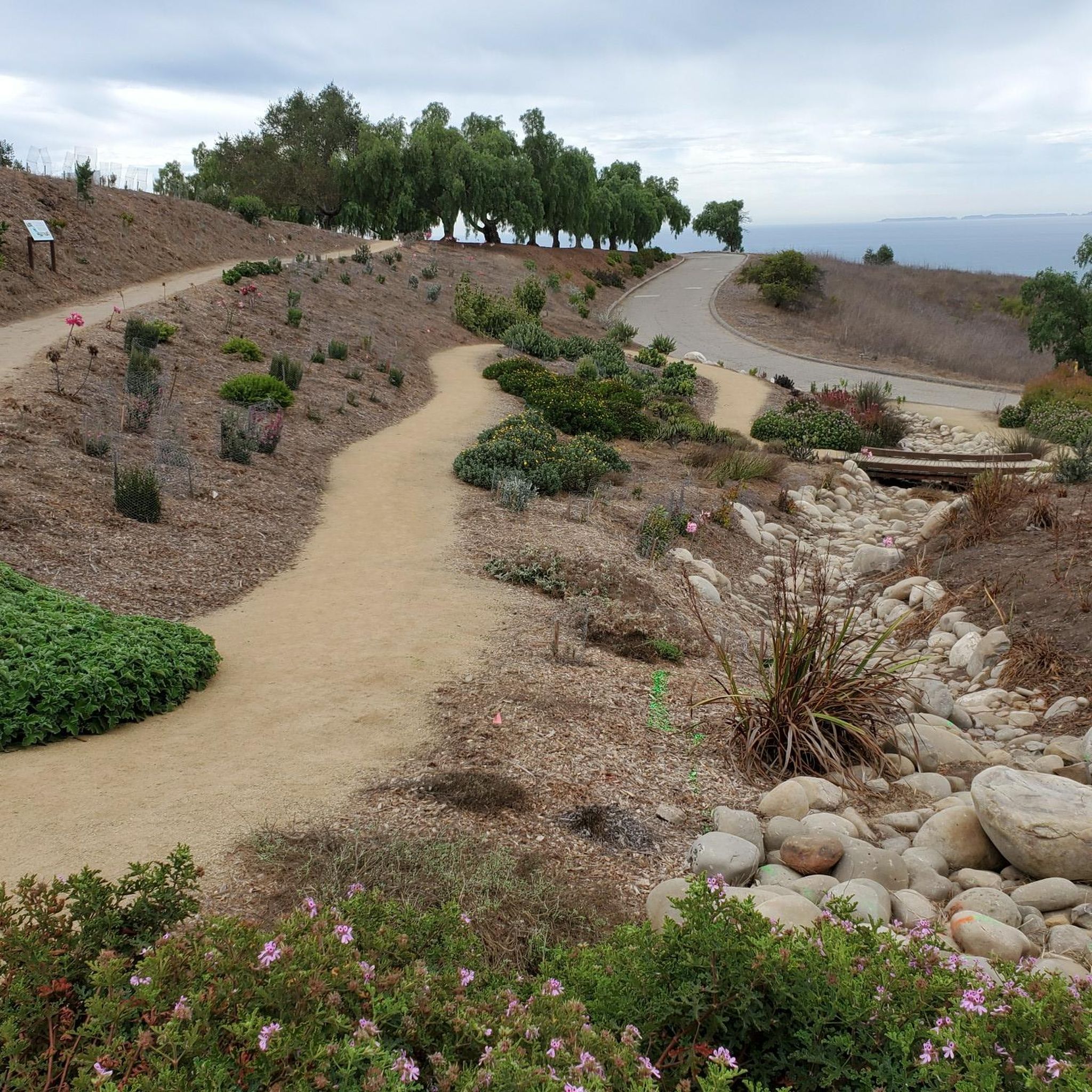
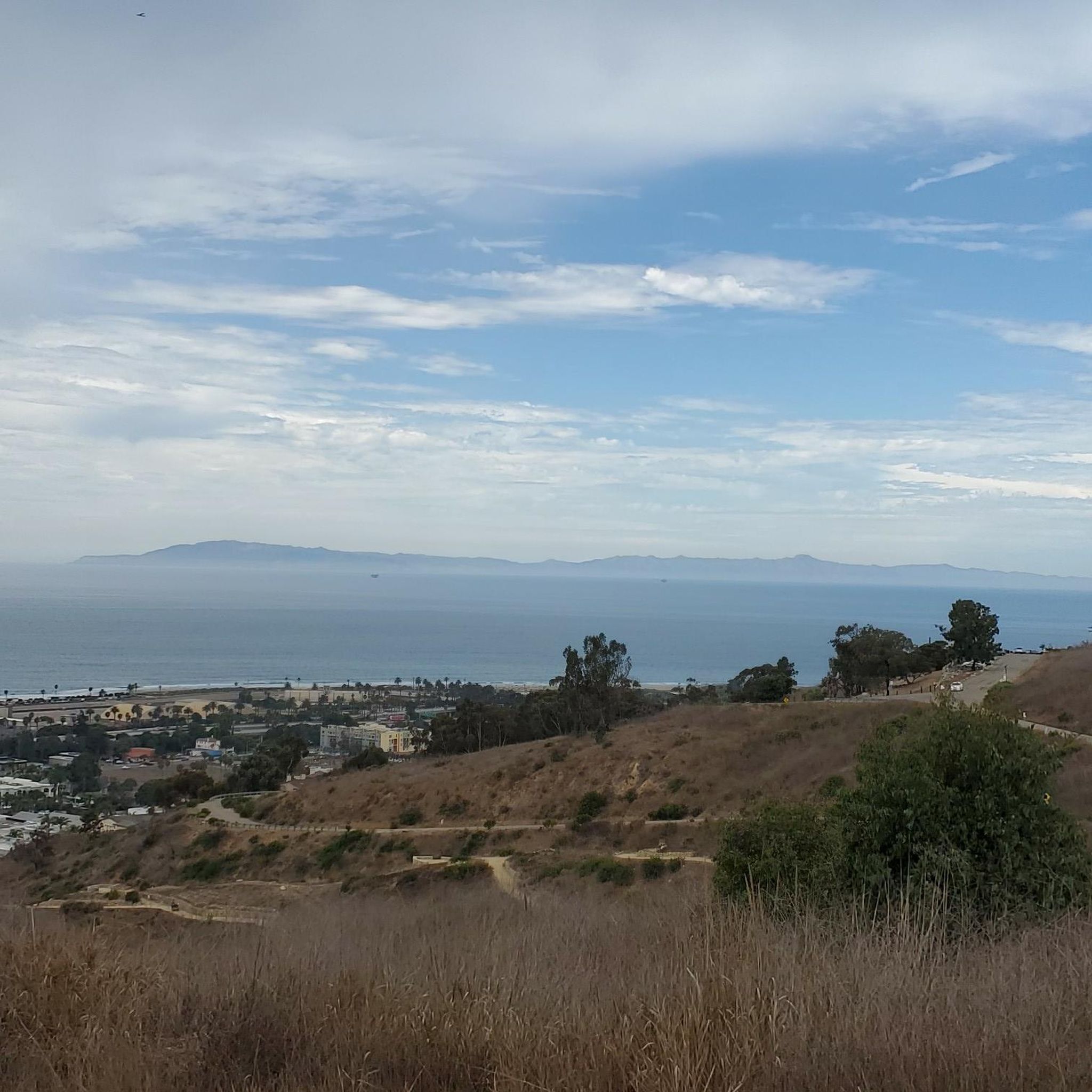
Ventura City Hall, once the Ventura County Courthouse, sits atop California Street, with views of downtown Ventura, the Santa Barbara Channel, and the Channel Islands. Built between 1912 and 1913, this Neoclassical landmark, designed by architect Albert C. Martin Sr., features exquisite details like white terra cotta panels, whimsical friars' faces, Roman-arched windows, and a copper dome. Inside, admire stained glass skylights and mahogany woodwork in the council chambers. Listed on the National Register of Historic Places, this architectural treasure has served as City Hall since 1974.
1
0
This trailhead marks one end of the Ojai-Ventura Bike Path, connecting Ventura Rex Street to Ojai near the Soule Park Golf Course.
0
0

The Ortega Adobe is a historic adobe house built in 1857. Owned by the city, it now serves as a self-guided historical site. The house was once the residence of Emilio Ortega, who began roasting chilies there, establishing California's first commercial food operation.
0
0
The Ralph Fertig Memorial Bike Trail, also known as the Rincon Bike Path, runs along the 101 between Rincon and Mussel Shoals, offering scenic coastal views from Ventura to Carpinteria. Named in honor of Ralph Fertig, a respected advocate for cyclists, who died in 2014.
1
0

The center of town has a lot of cafes and breweries, and many of the streets have designated bike lanes. Carpinteria is a surfing destination, and the town's record shops and bistros complement its seaside aesthetic.
0
0

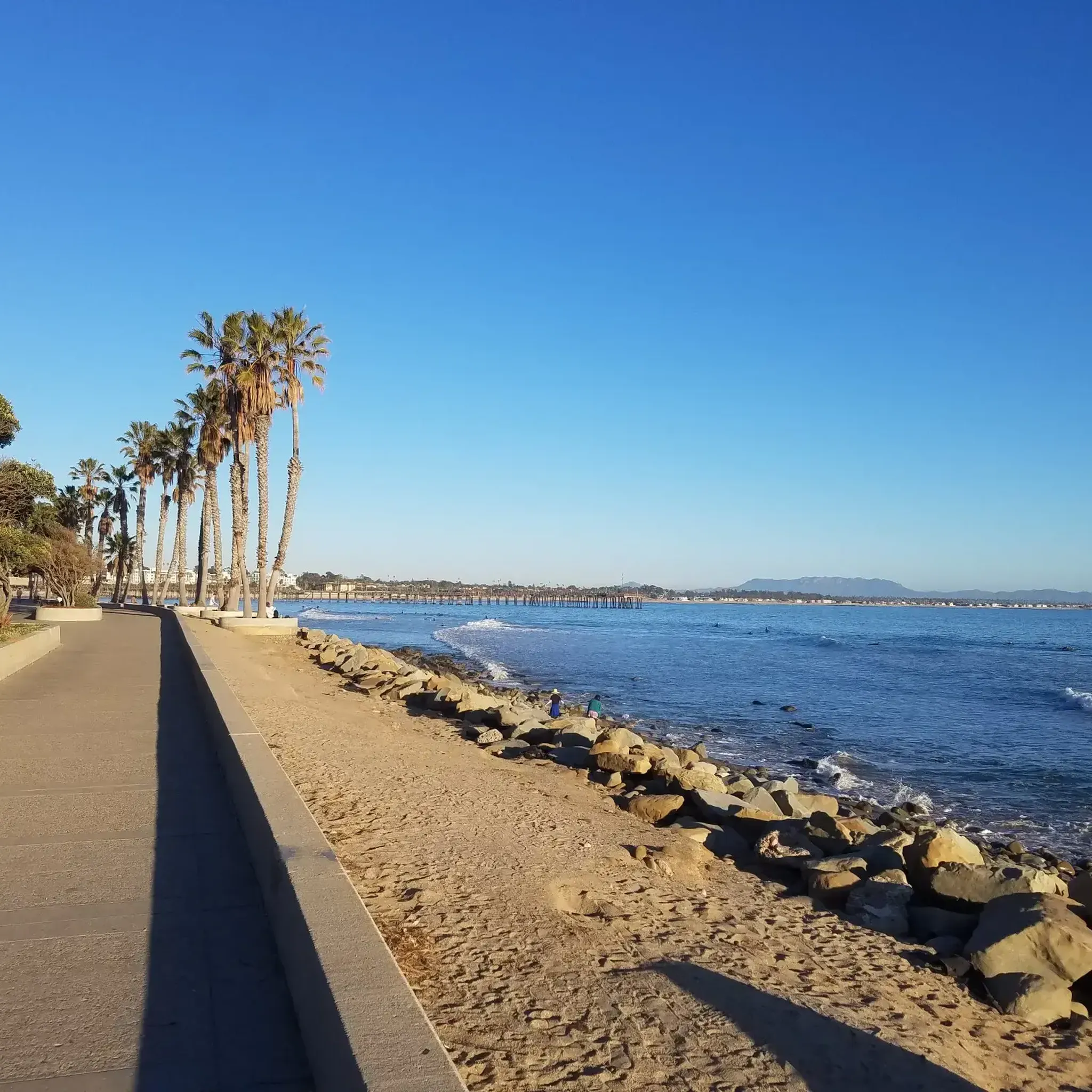
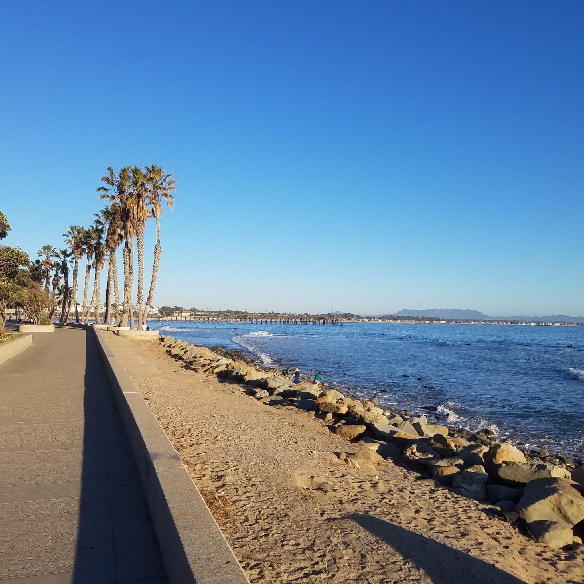
The Omer Rains Coastal Bike Trail was named after a prominent local politician and environmentalist and offers a scenic journey along Ventura's Pacific coast. Starting at San Buenaventura State Beach, the trail features dramatic ocean views, Channel Islands vistas, and sightings of local wildlife such as raccoons, songbirds, and great blue herons. It begins by passing through Ventura’s waterfront promenade, to the historic Ventura Pier. Continuing west, the trail reaches Surfers' Point and then parallels the Ventura Raceway before turning north at the Ventura River mouth. This part of the trail passes under US 101 near Emma Wood State Park. Emma Wood State Park is a lovely spot on the water where you can enjoy the views or leave your car, making it a great spot on the coast to start or end your ride.
0
0

Frequently Asked Questions
How many road cycling routes are available in San Buenaventura (Ventura)?
San Buenaventura (Ventura) offers a wide selection of road cycling routes, with over 25 routes available on komoot. These routes cater to various skill levels, including 13 easy, 9 moderate, and 3 difficult options, ensuring there's something for every road cyclist.
What kind of terrain can I expect on road cycling routes in Ventura?
Ventura's road cycling routes feature diverse terrain. You can enjoy flat coastal paths like the Ventura Waterfront loop, which offers continuous exploration along the oceanfront. Inland, routes like the Ojai-Ventura Bike Path – Ventura Beach and Pier loop from Ventura lead through valleys, fields, and tree-lined corridors. For more challenging rides, you'll find rolling hills and climbs through canyons and mountains, such as those encountered on the Ojai Loop.
Are there any family-friendly road cycling routes in Ventura?
Yes, Ventura offers several family-friendly options. The **Omer Rains Coastal Bike Trail** and the **Ventura Beach Promenade** provide pleasant, mostly flat rides along the ocean, perfect for families. The Ventura Waterfront loop is an easy 10.6-mile path that's also suitable for a relaxed family outing.
What are the best times of year for road cycling in Ventura?
Ventura's Mediterranean climate makes it ideal for road cycling year-round. With an average of 273 sunny days and temperatures consistently around 70 degrees Fahrenheit, you can enjoy comfortable rides in any season. Spring and fall offer particularly pleasant conditions with mild temperatures and less chance of extreme weather.
What scenic landmarks or attractions can I see along Ventura's road cycling routes?
Many routes offer stunning views and pass by notable landmarks. You can cycle along the San Buenaventura State Beach, ride past the iconic Ventura Pier, and enjoy coastal vistas from Surfers Point Beach. Inland routes often provide views of the Ojai Valley, Lake Casitas, and the Santa Monica Mountains. The Ventura Waterfront loop is a great option for coastal sightseeing.
Are there challenging road cycling routes for experienced riders?
Absolutely. For experienced riders seeking a challenge, the region offers routes with significant elevation gains. The Ojai Loop, for example, is a moderate 49.2-mile route with over 2,000 feet of elevation gain, sampling both the coast and inland valleys. The Ventura – Santa Paula – Ojai Loop also features hilly, winding roads with mountain views, and options to explore climbs through Aliso and Wheeler Canyons.
Where can I find parking for road cycling trails in Ventura?
Parking is generally available at various access points for Ventura's bike trails. For coastal routes, you can often find parking near state beaches like San Buenaventura State Beach or along the Ventura Pier area. For inland routes, trailheads for paths like the Ojai Valley Trail typically have designated parking areas. It's advisable to check specific route details for the most convenient parking locations.
Can I access Ventura's road cycling paths using public transport?
Yes, some of Ventura's cycling paths are accessible via public transport. The city's bus system, Gold Coast Transit, offers routes that can get you close to various trailheads, especially those within the city and along the coast. For more detailed information on routes and schedules, you can visit the City of Ventura's bicycling resources page: cityofventura.ca.gov/420/Bicycling-Walking.
What do other road cyclists enjoy most about cycling in Ventura?
The road cycling experience in San Buenaventura (Ventura) is highly rated by the komoot community, with an average score of 4.8 stars from over 40 reviews. Cyclists frequently praise the region's diverse terrain, from scenic coastal paths to challenging inland climbs, and the year-round favorable weather. Many appreciate the variety of routes that cater to all fitness levels, as well as the stunning views of the Pacific Ocean and surrounding natural landscapes.
Are there any circular road cycling routes in Ventura?
Yes, Ventura offers several excellent circular road cycling routes. The Ojai Loop is a popular option that samples both the coast and inland valleys. Another favorite is the Ojai-Ventura Bike Path – Ventura Beach and Pier loop from Ventura, which provides a comprehensive tour of the area's diverse landscapes. The Ventura Waterfront loop is a shorter, easy circular route along the oceanfront.
What is the difficulty level of the Ojai Valley Trail when cycling from Ventura?
The Ojai Valley Trail, when cycled from Ventura towards Ojai, is generally considered a moderate ride. It follows old train tracks with a gradual, gentle ascent. The return trip from Ojai to Ventura is largely downhill, making it a rewarding experience. The full Ojai-Ventura Bike Path – Ventura Beach and Pier loop from Ventura is rated as moderate.
Are there any easy road cycling routes suitable for beginners in Ventura?
Beginners will find plenty of accessible road cycling routes in Ventura. The Ventura Waterfront loop is an easy 10.6-mile path offering continuous exploration along the oceanfront. The **Ventura Beach Promenade** and sections of the **Pacific Coast Trail** also provide relatively flat and scenic rides perfect for those new to road cycling or looking for a relaxed experience.
Most popular routes around San Buenaventura (Ventura)
Most popular attractions around San Buenaventura (Ventura)

Get inspired with the komoot mobile app


Explore more
Browse the best Road cycling routes in other regions.
