The best road cycling routes around Orange
4.7
(139)
6,652
riders
25
rides
If you've ever tried to plan road cycling around Orange, you know how quickly the sheer number of options can become overwhelming. With so many routes crisscrossing the region, it's tough to tell which ones are genuinely worth your time and effort, and which are just filler. We get it, and we're here to help you cut through the noise.
Our komoot community has ridden, mapped, and reviewed countless miles here, and we've distilled that collective wisdom into a curated shortlist of the best road cycling routes around Orange. This guide promises to save you the guesswork, pointing you straight to the rides that deliver on scenery, challenge, and pure cycling joy. Expect a diverse landscape, from flat, paved river trails to challenging climbs in the Santa Ana Mountains, offering something for every skill level.
For those looking for a serious challenge and extensive coastal views, the Orange to Seal Beach via Huntington Beach Trail loop is a difficult 96.7 miles (155.6 km) ride that truly earns its place. If you're after a solid moderate day out with some elevation, we'd point you towards the Aliso Creek Bikeway – Santiago Canyon Road loop from Orange, a 44.8 miles (72.2 km) route with 2,456 feet (748.7 m) of climbing. With over 6,600 visitors already exploring Orange with komoot, you're in good company.
Last updated: May 10, 2026
1
riders
156km
06:36
890m
890m
The Orange to Seal Beach via Huntington Beach Trail loop offers road cyclists a diverse and demanding ride through Southern California's varied landscapes. You'll experience the expansive coastal views along the Pacific Ocean, especially on the well-paved Huntington Beach Trail, before venturing onto river trails and urban sections. Keep an eye out for the historic Water Tower and enjoy the backdrop of the distant San Gabriel Mountains as you navigate this extensive route.
This difficult road cycling adventure covers 96.7 miles (155.6 km) with a significant 2911 feet (887 metres) of elevation gain, typically taking around 6 hours and 36 minutes. While parts are flat, the overall loop includes unpaved and challenging segments, requiring good to very good fitness. Be aware that the Huntington Beach Trail can be crowded on weekends and may have sandy patches; amenities like restrooms and water are available along the beach sections.
Recognized as one of the most popular road cycling routes in the Orange area, this loop connects key locations like Huntington State Beach and Bolsa Chica State Beach. It also links to the Santa Ana River Trail, allowing for extended inland rides. The varied terrain and scenic highlights make it a standout option for those seeking a long-distance challenge in Orange County.
229
riders
Moderate road ride. Great for any fitness level. Some segments of this route may be unpaved and difficult to ride.

5.0
(2)
216
riders
72.7km
03:20
770m
770m
Moderate road ride. Good fitness required. Mostly well-paved surfaces and easy to ride.
4.5
(2)
134
riders
Moderate road ride. Good fitness required. Mostly well-paved surfaces and easy to ride.
15
riders
38.6km
01:48
300m
300m
Moderate road ride. Good fitness required. Mostly well-paved surfaces and easy to ride.
Get access to more routes and recommendations from other explorers.
Already have an account?
Our route recommendations are based on thousands of hikes, rides, and runs completed by other people on komoot.
Start today with a free account
Your next adventure awaits.

Tips from the Community


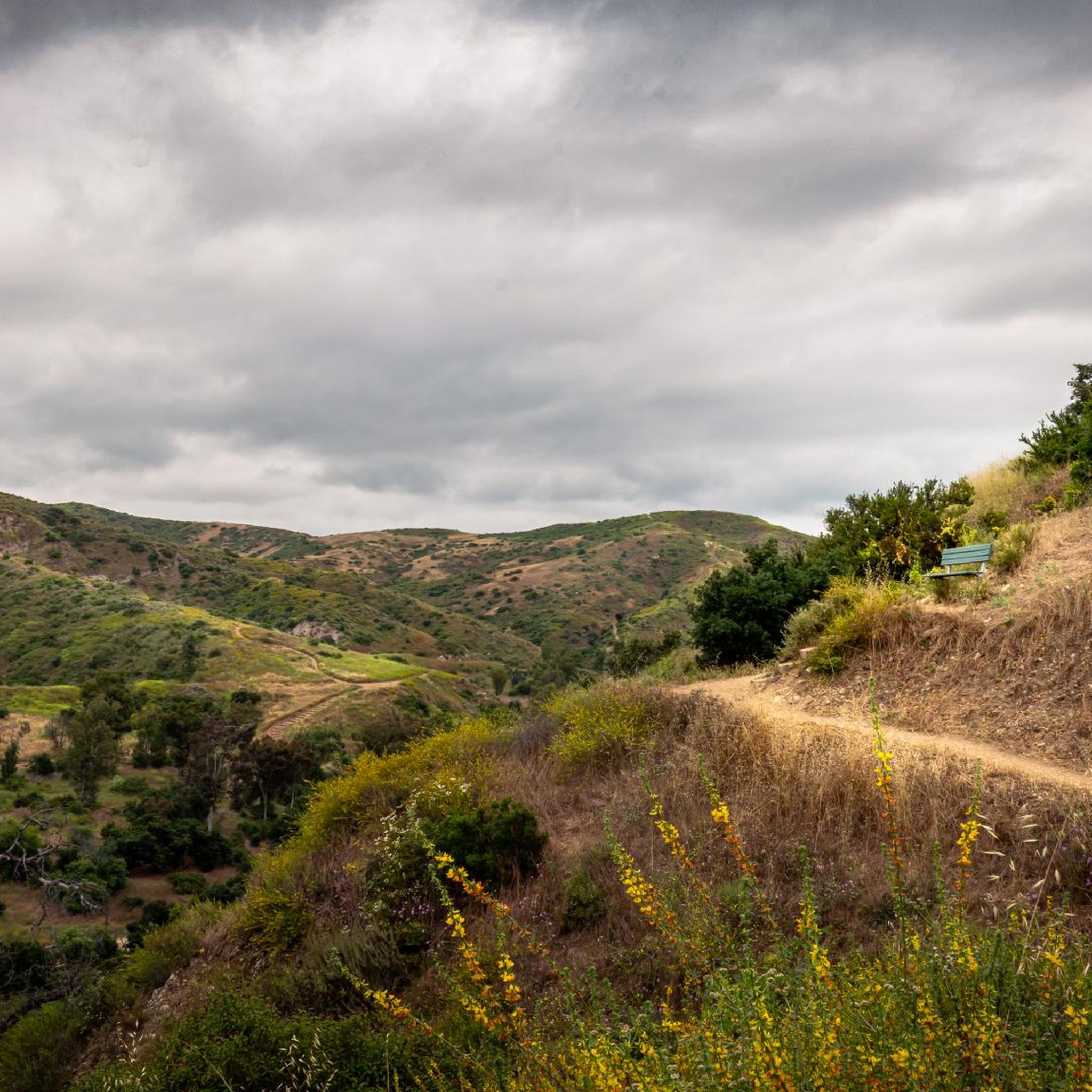
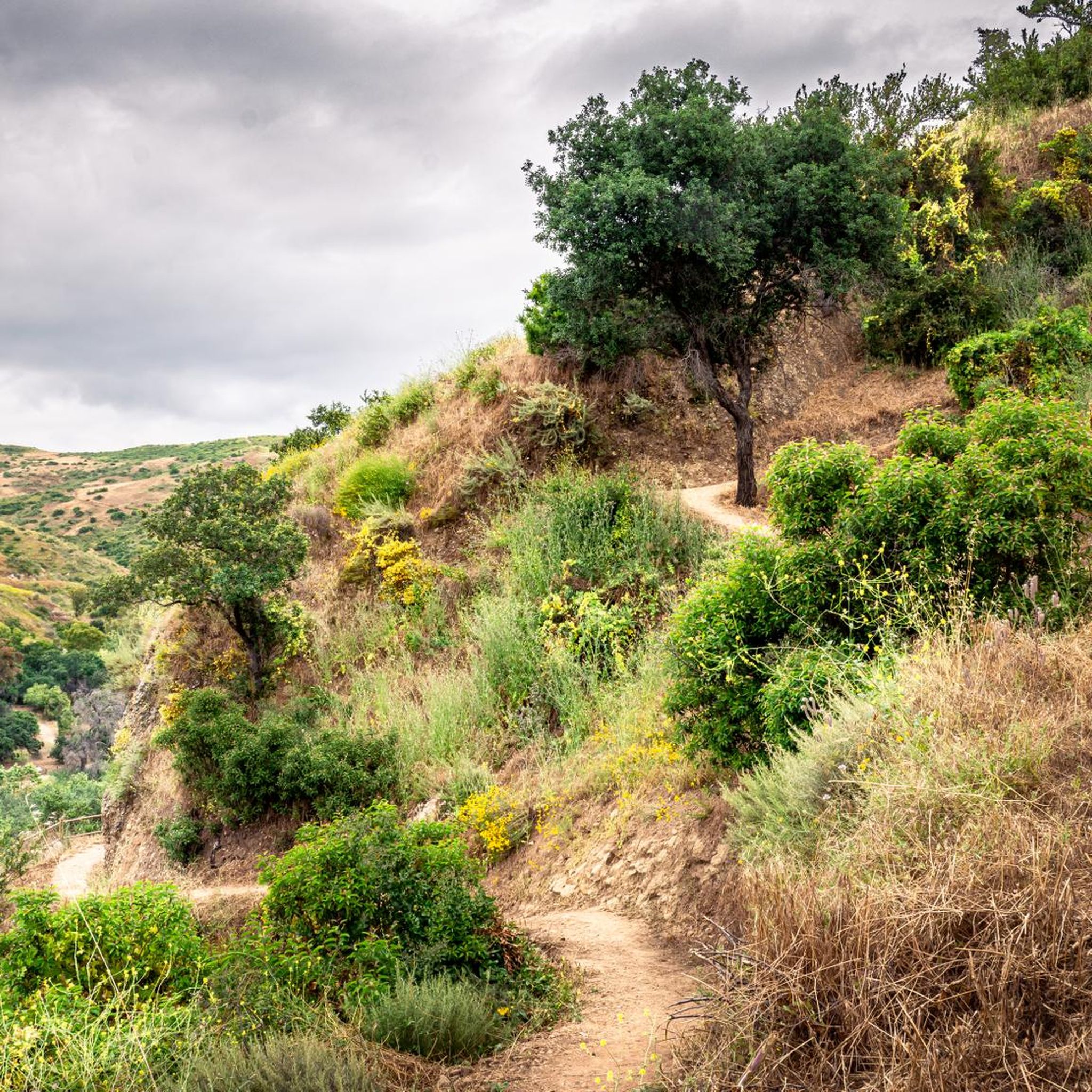
Santiago Canyon Road is a scenic favorite for road cyclists in Orange County. It’s a long, winding stretch with rolling hills, light traffic, and wide shoulders in most parts. The views of open hills and oak trees make the climb worth it, and you’ll find classic stops along the way for a break.
0
0
Cook’s Corner is a classic stop for cyclists riding through Santiago Canyon and one of the most popular biker hangouts in Southern California. It’s casual and bike-friendly, with shaded picnic tables and plenty of space to park. Grab a burger or a cold drink, rest your legs, and soak in the lively atmosphere—especially on weekends when it’s packed with motorcycles and live music.
0
0

Bring plenty of water. There only are water fountains midway in Anaheim.
0
0

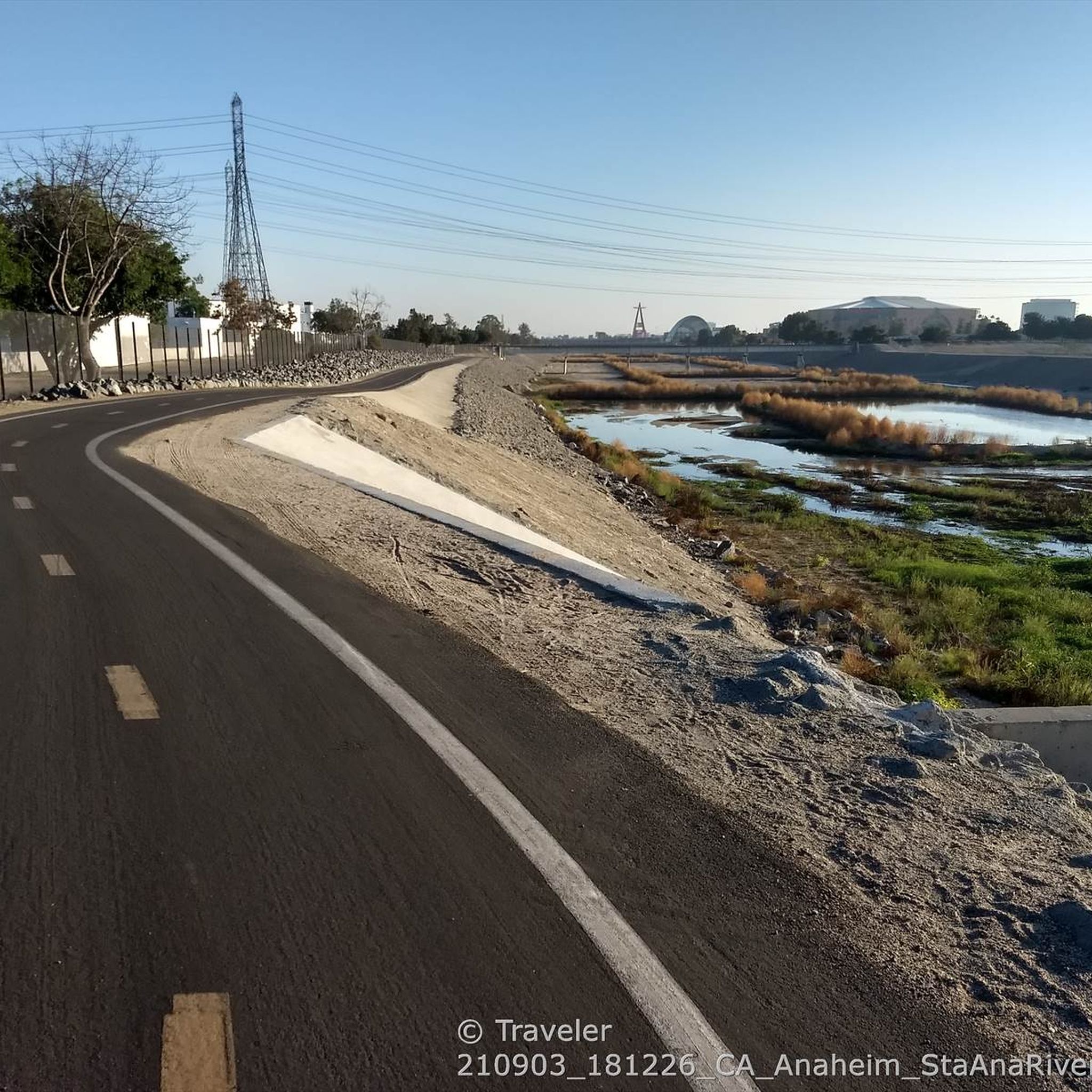
Not a bad trail. Super smooth and free of cars and gravel
0
0

Nice wooden bridge along the Santa Ana River Trail. It takes you over the river and gives you a good view of the water.
1
0
Frequently Asked Questions
How many road cycling routes are available around Orange?
There are over 25 road cycling routes around Orange, offering a diverse range of experiences. These include 11 easy routes, 13 moderate routes, and 2 more challenging options, catering to various skill levels.
What kind of terrain can I expect when road cycling in Orange?
Road cycling in Orange, California, offers a mix of terrain. You can enjoy scenic coastal paths along the Pacific Ocean, challenging climbs in the Santa Ana Mountains, and extensive river trails like the Santa Ana River Trail and Santiago Creek Bike Trail, which provide flat, paved options through natural riparian corridors and urban green spaces.
Are there road cycling routes suitable for beginners or families in Orange?
Yes, Orange offers several easy and family-friendly road cycling routes. For instance, the Santiago Creek Bike Trail – Along Santiago Creek loop from Orange Park Acres is an easy 10.9-mile paved path, ideal for a relaxed ride. Another accessible option is the Anaheim Coves Trail loop from Olive, which is also an easy route.
Where can I find more challenging road cycling routes in Orange?
For those seeking a challenge, the region around Orange provides routes with significant elevation gain, particularly in the Santa Ana Mountains. A notable difficult route is the Orange to Seal Beach via Huntington Beach Trail loop, which spans over 96 miles and includes extensive coastal views and varied terrain.
What scenic viewpoints or natural features can I discover along road cycling routes in Orange?
Road cycling routes in Orange can lead you to various natural attractions. You might encounter the serene Black Star Falls, the unique Redwood Grove, or enjoy panoramic views from Robber's Peak. The Santa Ana Mountains also offer stunning vistas of the greater Los Angeles region.
Are there any loop routes for road cycling in Orange?
Yes, many of the road cycling routes around Orange are designed as loops, allowing you to start and end at the same point. Examples include the Anaheim Coves Trail – Anaheim Coves Trail loop from Orange and the Hicks Canyon Trail – Walnut Trail loop from Orange, providing convenient circular journeys.
What do other road cyclists enjoy the most about road cycling in Orange?
The area is highly rated by the komoot community, with an average score of 5.0 stars from over 4 reviews. Reviewers often praise the diverse terrain, from coastal paths to river trails and mountain ascents, and the variety of options available for different ability levels.
Are there any historical sites or unique landmarks accessible by road bike in Orange?
While primarily known for its natural beauty, you can find interesting historical elements. For example, the Native American Grinding Stones are a historical site that can be explored in the vicinity of some routes. Additionally, the region's parks and wilderness areas often hold local historical significance.
What are some moderate-difficulty road cycling routes in Orange?
For a moderate challenge, consider the Anaheim Coves Trail – Anaheim Coves Trail loop from Orange, a 29.2-mile route that takes you through urban green spaces. Another good option is the Hicks Canyon Trail – Walnut Trail loop from Orange, which is a 40-mile route with some elevation.
Are there any specific trails that offer a car-protected cycling experience?
Yes, the Santa Ana River Trail is a notable car-protected route, offering a flat, paved path for many miles. Similarly, the Santiago Creek Bike Trail provides a paved path alongside Santiago Creek, ensuring a safer and more relaxed cycling experience away from vehicle traffic.
Can I find routes that connect to other parks or recreational areas?
Many road cycling routes in Orange connect to or pass through various parks and recreational areas. For instance, the Santa Ana River Trail provides access to parks like Grijalva, Yorba, and Hart Parks, offering additional recreational opportunities and scenic stops along your ride.
Most popular routes around Orange
Most popular attractions around Orange

Get inspired with the komoot mobile app


Explore more
Browse the best Road cycling routes in other regions.
