The best walks and hikes around Vorsperre Thossfell
4.6
(5584)
17,698
hikers
958
hikes
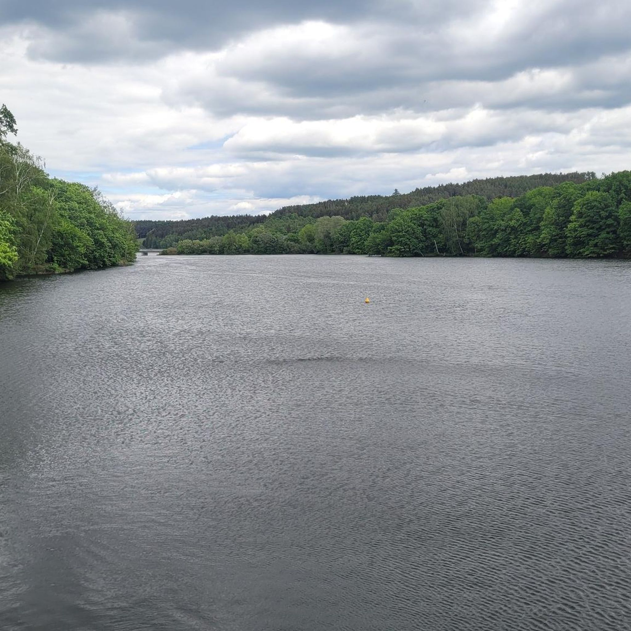
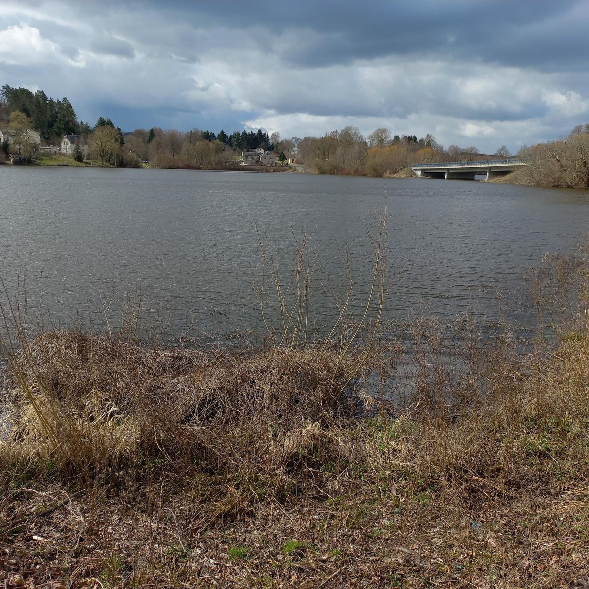
Hiking around Vorsperre Thossfell offers trails around a forebay dam that serves as a right arm of the larger Pöhl Reservoir. The region is characterized by the dam structure, the Trieb river, and views of the A72 motorway bridge. This area in Vogtlandkreis features varied terrain, including paths along the reservoir and through local landscapes. The forebay dam itself is 21 meters high and 155 meters long.
Best hiking trails around Vorsperre Thossfell
- The most popular hiking route is Ziehteich…
Last updated: August 20, 2026
4.5
(11)
25
hikers
6.48km
01:45
80m
80m
Easy hike. Great for any fitness level. Easily-accessible paths. Suitable for all skill levels.
3.0
(1)
8
hikers
3.73km
01:01
50m
50m
Easy hike. Great for any fitness level. Easily-accessible paths. Suitable for all skill levels.

Sign up for free
3.7
(3)
11
hikers
3.94km
01:04
50m
50m
Easy hike. Great for any fitness level. Easily-accessible paths. Suitable for all skill levels.
5.0
(2)
9
hikers
10.3km
02:46
130m
130m
Moderate hike. Good fitness required. Easily-accessible paths. Suitable for all skill levels.
5.0
(3)
11
hikers
15.3km
04:07
190m
190m
Moderate hike. Good fitness required. Easily-accessible paths. Suitable for all skill levels.
Get access to more routes and recommendations from other explorers.
Sign up for free
Already have an account?
Our route recommendations are based on thousands of hikes, rides, and runs completed by other people on komoot.
Start today with a free account
Your next adventure awaits.
Login or Signup

Tips from the Community

Cool view of the giant bridge
0
0

Monument on the village square opposite Hauptstraße 21: Made of granite and Theuma slate, with a fountain in the center, above it an inscription and name plates on the left and right (partially illegible).
2
0

Or try to miss it with a lot of effort ;)
1
0

On the trail, which is in parts extremely narrow and washed out, after the nudist area it was impossible to go any further due to fallen trees. Had to take to the streets. Not recommended.
0
0

Very nice view of the A 72 motorway bridge
0
0

Nice place. It's a shame there are no benches or rest areas.
0
0
A beautiful spot. There is also a covered rest area around the corner.
0
0

everything is beautifully laid out, you would like to experience a school lesson 🙂
0
0
Frequently Asked Questions
How many hiking trails are available around Vorsperre Thossfell?
The Vorsperre Thossfell area offers a wide variety of hiking trails, with over 950 routes recorded. This includes more than 570 easy trails, over 340 moderate options, and around 40 more challenging routes, ensuring there's something for every skill level.
What kind of terrain can I expect when hiking around Vorsperre Thossfell?
You can expect varied terrain, including paths along the reservoir, through local landscapes, and along river valleys. The region is characterized by the dam structure, the Trieb river, and offers views of the A72 motorway bridge. Some paths can be narrow or steep in places, particularly near the dam.
Are there easy hiking options suitable for beginners around Vorsperre Thossfell?
Yes, there are over 570 easy trails. A good option for a relaxed walk is the Pöhl Reservoir – Thossfell Forebay Dam loop from Neuensalz, which is 2.3 miles (3.7 km) long and offers pleasant views of the reservoir and the dam.
Can I find circular hiking routes in the Vorsperre Thossfell area?
Many of the trails around Vorsperre Thossfell are circular. For example, the Ziehteich – Bridge Over the Trieb loop from Thoßfell is a popular 4.0-mile (6.5 km) loop that provides views of the Trieb river and local dam structures.
What are some notable landmarks or viewpoints to see while hiking?
Hikers often enjoy the views of the A72 motorway bridge, especially from points near the dam. The dam itself is a significant structure, 21 meters high and 155 meters long. You can also find the Thossfell Forebay Dam and the Trieb Bridge at Rosenmühle as points of interest.
Are there any moderate hiking trails for a bit more challenge?
Yes, the region features over 340 moderate routes. A good example is the Ziehteich – Trieb Bridge at Rosenmühle loop from Thoßfell, a 10.3 km (6.4 miles) trail with a bit more elevation gain, offering a more extended experience.
What do other hikers say about the trails around Vorsperre Thossfell?
The trails around Vorsperre Thossfell are highly rated by the komoot community, with an average score of 4.7 stars from over 4,800 reviews. Hikers frequently praise the scenic views of the dam and reservoir, as well as the variety of paths available.
Is the area around Vorsperre Thossfell suitable for family hikes?
Yes, with many easy and moderate routes, the area is well-suited for families. Trails like the Knupfer's Restauration – Thossfell Chapel loop from Thoßfell, a 2.5-mile (4.0 km) path through local villages, are often enjoyed by families.
Are there any specific considerations for hiking near the dam?
When hiking near the dam, be aware that some sections, particularly around the Thossfell Forebay Dam, might involve stairs or steeper inclines. While a barrier-free path has been created in some areas, it can still be quite steep.
Are there options for longer hikes in the region?
Absolutely. While many routes are shorter, you can combine trails or choose longer loops. The Ziehteich – Trieb Bridge at Rosenmühle loop from Thoßfell, at over 10 km, is a good example of a longer, moderate hike.
What is the best time of year to go hiking around Vorsperre Thossfell?
The region is enjoyable throughout the warmer months, from spring to autumn, when the weather is generally mild and the natural scenery is vibrant. Spring brings fresh greenery, while autumn offers beautiful foliage around the reservoir.
Most popular routes around Vorsperre Thossfell

Get inspired with the komoot mobile app


Explore more
Browse the best Hikes in other regions.
