The best MTB trails around Dam Schönbrunn
4.7
(1394)
3,917
riders
199
rides
Mountain bike trails around Dam Schönbrunn are characterized by a diverse landscape centered around the beautiful lake in Hildburghausen. The region features rolling hills, dense woodlands, and varied terrain suitable for mountain biking. Riders can expect routes with significant elevation changes, offering both challenging climbs and rewarding descents. The area provides a natural setting for outdoor activities, with paths winding through forests and alongside the reservoir.
Best mountain bike trails around Dam Schönbrunn
- The most popular mountain bike trail is…
Last updated: October 13, 2026
4.8
(63)
137
riders
31.1km
02:14
590m
590m
Moderate mountain bike ride. Good fitness required. Suitable for all skill levels.
4.8
(14)
31
riders
37.3km
02:21
370m
370m
Moderate mountain bike ride. Good fitness required. Suitable for all skill levels.

4.8
(11)
18
riders
23.9km
01:55
530m
530m
Moderate mountain bike ride. Good fitness required. Advanced riding skills necessary.
5.0
(3)
8
riders
49.7km
04:19
1,060m
1,060m
Hard mountain bike ride. Very good fitness required. Advanced riding skills necessary.
5.0
(1)
5
riders
55.1km
03:49
770m
770m
Hard mountain bike ride. Good fitness required. Advanced riding skills necessary. Some portions of the route may require you to push your bike.
Get access to more routes and recommendations from other explorers.
Already have an account?
Our route recommendations are based on thousands of hikes, rides, and runs completed by other people on komoot.
Start today with a free account
Your next adventure awaits.

Tips from the Community

The summit cross on the 978-meter-high Schneekopf was erected in 2018.
0
0

The Große Dreiherrenstein (808 m) is a prominent historical border point and a central junction on the Rennsteig in the Thuringian Forest. The stone marks the historical border between the former lordships of Saxe-Weimar-Eisenach, Schwarzburg-Sondershausen, and Henneberg/Prussia.
4
0

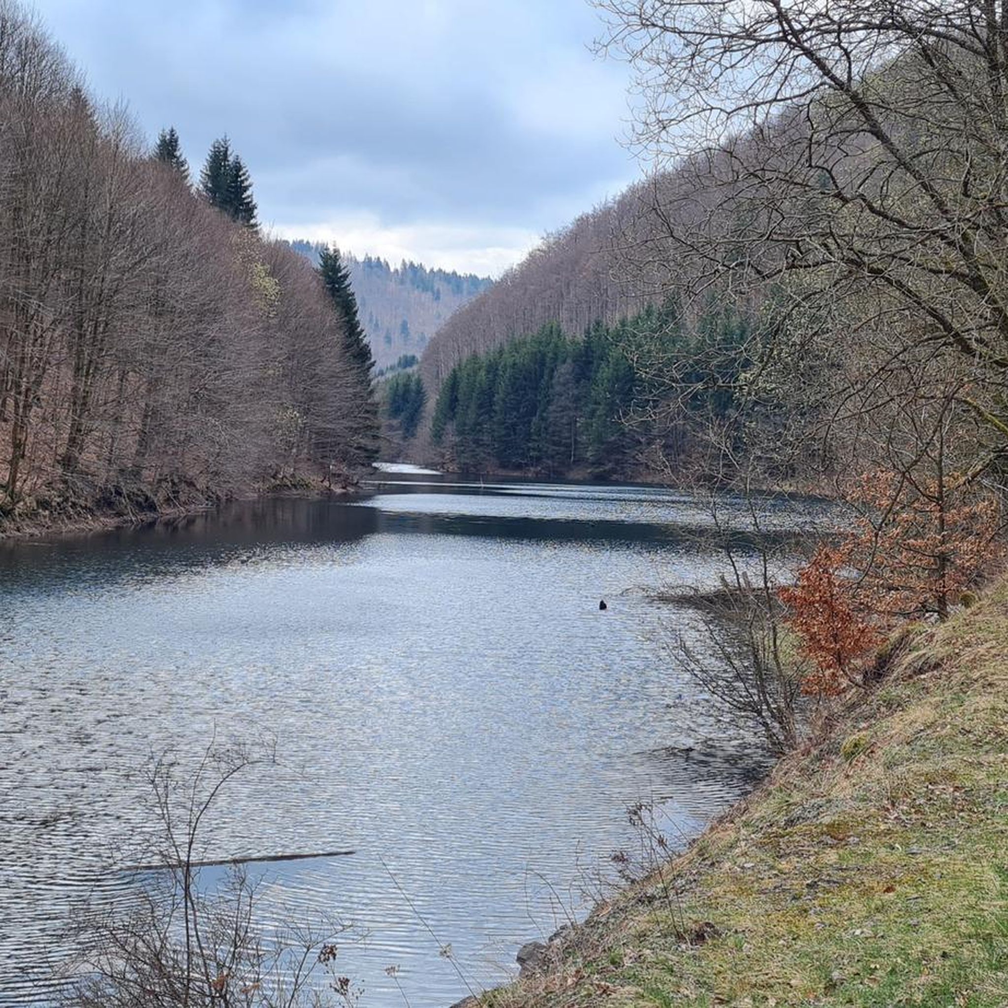
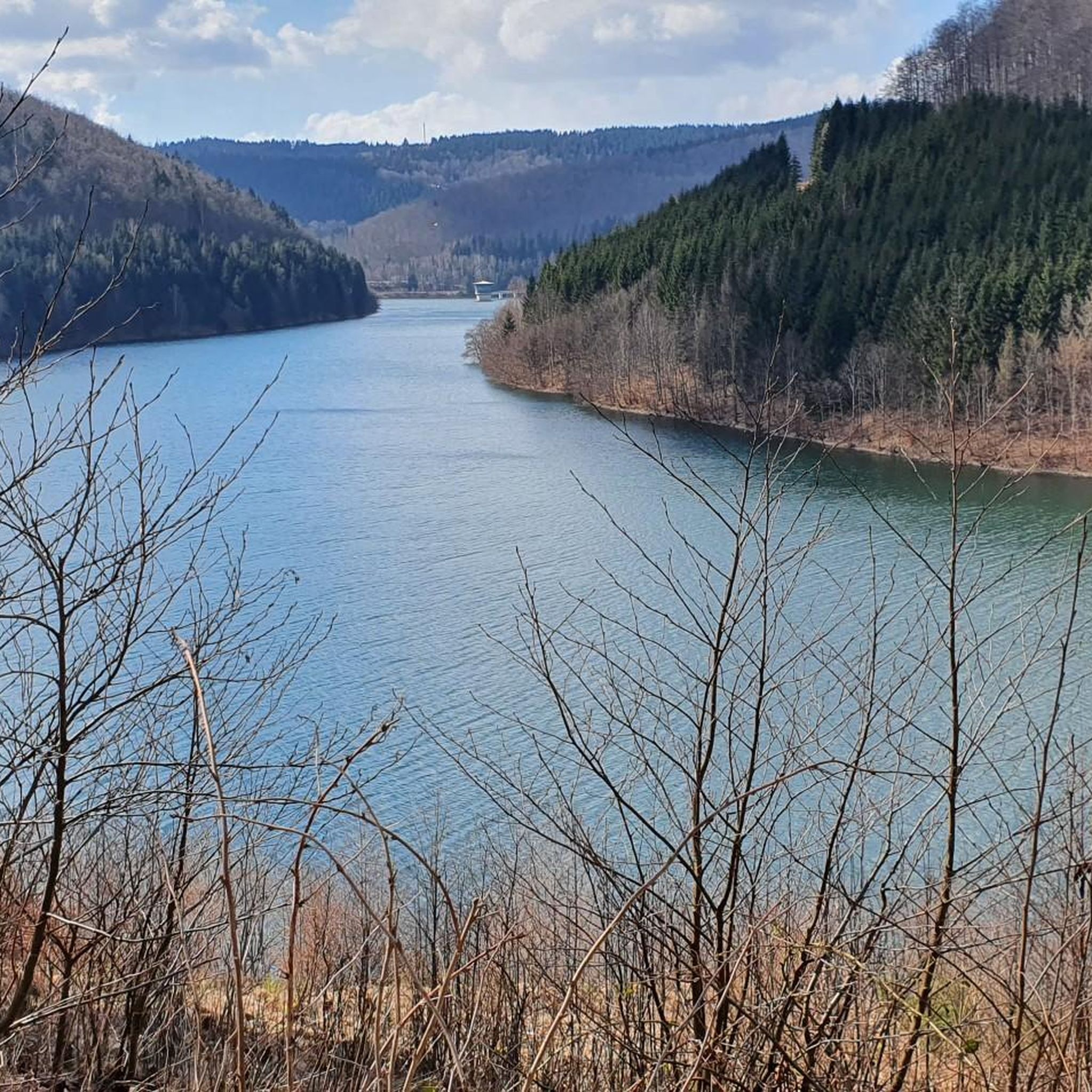
The loop around the Schönbrunn reservoir is about 14 km. There are enough resting places and views to enjoy are included anyway.
0
0

Top location on the Rennsteig: The proximity to the famous ridge trail allows for a combination of forest descents and ridge tours. Varied topography: Steep ascents from the Tannengrund or Reuscheltal demand stamina, but reward with brisk descents. Nature experience: The reservoir, with its bays, is reminiscent of a small fjord landscape in the middle of the dense low mountain forest. Tour combinations: Perfect as a stopover or turning point for larger loops, which often start in Schleusingen or Masserberg.
3
0
The Schönbrunn dam is located in the southern Thuringian Forest in the municipality of Schleusegrund (Hildburghausen district, Thuringia). It was commissioned in 1977. The dam is located about 20 kilometers south of Ilmenau and 15 kilometers northeast of Schleusingen. The river Schleuse is dammed. Source: https://de.wikipedia.org/wiki/Talsperre_Sch%C3%B6nbrunn#:~:text=Die%20Talsperre%20Sch%C3%B6nbrunn%20liegt%20im,Gestaut%20wird%20der%20Fluss%20Schleuse.
3
0
The Schönbrunn dam in the Thuringian Forest is attractive for mountain biking due to its charming combination of idyllic, flat shore paths and challenging, hilly ascents in the surrounding mountainous terrain around the Rennsteig. The circuit offers constant views of the blue water of the reservoir and the forest-rich heights of the Thuringian Forest.
3
0

Large intersection with many small roads.
2
0

Frequently Asked Questions
How many mountain bike trails are available around Dam Schönbrunn?
There are over 200 mountain bike trails around Dam Schönbrunn, offering a wide range of options for different skill levels. This includes approximately 30 easy routes, 135 moderate routes, and 48 difficult routes.
Are there any family-friendly mountain bike trails in Dam Schönbrunn?
Yes, Dam Schönbrunn offers several family-friendly mountain bike trails. An excellent option for beginners or families is the Lake Ratscher – View of Ratscher Mountain Lake loop from Gießübel, which is an easy 24.2 km route that takes about 1 hour 22 minutes to complete.
What kind of views can I expect on the mountain bike trails around Dam Schönbrunn?
The trails around Dam Schönbrunn offer picturesque views of the expansive reservoir, rolling hills, and dense woodlands. Many routes provide scenic overlooks, such as the Schönbrunn Reservoir – View of the Schönbrunn Reservoir loop from Schleusegrund, which features beautiful vistas of the reservoir and surrounding forests.
Are there any challenging mountain bike trails for experienced riders?
Absolutely. For experienced riders seeking a challenge, the Schönbrunn Reservoir – View of the Schönbrunn Reservoir loop from Oberneubrunn is a difficult 48.2 km route with substantial elevation gain, typically taking over 4 hours to complete. Another difficult option is the Werra Spring Fehrenbach – Needle Eye Rock Formation loop from Gießübel, spanning 26.7 km.
What do other mountain bikers say about the trails in Dam Schönbrunn?
The mountain bike trails in Dam Schönbrunn are highly regarded by the komoot community, holding an impressive average rating of 4.7 stars from over 1200 reviews. Riders frequently praise the diverse landscape, the well-maintained paths winding through forests, and the rewarding descents after challenging climbs.
Are there any circular mountain bike routes around Dam Schönbrunn?
Yes, many of the mountain bike trails around Dam Schönbrunn are designed as loops. Popular circular routes include the Schönbrunn Reservoir – View of the Schönbrunn Reservoir loop from Schleusegrund and the Lake Ratscher – Bertholdsburg Castle loop from Gießübel, which takes you through forested areas and past Lake Ratscher.
What are some interesting landmarks or attractions I can see along the mountain bike trails?
While mountain biking, you can encounter several interesting points. The Schönbrunn Reservoir itself is a prominent feature. You might also pass by the View of the Schönbrunn Dam control building or the View from Vorsperre Schleusegrund towards Schönbrunn Dam, offering unique perspectives of the area's infrastructure and natural beauty.
What is the typical duration for mountain bike tours in Dam Schönbrunn?
The duration of mountain bike tours varies significantly depending on the route's length and difficulty. Easy routes, like the Lake Ratscher – View of Ratscher Mountain Lake loop from Gießübel, can be completed in about 1 hour 22 minutes. More challenging routes, such as the Schönbrunn Reservoir – View of the Schönbrunn Reservoir loop from Oberneubrunn, can take over 4 hours.
Are there any specific highlights or natural features to look out for?
Beyond the main reservoir, you can explore other natural features like the Rennsteig ladder Dreiherrenstein-Oehrenstock. The region is characterized by its dense woodlands and the serene presence of the reservoir, providing a natural setting for outdoor activities.
What kind of terrain can I expect on the mountain bike trails?
The terrain around Dam Schönbrunn is diverse, featuring rolling hills, dense woodlands, and paths that wind alongside the reservoir. Riders can expect routes with significant elevation changes, offering a mix of challenging climbs and rewarding descents on varied surfaces.
Is there parking available near the mountain bike trailheads?
While specific parking locations are not detailed for each trailhead, the region is generally accessible for visitors. It is advisable to check individual route descriptions on komoot for recommended starting points and potential parking information near towns like Schleusegrund, Oberneubrunn, or Gießübel, which serve as common access points for these trails.
Most popular routes around Dam Schönbrunn
Most popular attractions around Dam Schönbrunn

Get inspired with the komoot mobile app


Explore more
Browse the best MTB trails in other regions.
