Rogue River-Siskiyou National Forests
Rogue River-Siskiyou National Forests
The 7 Most Amazing Peaks in Rogue River-Siskiyou National Forests
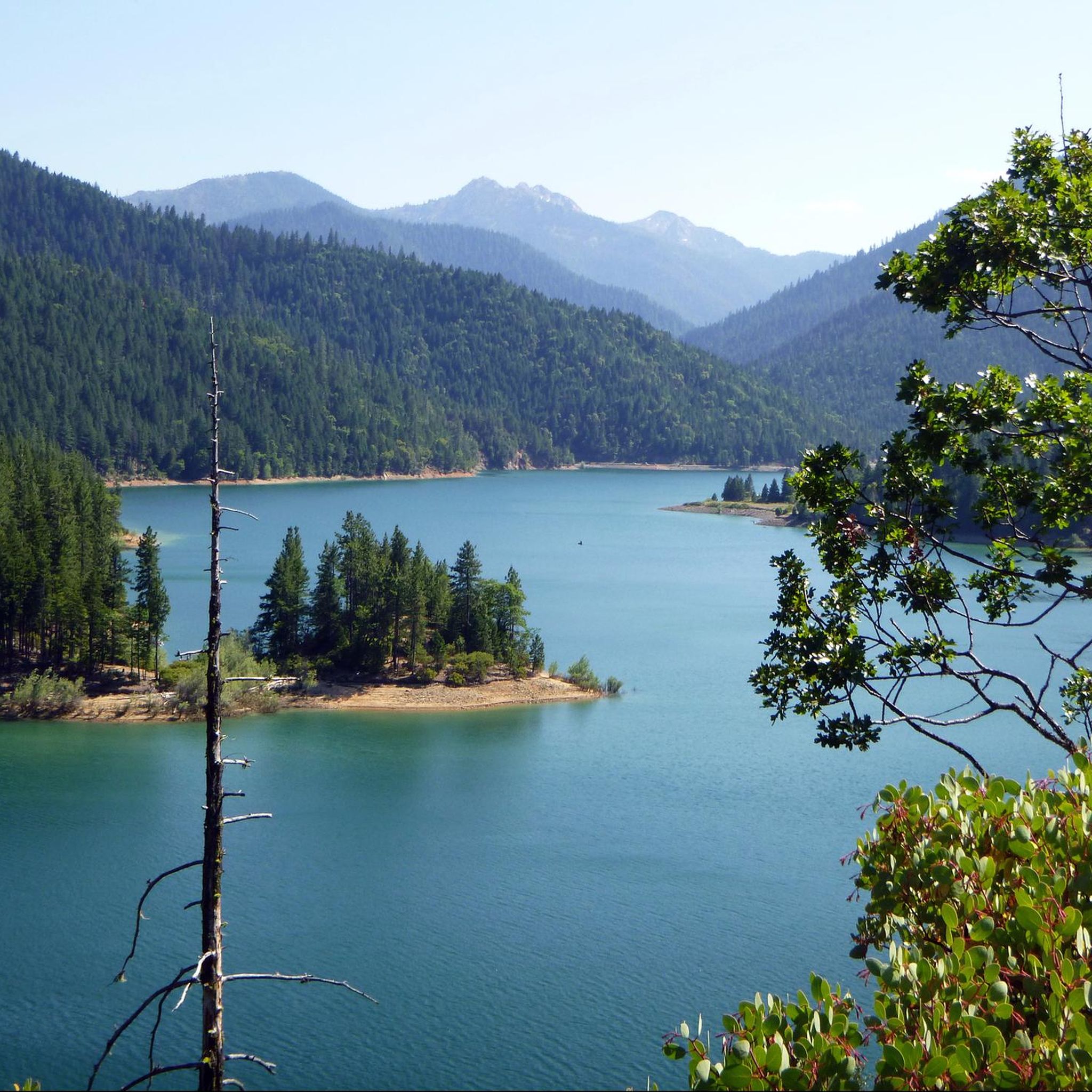
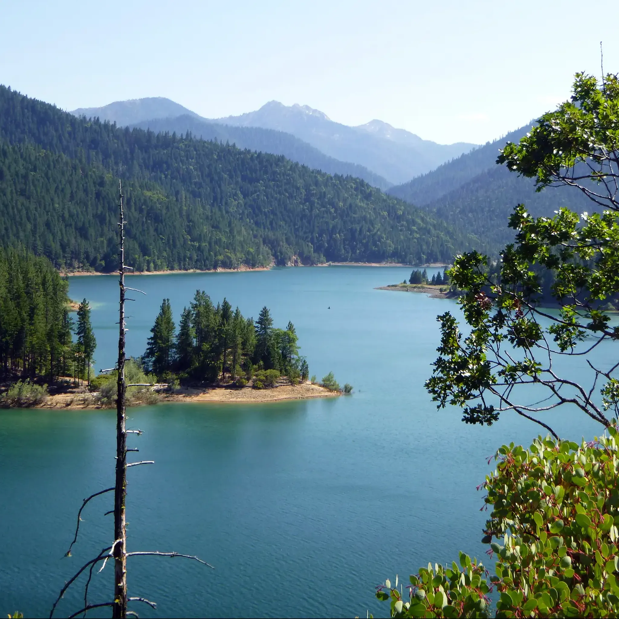
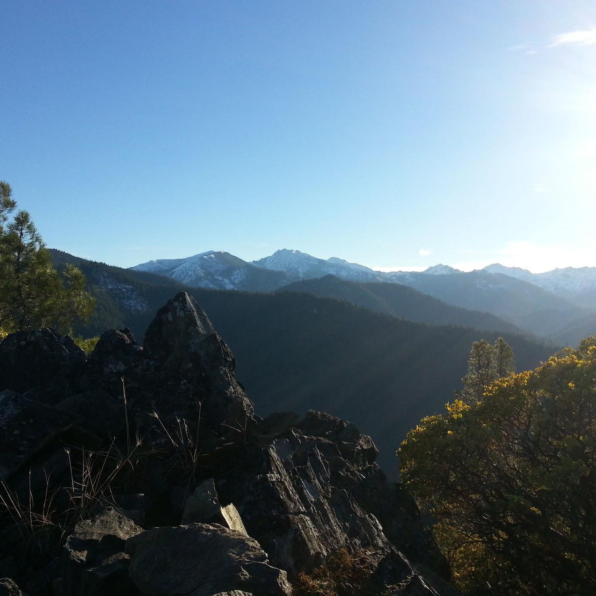
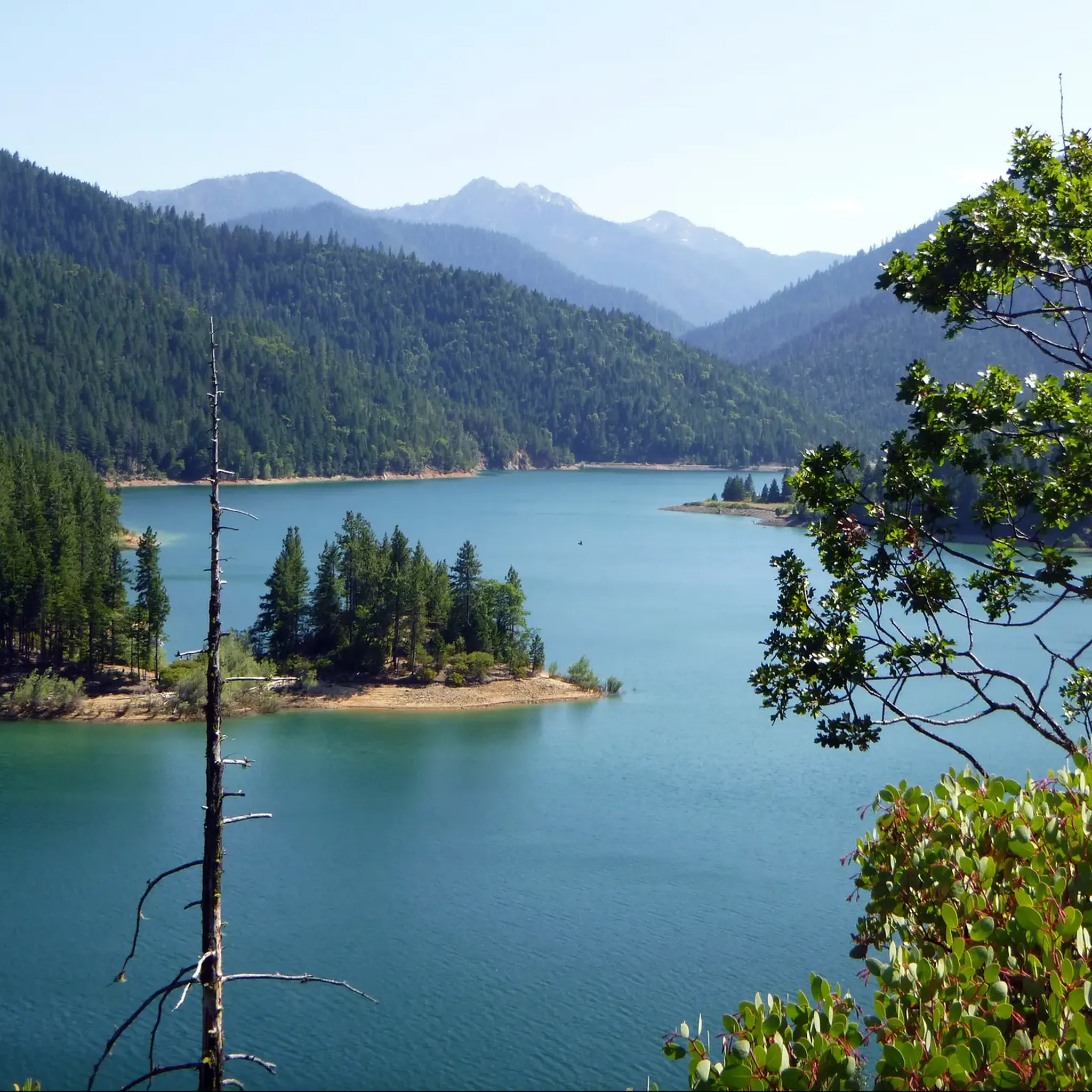
Best mountain peaks in Rogue River-Siskiyou National Forests are found within a diverse landscape spanning southwestern Oregon and northwestern California. This region features a mix of volcanic formations, high summits, and forested trails. It offers varied terrain for exploration, from ancient volcanoes to prominent peaks in the Siskiyou Mountains. The area provides opportunities to experience the natural environment of the Pacific Northwest.
Best mountain peaks in Rogue River-Siskiyou National Forests
- The most popular mountain peaks is Mount McLoughlin, a…
Last updated: July 8, 2026
Mount McLoughlin
Highlight • Volcano
Tip by

Grayback Mountain Trail (switchbacks up to Big Sugarloaf Peak)
Highlight (Segment) • Trail
Tip by

Sign up now to discover places like this
Get recommendations on the best single tracks, peaks, & plenty of other exciting outdoor places.
Sign up for free
Mount Ashland
Highlight • Summit
Tip by
Iron Mountain South Trailhead
Highlight • Trail
Translated by Google •
Tip by

Wagner Butte
Highlight • Viewpoint
Tip by

Sign up for free to discover even more peaks in Rogue River-Siskiyou National Forests.
Sign up for free
Already have an account?
Start today with a free account
Your next adventure awaits.
Login or Signup
Popular around Rogue River-Siskiyou National Forests

Bigfoot Trail — Exploring the remote Klamath Mountains
Hiking in Rogue River-Siskiyou National Forests
Running Trails in Rogue River-Siskiyou National Forests
Cycling in Rogue River-Siskiyou National Forests
Road Cycling Routes in Rogue River-Siskiyou National Forests
MTB Trails in Rogue River-Siskiyou National Forests
Other adventures in Rogue River-Siskiyou National Forests

Tips from the Community

The Grayback Mountain Trail is named for Grayback Mountain, the highest peak in Josephine County, Oregon at 7,048 feet. The trail begins from a trailhead south of Williams, Oregon, about two miles up Rock Creek Road (BLM Road 39-5-14). There is a BLM sign and a gravel pullout area where the trail starts. Hikers can shorten the route a little by a mile by driving further to a yellow gate, parking, and walking past the gate to join the trail. Initially, the trail rolls up and down for the first couple of miles before beginning a moderate, steady climb along the southeast side of the ridge through forests of madrones and pines. At about 4,400 feet, long switchbacks provide views of the Williams Creek Valley to the north. The trail continues to traverse the ridge, reaching another set of tight switchbacks. The trail turns southeast and climbs several steeper switchbacks over the east ridge of Big Sugarloaf Peak (6,679 feet), eventually ending at Windy Gap saddle at 6,500 feet. The best views are from the summit of Big Sugarloaf, providing a rewarding experience for those who make the climb. Although the trail does not reach the summit of Grayback Mountain, it offers an almost brush-free, cross-country scramble from Windy Gap to the peak.
0
0

Mount McLouglin is one of the tallest peaks in Oregon. It is a dormant volcano that last erupted between 20,000 and 30,000 years ago. There are amazing views from the top of Sky Lakes Wilderness, Fourmile Lake, Lake of the Woods and Fish Lake.
0
0
Mount Ashland is the highest peak in the Siskiyou Mountains. In the winter, it is a ski resort, but in warmer weather it is a great place for a trail run. As you will be at the highest point in the area, you get great views of the valleys and nearby peaks.
0
0
Wagner Butte is a very popular spot for hikers and trail runners. There are great views from the trail of the valleys and mountains in the area.
0
0

Wagner Butte is a prominent peak and popular hiking destination in southern Oregon. The marked spot is not the actual summit but a beautiful viewpoint, that offers views of the surrounding Rogue Valley, Siskiyou Mountains and Mount Ashland.
0
0

Mount McLoughlin is an ancient, but still dormant stratovolcano within the Cascade Range that last erupted 30,000 to 20,000 years ago. It is the tallest volcano between Mount Shasta in California and South Sister further north. If you hike along the Pacific Crest Trail, you can see it way in front of you. The summit is at 9,493 feet with breathtaking views over the Sky Lakes Wilderness, Fourmile Lake, Lake of the Woods and Fish Lake. You can climb it in a strenuous hike taking a trail that splits from the PCT. There are some nice campsites at the base of the mountain.
2
0
With 7,532 feet, Mount Ashland is the highest peak in the Siskiyou Mountains in southern Oregon. It is a popular ski area, but also a very nice destination for a scenic hike. The white ball you can see up here is a weather radar station, called the Doppler.
3
0

This junction is the highest point on the Tour de Fronds cycle routes. The path is rocky and officially only for pedestrians. It leads to Iron Mountain in 1.6 miles, with a panoramic view of the coastal mountains. A few hundred meters west of the trailhead is McCurdy Campground,
1
0
Frequently Asked Questions
What are some of the most popular mountain peaks to visit in the Rogue River-Siskiyou National Forests?
Visitors frequently enjoy Mount McLoughlin, a prominent dormant stratovolcano offering breathtaking views. Another favorite is Mount Ashland, the highest peak in the Siskiyou Mountains, known for its scenic vistas. Wagner Butte is also a popular hiking destination with views of the Rogue Valley.
Are there challenging hikes to mountain peaks in the Rogue River-Siskiyou National Forests?
Yes, for those seeking a challenge, the hike to the summit of Mount McLoughlin is strenuous but rewarding. The Grayback Mountain Trail, leading towards Big Sugarloaf Peak, also offers a moderate to challenging climb with significant elevation gain and switchbacks.
How long does it typically take to hike Mount Ashland?
While the guide doesn't specify an exact duration, hiking Mount Ashland can vary depending on your starting point and pace. It's a popular destination for both scenic hikes and trail runs, suggesting a half-day to full-day excursion for a summit attempt, allowing time to enjoy the extensive views from the highest peak in the Siskiyou Mountains.
Do I need a permit to hike to mountain peaks in the Rogue River-Siskiyou National Forests?
Generally, permits are not required for day hiking on established trails within the Rogue River-Siskiyou National Forests. However, it's always advisable to check with the local Forest Service office for any specific regulations, especially if you plan to enter designated wilderness areas or engage in overnight backpacking.
Are there family-friendly mountain hikes in the Rogue River-Siskiyou National Forests?
While some peaks offer more strenuous climbs, the region also provides trails suitable for families. For easier options, consider exploring the general area around peaks like Wagner Butte, which has popular hiking routes. You can find several easy hiking routes in the region, such as the Lewis Loops or Jeffrey Pine Loop, which are listed in the Easy hikes in Rogue River-Siskiyou National Forests guide.
What is the best time of year to hike the mountain peaks in the Rogue River-Siskiyou National Forests?
The best time to hike the mountain peaks is typically from late spring through early fall (May to October) when trails are generally free of snow and weather conditions are more favorable. Summer offers warm, dry conditions, while spring and fall provide cooler temperatures and vibrant foliage. Always check current weather and trail conditions before heading out, especially at higher elevations.
What kind of wildlife might I encounter on the mountain peaks?
The Rogue River-Siskiyou National Forests are home to diverse wildlife. Hikers might spot black bears, deer, elk, and various small mammals. Birdwatchers can look for raptors like eagles and hawks, as well as numerous songbirds. Always maintain a safe distance and store food properly to avoid attracting animals.
What outdoor activities can I do near these mountain peaks?
Beyond peak bagging, the region offers extensive opportunities for hiking, trail running, and mountain biking. You can explore various trails, from easy strolls to challenging ascents. For more detailed options, check out the Hiking in Rogue River-Siskiyou National Forests guide or the Running Trails in Rogue River-Siskiyou National Forests guide.
Are there any hidden gem mountain trails in the Rogue River-Siskiyou National Forests?
While popular peaks like Mount McLoughlin and Mount Ashland draw crowds, exploring lesser-known sections of trails like the Grayback Mountain Trail can offer a more secluded experience. This trail provides views of the Williams Creek Valley and leads to Big Sugarloaf Peak, offering a rewarding experience away from the busiest spots.
What are the winter hiking conditions like on the mountain peaks?
Winter conditions on the mountain peaks can be challenging, with significant snow accumulation, icy trails, and colder temperatures. While some areas might be accessible for snowshoeing or cross-country skiing, many higher elevation trails become impassable or require specialized gear and experience. Mount Ashland, for example, transforms into a popular ski resort during winter. Always check current conditions and avalanche forecasts before attempting winter hikes.
Are there loop trails available around the mountain peaks?
Yes, the Rogue River-Siskiyou National Forests offer various loop trails that allow for diverse hiking experiences. While specific loop trails directly around the highest peaks might be limited, you can find options like the Mount Elijah and Bigelow Lakes Loop or the Lewis Loops, which are detailed in the Hiking in Rogue River-Siskiyou National Forests guide.
What natural features can I expect to see from the mountain peaks?
From the mountain peaks, you can expect panoramic views of diverse landscapes. For instance, Mount McLoughlin offers views over the Sky Lakes Wilderness, Fourmile Lake, Lake of the Woods, and Fish Lake. From Mount Ashland, you'll see expansive views of valleys and nearby peaks. The region is characterized by volcanic formations, high summits, and dense forests.
Most popular routes in Rogue River-Siskiyou National Forests
Most popular attractions in Rogue River-Siskiyou National Forests

Get inspired with the komoot mobile app


Explore more
See even more amazing summits in Rogue River-Siskiyou National Forests with these guides:
