The best walks and hikes in Mt. Baker-Snoqualmie National Forest
4.7
(1101)
24,441
hikers
340
hikes
Hiking in Mt. Baker-Snoqualmie National Forest offers diverse terrain across 1.2 million acres of Washington's Cascade Mountain Range. The landscape features glacier-covered peaks, dense evergreen forests, and an extensive network of alpine lakes and waterfalls. This area provides a wide array of trails, from paths through old-growth forests to climbs up mountains.
Best hiking trails in Mt. Baker-Snoqualmie National Forest
- The most popular hiking route is Snow Lake Trail, a 7.0 miles (11.3 km) trail that takes 3 hours 46 minutes to complete, leading to a scenic alpine lake.
- Another top favourite among local hikers is Lake Twenty Two Trail, a moderate 6.0 miles (9.7 km) path that traverses old-growth forest to a subalpine lake.
- Local hikers also love the Lake Serene Trail, a 7.3 miles (11.8 km) trail leading through dense forest to a waterfall and a serene lake, often completed in about 4 hours 27 minutes.
- Hiking in Mt. Baker-Snoqualmie National Forest is defined by glacier-capped mountains, vast evergreen forests, and numerous alpine lakes. The network offers options for various ability levels, including family-friendly paths and rugged ascents.
- The routes in Mt. Baker-Snoqualmie National Forest are highly rated by the komoot community with an average score of 4.7 stars from more than 350 reviews. More than 9000 hikers have used komoot to explore Mt. Baker-Snoqualmie National Forest's varied terrain.
Last updated: October 11, 2026
4.9
(19)
412
hikers
10.5km
03:26
530m
340m
The Chain Lakes Loop Trail is a truly rewarding experience in the Mount Baker Wilderness, offering a moderate 6.5-mile (10.5 km) hike with 1748 feet (533 metres) of elevation gain that typically takes around 3 hours and 25 minutes. You'll be treated to continuous panoramic views of Mount Baker and Mount Shuksan as the path winds past several pristine sub-alpine lakes, including Iceberg Lake and Mazama Lake. The route's loop design ensures you're always seeing new scenery, from vibrant wildflowers in summer to rugged boulder fields and the impressive Stone Bridge.
Planning your visit requires attention to the short hiking season, which usually runs from July to September due to significant snow cover at high elevations. Trailheads are easily accessible near Artist Point, but it's wise to carry an offline map as signage can be limited. Pets are welcome on a leash, and there are designated campsites around Hayes and Mazama Lakes for those considering an overnight trip.
This trail is considered a
5.0
(4)
99
hikers
5.48km
01:40
90m
380m
The Snow Lake Trail offers a delightful journey into the Alpine Lakes Wilderness, treating you to spectacular views of the iconic Snow Lake. This easy 3.4-mile (5.5 km) hike, with a gentle 296 feet (90 metres) of elevation gain, winds through a forest path before revealing the expansive mountain vistas and the shimmering lake. It's a perfect choice for a relatively short outing, taking approximately 1 hour and 40 minutes, making it accessible for most hikers seeking a scenic reward without a strenuous climb.
Planning your visit means considering the trail's popularity; it's a highly frequented spot, especially on warm summer weekends. The trailhead is conveniently located near Snoqualmie Pass, an hour's drive from Seattle. Due to high demand, parking lots can fill up early, so an early start is recommended. Always confirm any necessary permits or passes before heading out.
Snow Lake is the most visited lake in the Alpine Lakes Wilderness, renowned for its stunning natural beauty and relatively easy access. While this specific route provides a taste of its charm, the broader area offers opportunities for activities like swimming or paddleboarding at the lake. It also serves as a gateway to longer backpacking adventures for those seeking more solitude beyond the main crowds.

5.0
(6)
97
hikers
20.9km
07:12
450m
660m
Embark on the Elliot Creek (Goat Lake) Trail, a difficult hiking route that spans 13.0 miles (20.9 km) and climbs 1489 feet (454 metres). You can expect to spend around 7 hours and 11 minutes navigating through thick old-growth forests and alongside Elliot Creek. The journey is rich with abundant waterfalls, including the notable Mackintosh Falls, before you reach the stunning emerald-colored Goat Lake, offering expansive views of peaks like Foggy Peak and Sloan Peak.
Before you head out, remember that a Northwest Trail Pass is necessary for parking at the Elliot Creek Trailhead. It is always a good idea to check for any road closures, especially during the winter months, as access to the trailhead can be impacted. If you plan to backpack, designated campsites and pit toilets are available at the north end of Goat Lake.
This trail is nestled within the vast Mount Baker-Snoqualmie National Forest, providing a true wilderness experience. Beyond the challenging climb, the route is particularly known for its lush wildflowers that bloom vibrantly in spring and early summer. The pristine Goat Lake itself is a significant natural highlight, marking a memorable destination for your efforts.
4.9
(31)
615
hikers
11.3km
03:46
500m
500m
Embark on the Snow Lake Trail, a moderate hike that takes you through diverse terrain, from dense forests to open talus slopes. You will cover 7.1 miles (11.3 km) and gain 1634 feet (498 metres) in elevation, with the journey typically taking around 3 hours and 46 minutes. The route culminates at the pristine Snow Lake, a stunning alpine gem nestled beneath the impressive 2000-foot Chair Peak, offering clear waters and dramatic mountain views.
Planning your visit requires some foresight, as this trail is very popular, especially on summer weekends. To enjoy a more peaceful experience, consider starting your hike early in the morning or choosing a weekday. If you are thinking about a winter hike, be aware that it is only recommended for experienced individuals with proper gear due to the high avalanche risk in the steep sections of the trail.
The Snow Lake Trail is a highlight within Washington's expansive Alpine Lakes Wilderness, an area renowned for its rugged beauty. As you hike, you might spot waterfalls cascading down the mountainsides, with snow often lingering in shaded areas well into July. The trail provides a rewarding experience, showcasing the natural grandeur of the region and its unique geological features.
64
hikers
5.83km
01:43
20m
430m
Immerse yourself in a lush mountain rainforest on the Lake Twenty Two Trail, where old-growth trees, moss, and ferns create a vibrant green canopy. The path follows rushing water, leading you to the stunning alpine Lake 22, cradled by dramatic rock cliffs. A boardwalk allows you to explore the lake's edge, offering unique perspectives of this glacier-carved basin.
This easy 3.6-mile (5.8 km) hike, with a minimal 63 feet (19 metres) of elevation gain, takes approximately 1 hour and 42 minutes to complete. It's a popular destination, so plan to arrive early, especially on weekends, to find parking. The trail is open year-round, but be mindful of potential snow and avalanche risks if hiking in winter.
The Lake Twenty Two Research Natural Area protects nearly 800 acres of old-growth cedars and hemlocks, making this trail a special place to experience a pristine ecosystem. The trail's unique name is thought to originate from a 19th-century railroad map designation, adding a touch of history to your journey through this protected natural wonder.
Get access to more routes and recommendations from other explorers.
Already have an account?
Our route recommendations are based on thousands of hikes, rides, and runs completed by other people on komoot.
Start today with a free account
Your next adventure awaits.
Popular around Mt. Baker-Snoqualmie National Forest

Pacific Northwest National Scenic Trail — From Alpine to Alava through the untamed Northwest

Pacific Crest Trail from Mexico to Canada – 4,200 kilometres of wilderness
Running Trails in Mt. Baker-Snoqualmie National Forest
Road Cycling Routes in Mt. Baker-Snoqualmie National Forest
MTB Trails in Mt. Baker-Snoqualmie National Forest
Cycling in Mt. Baker-Snoqualmie National Forest

Gravel biking in Mt. Baker-Snoqualmie National Forest


Tips from the Community

Do not take the loop shown here. There is no trail. I would follow the sign to Snowlake. Another tip, I highly recommend against this hike due to the size of the massive crowds. There was a line of people to go up.
0
0

Snow lake is a very popular lake in the area, surrounded by beautiful scenery. The lake is home to rainbow trout and is a good spot for fishing. More information on fishing at Snow Lake can be found here: https://wdfw.wa.gov/fishing/locations/high-lakes/snow-lake-king#trout-plants
0
0
This pond is the source of the Snoqualmie River. Its a beautiful setting to take a break and enjoy the wonderful view.
0
0
Great view point of the blue waters and peaks around Snow lake.
0
0

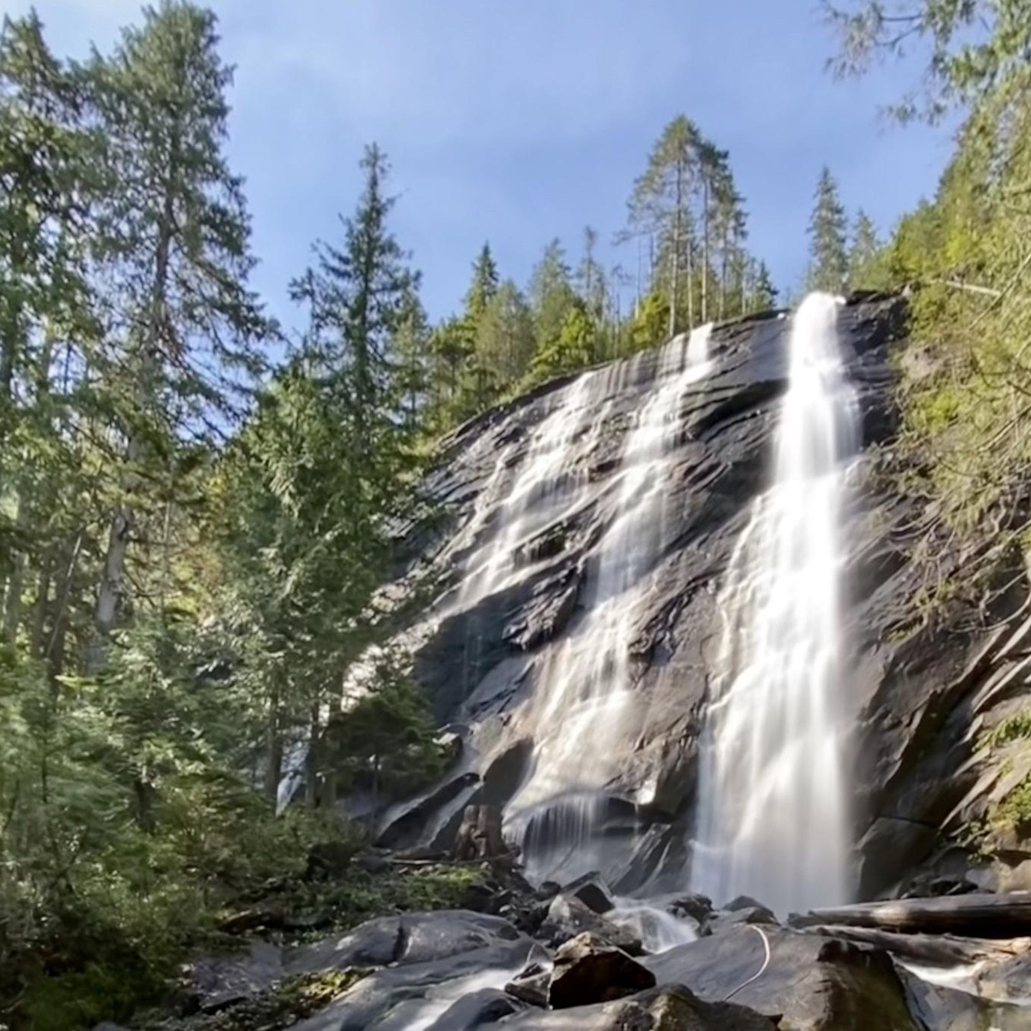
Mackintosh Falls cascades over rocks, and flows off of Goat lake into Elliot Creek, you can visit the falls right before arriving at Goat Lake. Between the falls and Goat Lake a public restroom is also available. Keep an eye out for Tiger Lillys!
0
0

This trailhead, also known as the Elliot Creek Trailhead, provides access to the Henry M. Jackson Wilderness. Parking is available and costs $5 per vehicle, but it may be unreachable depending on the snow conditions and washouts.
0
0

A short loop trail leads you to this beautiful alpine setting. Follow the Bagley Lakes Trail from here at Lower Bagley Lake to the slightly bigger Upper Bagley Lake.
2
0
Frequently Asked Questions
How many hiking trails are available in Mt. Baker-Snoqualmie National Forest?
The Mt. Baker-Snoqualmie National Forest offers a vast network of trails. On komoot, you'll find over 200 hiking routes, ranging from easy strolls to challenging multi-day treks, ensuring options for every skill level.
What kind of natural features can I expect to see while hiking in the forest?
Hikers in Mt. Baker-Snoqualmie National Forest will encounter a dramatic and varied landscape. Expect to see glacier-covered peaks like Mount Baker and Glacier Peak, dense evergreen forests, serene alpine meadows, and over 700 glacial lakes. The forest is also home to numerous impressive waterfalls, including Franklin Falls, Bridal Veil Falls, and Deception Falls.
Are there any family-friendly hiking options in Mt. Baker-Snoqualmie National Forest?
Yes, the forest offers many family-friendly paths suitable for various ages and abilities. These include gentle strolls through old-growth forests and ADA-accessible trails. While specific routes vary, many trails provide a great introduction to the natural beauty without being overly strenuous.
Can I bring my dog on the trails in Mt. Baker-Snoqualmie National Forest?
Many trails within Mt. Baker-Snoqualmie National Forest are dog-friendly, but leash regulations and specific restrictions can vary by area, especially in designated wilderness areas or near sensitive wildlife habitats. It's always best to check the specific trail regulations before heading out with your canine companion.
What is the best time of year to hike in Mt. Baker-Snoqualmie National Forest?
The best time to hike generally depends on the elevation and specific trail. Lower elevation trails are often accessible from late spring through fall. For higher alpine trails, late summer (July to September) typically offers the most snow-free conditions and vibrant wildflowers. Winter provides opportunities for snowshoeing and cross-country skiing on designated routes.
Are there any challenging routes for experienced hikers?
Absolutely. The Mt. Baker-Snoqualmie National Forest is known for its rugged climbs up boulder-studded mountains and challenging multi-day backpacking trips. Trails like Lake Serene via Bridal Veil Falls offer significant elevation gain and a rewarding experience for those seeking a more strenuous adventure.
Are there any loop trails available, or are most routes out-and-back?
The forest features a mix of both loop trails and out-and-back routes. For example, the Chain Lakes Loop Trail offers a scenic circular experience, while many other trails lead to a specific destination like a lake or viewpoint and return along the same path. You can filter for loop trails on komoot to find options.
What are some notable viewpoints or landmarks to explore?
The forest is rich with stunning viewpoints and landmarks. Park Butte Lookout and Granite Mountain Lookout offer breathtaking panoramic vistas of the Cascade peaks. Huntoon Point is another popular spot for incredible views of Mount Baker and Mount Shuksan.
What do other hikers enjoy most about hiking in Mt. Baker-Snoqualmie National Forest?
The area is highly rated by the komoot community, with an average score of 4.7 stars from over 350 reviews. Hikers often praise the diverse terrain, from quiet old-growth forests to rugged alpine ascents, and the stunning natural beauty, including glacier-capped mountains, serene lakes, and powerful waterfalls.
Are there any trails that feature waterfalls?
Yes, the Mt. Baker-Snoqualmie National Forest is home to several impressive waterfalls. You can hike to the majestic Franklin Falls, or combine a visit to Bridal Veil Falls with a hike to Lake Serene on routes like Bridal Veil Falls and Lake Serene.
What kind of wildlife might I encounter while hiking?
The dense evergreen forests and wilderness areas provide habitat for diverse wildlife. Hikers might spot various bird species, deer, and smaller mammals. While less common, larger animals like black bears and mountain goats also inhabit the region, so it's always wise to be aware of your surroundings and practice Leave No Trace principles.
Are there any easy day hikes that lead to a scenic lake?
Yes, there are several options for easy to moderate day hikes that lead to beautiful alpine lakes. The Snow Lake Trail is a popular choice, leading to a picturesque alpine lake and offering a rewarding experience without being overly strenuous.
Most popular routes in Mt. Baker-Snoqualmie National Forest
Most popular attractions in Mt. Baker-Snoqualmie National Forest

Get inspired with the komoot mobile app


Explore more
Browse the best Hikes in other regions.
