RoutesPlannerFeaturesUpdates
App
Login or Signup
Get the App
Login or Signup
Routes
Hikes
Canada
British Columbia

Area F (Trout Creek Valley)

Routes
Hikes
Canada
British Columbia

Area F (Trout Creek Valley)

The best walks and hikes around Area F (Trout Creek Valley)

4.6

(56)

540

hikers

15

hikes

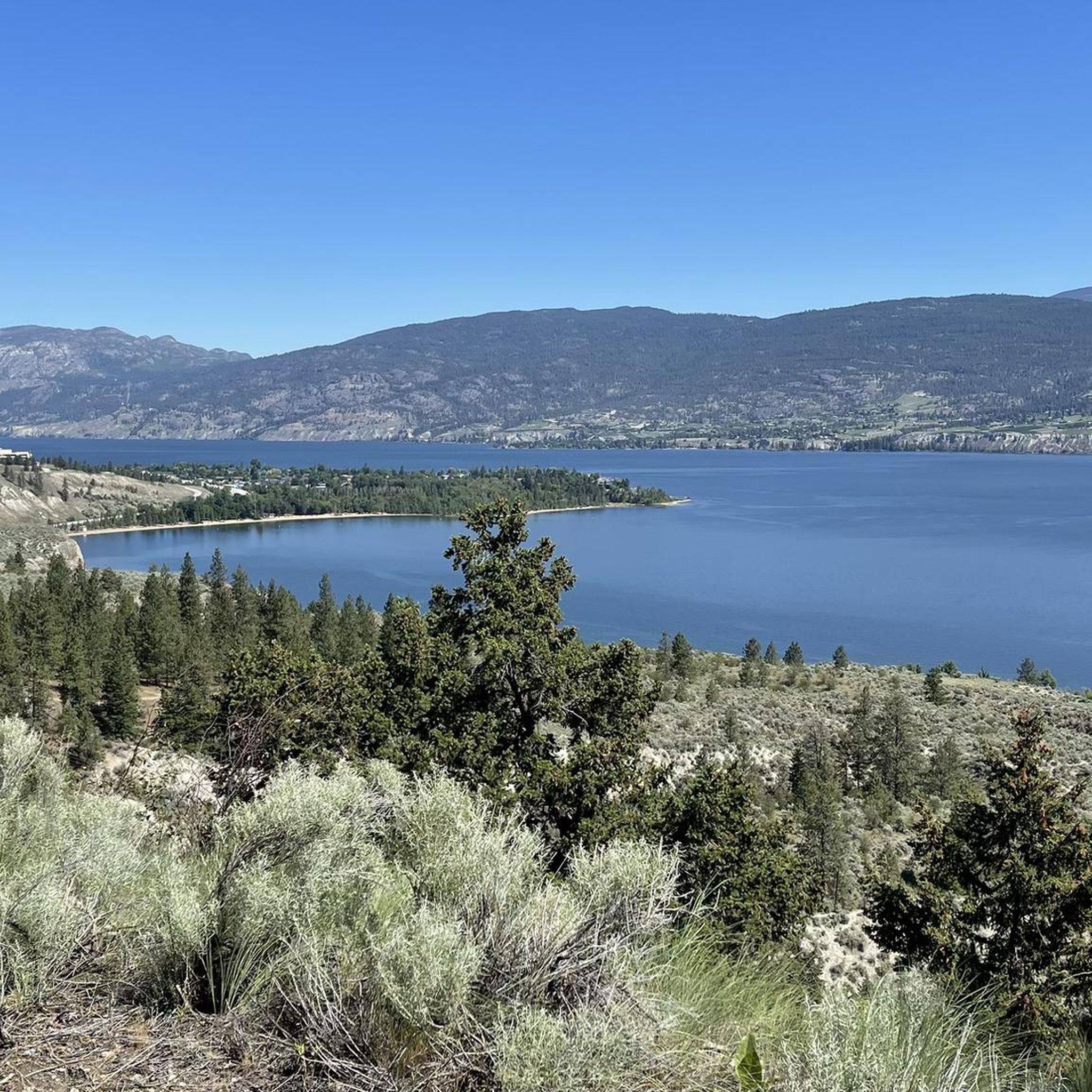
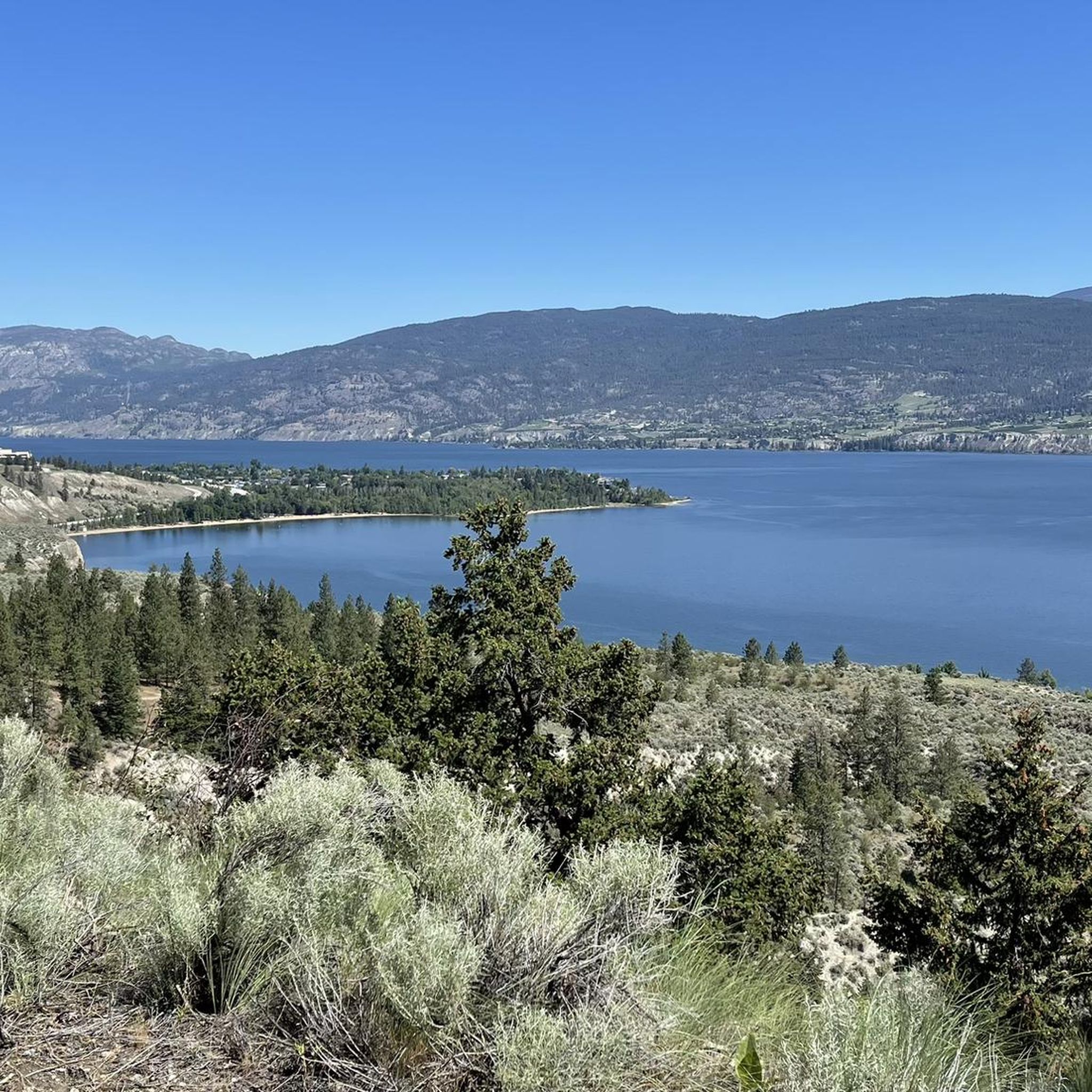
Hiking around Area F (Trout Creek Valley) offers trails through diverse landscapes, primarily characterized by the Okanagan Valley's unique blend of semi-arid terrain and lakeside environments. The region features prominent hills like Giant's Head, providing elevated viewpoints over the valley and Okanagan Lake. Trails often traverse areas with varied vegetation, from open parklands to more forested sections.

Best hiking trails around Area F (Trout Creek Valley)

  • The most popular hiking route is Giant's Head Loop — Giant's Head Mountain Park…

Last updated: October 14, 2026

5.0

(6)

33

hikers

#1.

Giant's Head Loop — Giant's Head Mountain Park

4.35km

01:32

250m

250m

Easy hike. Great for any fitness level. Easily-accessible paths. Suitable for all skill levels.

Navigate with deviceSend to Phone
Save
Easy

Easy hike. Great for any fitness level. Easily-accessible paths. Suitable for all skill levels.

Easy
guide_signup
Let us show you the way with the komoot mobile app
With a free komoot account, you can easily find, customize, and navigate endless outdoor adventures.
Sign up for free

5.0

(2)

27

hikers

Moderate hike. Good fitness required. Easily-accessible paths. Suitable for all skill levels.

Moderate

4.3

(3)

10

hikers

Moderate hike. Good fitness required. Easily-accessible paths. Suitable for all skill levels.

Moderate

7

hikers

Hard hike. Very good fitness required. Easily-accessible paths. Suitable for all skill levels.

Hard
Sign up for free to see 11 more hikes around Area F (Trout Creek Valley).

Get access to more routes and recommendations from other explorers.

Sign up for free

Already have an account?

Our route recommendations are based on thousands of hikes, rides, and runs completed by other people on komoot.

Start today with a free account

Your next adventure awaits.

Login or Signup

Popular around Area F (Trout Creek Valley)
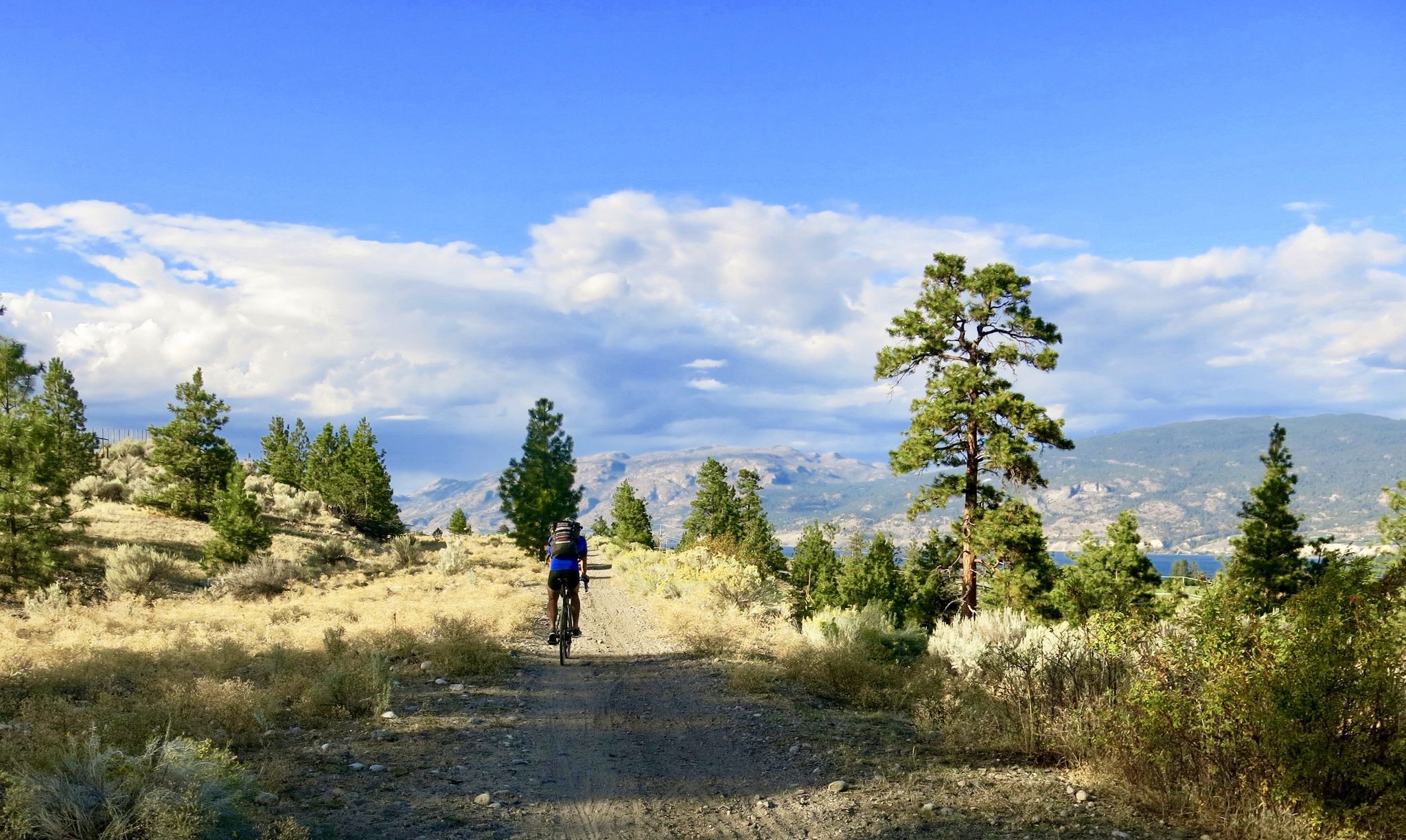
Vancouver roundtrip — Bikepacking British Columbia

Gravel biking around Area F (Trout Creek Valley)
Road Cycling Routes around Area F (Trout Creek Valley)
Cycling around Area F (Trout Creek Valley)

MTB Trails around Area F (Trout Creek Valley)

Running Trails around Area F (Trout Creek Valley)

Other adventures around Area F (Trout Creek Valley)

Vancouver roundtrip — Bikepacking British Columbia

Cycling Collection by

komoot

Tips from the Community

AaronLavanchy
November 12, 2025, Sun-Oka Provincial Park

Sun-Oka Beach Provincial Park is a 30-hectare park situated on the shores of Okanagan Lake. It features a large, south-facing beach that is perfect for swimming. The park also offers amenities such as a playground, fire pits, picnic tables, water fountains, and watersport rentals.

0

0

AaronLavanchy
November 12, 2025, Trout Creek

Trout Creek is a small yet vital river located just south of Summerland, serving as the primary water source for the district. Further upstream, the creek becomes a popular destination for whitewater kayaking in the dramatic Trout Creek Canyon.

0

0

oliviakellis
October 23, 2025, The Grind trail

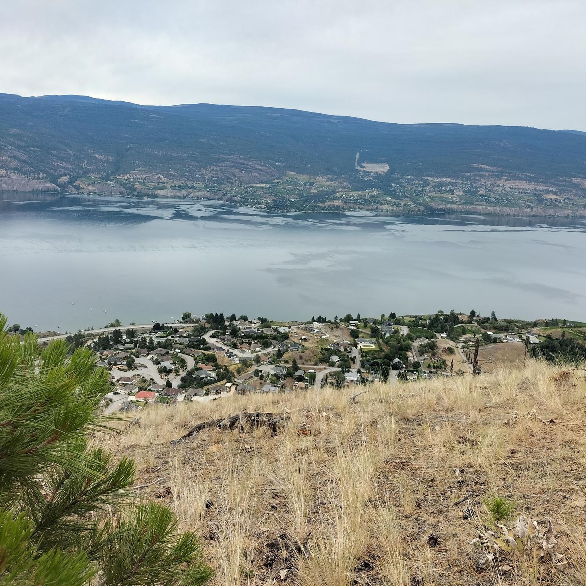
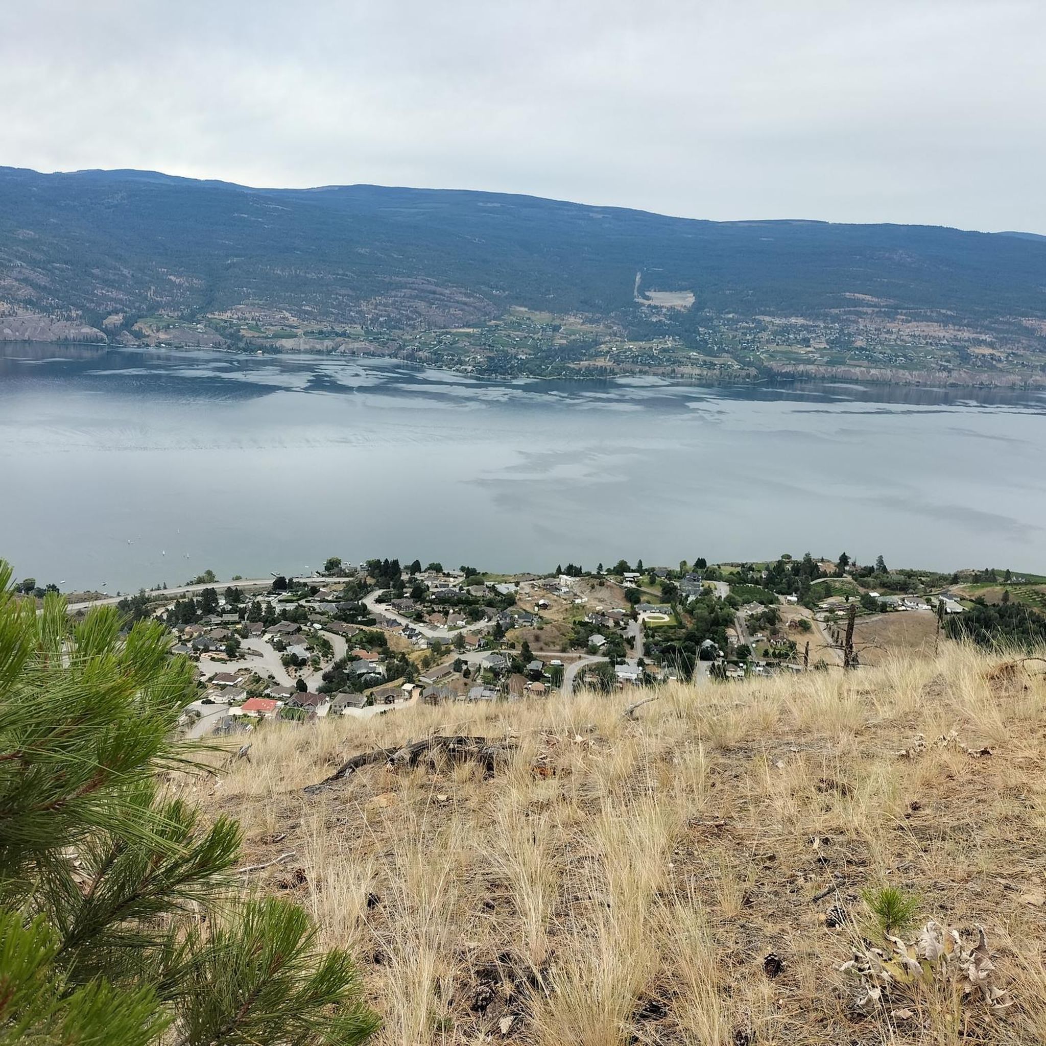
True to its name, the Grind Trail is the steepest route to the summit of Giant’s Head Mountain. It climbs quickly through exposed hillside terrain, offering a solid workout and impressive lake views as you gain elevation. The trail is well maintained but demanding — bring water, take breaks at the benches, and be prepared for a steady climb from start to finish.

0

0

A compact park with some of the best views in the South Okanagan, Giant’s Head Mountain Park features a mix of paved and dirt trails leading to a panoramic summit lookout. The route is short but steep, so bring water and sturdy shoes, especially in summer when the sun can be intense. Parking is available near the upper gate, and benches along the trail offer good rest stops for taking in the lake and valley scenery.

0

0

The summit of Giant’s Head Mountain offers sweeping panoramas across the Okanagan Valley — look out over the shimmering waters of Okanagan Lake, the vineyards of the Naramata Bench, and the hills surrounding Penticton. From here, you’re perched above the valley’s patchwork of orchards, vineyards and lakefront homes, making the viewpoint a standout for both sunrise and sunset. It’s accessible enough for many hikers yet delivers those “high vantage” views that feel more remote.

0

0

Great view! Anyone who wants to see the Okanagan Valley from above should have been at Giants Head in Summerland. You can drive up and then walk about 20min to the summit and have a fantastic view. We recommend.

Translated by Google•

0

0

Frequently Asked Questions

How many hiking trails are available in Area F (Trout Creek Valley)?

There are 16 hiking routes in Area F (Trout Creek Valley). These trails range in difficulty, offering options for various skill levels.

What kind of landscapes can I expect to see while hiking in Area F (Trout Creek Valley)?

Hiking in Area F (Trout Creek Valley) primarily features the unique blend of semi-arid terrain and lakeside environments characteristic of the Okanagan Valley. You'll find trails traversing prominent hills like Giant's Head, offering elevated viewpoints, as well as paths through varied vegetation, from open parklands to more forested sections. Many routes also feature beautiful lakeside paths.

Are there any easy hikes suitable for beginners or families in Area F (Trout Creek Valley)?

Yes, Area F (Trout Creek Valley) offers 5 easy hiking routes. A great option is the Sun-Oka Beach and Trout Creek loop, an easy 5.2 km path that follows the shoreline and the banks of Trout Creek, providing a flat and accessible experience.

What are some notable landmarks or attractions to see near the hiking trails?

Hikers can explore several interesting landmarks. The Giants Head Summit offers panoramic views. You can also find highlights like Okanagan Lake, Lakeside Beach on Okanagan Lake, and sections of the historic Kettle Valley Railway, including the Adra Tunnel.

Are there any circular hiking routes in Area F (Trout Creek Valley)?

Yes, there are several circular routes. For example, the Giant's Head Loop is an easy 4.4 km trail offering panoramic views from the summit. Another option is the Mount Nkwala loop from Madeline Lake, a moderate 7.5 km trail through varied terrain.

What do other hikers say about the trails in Area F (Trout Creek Valley)?

The trails in Area F (Trout Creek Valley) are highly rated by the komoot community, with an average score of 4.6 stars from over 30 reviews. Hikers often praise the diverse terrain, the beautiful lakeside paths, and the rewarding views from elevated points like Giant's Head.

Are there any challenging hikes for experienced hikers?

Yes, for experienced hikers seeking a challenge, there is 1 difficult route available in Area F (Trout Creek Valley). Additionally, there are 10 moderate routes, such as the Mount Nkwala loop from Madeline Lake, which involves significant elevation gain.

Can I find trails that offer views of Okanagan Lake?

Absolutely. Many trails in Area F (Trout Creek Valley) provide stunning views of Okanagan Lake. Hikes around prominent hills like Giant's Head offer elevated perspectives, and routes near the shoreline, such as the Sun-Oka Beach and Trout Creek loop, follow the lake's edge.

What is the typical duration for hikes in this area?

Hike durations vary depending on the trail and your pace. Easy loops like the Giant's Head Loop can be completed in about 1 hour 30 minutes, while moderate trails such as the Mount Nkwala loop from Madeline Lake might take around 2 hours 40 minutes.

Are there any trails that follow a river or creek?

Yes, the Sun-Oka Beach and Trout Creek loop is an excellent option. This easy path follows the banks of Trout Creek, offering a pleasant experience alongside the water.

What are the elevation changes like on the trails in Area F (Trout Creek Valley)?

Elevation changes vary significantly. Easy trails like the Sun-Oka Beach and Trout Creek loop have minimal elevation gain (around 36m). More challenging routes, such as the Mount Nkwala loop from Madeline Lake, can feature substantial climbs, with over 430m of ascent.

Most popular routes around Area F (Trout Creek Valley)

Easy hikes around Area F (Trout Creek Valley)

Most popular attractions around Area F (Trout Creek Valley)

Places to see

Store rating

Get inspired with the komoot mobile app

With a free komoot account, you can easily find, customize, and navigate endless outdoor adventures.

or

Join komoot Now
Store rating

Explore more

Browse the best Hikes in other regions.

Rocky MountainsSelkirk MountainsMonashee MountainsElectoral Area AAlberni-ClayoquotVancouver IslandVancouverArea C (Pemberton Valley/Mount Currie/D'Arcy)Metro Vancouver Regional ParksArea A (Kicking Horse/Kinbasket Lake)Area D (Oyster Bay/Buttle Lake)Area D (Elaho/Garibaldi)Yoho National ParkBurnabySaanichNanaimoEast Central Okanagan Electoral AreaColony Farm Regional ParkCentral Okanagan JFraser River Delta -- RamsarCowichan Valley GArea G (Forster Creek/Mount Assiniboine)Okanagan LakeArea A (Baynes Sound)Purcell MountainsArea B (South Fraser Canyon/Sunshine Valley)Sunshine Coast Regional DistrictArea E (Chilliwack River Valley)SurreyArea P (Rivers and the Peaks)Area F (McConnell Creek/Hatzic Prairie)Area F (Columbia Lake/Windermere Lake)Hazelton MountainsArea D (Falkland/Silver Creek)Stave West Forest & Recreation AreaSpallumcheenNorth Okanagan BNorth CowichanAbbotsfordArea L (Grasslands)Kanaka Creek Regional ParkArea A (Upper Flathead/Elk Valley)Burns Bog Ecological Conservancy AreaFraser Islands Regional Park ReserveNanaimo GTynehead Regional ParkSurrey Bend Regional ParkLangleyArea C (Arrowsmith-Benson)Upper Trent River WoodlandsArea C (Moyie/Bull River)Area B (Shelter Bay/Mica Creek)Coquitlam WatershedArea F (Grindrod/Ashton Creek/Mabel Lake)Maple RidgeStephens Coyote Ridge Regional ParkKootenay National ParkOkanagan Mountain Provincial ParkArea C (Puntledge/Black Creek)Cariboo MountainsRichmondBeaufort East WoodlandsArea H (Lighthouse Country)Area G (Deroche/Dewdney/Sumas Mountain)K'Ómoks Royston LandsArea A (Kyuquot/Nootka/Sayward)Tsable Lakes WoodlandsRobert'S Lake Regional ParkGlen Valley Regional ParkArea A (Wells Gray Country)Upper Puntledge River WoodlandsArea C (Sasquatch Country)Central SaanichUpper Qualicum River WoodlandsBeaver Lodge Forest LandsPacific Rim National Park Reserve - Long Beach UnitWoodley Range Ecological ReserveStave LakeAkamina-Kishinena Provincial ParkArea H (The Slocan Valley)Fraser Valley DCrown Land ReservePacific Rim National Park Reserve - West Coast Trail UnitStikine RegionUpper Little Qualicum River WoodlandsShuswap LakeWells Gray Provincial ParkBurnaby Lake Regional ParkVictoriaStrathcona Provincial ParkEagle Mountain Recreation SiteCypress Provincial ParkSumas Mountain Regional ParkDawley Passage Provincial ParkIona Beach Regional ParkBlackcomb Glacier Provincial ParkArea N (Beautiful Nicola Valley - South)Area E (Moberly Lake/Sukunka Valley)Area H (Robson Valley/Canoe)Area C (Chilako River/Nechako)DeltaAyum Creek Regional Park ReservePowell LakeArea E (Eagle River Valley)Callaghan ConservancyTantalus Provincial ParkMount Geoffrey Escarpment Provincial ParkGaribaldi Provincial ParkBoyle Point Provincial ParkBlaney Bog Regional Park ReserveCapital GGowlland Tod Provincial ParkBlue Mountain Recreation SiteColumbia National Wildlife AreaPitt MeadowsOkanagan-Similkameen DArea F (Alberni Highway)Juan De Fuca Provincial ParkArea C (Blind Bay/Sorrento)Telemark Cross-Country Ski Trails Recreation SiteTəmtəmíxʷtən/Belcarra Regional ParkCapilano River Regional ParkStawamus Chief Provincial ParkComox Valley B (Lazo North)Deas Island Regional ParkBurnaby Mountain Conservation AreaInland Lake Provincial ParkStanley Park National Historic SiteLarch Hills Trails Recreation SiteSeal Bay Regional Nature ParkWhistler Interpretive ForestSooke Hills Wilderness Regional ParkUbc Malcolm Knapp Research ForestArea B (Paradise Valley)Area A (Malaspina/Toba)Area B (Lake Koocanusa)Showh Lakes-Ancient Cedars Trail Recreation SiteSayres Lake Recreation SiteLittle Qualicum Falls Provincial ParkArea H (Manning Park/Tulameen/Siwash)Brackendale Eagles Provincial ParkElk Falls Provincial ParkHelliwell Provincial ParkKoksilah River Provincial ParkCodd Wetland Ecological Conservancy AreaArea B (Discovery Islands/Mainland Inlets)Pacific Spirit Regional ParkCowichan Valley FArea D (Lardeau Valley/Duncan Lake)Harrison LakeMount Revelstoke National ParkArea F (Scotch Creek/Seymour Arm)Kennedy Lake Provincial ParkAlberni - Ash River WoodlandsȽáu,Welṉew̱/John Dean Provincial ParkRathtrevor Beach Provincial ParkAlberni Beaufort Range WoodlandsE.C. Manning Provincial ParkArea E (Saint Mary/Skookumchuck)Cowichan River Provincial ParkNorth SaanichMount Seymour Provincial ParkWidgeon Marsh Regional Park ReserveVictoria Harbour Migratory Bird SanctuaryArea J (Copper Desert Country)Mount Arrowsmith Regional Park (Acrd)Strathcona Park - Upper Puntledge River WatershedArea F (Willow River/Upper Fraser)Lynn Headwaters Regional ParkSx̱Ótsaqel / Chilliwack Lake Provincial ParkPinecone Burke Provincial ParkArea B (Shawnigan Lake)Epper Passage Provincial ParkArea I (Youbou / Meade Creek)Grouse Mountain Regional ParkArea A (North Skeena)Buntzen Lake Recreation AreaGoldstream Provincial ParkMacmillan Provincial ParkCultus Lake Provincial ParkThacker Regional ParkThwaytes Landing Regional ParkSalt Spring Island Electoral AreaCheam Wetlands Regional ParkArea D (Trinity/West Creighton)Area E (Balfour/Cottonwood Lake)Mount Arrowsmith Massif Regional Park (Rdn)Alberni - Great Central Lake WoodlandsStamp River Provincial ParkLower Seymour Conservation ReserveCrippen Regional ParkBrandywine Falls Provincial ParkMount Terry Fox Provincial ParkArea C (Lois Lake/Saltery Bay)Mount Fernie Provincial ParkCougar Canyon Ecological ReserveArea A (Upper Bridge River Valley)Coquihalla Summit Recreation AreaKootenay Boundary EMount Gardner Recreation SiteArea B (Lower Columbia/Old Glory)Seymour WatershedGolden Ears Provincial ParkMyra-Bellevue Provincial ParkSkaha Bluffs Provincial ParkAlouette LakeValhalla Provincial ParkFlorence Lake Recreation ReserveArea K (The Arrow Lakes)Area D (Kiskatinaw Valley)Area E (Cherryville/East Creighton)Liumchen Ecological ReserveMt Begbie Area Recreation SiteHillkeep Regional ParkMinnekhada Regional ParkArea B (Cayoosh/Pavilion)Boundary Bay Regional ParkArea H (Canim Lake/Forest Grove)Area C (Inkaneep/Willowbrook)Area J (Lower Arrow/Columbia)Sasquatch Provincial ParkMount Assiniboine Provincial ParkPitt LakeStebbings Road Community ForestSkeena MountainsFraser River Ecological ReserveMount Begbie Recreation SiteArea O (Lower North Thompson)Alice Lake Provincial ParkArea C (Hyde Creek/Benson Valley)Area E (Naramata/Greyback)Area D (Nimpkish Valley/Cormorant Island)Campbell Valley Regional ParkWeaver Lake Recreation SiteNorth Cowichan Municipal Forest ReserveCapilano WatershedBowen Island Ecological ReserveCarmanah Walbran Provincial ParkNanaimo ENorthern Rockies

Nearby adventure guides

Things to Do in Darke Lake Provincial Park

background

Get ready to conquer new peaks

Sign up for Free
Explore
RoutesRoute plannerFeaturesRedeem a voucherHikesMTB TrailsRoad cycling routesBikepackingSitemap
Download the app
Follow Us on Socials

© komoot GmbH

Privacy Policy