The best mountain hikes around Ausgleichsspeicher Gößkar
5.0
(21)
176
hikers
7
hikes
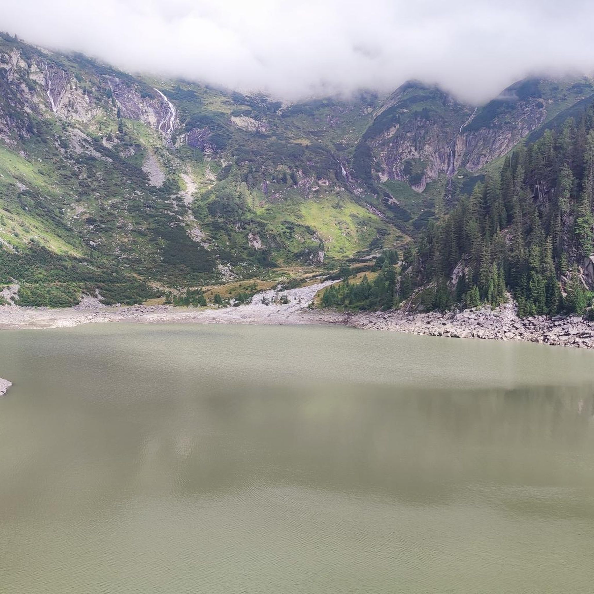
Mountaineering routes around Ausgleichsspeicher Gößkar are characterized by high-alpine terrain, significant elevation changes, and rocky paths leading to panoramic viewpoints. The region features a network of trails that navigate through rugged landscapes, often involving ascents to prominent peaks and passes. These routes provide access to the unique natural environment of the Austrian Alps, offering varied challenges for mountaineers.
Best mountaineering routes around Ausgleichsspeicher Gößkar
- The most popular mountaineering route is Gießener Hütte loop from Parkplatz Obere Thomanbaueralm 1677 m,…
Last updated: July 8, 2026
47
hikers
Moderate mountaineering route. Good fitness required. Easily-accessible paths. Suitable for all skill levels.
4
hikers
10.9km
07:16
940m
940m
Hard mountaineering route. Very good fitness required. Sure-footedness, sturdy shoes and alpine experience required.

Sign up for free
5.0
(4)
25
hikers
6.02km
04:41
740m
740m
Hard mountaineering route. Good fitness required. Sure-footedness, sturdy shoes and alpine experience required.
5.0
(4)
11
hikers
7.05km
04:23
740m
740m
Hard mountaineering route. Good fitness required. Sure-footedness, sturdy shoes and alpine experience required.
5.0
(1)
6
hikers
12.1km
06:28
1,020m
1,020m
Hard mountaineering route. Very good fitness required. Sure-footedness, sturdy shoes and alpine experience required.
Get access to more routes and recommendations from other explorers.
Sign up for free
Already have an account?
Our route recommendations are based on thousands of hikes, rides, and runs completed by other people on komoot.
Start today with a free account
Your next adventure awaits.
Login or Signup
Popular around Ausgleichsspeicher Gößkar
Tips from the Community

Super nice hut and an incredibly nice hut host!
0
0

Not very difficult, very varied, high alpine mountain hike in a unique landscape. However, you need to be in good shape - it is also possible to spend the night in the Arthur-von-Schmid-Haus. You definitely need to be sure-footed and not afraid of heights for the final climb over the southern ridge.
1
0

It used to be called the “women’s three-thousander”. “Easy entry to the three-thousander” is nicer and more accurate. Also works with sure-footed children. But it can also be rough if the weather isn't right. It is best to go from the A.-v.-Schmid-Haus (2-3 hours). The climb is steep at times and you have to be careful at the top for loose stones and rubble. You will be rewarded with a great view of the Hohe Tauern, over to Dachstein, Tennengebirge, Hochkönig, in the south the Karawanken and in front of you Hochalmspitze and Ankogel.
1
0
If you're intrepid, you can go swimming here when it's 10 degrees or less.
2
0
One of the most beautiful huts I know: beautifully situated, on Lake Dösener, at the end of a valley with a rock glacier. Nice hut owners (Bernd and Pia), swimming (if it's not too cold for you), good food, rocks reflected in the lake, beautiful view of the valley (at the edge with cell phone reception) and an easily doable 3000m peak (Säuleck) right in front of you. Recommended!
2
1

It's worth leaving early in the morning
0
0

The Arthur-von-Schmidt-Haus is an ideal starting point for further summit ascents, especially to the pillar corner (3000 m).
2
0
Words are almost at a loss here - the Arthur-von-Schmidt-Haus on Lake Dösen is so incredibly beautiful in the middle of a fantastic rock glacier landscape 🤗
2
0
Frequently Asked Questions
Are there mountaineering routes suitable for beginners around Ausgleichsspeicher Gößkar?
While the region is known for its high-alpine terrain, there are a few moderate routes available. For instance, the Gießener Hütte loop from Parkplatz Obere Thomanbaueralm 1677 m is a moderate 3.9-mile (6.2 km) trail that offers a good introduction to the area's beauty.
What are some challenging mountaineering routes for experienced climbers?
For experienced mountaineers, the region offers several difficult routes. The Gießener Hütte loop from Gießener Hütte is a demanding 5.2-mile (8.4 km) path with substantial elevation gain. Another challenging option is the Mallnitzer Scharte – Säuleck Summit loop from Gießener Hütte, which includes a summit ascent and typically takes over 7 hours.
Where can I park when planning a mountaineering trip to Ausgleichsspeicher Gößkar?
Many routes, such as the Gießener Hütte loop from Parkplatz Obere Thomanbaueralm 1677 m, start from designated parking areas like Parkplatz Obere Thomanbaueralm 1677 m. It's advisable to check the specific starting point of your chosen route for parking information.
What is the typical duration for mountaineering routes in this area?
The duration of mountaineering routes around Ausgleichsspeicher Gößkar varies significantly based on difficulty and length. You can expect routes to range from approximately 2.5 hours for shorter, moderate loops to over 7 hours for more challenging summit ascents.
Can I bring my dog on the mountaineering routes around Ausgleichsspeicher Gößkar?
Generally, dogs are permitted on hiking trails in the Austrian Alps, but they should always be kept on a leash, especially in alpine pastures or near wildlife. Always check local regulations, particularly if your route passes through protected areas or involves mountain huts, as specific rules may apply.
When is the best time of year for mountaineering around Ausgleichsspeicher Gößkar?
The best time for mountaineering in this high-alpine region is typically from late June to early October. During this period, snow has usually melted from higher elevations, and weather conditions are generally more stable. Always check current weather forecasts and trail conditions before heading out.
What gear should I bring for mountaineering in the Ausgleichsspeicher Gößkar region?
Given the high-alpine terrain, essential gear includes sturdy mountaineering boots, weather-appropriate layered clothing, rain protection, a hat, gloves, sunglasses, sun cream, sufficient water and food, a first-aid kit, and a map or GPS device. For more challenging routes, consider bringing a helmet and via ferrata equipment if applicable.
Are the mountaineering routes around Ausgleichsspeicher Gößkar accessible in winter?
Mountaineering in winter around Ausgleichsspeicher Gößkar is only recommended for highly experienced individuals with proper winter mountaineering equipment, including crampons, ice axe, and avalanche safety gear. Many routes become impassable due to deep snow and high avalanche risk. It's crucial to consult local avalanche reports and guides if considering winter ascents.
Are there any mountain huts or places to stop for refreshments along the routes?
Yes, the Gießener Hütte is a prominent mountain hut in the area, serving as a starting point or a stopover for several routes. It offers refreshments and overnight stays, providing a welcome break during longer tours.
What kind of scenery and wildlife can I expect to see on these mountaineering routes?
The routes offer breathtaking panoramic views of the Austrian Alps, rugged peaks, and pristine alpine lakes like Dösner Lake. You might spot typical alpine wildlife such as chamois, ibex, marmots, and various bird species, including eagles, in their natural high-alpine habitat.
Are there circular mountaineering routes available around Ausgleichsspeicher Gößkar?
Yes, many of the mountaineering routes in the region are designed as loops, allowing you to return to your starting point without retracing your steps. Examples include the Dösner Lake – Säuleck Summit (3,086 m) loop from Dösener See and the Säuleck Summit – Junction to Mallnitzer Scharte loop from Dösener See.
What do other mountaineers enjoy the most about mountaineering in Ausgleichsspeicher Gößkar?
The area is highly rated by the komoot community, with an average score of 5.0 stars. Reviewers often praise the stunning high-alpine scenery, the challenging yet rewarding ascents to prominent peaks, and the well-maintained trails that lead to impressive summit views.
Most popular routes around Ausgleichsspeicher Gößkar

Get inspired with the komoot mobile app


Explore more
Browse the best Mountain Hikes & Routes in other regions.
