The best walks and hikes around Soløyvannet
4.6
(672)
4,212
hikers
137
hikes
Hiking around Soløyvannet offers diverse trails through varied landscapes, including paths along rivers and through woodlands. The region is characterized by its proximity to mountains and fjords, with notable features like Skaugtuva Summit providing panoramic views. Hikers can also explore tranquil spots such as Tussvatnet Lake and viewpoints overlooking the Sandjord lakes, presenting wide, open vistas.
Best hiking trails around Soløyvannet
- The most popular hiking route is Trail Along the River – Skaugtuva Summit loop from Mørkved, a 9.3 miles (15.0 km) trail that takes 4 hours 42 minutes to complete. This moderate route includes an ascent to Skaugtuva Summit, offering expansive views.
- Another top favourite among local hikers is Wooden Bridge Over River – View of the Waterfall loop from Mørkved, an easy 3.1 miles (5.0 km) path. This route features a wooden bridge and views of a waterfall, suitable for a shorter outing.
- Local hikers also love the Trail to Tussvatnet from Arlia, a 3.9 miles (6.2 km) trail leading through varied terrain to Tussvatnet Lake, often completed in about 1 hour 41 minutes.
- Hiking around Soløyvannet is defined by diverse trails, mountains, fjords, and lakes, with options ranging from easy, accessible paths to more challenging routes with significant elevation gain. The network offers options for different ability levels.
- The routes in Soløyvannet are highly rated by the komoot community with an average score of 4.5 stars from over 600 reviews. More than 3,800 hikers have used komoot to explore Soløyvannet's varied terrain.
Last updated: June 27, 2026
4.5
(2)
7
hikers
Moderate hike. Good fitness required. Easily-accessible paths. Suitable for all skill levels.
4.3
(3)
8
hikers
Easy hike. Great for any fitness level. Easily-accessible paths. Suitable for all skill levels.

Sign up for free
8
hikers
Moderate hike. Good fitness required. Easily-accessible paths. Suitable for all skill levels.
5
hikers
5.69km
01:39
150m
150m
Easy hike. Great for any fitness level. Easily-accessible paths. Suitable for all skill levels.
5.0
(2)
21
hikers
6.23km
01:41
80m
80m
Easy hike. Great for any fitness level. Easily-accessible paths. Suitable for all skill levels.
Get access to more routes and recommendations from other explorers.
Sign up for free
Already have an account?
Our route recommendations are based on thousands of hikes, rides, and runs completed by other people on komoot.
Start today with a free account
Your next adventure awaits.
Login or Signup
Tips from the Community

On this scenic trail, the water is your constant companion. A recipe for a lovely, relaxing hike.
0
0

On your way to the lake you will cross this bridge.
0
0
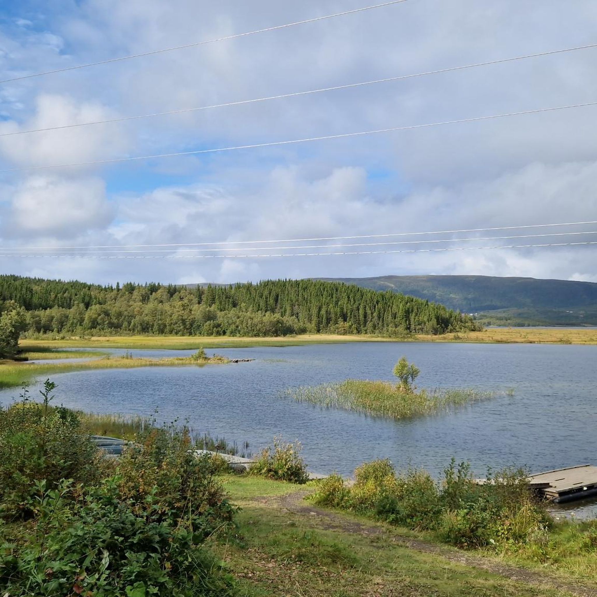
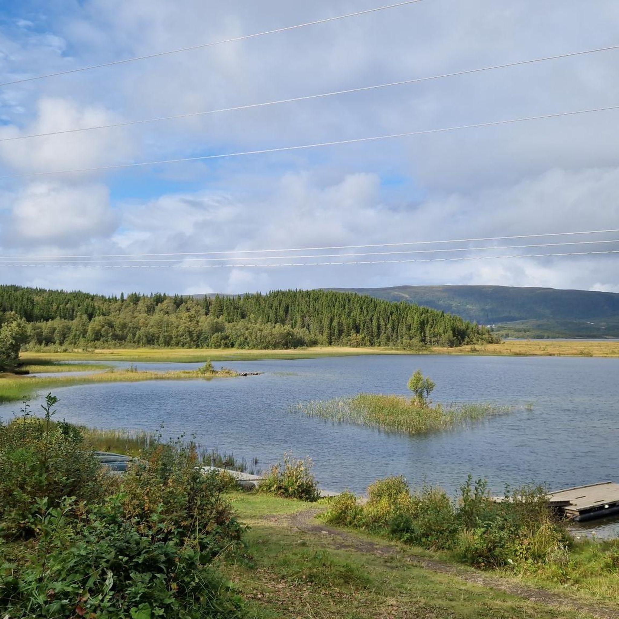
Tussvatnet lake is a quiet water body where you can enjoy nature and take amazing pictures.
0
0
Enjoy this beautiful path through the woods, where you breathe pure nature.
0
0
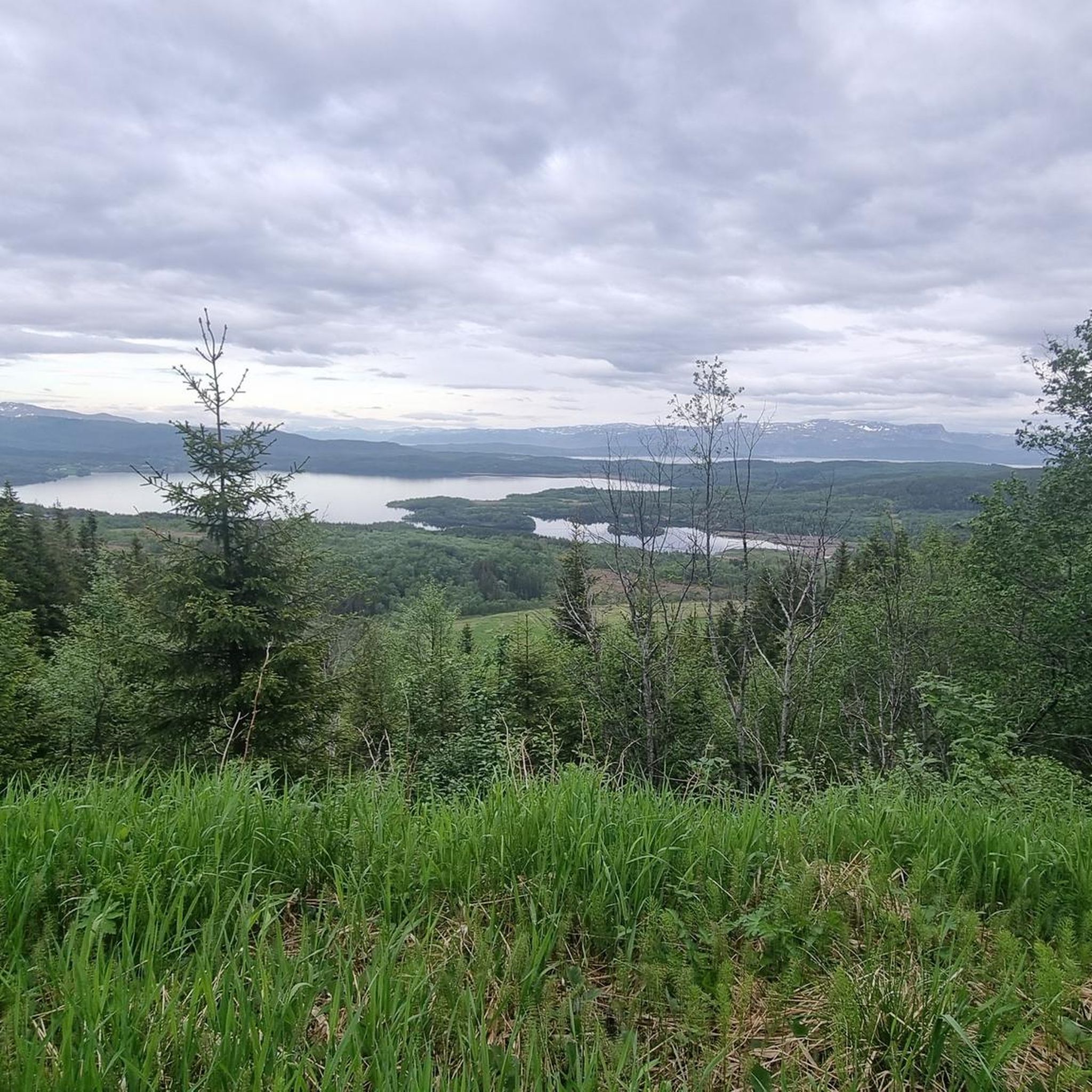
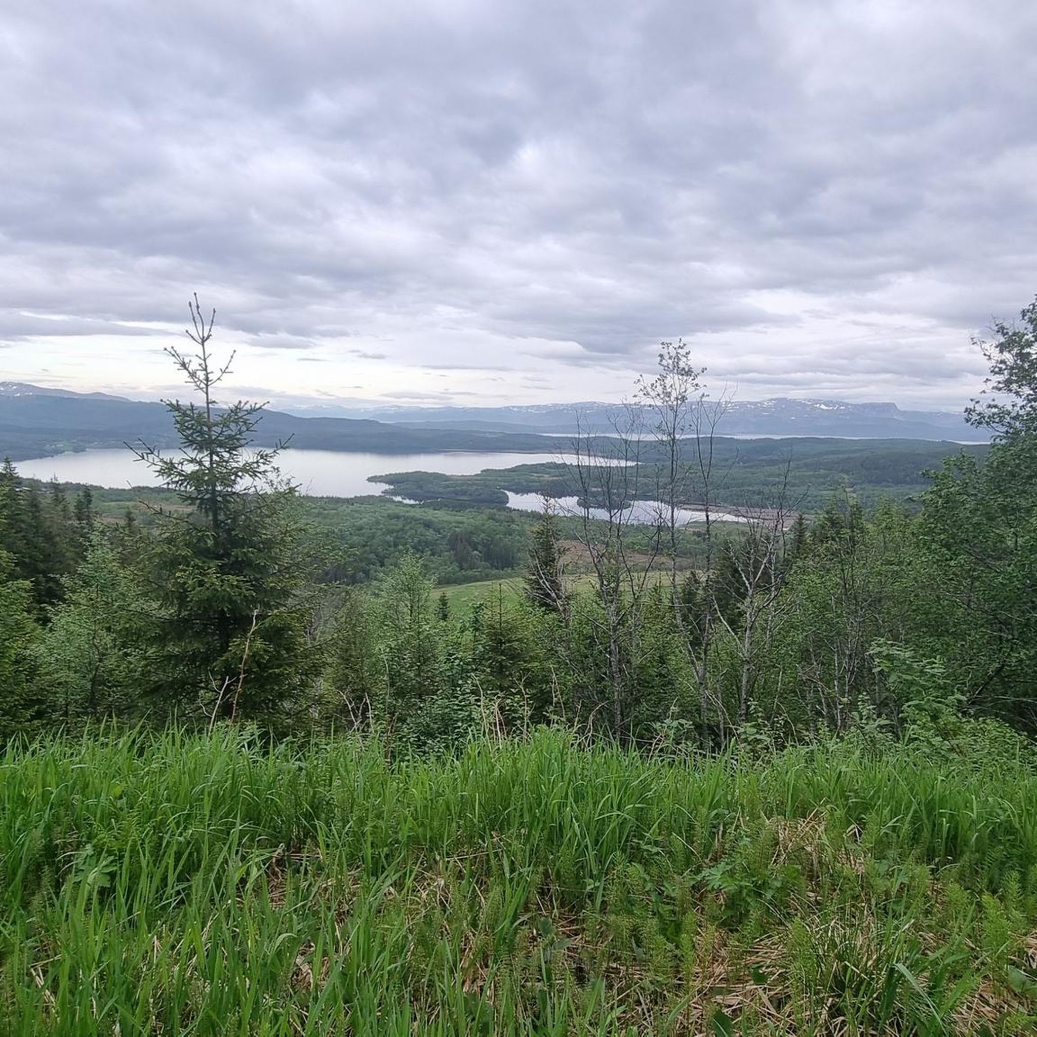
Skaugtuva Summit is a rewarding hike that delivers stunning panoramic views of the surrounding mountains and fjords. It’s an excellent spot to experience Northern Norway’s dramatic landscapes and feel the thrill of reaching a serene high point.
0
0

Great little viewpoint over the Sandjord lakes: wide, open landscape with a real sense of space.
0
0
Frequently Asked Questions
How many hiking trails are available around Soløyvannet?
Soløyvannet offers a wide variety of hiking experiences, with over 130 trails recorded. These range from easy strolls to more challenging ascents, ensuring options for all fitness levels.
Are there easy hiking options suitable for families or beginners?
Yes, Soløyvannet has many accessible paths. Nearly half of the trails, 59 to be exact, are rated as easy. An excellent option is the Wooden Bridge Over River – View of the Waterfall loop from Mørkved, which is 3.1 miles (5.0 km) long and features a scenic wooden bridge and a waterfall view.
What kind of views can I expect on the trails around Soløyvannet?
Hikers can enjoy diverse and stunning views. The ascent to Skaugtuva Summit, for instance, offers panoramic vistas of the surrounding mountains and fjords, characteristic of Northern Norway. You can experience this on the Trail Along the River – Skaugtuva Summit loop from Mørkved. Additionally, there's a great viewpoint overlooking the Sandjord lakes, providing a sense of wide, open landscapes.
Are there any circular hiking routes in the area?
Yes, many trails around Soløyvannet are designed as loops, offering varied scenery without retracing your steps. For example, the Wooden Bridge Over River loop from Mørkved is an easy 5.7 km circular route.
Can I hike to a lake in Soløyvannet?
Absolutely. Tussvatnet Lake is a tranquil spot close to Soløyvannet, perfect for enjoying nature. You can reach it via the Trail to Tussvatnet from Arlia, an easy 3.9-mile (6.2 km) route.
What are the more challenging hiking options around Soløyvannet?
For those seeking a greater challenge, Soløyvannet offers routes with significant elevation gain. While most trails are easy to moderate, there are 7 difficult routes available. More demanding routes in the broader Bodø & Salten region can involve up to 3,000 feet of elevation gain over five hours, catering to experienced hikers.
What do other hikers say about the trails in Soløyvannet?
The trails in Soløyvannet are highly regarded by the komoot community, holding an average rating of 4.5 stars from over 600 reviews. Hikers frequently praise the diverse landscapes, from river paths to woodland trails, and the rewarding views from summits like Skaugtuva.
Is Soløyvannet a good destination for nature photography?
Yes, the area is very picturesque. With diverse landscapes including lakes like Tussvatnet, panoramic summit views, and the dramatic natural environment of the broader Bodø & Salten region featuring steep mountains and turquoise seas, there are ample opportunities for stunning nature photography.
Are there any trails that feature waterfalls?
Yes, you can find trails that lead to scenic waterfalls. The Wooden Bridge Over River – View of the Waterfall loop from Mørkved is an easy route that specifically highlights a waterfall, making it a great choice for those interested in this natural feature.
What kind of natural environment defines the Soløyvannet area?
Soløyvannet is situated within the stunning Bodø & Salten region, known for its dramatic natural environment. This includes steep mountains, vibrant turquoise seas, untouched wilderness, and pristine chalk-white beaches. The area offers a mix of river-side paths, woodland trails, and ascents to summits with expansive views.
Are there other notable hiking areas or national parks nearby?
The broader Bodø & Salten region is a hiking paradise. It encompasses five national parks: Rago, Láhko, Junkerdal, Saltfjellet-Svartisen, and Sjunkhatten, offering diverse landscapes, unique plant life, and thriving wildlife. For more information on hiking in the wider region, you can visit visitbodo.com.
Is there a trail that combines river views with a summit ascent?
Yes, the Trail Along the River – Skaugtuva Summit loop from Mørkved is a moderate 9.3-mile (15.0 km) route that perfectly combines a relaxing path along a river with a rewarding ascent to Skaugtuva Summit, offering expansive views.
Most popular routes around Soløyvannet

Get inspired with the komoot mobile app


Explore more
Browse the best Hikes in other regions.
