The best road cycling routes around Langley
4.6
(38)
715
riders
20
rides
Road cycling routes around Langley offer a diverse landscape, characterized by scenic farmlands, river views, and numerous parks. The region features a mix of relatively flat sections, particularly along the Fraser River, and areas with small climbs for varied terrain. Dedicated cycling infrastructure, including multi-use paths and greenways, supports a range of road cycling experiences. This makes Langley suitable for both leisurely rides and more challenging routes.
Best road cycling routes around Langley
- The most popular road cycling route is…
Last updated: October 8, 2026
4.9
(10)
154
riders
52.6km
02:10
290m
290m
Moderate road ride. Good fitness required. Mostly well-paved surfaces and easy to ride.
4.0
(5)
87
riders
39.7km
01:41
210m
210m
Moderate road ride. Great for any fitness level. Some segments of this route may be unpaved and difficult to ride.

71
riders
Easy road ride. Great for any fitness level. Mostly well-paved surfaces and easy to ride.
5.0
(4)
52
riders
Moderate road ride. Good fitness required. Mostly well-paved surfaces and easy to ride.
5.0
(1)
13
riders
Easy road ride. Great for any fitness level. Mostly well-paved surfaces and easy to ride.
Get access to more routes and recommendations from other explorers.
Already have an account?
Our route recommendations are based on thousands of hikes, rides, and runs completed by other people on komoot.
Start today with a free account
Your next adventure awaits.

Tips from the Community

St. George's Anglican Church in Fort Langley, BC, is a historic Carpenter Gothic-style church established in 1859 and consecrated in 1901. Located at 9160 Church Street, it remains an active parish known for its inclusive community and heritage architecture.
0
0

Quiet, bucolic, meandering little country road - Telegraph Trail. Ride it either way on a trip around the picturesque Fort Langley Area.
0
0

Small town with lots of cute small shops. Not to be confused with the City of Langley (uninteresting to cyclists) or Langley Township (with lots of country roads through farmland).
0
0
The Golden Ears Bridge is a six-lane extradosed bridge in Metro Vancouver, British Columbia on Fraser River, connecting Langley on the south side with Pitt Meadows and Maple Ridge on the north side. The bridge opened on 16 June 2009.
0
0
The Pitt River Bridge is a cable-stayed bridge that spans the Pitt River between Port Coquitlam and Pitt Meadows in British Columbia, Canada.
0
0
Saba cafe is great for a coffee stop, and snacks, breakfast, or lunch, but they're not open on Mondays. Wendell's is very good, but typically very busy and can be a long wait. Little Donkey has great burritos!
0
0
Picturesque village centre with a number of great cafes for a coffee stop, and casual lunch spots for something more substantial.
0
0
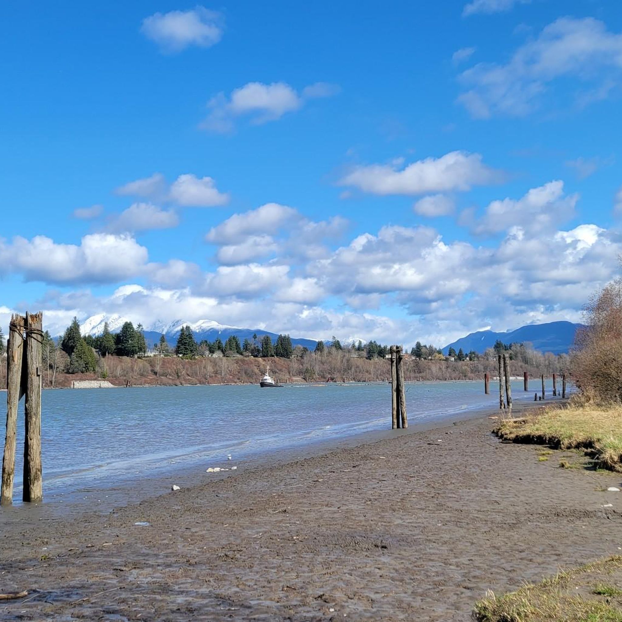
Beautiful and usually quiet road through the park, parallel to the river, that makes a great approach to, or sortie from, Fort Langley.
0
0
Frequently Asked Questions
How many road cycling routes are available in Langley?
Langley offers a diverse selection of over 20 road cycling routes, catering to various skill levels. These routes explore scenic farmlands, river views, and numerous parks, providing a rich cycling experience.
Are there road cycling routes suitable for beginners or families in Langley?
Yes, Langley has 14 easy road cycling routes perfect for beginners or family outings. These routes often feature relatively flat sections, particularly along the Fraser River and through parks, making for a comfortable ride. The Derby Reach Regional Park – Rest Stop loop from Hope Redwoods Nature Area is an excellent easy option, offering natural beauty.
What kind of terrain can I expect on road cycling routes in Langley?
Langley's road cycling routes offer varied terrain. You'll find many relatively flat sections, especially along the Fraser River and through farmlands. However, areas like Glen Valley also include small climbs, and some routes provide more challenging options for those seeking greater elevation. The region's dedicated cycling infrastructure, including multi-use paths and greenways, ensures a smooth ride.
Are there any long-distance road cycling routes in Langley?
For cyclists looking for longer distances, Langley offers several routes over 50 km. The Telegraph Trail – Derby Reach Regional Park loop from Walnut Grove Secondary School is a moderate 60.3 km route, providing an extended ride through the area's beautiful landscapes.
What do other road cyclists enjoy most about cycling in Langley?
The road cycling routes in Langley are highly rated by the komoot community, with an average score of 4.5 stars from over 20 reviews. Cyclists often praise the scenic river views, peaceful farmlands, and the well-maintained green spaces within regional parks that define the riding experience.
Are there any scenic viewpoints or attractions along the road cycling routes?
Absolutely! Many routes offer picturesque views, particularly along the Fraser River. The Derby Reach Regional Park – Glen Valley Viewpoint loop from 201 St (NB) at 96 Ave specifically highlights the Glen Valley Viewpoint. Additionally, the historic village of Fort Langley, home to the Fort-to-Fort Trail, is a charming stop with cafes and shops.
Can I find loop routes for road cycling in Langley?
Yes, many of Langley's road cycling routes are designed as loops, allowing you to start and end at the same point. Popular loop options include the Derby Reach Regional Park – Rest Stop loop from Walnut Grove, which navigates through the scenic Derby Reach Regional Park, and the Tynehead Trail – Derby Reach Regional Park loop from Hope Redwoods Nature Area.
Are there any cafes or places to stop for refreshments along the routes?
Yes, the historic village of Fort Langley is a popular starting point or stop for cyclists, offering a variety of cafes and shops. Additionally, some routes, particularly those in South Langley and around Campbell Valley Park, incorporate stops at local wineries, combining your ride with a chance to experience local viticulture.
What are some notable parks for road cycling in Langley?
Langley is home to several parks ideal for road cycling. Campbell Valley Park offers a 27 km loop through meadows and forests, while Derby Reach Regional Park is a popular destination for scenic loops along the Fraser River. The Nicomekl Floodplain also features multi-use pathways like the Rotary Floodplain Trail, connecting to other nature trails.
Are there any challenging road cycling routes in Langley?
While many routes are relatively flat, Langley does offer options for cyclists seeking more elevation. Areas like Glen Valley include small climbs, and local cyclists mention routes with 'nice hills' in areas like Zero Avenue, providing a good challenge for those looking for bigger ascents.
Is there public transport access to road cycling trails in Langley?
Langley has a developing network of cycling infrastructure, including multi-use paths and greenways. While specific public transport connections to trailheads may vary, the city and township are working on improving accessibility to their cycling networks. It's advisable to check local transit schedules for routes serving areas near your chosen starting point.
Where can I find parking near road cycling routes in Langley?
Many regional parks and trailheads in Langley, such as Derby Reach Regional Park and Campbell Valley Park, offer designated parking areas for visitors. The historic village of Fort Langley also provides parking options, serving as a convenient starting point for routes like the Fort-to-Fort Trail.
Most popular attractions around Langley

Get inspired with the komoot mobile app


Explore more
Browse the best Road cycling routes in other regions.
