The best walks and hikes in Armstrong County
5.0
(9)
44
hikers
19
hikes
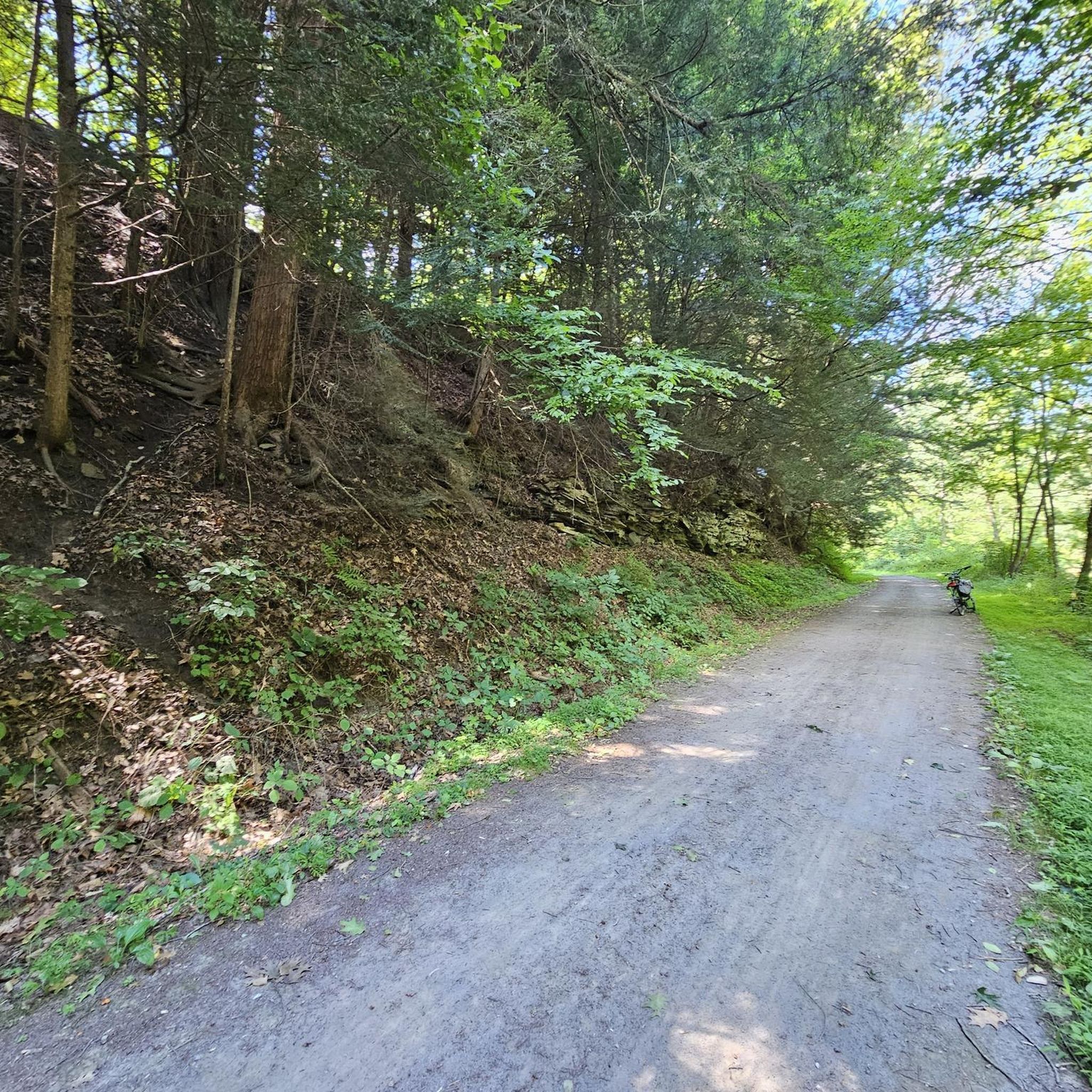
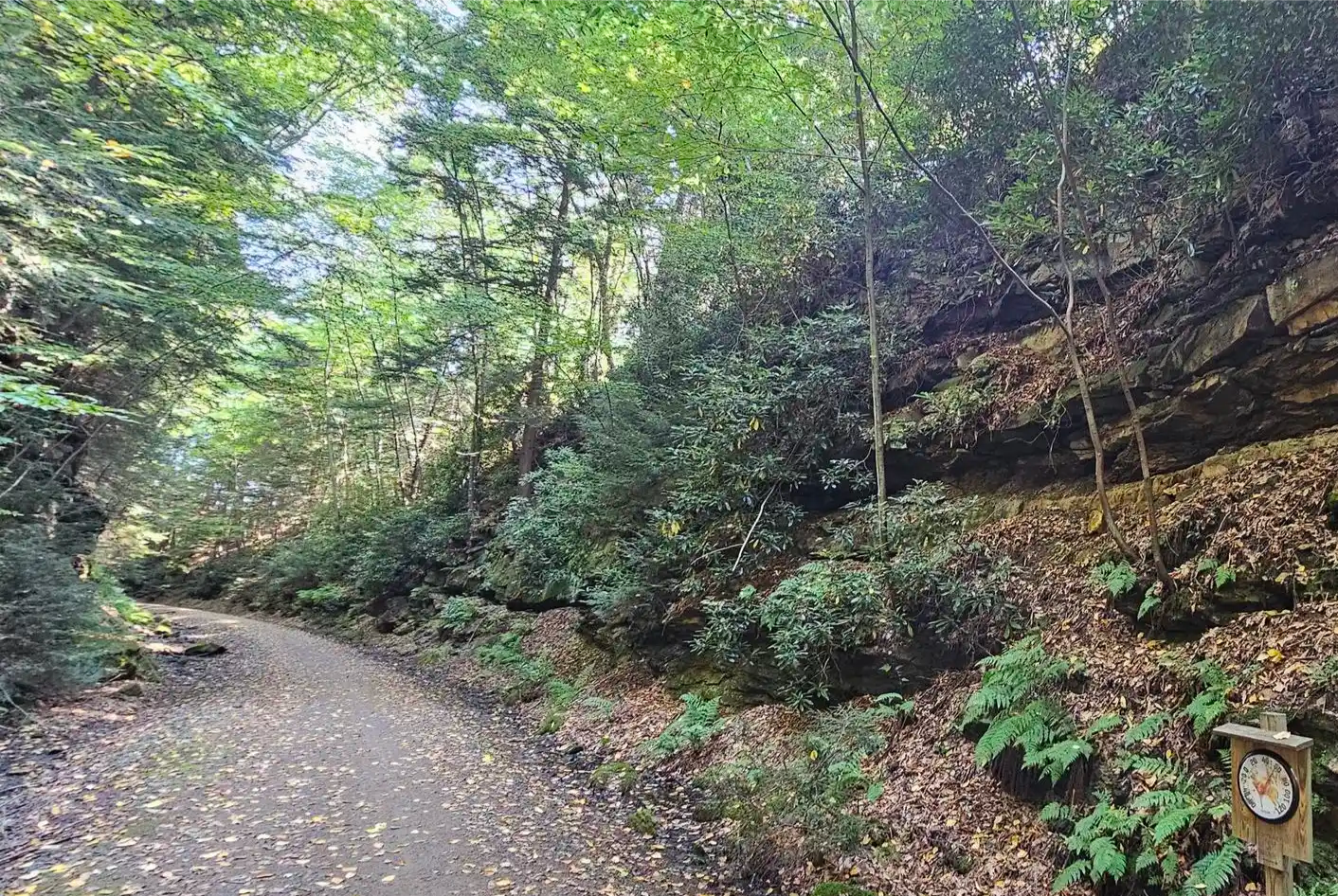
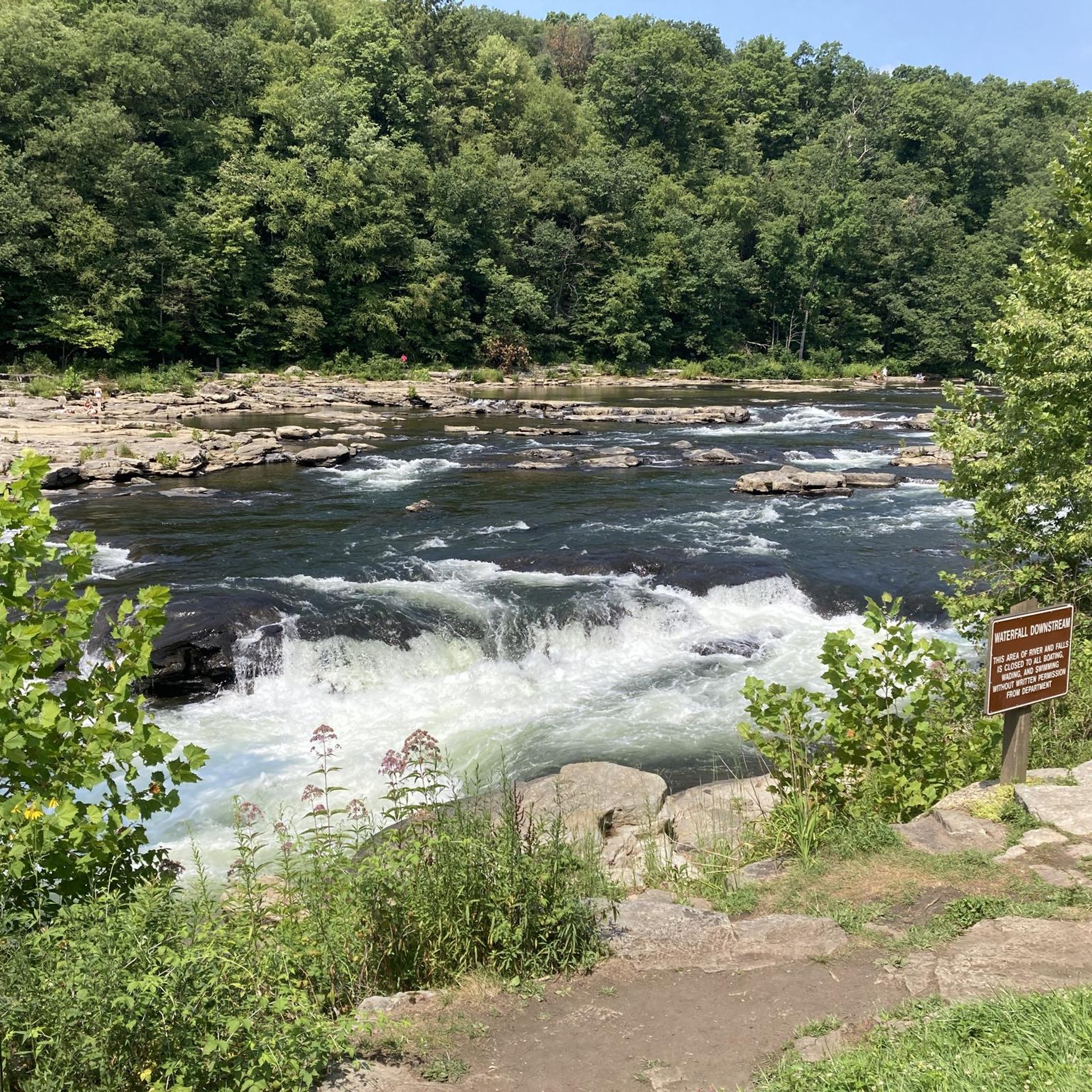
Hikes in Armstrong County PA explore the rolling hills and steep-sided valleys of the Western Allegheny Plateau. The landscape is characterized by dense forests and major waterways, including the Allegheny and Kiskiminetas Rivers. Trails in the region range from flat, crushed-stone paths along riverbanks to more rugged routes through stream-fed valleys.
Best hiking trails in Armstrong County
- The most popular hiking route is Baker Trail — Mahoning Creek Lake, a 11.9 mile (19.1 km) trail that takes around 6 hours 23 minutes to complete. This difficult route follows a section of the long-distance Baker Trail through forest and along Mahoning Creek Lake.
- Another top favourite among local hiking enthusiasts is Roaring Run Trail — Kiskiminetas River Corridor, a moderate 6.8 mile (11.0 km) path. The trail follows the Kiskiminetas River on a relatively flat course.
- Local hiking enthusiasts also love the Baker Trail — Crooked Creek Lake Recreation Area, a 6.1 mile (9.7 km) trail leading through the Crooked Creek Lake Recreation Area, often completed in about 3 hours 12 minutes.
- Hiking in Armstrong County is defined by its winding river corridors, dense woodlands, and rolling plateau terrain. The trail network provides options for different ability levels, from easy riverside walks to more challenging forest hikes.
- The routes in Armstrong County are highly rated by the komoot community with an average score of 5.0 stars from 10 reviews. More than 40 hikers have used komoot to explore Armstrong County's varied terrain.
Last updated: October 10, 2026
3
hikers
4.93km
01:18
60m
0m
The Roaring Run to Rock Furnace Trail is a delightful easy hike that winds through lush woodlands and along the scenic Roaring Run Creek. You'll traverse a well-packed path, enjoying the sounds of cascading water and the sight of wildflowers, especially trillium in spring. The route offers picturesque views of the creek and the Kiskiminetas River, with the impressive 72-foot cable suspension bridge being a memorable landmark.
Planning your visit is straightforward, as the trail is open year-round and offers convenient parking at the main entrance. This makes it an excellent choice for a family friendly outing. You'll find amenities like a portajohn and picnic shelter, perfect for a leisurely stop. For the best experience, consider an early morning or late afternoon start to enjoy the tranquility and natural beauty.
Beyond the natural beauty, the Rock Furnace hiking trails are steeped in history. You'll encounter the fascinating stonework remains of the Biddle Iron Furnace, which operated in the 19th century, connecting you to the region's industrial past. This blend of easy hiking, scenic viewpoints, and historical significance makes it a standout among Roaring Run trails.
5.76km
01:43
110m
110m
The Woodlands, Wetlands, and Scouts Loop offers a delightful escape into nature, winding through peaceful woodlands and vibrant wetlands. You'll traverse boardwalks over marshy areas, discover the serene Lily Pond, and even pass by Rachel Carson Falls, making for a visually engaging experience. The diverse ecosystems within Harrison Hills Park provide a constant change of scenery, perfect for those who appreciate varied natural features.
Planning your visit is straightforward, with ample parking available within Harrison Hills Park and no fees or permits required. This trail is considered dog-friendly (on leash) and is an excellent choice for families, especially with its manageable 3.6-mile (5.8 km) distance. While enjoyable year-round, spring and fall are particularly pleasant, though winter hiking is an option if you're prepared for potential mud or ice.
Rated as moderate, this 1 hour and 42 minute hike involves a gentle 368 feet (112 metres) of elevation gain, making it accessible for many. The blend of natural features and accessibility, including boardwalks and the chance to spot wildlife, makes it a notable trail in Allegheny County, Pennsylvania. It's a great way to experience the natural beauty of the region without committing to a strenuous all-day adventure.

49.5km
12:43
210m
240m
Hike the difficult 30.7-mile Armstrong Trail along the Allegheny River, featuring industrial relics and varied surfaces.
5.0
(6)
18
hikers
8.18km
02:25
150m
150m
Scouts Trail offers a delightful escape into nature, winding through the scenic landscapes of Allegheny County. You'll discover the peaceful Rachel Carson Falls, where the sound of water provides a calming backdrop, and later, the serene Lily Pond in Harrison Hills Park, perfect for a quiet moment. The path itself is a mix of natural surfaces, providing a pleasant and engaging experience for hikers.
This moderate 5.1-mile (8.2 km) hike involves 489 feet (149 metres) of elevation gain and typically takes around 2 hours and 24 minutes to complete. Parking is usually available at the trailhead, but it's wise to arrive early on busy days. The trail is best enjoyed in spring or fall for comfortable temperatures and vibrant foliage, but it's accessible year-round.
Located within Harrison Hills Park, this trail is a local favorite for its accessibility and natural beauty. It provides a fantastic opportunity to immerse yourself in the local ecosystem, offering glimpses of diverse flora and fauna. The trail's highlights, like the waterfall and pond, make it a memorable outing for families and solo adventurers alike.
5
hikers
10.6km
02:47
90m
90m
The Butler-Freeport Community Trail offers a pleasant journey through a scenic wooded valley, tracing Little Buffalo Creek and Buffalo Creek before reaching the Allegheny River at Freeport. This predominantly flat route, made up of crushed limestone, dirt, and asphalt, meanders through forests and farmlands, revealing charming historical remnants like old stone foundations and brick kilns. You'll also encounter small dams and delightful waterfalls, making it a visually engaging experience for hikers of all levels.
This moderate 6.6-mile (10.6 km) hike involves a gentle 302 feet (92 metres) of elevation gain and typically takes around 2 hours and 47 minutes. The trail is well-marked with mile and half-mile indicators, and restrooms are available seasonally from May to October. Dogs are welcome but must be leashed. With frequent access points along its 20-mile length, you can easily tailor your outing.
As a converted rail-trail, the route follows the corridor of Butler County's first railroad, established in 1871, offering a consistent, gentle grade. This historical significance is visible in the 19th and early 20th-century industrial remnants found along the way. It's a multi-use path, popular for walking, jogging, and cycling, providing a low-impact option for enjoying the region's natural beauty and history.
5.0
(1)
3
hikers
11.0km
02:48
30m
30m
The Roaring Run Trail offers a delightful journey through natural beauty and history, tracing the Kiskiminetas River. You'll enjoy extensive stands of wildflowers and stately hardwoods, with picturesque views of the river and Flat Run Falls, especially after a good rain. The initial three miles are a breeze on a level, crushed limestone surface, but be ready for some steeper climbs later on, adding a bit of challenge to this otherwise gentle route.
This moderate 6.8-mile (11.0 km) hike, with a modest 103 feet (32 metres) of elevation gain, typically takes around 2 hours and 48 minutes to complete. Parking is available at various access points along the Trans Allegheny Trails system; consider an early start to beat any crowds. The trail is particularly stunning in spring for wildflowers and in autumn for vibrant leaf displays, making these ideal times to visit.
Beyond the natural scenery, the Roaring Run Trail is steeped in history. You'll walk alongside remnants of the Main Line Canal, with visible traces of canal locks from the 1820s to 1860s, and even parts of the Pennsylvania Railroad corridor. The area, maintained by the Roaring Run Watershed Association, has largely recovered from past mining scars, showcasing a successful blend of recreation and ecological restoration.
3
hikers
4.57km
01:14
60m
60m
The Rock Furnace Trail offers a delightful journey through natural beauty and local history, tracing the scenic Roaring Run Creek. You'll be treated to continuous water views, the sound of small waterfalls, and the unique sight of the 72-foot suspension bridge. Keep an eye out for the impressive "Camel Rock" and the historical Briddle Iron Furnace remains, which add character to this easy route.
Planning your visit is straightforward; the trail is accessible from Brownstown Road and is dog-friendly, so your leashed canine companions can join. While generally easy, be prepared for potentially muddy conditions after rain. The trail is beautiful in any season, with spring wildflowers and
1
hikers
9.75km
03:12
110m
110m
Hike the moderate 6.1-mile Baker Trail in Crooked Creek Lake Recreation Area, gaining 364 feet over varied terrain.
19.1km
06:23
210m
210m
Tackle the difficult 11.9-mile Baker Trail near Mahoning Creek Lake, featuring 700 feet of elevation gain and diverse scenery.
6.70km
01:42
10m
10m
The Apollo's Kiski Riverfront Trail offers a delightful, easygoing hike along the Kiskiminetas River, perfect for a relaxed afternoon. You'll trace a path built on a historic railroad bed, enjoying views of the water and passing through a mix of open shade, residential areas, and industrial landscapes. The terrain is mostly fine crushed limestone, making for a smooth journey, though some sections in Apollo incorporate pavement and gravel. It's a great option for families or anyone seeking a gentle riverside walk.
Planning your visit to this trail is straightforward, as it provides convenient access to downtown Apollo, where you can explore local shops and historical sites. While the trail itself is largely flat and accessible, it connects to the broader Roaring Run Trail system, which includes a notably steep 1.0-mile section near Edmon if you're looking for more challenge. For the main Apollo's Kiski Riverfront Trail, simply head to Apollo and enjoy the riverside path.
This trail isn't just a pleasant walk; it's also a piece of history, following the route of a former M-Line Railroad bed and the Pennsylvania Main Line Canal towpath. It's an easy 4.2-mile (6.7 km) hike with only 42 feet (13 metres) of elevation gain, typically taking about 1 hour and 41 minutes. The trail is also part of the extensive Trans Allegheny Trails System, highlighting its role in a larger network of recreational paths and offering connections to other adventures.
Get access to more routes and recommendations from other explorers.
Already have an account?
Our route recommendations are based on thousands of hikes, rides, and runs completed by other people on komoot.
Start today with a free account
Your next adventure awaits.
Popular around Armstrong County







Other adventures in Armstrong County

Tips from the Community

Spring fed pond? I didn't see no damn pond. I'll go back tomorrow.
0
0
I don't know who this Scott guy is, but I used to live apollo, it's alright got some cool bars, big antique shop, good diner, decent restaurants, nice thrift shop, stop by get drunk, buy some shit and go for a hike, pass out, wake up, eat breakfast, there you had a vacation and you can bullshit to the guys at work on Monday.
0
0
There's a squirrel who resides about 500 yards north of the covered bridge. His name is Rodriguez, don't worry eastern Gray Squirrel, he's cool, he just eyeballs you from that big hemlock.
0
0

The Laneville Trailhead is the southernmost point of the Butler-Freeport Community Trail. This location offers a parking lot and convenient access to the Buffalo River to cool down after a hike.
0
0

The Butler-Freeport Community Trail spans 20 miles, winding through a scenic wooded valley along Little Buffalo Creek to Buffalo Creek and then to the Allegheny River at Freeport. The trail is a mix of surfaces, mainly crushed limestone, and well-placed mile and .5 mile markers along the way. Restrooms are available along the route and are open seasonally, from May to October. As you ride the trail, you'll encounter charming scenery, including old stone foundations, remains of brick kilns, small dams, and delightful waterfalls.
0
0
Buffalo Creek begins in Hartley Township, flowing eastward between Buffalo Mountain and Branch Mountain. It depends, though, on Gooseneck and Buffalo Gap. Its name origin is unclear, as buffalo were almost nonexistent in the state at the time it was named.
0
0
This trailhead is the southernmost point of the trail. There is a parking lot here with access to Buffalo River. The river is a great spot to rest and recharge in a beautiful setting before heading back on the trail if you are riding an out-and-back. Alternatively, you can stage another vehicle here if you want to plan a shorter ride.
0
0

While the Baker Trail is a much longer route stretching across Pennsylvania, its segment near Mahoning Creek Lake provides a taste of its allure. This section of the trail is known for its serene atmosphere, winding through wooded areas and offering glimpses of the lake.
0
0
Frequently Asked Questions
Are dogs allowed on the hiking trails in Armstrong County?
Yes, many trails in Armstrong County are dog-friendly, but it's always best to keep your dog on a leash. The trails within the Roaring Run Recreation Area and along the Armstrong Trail are popular choices for dog walkers. Always check local signage at trailheads for specific regulations.
Are there any easy, family-friendly hikes in the area?
Absolutely. For a gentle and scenic walk, consider the Apollo's Kiski Riverfront Trail. It's a relatively flat, 4.2-mile (6.7 km) path along the river that's great for all ages and abilities.
Can I see any waterfalls while hiking in Armstrong County?
Yes, you can. The region is home to the picturesque Buttermilk Falls, which is a highlight for many local hikers. You can also find smaller cascades and scenic water features along the trails in the Roaring Run Recreation Area, particularly on the Rock Furnace Trail.
What are some good circular hikes in Armstrong County?
For a great loop trail, the Harrison Hills County Park loop is an excellent option. This moderate 5-mile (8.2 km) route takes you through a beautiful park known for its scenic overlooks and well-maintained paths.
What do other hikers enjoy most about the trails in Armstrong County?
The trails in Armstrong County are highly rated by the komoot community, with an average score of 5.0 stars. Hikers often praise the region's serene river corridors, dense woodlands, and the variety of trails that cater to different skill levels.
How can I experience the region's industrial history while hiking?
The Armstrong Trail, a rail trail built on a former railroad corridor, is the best way to see remnants of the area's industrial past. As you hike, you'll see historic railroad artifacts set against the natural beauty of the Allegheny River.
How do the Baker Trail and the Armstrong Trail compare?
They offer very different experiences. The Armstrong Trail is a 52.5-mile relatively flat, crushed-stone rail trail ideal for easy hiking and biking along the river. In contrast, the Baker Trail is a much more rugged, 134-mile long-distance hiking trail that traverses forests and farmlands, offering a more challenging backcountry adventure.
What should I know about hiking in the Roaring Run Recreation Area?
The Roaring Run Recreation Area is a local favorite known for its rugged beauty. Trails here, like the popular Roaring Run Trail, follow a pristine, stream-fed valley with large boulders and a dense forest canopy. It offers a more intimate and challenging experience compared to the wider rail trails.
Are there any long-distance hiking options available?
Yes, the main option for long-distance hiking is the Baker Trail. A challenging section of this trail can be experienced on the Baker Trail — Mahoning Creek Lake route, which covers nearly 12 miles (19 km) through forest and along the lake.
Are the hiking trails in Armstrong County free to use?
Yes, the vast majority of hiking trails in Armstrong County, including the Armstrong Trail, Baker Trail, and those in the Roaring Run Recreation Area, are free and open to the public. Parking at the trailheads is also typically free of charge.
Where can I find parking for the trails?
Most major trails have designated parking areas at their trailheads. For example, the Spring-Fed Pond with Cave – Rock Furnace Trail loop from Apollo starts from a convenient lot. The Roaring Run Trailhead and various access points along the Armstrong Trail also offer ample parking.
What kind of terrain should I expect on the trails?
Armstrong County is part of the Western Allegheny Plateau, so expect varied terrain. You'll find everything from flat, easy rail trails along the Allegheny and Kiskiminetas Rivers to more strenuous hikes with significant elevation changes through steep, narrow valleys and across broad ridges.
Most popular attractions in Armstrong County

Get inspired with the komoot mobile app


Didn’t find what you were looking for?
Check out more Hikes throughout Armstrong County below and find the perfect route in your destination.
Explore more
Browse the best Hikes in other regions.
