The best walks and hikes in Fairfield County
4.5
(45)
477
hikers
12
hikes
Hiking in Fairfield County, Connecticut, offers diverse outdoor experiences across its parklands and natural areas. The region features a mix of gentle rolling hills, extensive forests, wetlands, and paths alongside rivers and lakes. Hikers can explore varied landscapes, from established routes within nature preserves to trails that traverse more open areas and ridge systems. The terrain includes woodlands, rock formations, and water features such as the Mianus River and Lake Mohegan.
Best hiking trails in Fairfield County
- The most popular hiking route is Homesite, Meadows, and Ridge Trail Loop, a 2.5 miles (4.0 km) trail that takes 1 hour 6 minutes to complete. This easy route features gentle elevation changes within a metro park setting.
- Another top favourite among local hikers is Clear Creek Metro Park loop from Lake Ramona Dam, a moderate 8.1 miles (13.1 km) path. This trail offers significant elevation gain through varied terrain in Clear Creek Metro Park.
- Local hikers also love the Sycamore Creek Park Loop, a 1.1 miles (1.8 km) trail leading through flat parkland, often completed in about 28 minutes.
- Hiking in Fairfield County is defined by its metro parks, creek valleys, and lake-side paths. The network offers options for different ability levels, from easy strolls to more challenging, longer routes.
- The routes in Fairfield County are highly rated by the komoot community with an average score of 4.4 stars from over 40 reviews. More than 400 visitors have used komoot to explore Fairfield County's varied terrain.
Last updated: October 10, 2026
1
hikers
37.5km
09:31
90m
70m
Embark on a challenging hiking adventure along the Blacklick Creek Greenway Trail, a difficult route spanning 23.3 miles (37.5 km) with an elevation gain of 285 feet (87 metres). You can expect to spend around 9 hours and 30 minutes exploring its varied landscape. The trail closely follows Blacklick Creek, guiding you through a mix of peaceful wooded sections and expansive open fields that often resemble natural prairies. Keep an eye out for distinctive features like large wooden bridges and underpasses that mark your journey, offering a dynamic and engaging experience. You will find a bench at Portman Park with views of a pond, a perfect spot to pause and take in the scenery. This route offers a significant challenge for those seeking a long-distance hike. You will find a bench at Portman Park with views of a pond, a perfect spot to pause and take in the scenery. This route offers a significant challenge for those seeking a long-distance hike.
Accessing the Blacklick Creek Greenway Trail is straightforward, as it connects various metro parks, each providing convenient trailheads and parking options. While much of the route features a smooth, paved surface, be prepared for some sections within Blacklick Woods Metro Park that consist of crushed limestone. Additionally, a short dirt path through Portman Park, located south of Refugee Road, can become muddy after rainfall. It is always a good idea to check current trail conditions, especially if rain is in the forecast, to ensure a comfortable visit. Plan your start time to allow ample daylight for this extensive journey.
The Blacklick Creek Greenway Trail is a multi-use path that stands out for its commitment to preserving the natural environment of the Blacklick Creek corridor. As you traverse the route, you will notice the deliberate blend of maintained paths and areas left in their natural state, fostering a rich habitat. This makes the trail an excellent location for wildlife viewing, particularly for birdwatching enthusiasts who can spot various species throughout the year. The trail's design and location within Columbus and Franklin County Metro Parks highlight its role in offering a substantial outdoor escape within an urban-adjacent setting.
2
hikers
1.80km
00:28
10m
10m
The Sycamore Creek Park Loop offers a delightful, easy hiking experience through a charming arboretum and along Sycamore Creek in Pickerington, Ohio. This 1.1-mile (1.8 km) route is mostly flat, with only 28 feet (8 metres) of elevation gain, making it a perfect 27-minute walk for all ages. You'll enjoy natural scenery, including a 2.3-acre pond and the historic Zeller-Smith Bridge, which adds a unique landmark to your stroll.
Planning your visit is simple, as the park provides ample parking and is easily accessible. There are no permits or fees required for this family-friendly trail. The best time to hike is during spring or fall to fully appreciate the arboretum's diverse plant life, though it's a pleasant walk year-round. Consider an early morning start for a more tranquil experience.
Beyond the natural beauty, Sycamore Creek Park is a hub of activity, featuring multiple playgrounds, a ninja obstacle course, and various sports fields. This makes the Sycamore Creek Park Loop an excellent choice for families looking to combine a gentle nature walk with other recreational activities, offering a well-rounded outdoor adventure in Fairfield County.

3.11km
00:55
90m
70m
The Christmas Rocks Orange Loop Trail, also known as the Jacob's Ladder Trail, offers a surprisingly rugged and scenic experience for its length. You'll traverse a path often covered with stones and tree roots, winding through deep hemlock forests and past impressive stone cliff walls. The highlight is undoubtedly the Jacob's Ladder Overlook, a towering sandstone formation providing expansive views of the valley and forested ridges. This 1.9-mile (3.1 km) hiking route, with 300 feet (91 metres) of elevation gain, is rated easy and typically takes around 54 minutes to complete.
When planning your visit, be aware that you'll need to walk about 0.5 to 1 mile from the parking lot along a gravel road to reach the trailheads. The preserve does not have restrooms or water facilities, so come prepared with everything you need. The Christmas Rocks State Nature Preserve is generally less crowded than other popular areas, offering a more tranquil hiking experience. Autumn is a particularly good time to visit for the vibrant fall foliage from Jacob's Ladder.
This trail is a gem within the Christmas Rocks State Nature Preserve in southern Fairfield County, Ohio, showcasing Appalachian-type plant communities. You'll find chestnut oak and mountain laurel on ridge tops, with tulip trees and sycamores in the valley. The preserve is known for its diverse flora, including wildflowers like pink lady's slipper in spring. It offers one of the best viewpoints in Ohio, especially given its proximity to the Columbus Metro Area.
22.3km
05:42
80m
80m
Hike the challenging Lancaster Bike Path, a 13.8-mile route with 272 feet of elevation gain, offering varied terrain and scenic views.
1.18km
00:20
20m
20m
The Allen Knob Trail offers a delightful, easy walk through the Shallenberger State Nature Preserve, perfect for a quick nature fix. You'll wander through pleasant wooded areas, enjoying gentle slopes and the serene atmosphere. The trail culminates in a charming 'little view of the Ohio countryside' from Allen Knob, providing a peaceful panorama that's particularly lovely during spring's bloom or autumn's vibrant colors.
Planning your visit to this easy 0.7-mile (1.2 km) hike, which takes about 19 minutes to complete with only 67 feet (20 metres) of elevation gain, is straightforward. It's an accessible route for most, including families and beginners. While specific parking permits aren't typically required for state nature preserves, it's always wise to check local regulations. The trail is enjoyable year-round, but spring and autumn offer the most picturesque scenery.
This trail is a fantastic introduction to the natural beauty of Fairfield County, Ohio, providing a tranquil experience without demanding much effort. Its location within the Shallenberger State Nature Preserve means you're immersed in a protected environment, making it a great spot for observing local flora and fauna. It's an excellent choice if you're looking for beginner hiking trails in the Allen Knob Trail area or a family-friendly outing.
676m
00:12
30m
10m
The Lakes Trail offers a wonderfully brief and accessible outdoor escape, perfect for a quick breath of fresh air. This easy route is a gentle stroll, likely winding alongside a tranquil body of water, providing a peaceful setting without any demanding terrain. You'll find it's a pleasant way to stretch your legs and enjoy some natural scenery, a stark contrast to the strenuous, high-alpine adventures of other trails with similar names.
Planning your visit to this Lakes Trail is refreshingly simple. With its short 0.4-mile (0.7 km) distance and just 97 feet (29 metres) of elevation gain, you can complete the entire loop in about 12 minutes. Parking is generally easy to find at the trailhead, and no special permits are required, making it a spontaneous and convenient option for a quick outing at any time of day.
This trail is a fantastic option for those seeking a low-impact activity or a family-friendly walk, especially if you're in the Fairfield County, Ohio area. It provides a quick connection to nature without the commitment of a longer hike, making it an ideal choice for a leisurely break or a short, refreshing interlude in your day.
1.48km
00:26
40m
40m
The Wahkeena Nature Trail in Ohio offers a delightful, easy escape into a diverse natural landscape. As you walk the 0.9-mile (1.5 km) route, you'll traverse natural, unpaved paths through wetlands and forests, enjoying views of Lake Odonata and unique Black Hand sandstone cliffs. Keep an eye out for the floating boardwalk over a marshy pond, which adds a distinctive touch to the experience, and appreciate the rich variety of ferns, rhododendron, and mountain laurel that thrive here.
This trail is a quick and accessible option, taking only about 25 minutes to complete with a minimal 131 feet (40 metres) of elevation gain. It's an excellent choice for families or anyone seeking a gentle, immersive nature walk without a significant time commitment. The sandy soil means the paths are rarely muddy, making for comfortable hiking in most conditions.
Wahkeena, meaning "most beautiful" in the Yakama language, truly lives up to its name, functioning as a living museum with a strong educational focus. The preserve is home to over 100 species of birds and 35 species of mammals, including white-tailed deer and beavers, making it a fantastic spot for wildlife observation. Consider visiting the Nature Center for more insights into the local ecosystem and its inhabitants.
4.5
(2)
28
hikers
4.05km
01:06
60m
60m
The Homesite, Meadows, and Ridge Trail Loop offers a delightful journey through varied landscapes, perfect for a quick nature escape. You'll wander through sun-drenched open meadows, transition into peaceful forested sections, and ascend gentle rolling hills that lead to a ridgeline with periodic views. Keep an eye out for the charming Pond and the Chestnut Ridge Metro Park Boardwalk and Bridge, which add unique character to the route.
This easy hiking route covers 2.5 miles (4.0 km) with a modest 186 feet (57 metres) of elevation gain, taking approximately 1 hour and 5 minutes to complete. It's an ideal choice for families, beginners, or anyone seeking a relaxing stroll. Parking is generally available at the trailhead within Chestnut Ridge Metro Park; arriving earlier on busy days is recommended.
What makes this trail notable is its ability to showcase diverse ecosystems in a compact loop, moving from open fields to dense woods and elevated viewpoints. The combination of easy terrain and scenic features makes it a great option for a casual outing, allowing you to enjoy the natural beauty of Fairfield County, Ohio, without a strenuous commitment.
4.7
(7)
34
hikers
7.34km
02:05
160m
160m
Moderate hike. Good fitness required. Easily-accessible paths. Suitable for all skill levels.
8
hikers
13.1km
03:46
320m
320m
Moderate hike. Good fitness required. Easily-accessible paths. Suitable for all skill levels.
Get access to more routes and recommendations from other explorers.
Already have an account?
Our route recommendations are based on thousands of hikes, rides, and runs completed by other people on komoot.
Start today with a free account
Your next adventure awaits.



Tips from the Community

This 92-acre park has a rain garden, picnic tables, athletic fields and some woods. It also serves as the trailhead for the Blacklick Creek Trail.
0
0

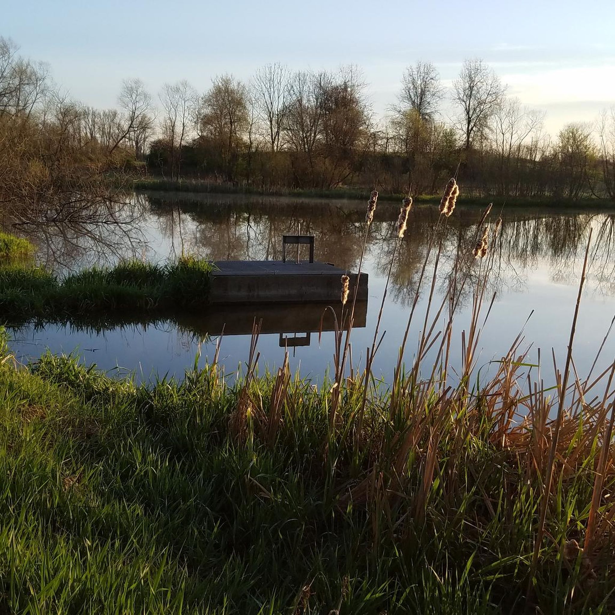
This is one of two ponds within Chestnut Ridge Metro Park. These ponds have observation decks on their banks and small fishing docks that are open to the public.
0
0
Chestnut Ridge Metro Park is a 486-acre park home to Chestnut Ridge, the first ridge in the foothills of the Appalachian Mountains. The ridge is about 1,116 feet in elevation and about 4,500 feet long. The park offers around 4 miles of hiking trails and over 10 miles of mountain biking trails. The park also offers opportunities for fishing on two small ponds and a first-come-first-served picnic shelter.
0
0
Portman Park is a 91-acre park named after longtime city council member Maurey Portman. The park has picnic and playground facilities and a portion of the park is on the bank of Blacklick Creek.
0
0
Frequently Asked Questions
How many hiking trails are available in Fairfield County?
Fairfield County offers a diverse selection of over 30 hiking routes. These trails cater to various preferences, from gentle strolls to more challenging excursions.
What are the difficulty levels of hiking trails in Fairfield County?
The trails in Fairfield County range in difficulty. There are 19 easy routes, 10 moderate routes, and 1 difficult route, ensuring options for all experience levels.
Are there any easy hiking trails suitable for beginners or families?
Yes, Fairfield County has many easy trails perfect for beginners or families. An excellent option is the Chestnut Ridge Metro Park loop — Carroll, Ohio, which is 2.5 miles (4.0 km) long with gentle elevation changes.
Can I find challenging hikes in Fairfield County?
For those seeking a challenge, Fairfield County offers routes with significant elevation gain. The Cemetery Ridge Trail to Good Prairie Trail loop — Clear Creek Metro Park is a difficult 12.8 miles (20.6 km) path with substantial ascents.
Are there loop trails in Fairfield County?
Many of the hiking routes in Fairfield County are designed as loops, offering varied scenery without retracing your steps. Examples include the Blacklick Metro Park loop — Reynoldsberg, Ohio and the Five Oaks Trail loop — Slate Run Creek.
What kind of landscapes can I expect to see on the trails?
Fairfield County's trails traverse a mix of landscapes, including forested paths, gentle rolling terrain, and routes alongside creeks and lakes. You'll find diverse natural settings within its metro parks and open areas.
Are there trails that feature lakes or water bodies?
Yes, several trails offer views of lakes and other water features. The Lakeside Trail — Buckeye Lake State Park is a great option for hiking along the water. You can also explore Buckeye Lake itself or Lake Ramona.
What do other hikers say about the trails in Fairfield County?
The trails in Fairfield County are highly regarded by the komoot community, with an average rating of 4.4 stars from over 40 reviews. More than 380 visitors have explored the area, often praising the well-maintained paths and varied terrain.
Are there any notable landmarks or attractions along the hiking routes?
Yes, hikers can discover several points of interest. You might encounter the Chestnut Ridge Metro Park Boardwalk and Bridge, or the natural beauty of E.E. Good Prairie. The Blacklick Creek Trail also offers scenic views.
Are there any trails suitable for a longer day hike?
For a longer day hike, consider routes like the Lakeside Trail — Buckeye Lake State Park, which covers nearly 8 miles (12.9 km). Another option is the Burning Lake Trail to Killdeer Trail — Pickerington Ponds Metro Park, which is over 6.5 miles (10.5 km).
Are there trails with minimal elevation gain for a relaxed walk?
Absolutely. Many trails in Fairfield County feature minimal elevation changes, ideal for a relaxed walk. The Blacklick Metro Park loop — Reynoldsberg, Ohio, for instance, has very little elevation gain, making it a flat and easy option.
Most popular attractions in Fairfield County

Get inspired with the komoot mobile app


Didn’t find what you were looking for?
Check out more Hikes throughout Fairfield County below and find the perfect route in your destination.
Explore more
Browse the best Hikes in other regions.
