The best walks and hikes in Pickett County
4.9
(7)
101
hikers
25
hikes
Hiking in Pickett County, Tennessee, offers diverse natural landscapes characterized by impressive sandstone bluffs, numerous rock shelters, and open hardwood forests. Situated on the Cumberland Plateau, the region features scenic gorges and a high concentration of natural bridges and arches. Many trails follow creeks, leading to waterfalls and exploring the varied ecosystems of Pickett CCC Memorial State Park and the adjacent Big South Fork National River and Recreation Area.
Best hiking trails in Pickett County
- The most popular hiking route is Hazard Cave and Natural Bridge Trail loop — Pickett CCC Memorial State Park, a 2.3 miles (3.7 km) trail that takes 1 hour to complete. This easy loop explores a massive rock shelter and an impressive natural sandstone bridge.
- Another top favourite among local hikers is Twin Arches Loop Trail — Big South Fork National River & Recreation Area, a moderate 4.9 miles (7.9 km) path. This route leads to one of the largest natural sandstone arches in the eastern United States.
- Local hikers also love the Hidden Passage Trail loop — Big South Fork National River & Recreation Area, a 7.5 miles (12.0 km) trail leading through hardwood forests, sandstone bluffs, and rock shelters, often completed in about 3 hours 15 minutes.
- Hiking in Pickett County is defined by sandstone bluffs, natural arches, and hardwood forests. The network offers options for different ability levels, from easy family-friendly walks to more challenging long-distance routes.
- The routes in Pickett County are highly rated by the komoot community with an average score of 5.0 stars from over 5 reviews. More than 90 hikers have used komoot to explore Pickett County's varied terrain.
Last updated: June 25, 2026
3
hikers
3.56km
01:01
70m
90m
Embark on an easy hike along the Mesa Top and Upper Canyon Trail, a 2.2-mile (3.6 km) route that offers a diverse landscape within Pogue Creek Canyon State Natural Area. You will experience a transition from a wooded ridge to dramatic canyon views, encountering towering rock walls and unique rock formations. The trail involves a gentle elevation gain of 234 feet (71 metres), making it a pleasant journey for most hikers.
This route typically takes about 1 hour to complete, perfect for a quick escape into nature. While the Mesa Top section is generally easy, combining it with the Upper Canyon Trail can introduce more moderate sections with descents and scrambles. Always check local conditions before you head out, especially if you plan to explore beyond the main path. Parking is usually available directly at the trailhead for your convenience.
A notable feature along the way is Killdeer Arch, also known as Birds Arch, which you can reach via a short detour. This natural arch is one of the region's most unique formations, adding a special highlight to your adventure. The trail also offers glimpses of small waterfalls, enhancing the natural beauty of the canyon environment.
1
hikers
18.0km
05:01
320m
320m
Embark on the Grand Gap and John Litton Farm Loop, a challenging hike that immerses you in the rugged beauty of the Big South Fork National River and Recreation Area. This difficult 11.2-mile (18.0 km) route takes you along the west rim of the Big South Fork River gorge, offering spectacular views from spots like the Angel Falls Overlook. You will gain 1059 feet (323 metres) in elevation over approximately 5 hours and 1 minute, experiencing diverse terrain and natural features including interesting rock formations and bluffs.
Before you set out, plan to carry all the water you will need for the entire journey, as there are no direct water sources along the trail. The route is shared with mountain bikers on weekdays, so stay aware of other users on the path. You can find convenient parking and access the trailhead near the Bandy Creek Visitor Center, making it a good starting point for your adventure.
This loop uniquely combines a journey through natural grandeur with a step back in time at the historic John Litton Farm. Here, you can explore an old log cabin, barn, and fields, providing a glimpse into the past amidst the wilderness. The trail is notable for its blend of historical exploration and panoramic gorge vistas, offering a rich experience that highlights both the natural and cultural heritage of the region.

Sign up for free
5.88km
01:34
60m
70m
The Oscar Blevins Loop Trail offers an easy hike through mixed forests, perfect for a relaxed outing. You will cover 3.7 miles (5.9 km) with a gentle elevation gain of 211 feet (64 metres), taking about 1 hour and 34 minutes to complete. Along the way, you can enjoy glimpses of Bandy Creek and might even spot wet-weather waterfalls, adding to the trail's natural charm.
To start your adventure, head to the Bandy Creek Trailhead, which provides easy access to the loop. While the trail is generally straightforward, be mindful that some sections, including steps and footbridges, can become slippery when wet. It is always a good idea to wear appropriate footwear, especially if recent rain has made parts of the path near Bandy Creek a bit soggy.
This route is a journey back in time, leading you to the historic Oscar Blevins Farmstead. Here, you can explore an original 1879 cabin and an impressive barn, offering a unique glimpse into the past within the Big South Fork National River and Recreation Area. The trail also showcases diverse plant life, including mountain laurel and rhododendron, making it a rewarding experience for nature enthusiasts.
24.1km
06:44
400m
560m
Embark on the Twin Arches-Charit Creek Loop, a difficult 15.0-mile (24.1 km) hiking adventure through the Big South Fork National River and Recreation Area. You will navigate diverse terrain, from forested plateaus to deep gorges, gaining 1299 feet (396 metres) in elevation. The route's highlight is undoubtedly the massive Twin Arches, considered some of the world's largest natural land bridges. Expect to spend around 6 hours and 44 minutes immersed in this challenging landscape, encountering impressive sandstone bluffs and huge rock houses along the way.
Before you set out on this demanding hike, remember that cell service can be unreliable in the area, so download your maps and trail information beforehand. The trail features significant elevation changes, including many steep wooden stairs and some exposed rock ledges, so wear appropriate footwear and be prepared for a strenuous workout. Charit Creek Lodge, located along the route, provides restrooms and sometimes offers refreshments, which can be a welcome stop.
This loop offers more than just a physical challenge; it's a journey through a landscape rich with natural history. As you descend towards Charit Creek, you will discover not only the impressive scale of the Twin Arches but also historical rock shelters and cliffs that tell tales of past human activity. The continuous display of natural beauty and geological formations makes this a truly unique experience in the region.
2.08km
00:34
20m
30m
Hike the easy 1.3-mile Eagle Point Trail in Dale Hollow Lake State Resort Park for scenic views and a peaceful outdoor experience.
930m
00:15
0m
30m
Embark on an easy hike along the Crystal Falls via Hidden Passage Trail, a short but rewarding journey through hardwood forests and past striking sandstone bluff lines. This route covers just 0.6 miles (0.9 km) with a gentle elevation gain of 9 feet (3 metres), making it perfect for a quick outing. You can expect to complete this scenic loop in about 14 minutes, with the highlight being the beautiful Crystal Falls, a 15-foot waterfall that tumbles over stairstep ledges into a clear pool.
Planning your visit is straightforward, as the trail is well-maintained and clearly marked within Pickett CCC Memorial State Park. Parking is typically available right at the trailhead, offering easy access to your adventure. Consider visiting after a good rain, as the waterfalls will be particularly impressive and full. This accessible trail is suitable for most hikers looking for a brief escape into nature.
Beyond the cascading falls, the trail reveals unique rock formations, including natural rock shelters and the namesake natural arch that forms the "Hidden Passage." As you hike, you'll enjoy views of Thompson Creek and have the chance to spot various wildflowers depending on the season. This trail offers a glimpse into the rich natural environment of the park, showcasing its geological wonders and diverse plant life.
5.0
(1)
14
hikers
7.86km
02:14
170m
170m
Embark on the Twin Arches Loop Trail, a moderate hike spanning 4.9 miles (7.9 km) with an elevation gain of 572 feet (174 metres). You can expect to complete this scenic route in about 2 hours and 14 minutes. The trail immerses you in hardwood forests as you descend into a valley, leading you to the colossal Twin Arches. These impressive natural formations, the North Arch and South Arch, are among the largest land bridges worldwide, offering a unique experience as you walk beneath them. Along the way, you'll also encounter large rock shelters, adding to the natural beauty and historical intrigue of the landscape.
Before you set out, be aware that while the trail is generally accessible, you should prepare for varying terrain, including sections with steep wooden stairs. It's always a good idea to check local conditions, especially regarding weather and trail status, before your visit. For convenience during your hike, Charit Creek Lodge is located along the loop and provides restrooms, accommodations, and refreshments, making it a useful stop.
This trail is a highlight within the Big South Fork National River & Recreation Area, renowned for its dramatic geological features. Beyond the natural arches, the route also features historic homesteads, offering a glimpse into the region's past. The combination of significant natural landmarks and cultural history makes this loop a distinctive and rewarding experience for hikers exploring the area.
5.0
(2)
11
hikers
17.7km
04:54
320m
320m
Embark on the Slave Falls and Twin Arches Loop, a moderate 11.0-mile (17.7 km) hike that takes you through varied terrain, from old fire roads to dense, moss-covered forests. You'll gain 1055 feet (322 metres) over an estimated 4 hours and 54 minutes, encountering impressive sandstone cliffs up to 100 feet high. The route's highlights include the massive Twin Arches, some of the largest natural stone arches in the Eastern United States, and the striking 60-foot high Slave Falls, which cascades from a vast alcove. Expect to see tree trunks coated in moss, adding to the trail's unique atmosphere.
When planning your visit, you'll find parking generally available at the trailhead, making access straightforward for your adventure. While the full loop is considered moderate, you can find options for shorter segments if you prefer a less strenuous hike. Be prepared for varied conditions, as the trail can involve steep stairs and switchbacks in places. This trail is located within the Big South Fork National River and Recreation Area.
Beyond the natural wonders, this trail offers a unique historical layer with its passage by old pioneer cabin foundations. The Twin Arches themselves are a significant geological feature, standing as some of the largest natural stone arches in the Eastern United States. The 60-foot high Slave Falls drops from a vast alcove, creating a memorable visual. This route provides a comprehensive experience of the region's natural beauty and history.
5
hikers
12.0km
03:15
160m
160m
Hike the Hidden Passage Trail Loop, a moderate route that covers 7.5 miles (12.0 km) with an elevation gain of 514 feet (157 metres). You can expect to spend around 3 hours and 14 minutes exploring this path. The trail leads you through open hardwood forests, past impressive sandstone bluff lines, and numerous rock shelters. It follows the rugged meanders of Thompson Creek, offering glimpses into deep, narrow gorges and expansive views. Keep an eye out for a small stone arch and the beautiful Crystal Falls, where water cascades in veil-like ribbons.
When planning your visit to the Hidden Passage Trail Loop, you will find parking generally available at the trailhead. While exploring, be aware that caution is advised near bluffs due to considerable drop-offs. Always stay on marked paths to ensure your safety and protect the natural environment. This trail offers a rewarding outdoor experience for hikers looking for a scenic journey.
This trail is located within Pickett CCC Memorial State Park, a region known for its rugged beauty. The unique rock formations and deep gorges are a highlight of the area's geology. You might also spot the endangered Cumberland Sandwort, so please observe caution to protect this delicate plant. The Hidden Passage Trail Loop provides a wonderful opportunity to connect with nature and discover the distinctive features of this park.
2
hikers
10.3km
02:44
110m
110m
Embark on the West Bandy Creek Trail, a moderate hiking route spanning 6.4 miles (10.3 km) with an elevation gain of 350 feet (107 metres). You can expect to complete this journey in about 2 hours and 43 minutes. The trail offers diverse terrain, from rolling singletrack to sections with sandstone climbs and drops. As you hike, you will often follow cliff lines that overlook the river, providing scenic views. Keep an eye out for impressive rock shelters carved into the landscape and beautiful streams featuring rapids and cascades.
The West Bandy Creek Trail is generally considered easy to intermediate for hiking, making it suitable for a wide range of users. Parking is typically available at various trailheads located within the Big South Fork National River & Recreation Area. It is a shared-use trail, so be aware that you might encounter mountain bikers during your visit. Consider hiking in May or June to witness mountain laurel and rhododendron in full bloom, adding vibrant colors to your experience.
This trail is nestled within the Big South Fork National River & Recreation Area, an expansive natural preserve known for its rugged gorges and sandstone bluffs. The presence of rock shelters highlights the unique geological formations of the region. The diverse flora, especially the seasonal blooms, contributes to the trail's appeal, offering a dynamic natural experience throughout the year.
Get access to more routes and recommendations from other explorers.
Sign up for free
Already have an account?
Our route recommendations are based on thousands of hikes, rides, and runs completed by other people on komoot.
Start today with a free account
Your next adventure awaits.
Login or Signup
Popular around Pickett County

Tips from the Community

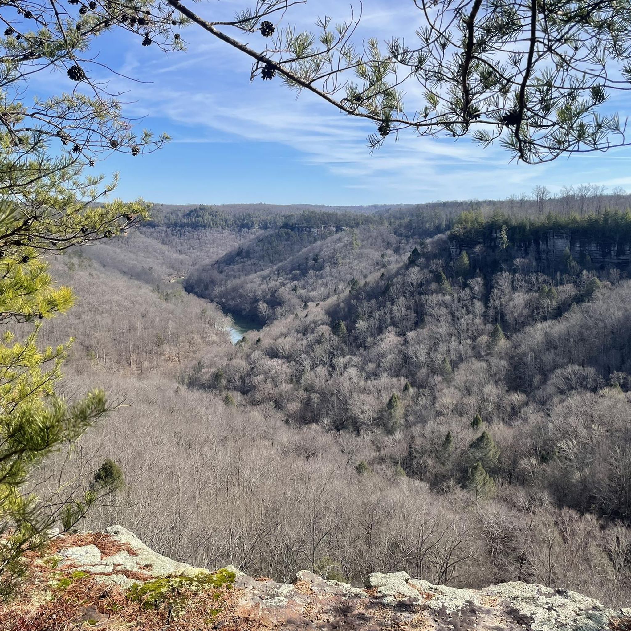
Up on the ridgeline you get a view of the creek network and Pickett State Forest. This is one of the most exciting parts of the trail, and as you continue on the loop you will be treated to cliffs, caves, waterfalls, and the intricate network of creeks crisscrossing the park.
0
0
Slave Falls is a small but high waterfall which tumbles into the sandstone crescent below. You can access the fall from the north or the south side of the creek.
0
0
The small out-and-back trail to the arch is remarkable and definitely worth it! True to its name, the natural bridge is long and thin and looks more closely resembles a tree that has fallen across the path than a stone formation.
0
0
The lodge is a rustic getaway experience which is only accessible via the Big South Fork trail system. You can learn more about room prices, meals, and the experience on the CCL website here: https://www.ccl-bsf.com.
0
0
The arch is gigantic and towers majestically over the forest floor. There are a ton of trail to explore from the base of the arch, so bring a map to make sure you are on track!
0
0
You can take the trail up on top of the arch to get sweeping views across Big South Fork. You can also explore the base of the arch. Both are great spots for photo ops!
0
0
As you follow the trial along the base off the bluff there are a number of carved-out cliffs. There are large rocks below the cliff pockets that you can scramble on and the views are a delight.
0
0
The trail here is a lazy singletrack that winds its way through the woods paralleling the gravel road. The path is fairly east singletrack the whole way. This is a beautiful spot in the fall when the leaves change!
0
0
Frequently Asked Questions
How many hiking trails are available in Pickett County?
Pickett County offers a diverse range of hiking experiences with over 18 routes documented on komoot. These trails cater to various skill levels, from easy strolls to more challenging long-distance treks.
What kind of natural features can I expect to see while hiking in Pickett County?
Hikers in Pickett County can explore impressive sandstone bluffs, numerous rock shelters, and open hardwood forests. The region is particularly known for its high concentration of natural bridges and arches, such as the Twin Arches in Big South Fork. Many trails also follow scenic creeks, leading to waterfalls like Crystal Falls on the Hidden Passage Trail.
Are there family-friendly hiking options in Pickett County?
Yes, Pickett County has several easy trails suitable for families. Pickett CCC Memorial State Park, in particular, is known for its shorter trails that lead to significant features. An example is the Hazard Cave and Natural Bridge Trail loop, which is an easy 2.3-mile route exploring a massive rock shelter and a natural sandstone bridge.
Can I bring my dog on the hiking trails in Pickett County?
Many trails within Pickett County, especially those in the Big South Fork National River and Recreation Area, are dog-friendly, but regulations can vary by specific park or trail. It's always best to check the current rules for the particular area you plan to visit. Generally, dogs should be kept on a leash.
Are there circular hiking routes available?
Yes, Pickett County offers several excellent circular hiking routes. For example, the Twin Arches Loop Trail is a moderate 4.9-mile path leading to one of the largest natural sandstone arches in the eastern United States. Another option is the John Muir Trail and Leatherwood loop, an easy 3-mile route.
When is the best time of year to hike in Pickett County?
Pickett County offers scenic beauty throughout the seasons. Spring brings lush greenery and wildflowers, while autumn showcases vibrant fall foliage in the hardwood forests. Summer is popular for enjoying the creeks and waterfalls, though it can be warm. Winter hiking is also possible, offering a different perspective of the bluffs and rock shelters, often with fewer crowds.
What are some longer, more challenging hikes in the area?
For those seeking a more challenging experience, Pickett County and its adjacent areas offer longer routes. The John Muir Trail from Grand Gap is a difficult 18.4-mile trek. Another demanding option is the Bandy Creek & Leatherwood Ford loop, a difficult 15.5-mile route.
Are there any trails that feature waterfalls?
Yes, several trails in Pickett County feature waterfalls. The Hidden Passage Trail, for instance, is known for Crystal Falls. While not explicitly listed in the guide data, the region research indicates that the Double Falls Trail also leads to a waterfall, offering picturesque natural sights.
What do other hikers enjoy most about hiking in Pickett County?
The area is highly rated by the komoot community, with an average score of 5.0 stars. Reviewers often praise the diverse natural landscapes, including the impressive sandstone bluffs, unique rock shelters, and the concentration of natural bridges and arches. The variety of trails for different skill levels is also frequently highlighted.
Is parking available at trailheads in Pickett County?
Yes, parking is generally available at the main trailheads within Pickett CCC Memorial State Park and the Big South Fork National River and Recreation Area. Specific parking information can often be found on individual park websites or detailed route descriptions.
What is the Big South Fork National River and Recreation Area?
The Big South Fork National River and Recreation Area is a massive 125,000-acre protected area adjacent to Pickett State Park and State Forest. It features miles of scenic gorges, sandstone bluffs, and numerous natural bridges, including the famous Twin Arches. It offers extensive opportunities for hiking and other outdoor activities, with many trails connecting to or easily accessible from Pickett County. You can find more information at nps.gov/BISO.
Most popular routes in Pickett County

Get inspired with the komoot mobile app


Didn’t find what you were looking for?
Check out more Hikes throughout Pickett County below and find the perfect route in your destination.
Explore more
Browse the best Hikes in other regions.
