The best walks and hikes around Storavannet
4.5
(4143)
28,877
hikers
437
hikes
Hiking around Storavannet offers diverse trails through varied terrain. The region is characterized by rugged mountains, serene lakes, and lush forests, providing a backdrop for outdoor activities. Hikers can expect panoramic vistas extending over island chains and fjords. The landscape also features coastlines with sandy beaches in some areas, creating a varied environment for exploration.
Best hiking trails around Storavannet
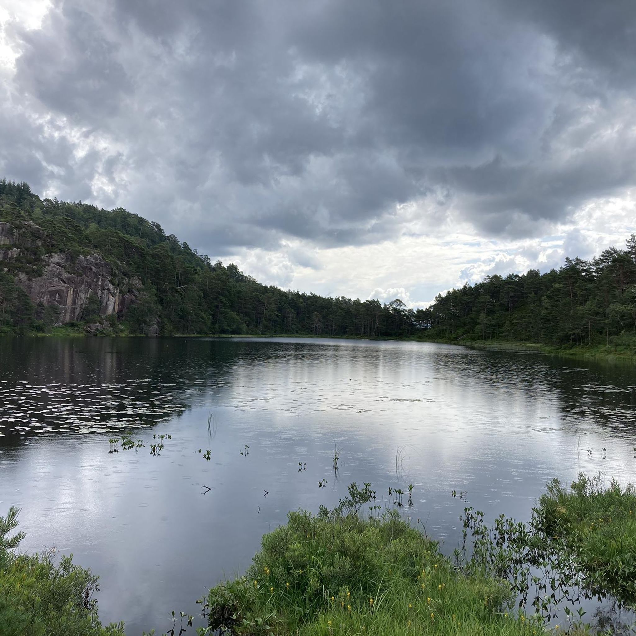
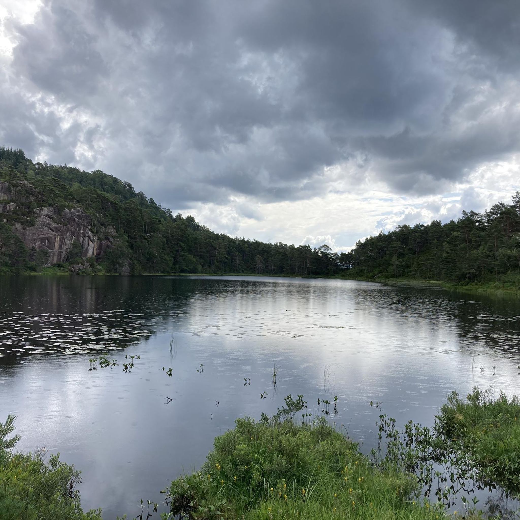
- The most popular hiking route is Storavatnet – Seljebakkmyren Shelter loop from Laksevåg, a 3.8 miles (6.1 km) trail that takes 1 hour 41 minutes to complete. This easy route offers views of the lake and leads through peaceful woodlands.
- Another top favourite among local hikers is Seljebakkmyren Shelter – Stone Mill and Jetty loop from Kongshavnsholmen, an easy 4.0 miles (6.4 km) path. This trail features a stone mill and jetty along its course.
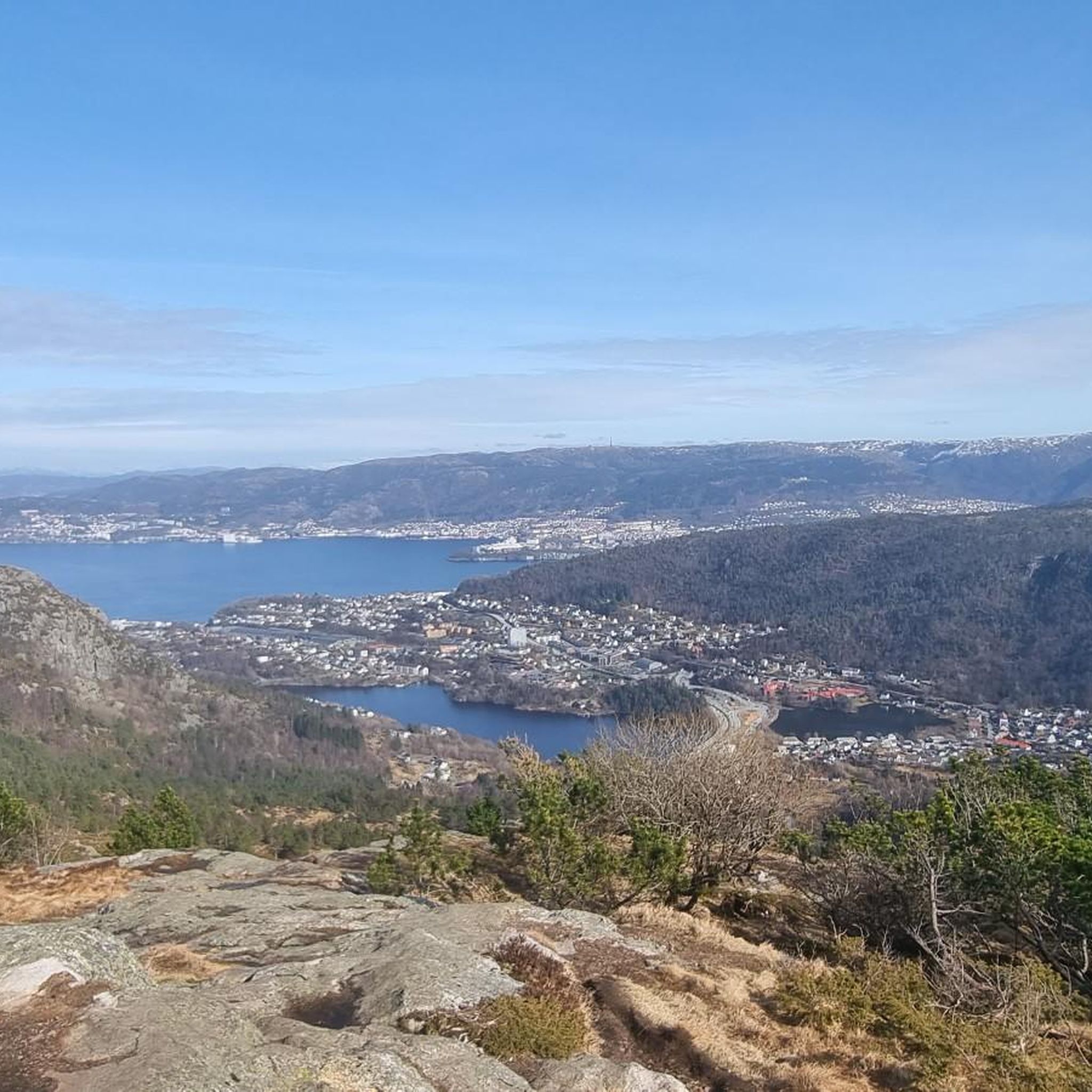
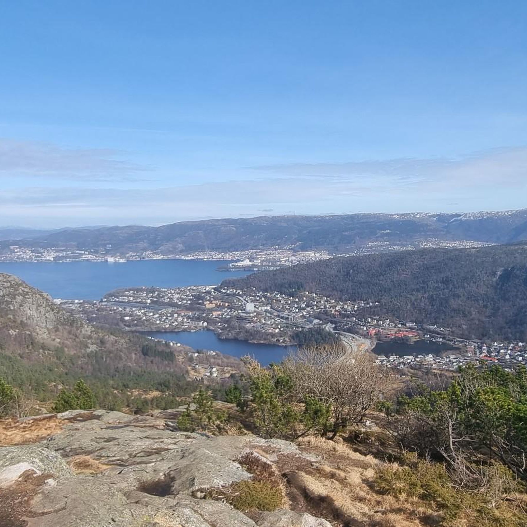
- Local hikers also love the View of Bergen from the Summit – View from the Lyderhorn loop from Laksevåg, a 1.9 miles (3.0 km) trail leading through varied terrain to a summit with views of Bergen, often completed in about 1 hour 42 minutes.
- Hiking around Storavannet is defined by rugged mountains, serene lakes, and lush forests. The network offers options for different ability levels, from easy strolls to moderate climbs.
- The routes in Storavannet are highly rated by the komoot community with an average score of 4.5 stars from over 4,000 reviews. More than 28,000 hikers have used komoot to explore Storavannet's varied terrain.
Last updated: August 20, 2026
8
hikers
6.13km
01:41
100m
100m
Easy hike. Great for any fitness level. Easily-accessible paths. Suitable for all skill levels.
3.0
(1)
38
hikers
6.52km
01:47
100m
100m
Easy hike. Great for any fitness level. Easily-accessible paths. Suitable for all skill levels.

Sign up for free
5.0
(2)
42
hikers
Moderate hike. Good fitness required. Mostly accessible paths. Sure-footedness required.
5.0
(1)
8
hikers
11.2km
03:04
180m
170m
Moderate hike. Good fitness required. Easily-accessible paths. Suitable for all skill levels.
7
hikers
12.6km
03:28
210m
210m
Moderate hike. Good fitness required. Easily-accessible paths. Suitable for all skill levels.
Get access to more routes and recommendations from other explorers.
Sign up for free
Already have an account?
Our route recommendations are based on thousands of hikes, rides, and runs completed by other people on komoot.
Start today with a free account
Your next adventure awaits.
Login or Signup
Tips from the Community

From the top of the Lyderhorn you have a phenomenal view of the fjords around Bergen.
2
0

nice rest area with shelter and barbecue area
0
0
Here are three huge millstones right on the lake shore
0
0
Gullaksgrind is a collection of historical foundations. Unfortunately, all information signs are only in Norwegian
0
0
Frequently Asked Questions
How many hiking trails are available around Storavannet?
There are over 450 hiking trails around Storavannet, catering to various skill levels. You'll find approximately 150 easy routes, over 230 moderate trails, and around 70 more challenging options.
What kind of landscapes can I expect to see while hiking around Storavannet?
Hikers around Storavannet can expect diverse and breathtaking scenery. The region features rugged mountains, serene crystal-clear lakes, and lush forests. Many trails offer panoramic vistas extending over entire island chains and majestic fjords. In some areas, you might also encounter picturesque coastlines with sandy beaches.
Are there any family-friendly hiking routes around Storavannet?
Yes, Storavannet offers several easy trails suitable for families. An excellent option is the Storavatnet – Seljebakkmyren Shelter loop from Laksevåg, which is 3.8 miles (6.1 km) long and takes about 1 hour 41 minutes to complete, offering views of the lake and peaceful woodlands.
What are some notable natural features or landmarks to look out for on the trails?
The region is rich in natural beauty. You can expect to see crystal-clear lakes, lush forests, and rugged mountain formations. Some trails, like the Seljebakkmyren Shelter – Stone Mill and Jetty loop from Kongshavnsholmen, feature unique elements such as a stone mill and jetty. Higher elevation trails provide sweeping panoramic views of fjords and island chains.
Are there any circular hiking routes in the Storavannet area?
Yes, many of the trails around Storavannet are circular, offering convenient starting and ending points. Examples include the Storavatnet – Seljebakkmyren Shelter loop from Laksevåg and the View of Bergen from the Summit – View from the Lyderhorn loop from Laksevåg.
What is the best season to go hiking around Storavannet?
The best time to hike around Storavannet is generally during the warmer months, from late spring to early autumn, when the weather is milder and trails are clear of snow. This period allows for the most comfortable hiking experience and offers the best conditions to enjoy the diverse landscapes.
What do other hikers enjoy most about the trails in Storavannet?
The trails around Storavannet are highly rated by the komoot community, with an average score of 4.5 stars from over 4,000 reviews. Hikers often praise the diverse terrain, from serene woodlands to challenging mountain ascents, and the rewarding panoramic views of lakes, fjords, and island chains.
Are there any challenging hikes for experienced trekkers?
Yes, for experienced trekkers seeking a challenge, Storavannet offers more difficult routes. While not explicitly detailed in the provided data, the region's rugged mountains, such as Mount Hermannsdalstinden and Storehesten Peak (mentioned in region research), provide strenuous climbs with significant elevation gain and rewarding panoramic views.
Is there parking available near the trailheads?
While specific parking locations are not detailed, it is generally common for popular hiking areas like Storavannet to have designated parking facilities near trailheads. It is advisable to check local signage or specific route information for the most accurate parking details before your hike.
Can I reach the hiking trails around Storavannet using public transport?
Information on specific public transport routes to trailheads is not provided in the guide data. However, for regions like Storavannet, it's common for local bus services to connect to areas near popular hiking spots. We recommend checking local public transport schedules for routes serving the Storavannet area.
Are there any easy routes with good viewpoints?
Yes, even easy routes can offer great views. The Storavatnet – Seljebakkmyren Shelter loop from Laksevåg provides lovely views of the lake and surrounding woodlands. For more elevated panoramic views, moderate trails like the View of Bergen from the Summit – View from the Lyderhorn loop from Laksevåg offer stunning vistas from the summit.
Are dogs allowed on the hiking trails around Storavannet?
Generally, dogs are welcome on hiking trails in Norway, but it's important to keep them on a leash, especially during certain seasons (e.g., nesting periods for birds or when livestock are grazing). Always check local regulations or specific trail signs for any restrictions before bringing your dog.
Most popular routes around Storavannet

Get inspired with the komoot mobile app


Explore more
Browse the best Hikes in other regions.
