The best walks and hikes in Rio Arriba County
4.3
(25)
272
hikers
17
hikes
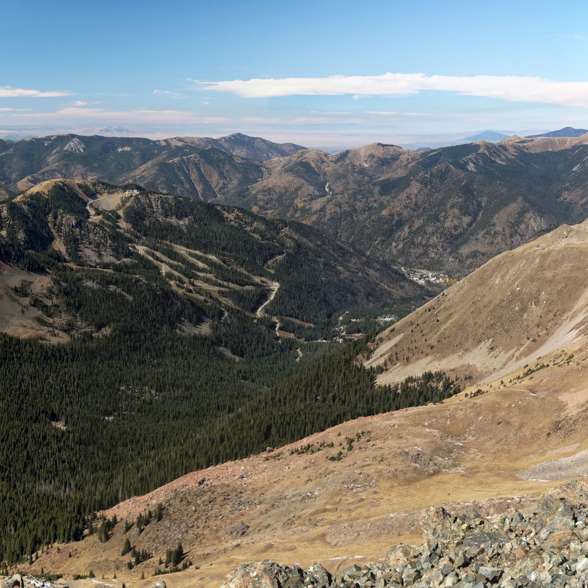
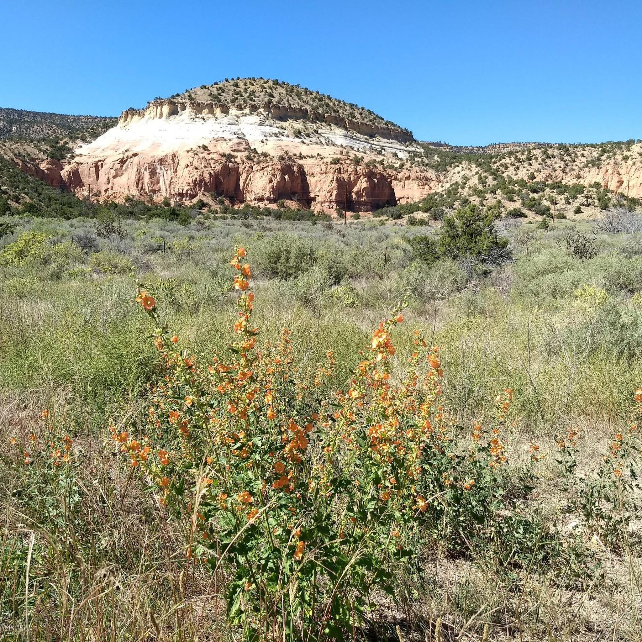
Hiking in Rio Arriba County offers diverse landscapes, from distinctive red rock formations and mesas to expansive mountain ranges and significant waterways. The region is characterized by features such as the Jemez Mountains, the Rio Grande, and the San Pedro Parks Wilderness. Trails often traverse varied terrain, including fossil-rich badlands and forested areas within national forests. This northern New Mexico county provides a range of natural environments for outdoor exploration.
Best hiking trails in Rio Arriba County
- The most popular hiking route is Chimney Rock Trail at Ghost Ranch Retreat Center — Abiquiu, New Mexico, a 2.6 miles (4.2 km) trail that takes 1 hour 19 minutes to complete. This easy path explores the distinctive red-grey mounded hills of Ghost Ranch.
- Another top favourite among local hikers is Kitchen Mesa Trail at Ghost Ranch Retreat Center — Abiquiu, New Mexico, a moderate 5.0 miles (8.0 km) path. This route offers views of the unique geological formations characteristic of the Ghost Ranch area.
- Local hikers also love the Continental Divide Trail & Rio Chama loop — Carson National Forest, a 21.3 miles (34.2 km) trail leading through the Carson National Forest and alongside the Rio Chama, often completed in about 9 hours 35 minutes.
- Hiking in Rio Arriba County is defined by red rock formations, mountain ranges, and river valleys, with trails traversing wilderness areas and national forests. The network offers options for various ability levels, from easy walks to challenging multi-hour treks.
- The routes in Rio Arriba County are highly rated by the komoot community with an average score of 4.5 stars from over 20 reviews. More than 230 hikers have used komoot to explore Rio Arriba County's varied terrain.
Last updated: August 17, 2026
5.0
(1)
3
hikers
2.42km
00:41
50m
60m
Hike the easy 1.5-mile Plaza Blanca Trail through stunning white sandstone formations, a landscape that inspired Georgia O'Keeffe.
2
hikers
22.4km
06:30
420m
770m
The CDT Section 26 from New Mexico Highway 96 to Skull Bridge Trailhead offers a diverse and strenuous hiking experience. You'll traverse varied landscapes, from exposed climbs with expansive views to forested paths and dramatic descents into the Chama River Canyon Wilderness. The route culminates at the stunning Rio Chama River, framed by picturesque red and orange sandstone cliffs that inspired artist Georgia O'Keeffe.
This difficult 13.9-mile (22.4 km) hike involves a significant 1375 feet (419 metres) of elevation gain and typically takes around 6 hours and 30 minutes. The initial ascent from Highway 96 is particularly challenging and exposed, so plan to carry ample water. Water sources along the trail are limited and require careful consideration, often found off-trail or in cattle tanks.
This segment of the Continental Divide Trail is notable for its passage through the wild and scenic Chama River Canyon Wilderness. The Rio Chama itself is a significant natural landmark, attracting kayakers and rafters, and the vibrant canyon walls provide a striking backdrop to your journey. It's a fantastic option for experienced hikers seeking a remote and visually rewarding adventure.

Sign up for free
3.26km
00:56
110m
10m
Embark on the Joseph’s Mine Trail for an easy hike through classic New Mexico high-desert scenery. You will cover 2.0 miles (3.3 km) with a gentle elevation gain of 368 feet (112 metres), taking about 55 minutes to complete. As you walk, you will see juniper, sage, and cactus dotting the arid landscape, leading you to the historic mica mine where the ground sparkles with countless flakes.
When planning your visit, be aware that the trail has exposed areas with limited shade. It is crucial to carry enough water, especially during warmer months, to stay hydrated. The path often follows an old jeep track, which can include sandy sections and crosses washes that are usually dry. This route is generally accessible, but preparing for rugged terrain will make your experience more comfortable.
This trail offers a unique glimpse into the region's mining history, centered around the abandoned Antonio Joseph's mica mine. The most striking feature is the abundance of mica, which still adheres to the rock or lies scattered across the ground, resembling brilliant diamonds. It is a distinctive natural and historical landmark that sets this route apart from other local hikes.
1.04km
00:17
30m
0m
Embark on an easy hike through Redwash Canyon, a short but vibrant journey that takes you through a dry river bottom. You'll discover a slot canyon where the walls burst with striking yellows, reds, and purples. This route is only 0.6 miles (1.0 km) long, with a gentle elevation gain of 96 feet (29 metres), making it an easy trek that most hikers can complete in about 17 minutes. Keep an eye out for unique rock formations and dryfalls as you explore this colorful landscape.
Planning your visit to Redwash Canyon Trail is straightforward. General parking is typically available right at the trailhead, making access easy. Since this is a relatively short and easy route, it's a great option for a quick outing, perhaps in the morning or late afternoon. You might find it less crowded than other trails, offering a peaceful experience. Always check local conditions before you go, especially regarding weather, as dry river bottoms can be affected by rain.
What makes Redwash Canyon Trail special is its unexpected display of natural artistry. The slot canyon walls are a geological marvel, showcasing a vivid palette of yellows, reds, and purples that change with the light. A significant highlight is the large, flat, black petroglyph rock you'll encounter, adorned with ancient images of a deer, a distinctive human figure, and other symbols, offering a glimpse into the past. This lesser-known gem provides unique small wonders and moments of discovery.
879m
00:14
10m
10m
Hike the easy 0.5-mile Abiquiu Lake Vista Trail for panoramic views of Abiquiu Lake, Pedernal Peak, and the Chama River Valley.
1.11km
00:23
90m
0m
Discover the Chavez Canyon Trail, an easy hiking route that takes you through a landscape shaped by water and time. This short adventure covers 0.7 miles (1.1 km) with an elevation gain of 289 feet (88 metres), typically completed in just 22 minutes. As you hike, you will encounter unique slot canyons, multi-colored sandstone walls, and towering cliffs that define the area's rugged beauty. Look for distinctive dryfalls and chambers along the way.
Before you head out, remember to check local weather conditions, especially for rain forecasts. Entering slot canyons in this region is strongly cautioned against during heavy rainfall due to the significant risk of flash floods. Planning your visit carefully ensures a safe and enjoyable experience on the trail.
The Chavez Canyon Trail offers a glimpse into a unique geological setting within Santa Fe National Forest. Its landscape is characterized by the erosive power of water, creating the striking slot canyons and sandstone formations you will see. Heavily wooded side canyons add to the diverse scenery, making this route a notable example of the region's natural features.
4.7
(3)
35
hikers
4.17km
01:19
180m
180m
Embark on the Chimney Rock Trail for an easy hike that takes you through the unique landscape of Ghost Ranch. You will cover 2.6 miles (4.2 km) with a gentle elevation gain of 584 feet (178 metres), leading you to the iconic Chimney Rock formation. The route offers rewarding views of this distinctive landmark and the surrounding area, making it a perfect outdoor adventure that typically takes about 1 hour and 19 minutes to complete.
When planning your visit, you will find parking readily available at the Chimney Rock Trailhead. This trail is generally accessible, but it is always wise to check local conditions before you go, especially concerning the weather, to ensure a pleasant and safe experience. No specific permits or fees are mentioned for accessing this particular trail.
The Chimney Rock Trail is named after its most prominent feature, a striking rock formation that stands out in the landscape. This route provides a unique perspective of the area, allowing you to appreciate the geological wonders of Ghost Ranch. It is a notable option for those seeking a quick and accessible way to connect with nature and experience the region's distinctive scenery.
5.0
(1)
19
hikers
8.03km
02:24
230m
230m
Embark on the Kitchen Mesa Trail, a moderate 5.0-mile (8.0 km) hike that typically takes around 2 hours and 23 minutes to complete. You will gain 758 feet (231 metres) in elevation as you navigate varied terrain, from valley floors with towering rock walls to steep ascents. The route culminates in a rewarding climb to the mesa top, offering expansive views of the Ghost Ranch valley and Abiquiu Lake.
Access the Kitchen Mesa Trail conveniently from the trailhead parking at Ghost Ranch. Be aware that some sections of the route can have loose dirt and steep ledges, which might be challenging, especially if conditions are wet. While rustic coffee can markers are present, pay close attention to navigation to stay on track.
This trail is considered one of the most beautiful and challenging routes directly at Ghost Ranch, featuring unique geological formations and passing by fossil dig sites. From the summit, you can spot the majestic Pedernal mountain, a peak famously depicted in the artwork of Georgia O'Keeffe.
9
hikers
9.26km
02:51
350m
350m
Hike the moderate 5.8-mile Continental Divide Trail: Ghost Ranch Alternate, gaining 1164 feet through unique New Mexico landscapes.
2
hikers
3.23km
00:54
60m
60m
The Las Vacas Trail offers a delightful escape into New Mexico's San Pedro Parks Wilderness, guiding you through serene lush meadows and open pine woodlands. You'll often walk alongside the Rio de las Vacas, with the highlight being the picturesque San Gregorio Reservoir, a popular spot for fishing and enjoying the views. This easy 2.0-mile (3.2 km) route, with a gentle 201 feet (61 metres) of elevation gain, is perfect for a leisurely stroll, taking around 53 minutes to complete.
Planning your visit to this section of the trail is straightforward, as it's known for its easy access near the San Gregorio Reservoir. While specific parking details aren't always highlighted, the area is generally welcoming for day-trippers. Consider visiting in July or August for the best wildflower displays, or in the fall for a chance to hear the wild elk bugling in the distance.
This particular segment of the Las Vacas Trail is a fantastic family-friendly option within the larger San Pedro Parks Wilderness, an area renowned for its high forests and mountain meadows. It's a great way to experience the solitude and natural beauty of the region, with opportunities for wildlife spotting, including cattle and elk. The trail's proximity to the Continental Divide National Scenic Trail also adds to its appeal for nature enthusiasts.
Get access to more routes and recommendations from other explorers.
Sign up for free
Already have an account?
Our route recommendations are based on thousands of hikes, rides, and runs completed by other people on komoot.
Start today with a free account
Your next adventure awaits.
Login or Signup
Popular around Rio Arriba County


Other adventures in Rio Arriba County

Tips from the Community

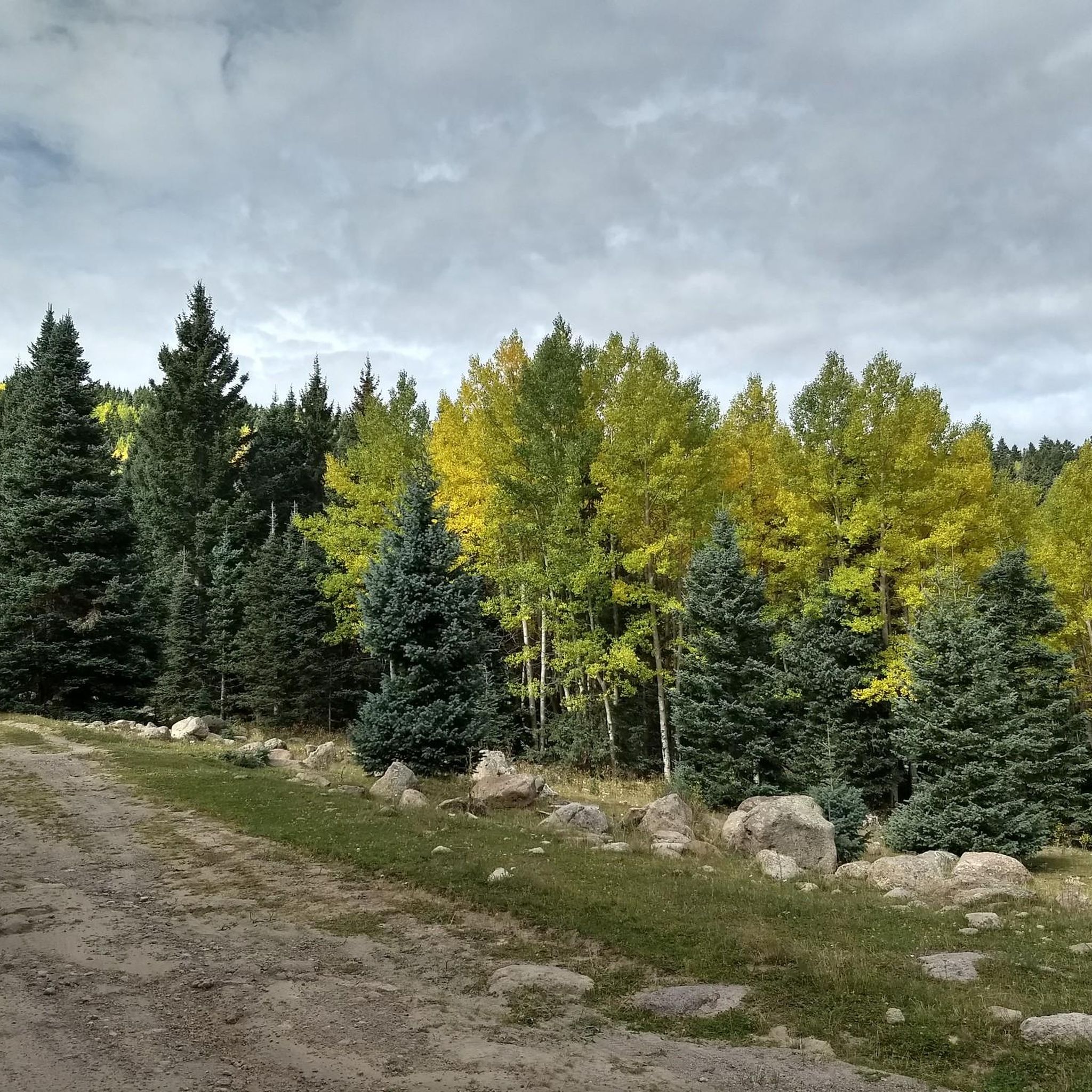
San Gregorio Reservoir is a picturesque high country lake located among a mixture of open meadows and thick forest.
0
0


There is a parking lot here in front of the main Ghost Ranch Retreat Center building where you can leave your car. You will need to purchase a $10 day pass inside this building in order to use the grounds and facilities.
0
0
There are a few dirt parking areas, each large enough for several cars, just off of FR 151.
0
0
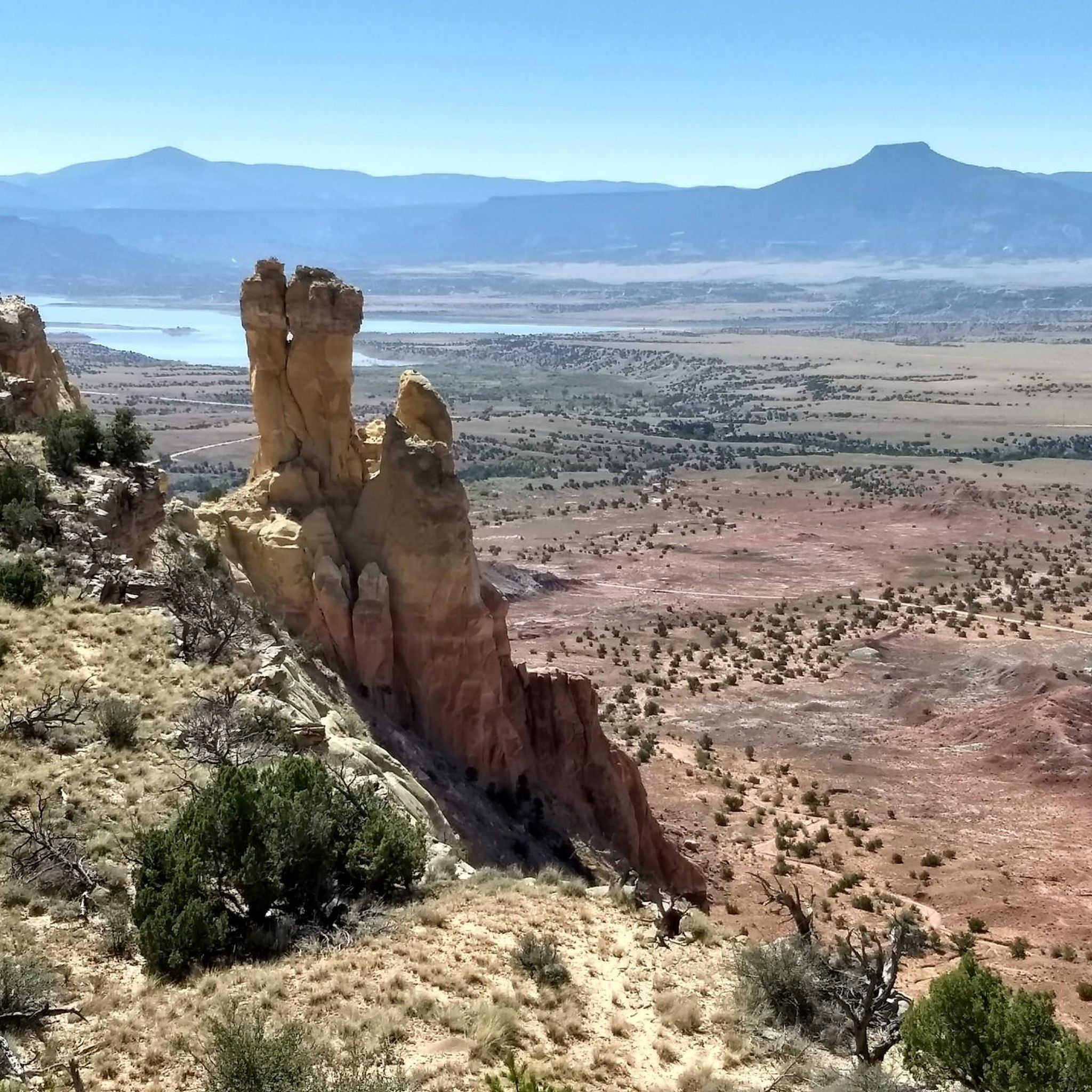
The rim of a desert plateau provides views of the expansive landscape below. The Continental Divide Trail and some of its alternate routes converge in this area.
1
0
Kitchen Mesa is a prominent geological formation that offers extensive views of the red, sandstone desert.
0
0
At this point, approximately halfway up the trail, you will have a good view of the stone spire that is Chimney Rock. Beyond here, you will seem to bypass the formation as you climb to the top of the mesa and then approach Chimney Rock from behind.
0
0
The trail to the summit of Chimney Rock departs behind the Ghost Ranch museum buildings. The trail is easy to follow and ascends steadily to the top of the mesa. You will need to purchase a $10 day pass from the Ghost Ranch Education and Retreat Center office to gain access to the grounds and trails. Parking is available in front of the main building, just to the east.
0
0
Frequently Asked Questions
How many hiking trails are available in Rio Arriba County?
Rio Arriba County offers a variety of hiking opportunities, with over 10 routes documented on komoot. These trails cater to different skill levels, including 4 easy, 4 moderate, and 3 difficult options.
What kind of terrain can I expect on hikes in Rio Arriba County?
The terrain in Rio Arriba County is incredibly diverse, ranging from the distinctive red rock formations and fossil-rich badlands of areas like Ghost Ranch to the expansive mountain ranges and forested areas within national forests such as Carson National Forest and Santa Fe National Forest. You'll also find trails that follow significant waterways like the Rio Chama.
Are there any family-friendly hiking trails in Rio Arriba County?
Yes, there are several easy trails suitable for families. For instance, the Chimney Rock Trail at Ghost Ranch Retreat Center is an easy 2.6-mile path that explores the unique red-grey mounded hills. Another accessible option is the San Gregorio Reservoir trail in the San Pedro Parks Wilderness Area, which is just over 2 miles long.
What are some notable landmarks or natural features to see while hiking in Rio Arriba County?
Rio Arriba County is rich in natural beauty and historical significance. You can explore the distinctive red rock formations at Ghost Ranch, which also features paleontological sites. The prominent basalt-capped mesa of Cerro Pedernal is a significant landmark in the Jemez Mountains. Hikers can also find scenic viewpoints like the Brazos Ridge Overlook in the Cruces Basin Wilderness.
Are there any trails that offer views of rivers or lakes?
Yes, several trails in Rio Arriba County feature waterways. The Continental Divide Trail & Rio Chama loop in Carson National Forest follows the Rio Chama. Additionally, the San Gregorio Reservoir trail leads to a scenic reservoir within the San Pedro Parks Wilderness Area.
What is the best time of year to go hiking in Rio Arriba County?
The best time to hike in Rio Arriba County generally depends on the elevation and specific trail. Spring and fall offer pleasant temperatures for most trails, with vibrant foliage in autumn. Summer can be hot at lower elevations but is ideal for higher mountain trails. Winter hiking is possible, especially on lower-elevation trails, but requires checking conditions for snow and ice.
Are there any challenging or long-distance hikes available?
For experienced hikers seeking a challenge, the Continental Divide Trail & Rio Chama loop is a difficult 21.3-mile route in Carson National Forest, typically taking over 9 hours to complete. Another demanding option is the Palomas Trail, Upper Clear Creek Trail & Damian Trail loop, a difficult 10.6-mile trek in the San Pedro Parks Wilderness.
What do other hikers say about the trails in Rio Arriba County?
The trails in Rio Arriba County are highly regarded by the komoot community, with an average rating of 4.5 stars from over 20 reviews. Hikers often praise the diverse landscapes, from the unique geological formations to the peaceful forested areas, and appreciate the variety of routes available for different skill levels.
Are there any trails that are loop routes?
Yes, several trails in Rio Arriba County are designed as loops, offering a varied experience without retracing your steps. Examples include the difficult Continental Divide Trail & Rio Chama loop and the challenging Palomas Trail, Upper Clear Creek Trail & Damian Trail loop.
Where can I find trails that offer scenic views?
Many trails in Rio Arriba County provide stunning vistas. The Kitchen Mesa Trail at Ghost Ranch offers views of the area's unique geological formations. For panoramic mountain scenery, consider the Rim Vista Trail in Carson National Forest or the hike to Chicoma Mountain in Santa Fe National Forest.
Are there any trails that explore badlands or fossil areas?
Yes, the Blanco Wash to Lybrook Badlands Overlook trail takes you through the Lybrook Fossil Area, offering a unique opportunity to explore badlands terrain and potentially see fossil-rich landscapes.
What kind of wildlife might I encounter on the trails?
Rio Arriba County's diverse ecosystems support a variety of wildlife. Depending on the trail and season, you might spot deer, elk, various bird species, and smaller mammals. Always maintain a respectful distance and avoid disturbing animals in their natural habitat.
Most popular routes in Rio Arriba County
Most popular attractions in Rio Arriba County

Get inspired with the komoot mobile app


Didn’t find what you were looking for?
Check out more Hikes throughout Rio Arriba County below and find the perfect route in your destination.
Explore more
Browse the best Hikes in other regions.
