The best cycling routes in Campbell County
4.6
(54)
618
riders
44
rides
Touring cycling in Campbell County, Kentucky, offers a network of routes primarily situated along riverfronts and through urban and suburban parklands. The terrain is generally flat to gently rolling, making it accessible for various skill levels. Many routes feature paved surfaces, suitable for touring bicycles, and often follow scenic river corridors. The region's landscape is characterized by its proximity to the Ohio River, providing views of the waterway and connecting various communities.
Best touring cycling routes in Campbell County
- The most popular touring cycling route is Ohio to Erie Trail, an 18.0 miles (29.0 km) trail that takes 1 hour 41 minutes to complete. This route offers a long-distance path suitable for extended rides.
- Another top favourite among local touring cyclists is Ramblin' River Bike Tour, a moderate 37.5 miles (60.3 km) path. This route provides extensive river views and covers a significant distance.
- Local touring cyclists also love the Viewpoint on Lunken Loop – Ice Under Bridges loop from Columbia Tusculum, a 10.2 miles (16.4 km) trail leading through urban park areas, often completed in about 57 minutes.
- Touring cycling in Campbell County is defined by riverfront paths, urban green spaces, and paved multi-use trails. The network offers options for different ability levels, from easy loops to longer, moderate routes.
- The routes in Campbell County are highly rated by the komoot community with an average score of 4.7 stars from over 64 reviews. More than 683 touring cyclists have used komoot to explore Campbell County's varied terrain.
Last updated: July 2, 2026
4.6
(5)
46
riders
29.0km
01:41
90m
90m
This easy 18.0-mile (29.0 km) touring cycling route along the Ohio to Erie Trail in Cincinnati offers a delightful urban escape. You'll pedal along the Ohio River Trail, enjoying continuous river views and passing by city landmarks like the Serpentine Wall and the whimsical Cincinnati Flying Pig Statues. With only 287 feet (87 metres) of elevation gain, this flat, paved path is perfect for a relaxed ride, taking approximately 1 hours and 41 minutes to complete.
Planning your visit is simple, as this urban trail is easily accessible within Cincinnati, with various parking options nearby. It's a great option for a casual outing any time of year, though spring and fall provide ideal cycling weather. You'll find plenty of amenities along the route, making it convenient for a spontaneous ride or a planned excursion.
This particular segment is a small but significant part of the much larger Ohio to Erie Trail, which stretches 326 miles (525 km) across Ohio, connecting the Ohio River to Lake Erie. While this section offers a taste of the trail's urban charm, the full route is celebrated for its diverse landscapes, from cityscapes to rural farmlands and natural parks, making it a key part of Ohio's cycling infrastructure.
2
riders
60.3km
03:34
350m
350m
The Ramblin' River Bike Tour offers a fantastic opportunity to explore Kentucky's riverfront scenery on two wheels. As you pedal, you'll enjoy expansive views along the Ohio River, passing by interesting features like the Public Landing and the distinctive Serpentine Wall. While the route largely follows river systems, it's not entirely flat; expect some moderate climbs as you cross creeks, adding a dynamic element to the ride. This touring bicycle route provides a great blend of natural beauty and engaging terrain, making it a rewarding experience for cyclists.
Planning your ride on the Ramblin' River Bike Tour is straightforward, though it's wise to consider the time of year. If you're cycling in late spring, particularly after heavy rains, be prepared for potential insect activity. The route's integration with the Ohio River Trail means various access points are available, and you'll find amenities in nearby towns. This 37.5-mile (60.3 km) journey, with its 1135 feet (346 metres) of elevation gain, is rated moderate and typically takes around 3 hours and 34 minutes, making it a solid day trip.
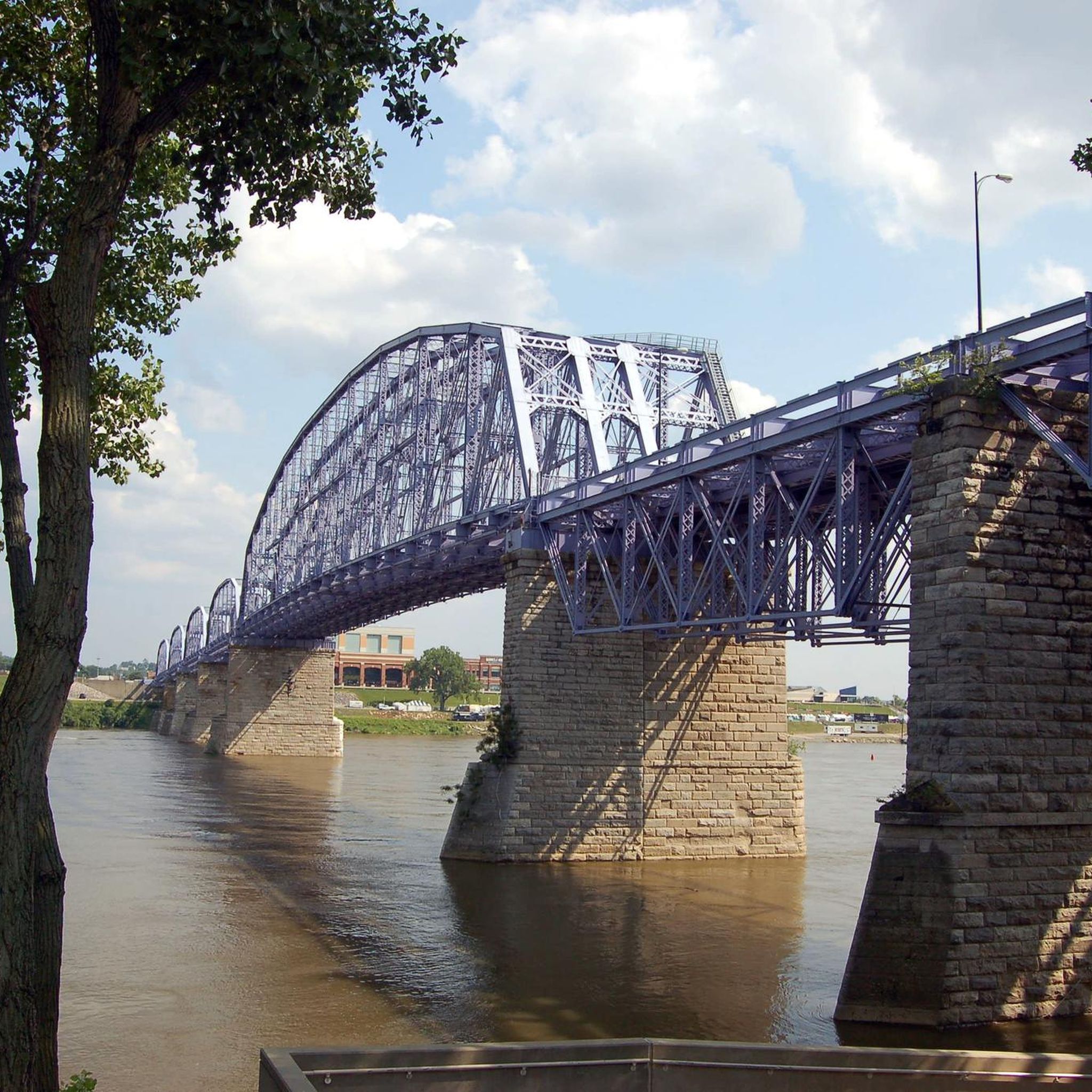
This segment of the Ramblin' River Bike Tour is part of the larger USBR 35, a significant cross-state cycling trail that spans Kentucky. It provides a unique perspective on the region's geography and history, connecting various communities along the Ohio River. You'll encounter highlights such as the Purple People Bridge, offering a chance to cross into Cincinnati, and the Cincinnati Flying Pig Statues, adding a quirky local touch. The route is an excellent way to experience the diverse landscapes of Kentucky from west to east, offering a consistent river-themed adventure.

Sign up for free
4.3
(6)
38
riders
The Eden Park – Memorial Groves loop offers a delightful touring cycling experience through one of Cincinnati's most beautiful urban parks. This moderate 18.2-mile (29.3 km) route, with its 583 feet (178 metres) of elevation gain, takes about 1 hour and 48 minutes to complete, guiding you past stunning views of the Ohio River and the Kentucky hillsides. You'll cycle through varied terrain, enjoying the blend of natural beauty and historical landmarks like the Water Tower and the contemplative Memorial Groves.
Beginning at the William Howard Taft National Historic Site, this cycling route is primarily on paved surfaces, making it accessible for a range of touring bicycles. While the rolling hills contribute to its moderate difficulty, the climbs are generally manageable for most cyclists. Consider parking near the William Howard Taft Historic Site for cycling to start your adventure, and allow extra time to explore the attractions within Eden Park.
What truly sets this route apart is its unique integration of a significant historical site with the vibrant cultural and natural offerings of Eden Park. You'll pass by the Cincinnati Art Museum and the Krohn Conservatory, making it more than just a bike ride; it's an active tour through Cincinnati's heritage and green spaces. This makes it one of the best cycling trails Cincinnati Eden Park has to offer for those seeking a rich, engaging ride.
5.0
(1)
28
riders
27.5km
01:41
130m
130m
Easy bike ride. Great for any fitness level. Mostly paved surfaces. Suitable for all skill levels.
5.0
(1)
20
riders
This easy touring cycling route along the Ohio River Trail offers a delightful blend of riverside scenery and urban charm, perfect for a relaxed outing. You'll glide along primarily paved paths, enjoying views of downtown Cincinnati and the iconic Roebling Suspension Bridge, with the added fun of spotting the unique Flying Pig Statues, such as 'Lucius Quinctus Pigasus' near Sawyer Point. The minimal 138 feet (42 metres) of elevation gain over 8.3 miles (13.3 km) makes this a genuinely accessible ride for all skill levels.
Starting from the Columbia Tusculum neighborhood, this route is straightforward to access and navigate. Given its easy difficulty and estimated duration of just 46 minutes, it's a fantastic option for a quick spin. The well-maintained paths mean you can enjoy this ride comfortably throughout the day, though earlier or later hours might offer a more serene experience.
Beyond its scenic appeal, this loop is a great way to experience a piece of Cincinnati's unique public art and its connection to the broader Ohio River Trail network. The Flying Pig Statues celebrate the city's history, adding a quirky cultural element to your ride. This section is also part of the larger, in-progress Ohio-to-Erie Trail, highlighting its significance in a regional cycling context.
6
riders
15.7km
01:02
80m
80m
Easy bike ride. Great for any fitness level. Mostly paved surfaces. Suitable for all skill levels.
3.0
(1)
8
riders
The Viewpoint on Lunken Loop – Ice Under Bridges loop from Columbia Tusculum offers a unique touring cycling experience in Cincinnati. You'll pedal along a smooth, paved path, enjoying diverse scenery that includes watching planes at Lunken Airport and pleasant views of the Little Miami River. The route also connects to the Ohio River Trail, providing scenic urban vistas, possibly including the "Ice Under Bridges" sections. It's a low-stress, car-free environment, perfect for a relaxed ride.
This easy 7.3-mile (11.8 km) route has a minimal 34 feet (10 metres) of elevation gain, making it suitable for all skill levels, including families. You can comfortably complete it in about 40 minutes. While the trail is mostly flat, there are two short, gentle climbs onto levees. The Lunken Loop is well-maintained and accessible, making planning your visit straightforward.
This trail is part of a larger network, connecting to the Ohio River Trail and even a segment of the vast Ohio to Erie Trail. Future plans include the "Oasis Trail," which will further extend the Ohio River Trail, enhancing connectivity. The Lunken Loop also passes by points of interest like the Land of Make Believe Park and Reeves Golf Course, adding to the experience.
7
riders
26.8km
01:34
100m
100m
Easy bike ride. Great for any fitness level. Mostly paved surfaces. Suitable for all skill levels.
Get access to more routes and recommendations from other explorers.
Sign up for free
Already have an account?
Our route recommendations are based on thousands of hikes, rides, and runs completed by other people on komoot.
Start today with a free account
Your next adventure awaits.
Login or Signup







Tips from the Community


https://www.radioartifact.com/ -This is a recording studio that has live audience during recordings. https://artifactbeer.com/ -This brewery has tarts, which I find delicious! Liquid, fruity, and quenching.
0
0
https://www.americansignmuseum.org/ Wednesday – Sunday 10 am – 4 pm
0
0
https://www.dojogelato.com/ Mon-Tues: Closed Wed-Fri: 5:30 PM - 9:30 PM Sat-Sun: 1:30 PM - 9:30 PM To-Go Orders, Walk-Up, Patio
0
0

The view of the surrounding river from the Taylor-Southgate Bridge is particularly wonderful at sunset.
0
0
Weekends on nice days draws many folk that are walking on this part of the trail. Slowly is the best way to enjoy the Ohio River vistas this trail section provides.
0
0

This public landing is along the Ohio River Trail is a nice spot to stop for a quick dip or to just enjoy the views over the water. It is also near the National Steamboat Monument and the Great American Ball Park.
0
0
The Lunken Loop Trail is a popular 5-mile paved trail located in Cincinnati, Ohio, encircling the Lunken Airport. This flat, multi-use trail is great for walking, running, and biking. The loop offers a unique experience, with portions of the trail running adjacent to the airport, which allow you to watch planes take off and land. This viewpoint overlooks the open, green field on the southern end of the airport.
1
0
Frequently Asked Questions
How many touring cycling routes are available in Campbell County?
Campbell County offers a diverse selection of over 45 touring cycling routes. These routes cater to various skill levels, with approximately half being easy and the rest ranging from moderate to difficult.
What is the typical terrain like for touring cyclists in Campbell County?
The terrain in Campbell County, Kentucky, is generally flat to gently rolling, making it accessible for a wide range of cyclists. Many routes feature paved surfaces and often follow scenic river corridors, providing pleasant views of the Ohio River.
What natural features or landmarks can I see along the touring cycling routes?
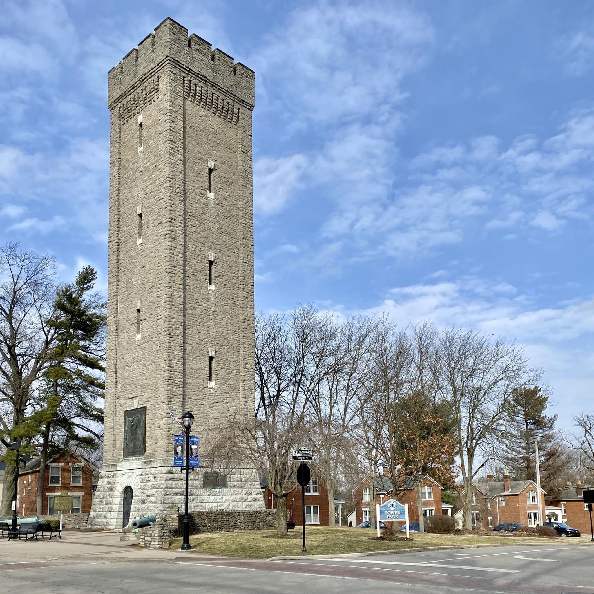
Many routes in Campbell County offer views of the Ohio River. You can also encounter various points of interest such as the Ohio River Trail, the Purple People Bridge, and the Geologic Timeline at Cincinnati Riverfront. Other notable landmarks include the Cincinnati Water Works and the Fort Thomas Tower at Tower Park.
Are there routes suitable for families or beginners?
Yes, Campbell County has many easy routes perfect for families and beginners. For instance, the Viewpoint on Lunken Loop – Ice Under Bridges loop from Columbia Tusculum is an easy 10.2-mile trail through urban park areas. Another great option is the Cincinnati Flying Pig Statues – Ohio River Trail loop from Columbia Tusculum, which is 8.3 miles long and also considered easy.
Are there any circular touring cycling routes in Campbell County?
Yes, several routes in Campbell County are designed as loops, offering convenient circular tours. Examples include the Viewpoint on Lunken Loop – Ice Under Bridges loop from Columbia Tusculum, the Purple People Bridge – Ohio River Trail loop from Newport, and the Riverfront Commons – Licking River Greenway loop from Newport.
What do other touring cyclists say about the routes in Campbell County?
The touring cycling routes in Campbell County are highly regarded by the komoot community, holding an average rating of 4.7 out of 5 stars from over 60 reviews. Cyclists often praise the scenic riverfront paths, urban green spaces, and well-maintained paved multi-use trails.
Are there any longer touring cycling routes for more experienced riders?
For those seeking a longer ride, the Ramblin' River Bike Tour is a moderate 37.5-mile path offering extensive river views. Another option is the Ohio to Erie Trail, an 18.0-mile route that is part of a longer-distance path suitable for extended rides.
What is the best time of year for touring cycling in Campbell County?
While specific seasonal data isn't available, the region's proximity to the Ohio River suggests pleasant cycling conditions during spring and fall, with milder temperatures and vibrant foliage. Summer can also be enjoyable, especially on routes with shade, but be mindful of warmer temperatures.
Where can I find parking for touring cycling routes in Campbell County?
Many routes in Campbell County are accessible from urban and suburban parklands, which typically offer designated parking areas. For specific parking information related to a route, it's best to check the individual tour details on komoot or local park websites.
Is public transport available to access touring cycling routes?
Given the urban and suburban nature of many routes in Campbell County, public transport options may be available to reach trailheads, particularly in areas closer to Cincinnati. We recommend checking local public transit schedules and bike-on-bus policies for specific routes.
Are there places to eat or stay near the touring cycling routes?
As many routes pass through or near communities along the Ohio River, you'll find various cafes, pubs, and accommodation options. Areas like Newport and Columbia Tusculum, which are starting points for several tours, offer amenities for cyclists.
Can I find scenic routes with river views?
Absolutely. Touring cycling in Campbell County is largely defined by its riverfront paths. Routes like the Ramblin' River Bike Tour and the Purple People Bridge – Ohio River Trail loop from Newport offer extensive and picturesque views of the Ohio River.
Most popular routes in Campbell County
Most popular attractions in Campbell County

Get inspired with the komoot mobile app


Didn’t find what you were looking for?
Check out more Cycling routes throughout Campbell County below and find the perfect route in your destination.
Explore more
Browse the best Cycling routes in other regions.
