The best road cycling routes in Vega Baja Municipio
4.7
(8)
420
riders
45
rides
Road cycling routes in Vega Baja Municipio traverse a diverse landscape characterized by coastal areas, fertile plains, and rolling hills. The region is part of Puerto Rico's Northern Karst region, featuring unique geological formations. Cyclists can experience routes that follow the coastline, offering views of beaches and lagoons, or venture inland through agricultural lands and gently undulating terrain. The varied topography provides options for different levels of road cycling.
Best road cycling routes in Vega Baja Municipio
- The most popular…
Last updated: October 19, 2026
5.0
(2)
69
riders
61.3km
02:26
220m
220m
Moderate road ride. Good fitness required. Mostly well-paved surfaces and easy to ride.
15
riders
58.4km
02:24
340m
340m
Moderate road ride. Good fitness required. Mostly well-paved surfaces and easy to ride.

3.0
(1)
23
riders
121km
04:50
490m
490m
Moderate road ride. Good fitness required. Some segments of this route may be unpaved and difficult to ride.
5.0
(1)
8
riders
43.4km
01:59
440m
440m
Moderate road ride. Good fitness required. Mostly well-paved surfaces and easy to ride.
6
riders
62.9km
02:46
600m
600m
Moderate road ride. Good fitness required. Mostly well-paved surfaces and easy to ride.
8
riders
Moderate road ride. Good fitness required. Mostly well-paved surfaces and easy to ride.
8
riders
24.7km
01:01
120m
120m
Easy road ride. Great for any fitness level. Mostly well-paved surfaces and easy to ride.
6
riders
42.4km
01:46
220m
220m
Easy road ride. Great for any fitness level. Mostly well-paved surfaces and easy to ride.
6
riders
Moderate road ride. Good fitness required. Mostly well-paved surfaces and easy to ride.
7
riders
98.2km
04:07
610m
610m
Moderate road ride. Good fitness required. Mostly well-paved surfaces and easy to ride.
Get access to more routes and recommendations from other explorers.
Already have an account?
Our route recommendations are based on thousands of hikes, rides, and runs completed by other people on komoot.
Start today with a free account
Your next adventure awaits.
Popular around Vega Baja Municipio



Tips from the Community

You can road all the way from Cataño county or you can drive until Punta Salinas beach and ride from there. If you came from west, you can drive trough Dorado county. The reference is allways the 165 road number. This sections is closed on Sunday mornings to cars and open exclusive to bicycle riders or pedestrians. On vacations days, the county dons't closes to cars on sundays. You can drive this road any day, even the hurricane one, but unless your own risk.
0
0


Area to practice recreational fishing, kayaking or MTB. It has gazebos for lunch, but they are pretty unworthy so use them at your own risk.
0
0

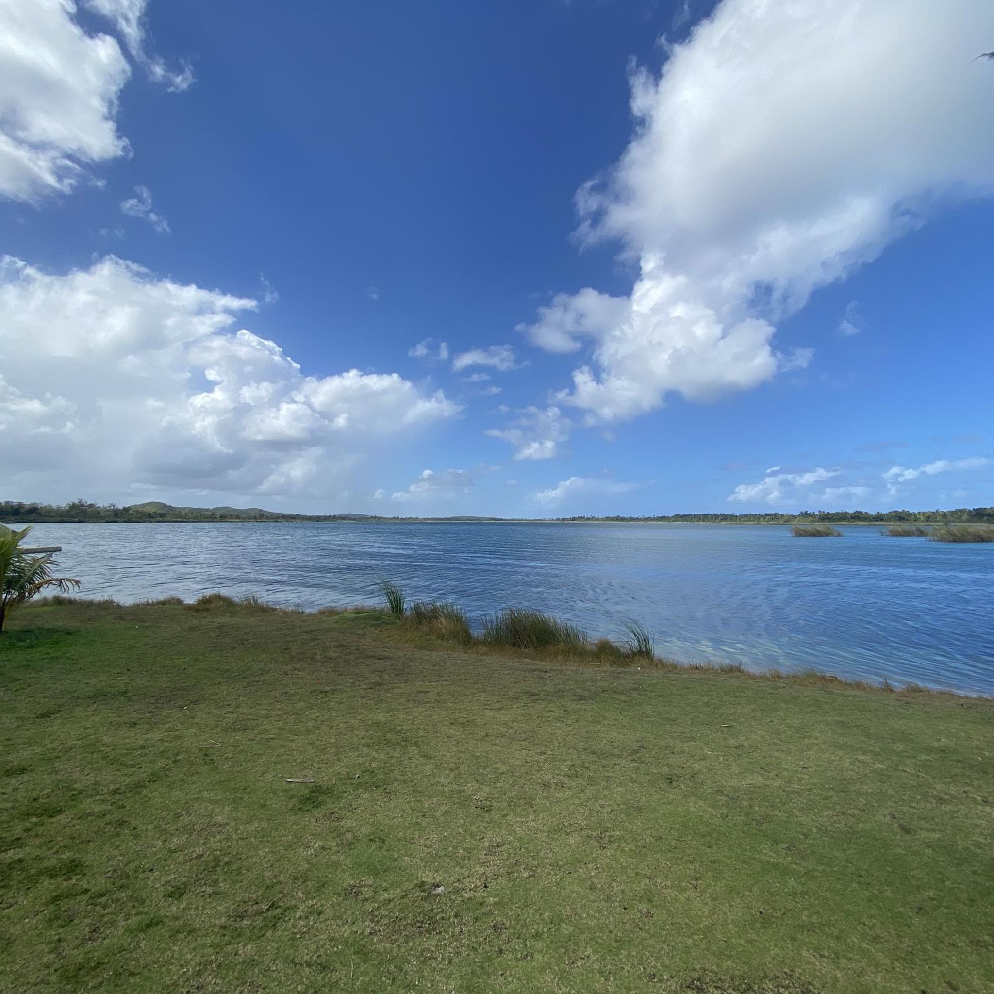
The lagoon covers an area of approximately 2.43 km2 and contains a total volume of water of 708 million gallons. It is made up of two segments: Laguna Tortuguero, which includes the northeastern swamp known as Cabo Caribe, and Laguna Rica. Its prevailing depth is between four to five feet. The most important hydrological consideration is the relationship between the Lagoon and its main water sources; groundwater from aquifers and water that runs through surface river discharges during rains.
0
0
Please dip into these refreshing waters....It is good for the soul.
0
0
Get a well-deserved dip into this urban fresh-water spring just off PR-2.
0
0
Frequently Asked Questions
What types of road cycling routes can I find in Vega Baja Municipio?
Vega Baja Municipio offers a diverse range of road cycling routes, traversing coastal areas with views of beaches and lagoons, as well as inland through fertile plains and rolling hills. The region's Northern Karst topography also adds unique geological features to the scenery. You'll find options catering to various skill levels, from easy coastal rides to more challenging routes with significant elevation changes.
How many road cycling routes are available in Vega Baja Municipio?
There are over 50 road cycling routes available in Vega Baja Municipio, catering to various skill levels. This includes 8 easy routes, 36 moderate routes, and 7 difficult routes, ensuring there's something for every cyclist.
What are some scenic highlights or landmarks I can expect to see on a road cycling route?
Road cycling routes in Vega Baja Municipio often feature stunning natural beauty. You might pass by beautiful beaches like Puerto Nuevo Beach or Playa Los Tubos, or explore areas near the unique Ojo de Agua (Water Spring). Some routes also venture towards natural reserves or offer views of the diverse karst landscape. For example, the Los Tobos Beach – Tortuguero Spring loop from Vega Baja takes you past a natural spring.
Are there any family-friendly road cycling options in Vega Baja Municipio?
Yes, Vega Baja Municipio offers several easy road cycling routes suitable for families. These routes typically feature less elevation gain and are shorter in distance, providing a pleasant experience for all ages. Look for routes categorized as 'easy' on komoot, which are designed to be more accessible.
Can I use public transport with my bicycle in Vega Baja Municipio?
Yes, Vega Baja Municipio's local Citizen Mobility Program (MOVICI) is bike-friendly. Their public transportation services, which cover tourist areas and sports centers, allow passengers to load bicycles onto the front of their buses. This provides a convenient option for cyclists to reach different starting points or combine cycling with public transport for longer distances.
What is the best time of year for road cycling in Vega Baja Municipio?
While specific seasonal considerations aren't detailed, Puerto Rico generally offers pleasant cycling weather year-round. However, it's always advisable to check local weather forecasts, especially for tropical rain showers, and to plan rides during cooler parts of the day, particularly in summer months.
What do other road cyclists say about their experience in Vega Baja Municipio?
The road cycling routes in Vega Baja Municipio are highly rated by the komoot community, with an average score of 5.0 stars from over 4 reviews. Cyclists often praise the varied terrain, from coastal paths to rolling hills, and the options available for different ability levels.
Are there any circular road cycling routes in the area?
Yes, many of the road cycling routes in Vega Baja Municipio are designed as loops, allowing you to start and end at the same point. Examples include the popular Toa Baja Bay – Cerro Gordo Recreational Area loop from Vega Baja and the Ojo de Agua (Water Spring) – Dos Bocas Dam and Lake, Ciales loop from Vega Baja.
Where can I find parking for road cycling routes in Vega Baja Municipio?
While specific parking locations for each route are not detailed, many routes start from central points within Vega Baja or nearby towns. It's recommended to check the starting point of your chosen route on komoot and look for available public parking in that vicinity. Areas near recreational facilities or beaches often have parking options.
Are there any challenging road cycling routes for experienced riders?
Absolutely. Vega Baja Municipio offers several challenging routes, including 7 categorized as 'difficult'. These routes often feature significant elevation changes, such as the Ojo de Agua (Water Spring) – Dos Bocas Dam and Lake, Ciales loop from Vega Baja, which explores inland terrain with substantial climbs, providing a good test for experienced cyclists.
Can I find places to eat or drink along the road cycling routes?
Vega Baja Municipio has various amenities, and routes that pass through or near towns and coastal areas will likely offer access to cafes, restaurants, and food vendors. For instance, Puerto Nuevo Beach, a common point of interest, is known to have food vendors. It's always a good idea to check the route map for towns or populated areas where you can refuel.
What kind of terrain should I expect on road cycling routes in Vega Baja Municipio?
The terrain in Vega Baja Municipio is quite varied. You can expect mostly paved surfaces, ranging from flat coastal roads offering ocean views to rolling hills and gently undulating terrain as you venture inland through agricultural lands. Some routes, especially those exploring the Northern Karst region, may include more significant climbs and descents.

Get inspired with the komoot mobile app


Explore more
Browse the best Road cycling routes in other regions.
