The best walks and hikes in Crawford County
4.5
(21)
185
hikers
22
hikes
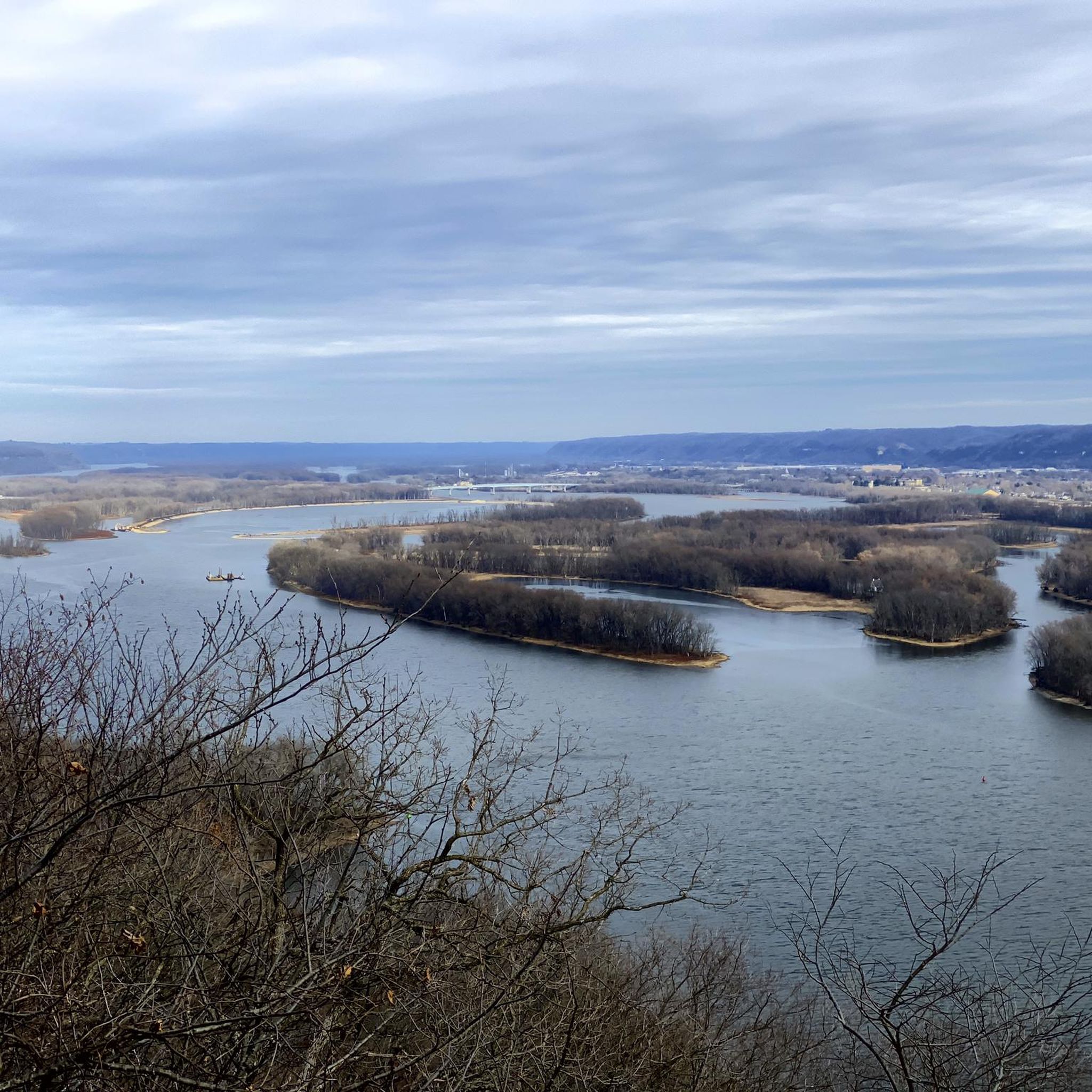
Hikes in Crawford County explore the landscape of southwestern Wisconsin, characterized by rolling hills, river bluffs, and dense woodlands along the Mississippi River. The region's trails are often found within state parks and natural areas, offering routes with moderate elevation changes. Many paths provide viewpoints over the surrounding river valleys and forested terrain.
Best hiking trails in Crawford County
- The most popular hiking route is Pikes Peak State Park loop — Clayton County, Iowa, a 10.3 mile (16.5 km)…
Last updated: August 18, 2026
4.8
(4)
40
hikers
2.74km
00:51
100m
100m
Easy hike. Great for any fitness level. Easily-accessible paths. Suitable for all skill levels.
1
hikers
5.73km
01:39
170m
80m
Easy hike. Great for any fitness level. Easily-accessible paths. Suitable for all skill levels.

Sign up for free
1.54km
00:33
140m
0m
Easy hike. Great for any fitness level. Easily-accessible paths. Suitable for all skill levels.
4.5
(2)
14
hikers
16.5km
04:38
340m
340m
Moderate hike. Good fitness required. Easily-accessible paths. Suitable for all skill levels.
3
hikers
4.18km
01:21
180m
180m
Easy hike. Great for any fitness level. Easily-accessible paths. Suitable for all skill levels.
4.7
(3)
21
hikers
Easy hike. Great for any fitness level. Easily-accessible paths. Suitable for all skill levels.
4.0
(3)
14
hikers
8.42km
02:28
220m
220m
Moderate hike. Good fitness required. Easily-accessible paths. Suitable for all skill levels.
5.0
(1)
17
hikers
3.96km
01:04
50m
50m
Easy hike. Great for any fitness level. Easily-accessible paths. Suitable for all skill levels.
5.0
(2)
12
hikers
4.47km
01:17
110m
110m
Easy hike. Great for any fitness level. Easily-accessible paths. Suitable for all skill levels.
5
hikers
5.71km
01:39
150m
150m
Easy hike. Great for any fitness level. Easily-accessible paths. Suitable for all skill levels.
Get access to more routes and recommendations from other explorers.
Sign up for free
Already have an account?
Our route recommendations are based on thousands of hikes, rides, and runs completed by other people on komoot.
Start today with a free account
Your next adventure awaits.
Login or Signup
Popular around Crawford County
Tips from the Community

In northeastern Iowa, Effigy Mounds National Monument protects over 200 prehistoric earthen mounds, many depicting animal forms such as bears or birds. These were constructed between 500 BC and 1200 AD by indigenous moundbuilders of the Woodland period—some as burial sites, some with ritual significance. The site lies above the Mississippi River in a geologically unique region that remained ice-free during the last ice age and was settled early on. Today, the preserve is part of the National Park Service and an important site of cultural remembrance.
1
0

The visitor center is a great place to begin your exploration of Effigy Mounds National Park. There is an exhibit that describes the natural and human history of the area. There is a small bookstore. And if you are into collecting National Parks cancellation stamps, you can also get those. In addition, this is the starting point for all the trails in the North, South, and more recently acquired Heritage areas of the park.
1
0
The Effigy Mounds Twin Views have two different viewpoints, each with its own bench. This highlight is located at the southern view.
0
0
The Effigy Mounds Twin Views have two different viewpoints, each with its own bench. This highlight is located at the northern view.
3
0
The Marching Bear Group, composed of 10 bear-shaped mounds, was first mapped in 1910 and is one of the key resources cited for creation of the national monument in 1949. The Marching Bear Group, consisting of 10 bear-shaped mounds, was first mapped in 1910 and is one of the primary resources cited for the creation of the national monument in 1949.
3
0
This mound group is situated in a clear grove of trees, allowing for an easy view of the mounds and the Mississippi River valley down below.
3
0
The hike to this overlook from the Effigy Mounds National Monument visitor center is a 1-mile roundtrip, 350 feet elevation gain, 30 minutes. This hike features a view of the interior valley of the Yellow River
2
0

Einfache Wanderung, wir haben im September 5 Adler auf einmal gesehen.
0
0
Frequently Asked Questions
Are there any easy, family-friendly hiking trails in Crawford County?
Yes, there are several options suitable for families. A great choice is the Big Sand Cave – Little Sand Cave loop from Wyalusing State Park. It's a relatively short walk of about 2.8 miles (4.5 km) that explores the unique cave formations in the park, making it an engaging adventure for all ages.
What are the trails like in Crawford County?
The hiking in Crawford County is defined by its location along the Mississippi River. You'll find many trails with rolling hills and paths that climb the river bluffs for rewarding views. The terrain is mostly a mix of dense woodlands and open areas within state parks and natural areas, offering both easy walks and more challenging routes with significant elevation changes.
Are there any hikes with particularly scenic views?
Absolutely. For some of the best views in the region, consider the View from Sentinel Ridge Trail loop from Woodridge Acres. This moderate hike takes you up to vantage points that provide expansive overlooks of the surrounding river valleys and forested landscape.
How many hiking trails are available in Crawford County?
You can find over 15 curated hiking routes in Crawford County on komoot. These range from short, easy walks to more demanding moderate trails, with the majority being easy-rated paths suitable for a wide range of fitness levels.
What do other hikers say about the trails in Crawford County?
The area is highly regarded by the komoot community, with an average rating of 4.5 out of 5 stars. Hikers often praise the beautiful bluff-top views over the Mississippi River valley and the quiet, well-maintained paths through the region's dense woodlands.
Are dogs allowed on the hiking trails?
Dog policies vary by park and trail. For example, in Wisconsin's State Parks like Wyalusing, dogs are generally welcome but must be kept on a leash no longer than 8 feet at all times. They are typically not allowed in picnic areas, on beaches, or inside buildings. Always check the specific regulations for the park or natural area you plan to visit before you go.
Can I find any circular or loop trails?
Yes, many trails in the area are designed as loops so you can end your hike where you started. A good example is the Hiking loop from Monona, a moderate 5-mile (8.1 km) circuit that offers a varied experience through the local landscape.
Are there any challenging day hikes in the area?
While there are no officially 'difficult' rated trails, you can find some challenging moderate hikes. The Pikes Peak State Park loop — Clayton County, Iowa, just across the river, is a substantial 10.3-mile (16.5 km) hike with over 1,000 feet of elevation gain, making for a strenuous day out.
Are there any trails that feature caves or interesting rock formations?
Yes, the region has some interesting geological features. The trail to Eagle Rock Viewpoint – Fire Point Viewpoint loop from Effigy Mounds National Monument not only provides great views but also explores an area known for its unique landscape and historical significance.
What is a good shorter hike for a quick outing?
If you're looking for a shorter walk, the Hiking loop from McGregor is an excellent option. It's an easy 2.5-mile (4 km) trail that can typically be completed in about an hour, perfect for when you're short on time but still want to get outside.
Are there any trails with waterfalls in Crawford County?
The geology of this specific region, characterized by river bluffs and rolling hills, means that large, dramatic waterfalls are not a common feature on the trails. Hikes here focus more on woodland scenery and expansive views over the Mississippi River valley rather than waterfalls.
Most popular routes in Crawford County

Get inspired with the komoot mobile app


Didn’t find what you were looking for?
Check out more Hikes throughout Crawford County below and find the perfect route in your destination.
Explore more
Browse the best Hikes in other regions.
