Routes

Planner

Features

Updates

App

Login or Signup

Get the App

Login or Signup

Routes
Hikes
United States
Nebraska

Douglas County

The best walks and hikes in Douglas County

5.0

(45)

543

hikers

50

hikes

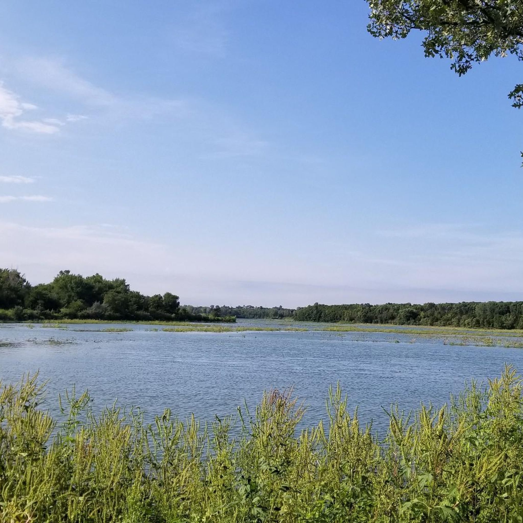
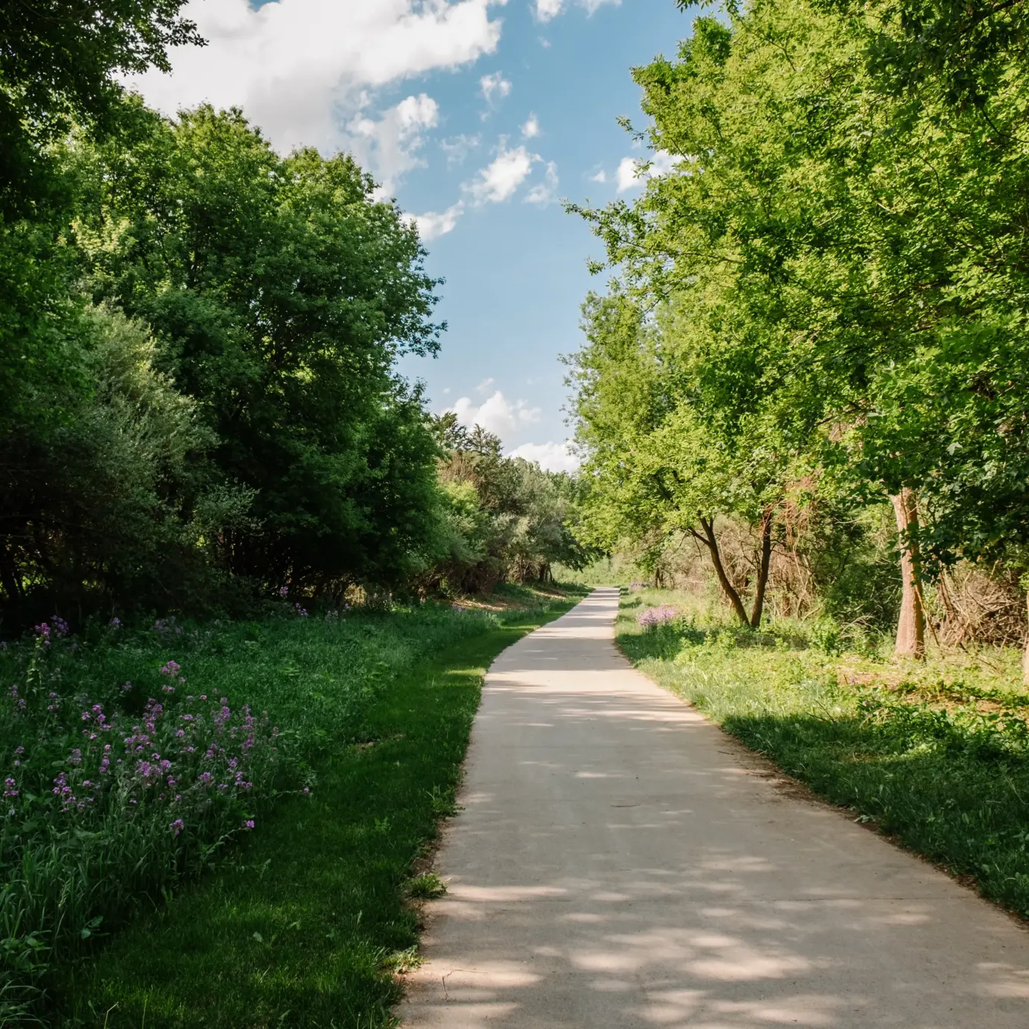
Hiking in Douglas County, Nebraska, offers a network of trails primarily centered around its numerous lakes and urban park systems. The region is characterized by generally flat to gently rolling terrain, with many routes encircling bodies of water or traversing established parklands. These trails provide accessible options for exploring the local environment, often featuring paved or well-maintained paths.

Best hiking trails in Douglas County

  • The most popular hiking route is Standing Bear Lake loop — Omaha, an easy 3.0 miles (4.9 km) trail that takes 1 hour 15 minutes to complete. This loop offers scenic views around the lake.
  • Another top favourite among local hikers is Zorinsky Lake Trail east loop — Omaha, an easy 4.4 miles (7.0 km) path. This trail provides a pleasant walk along the eastern side of Zorinsky Lake.
  • Local hikers also love the Glenn Cunningham Lake loop — Omaha, a 6.2 miles (10.0 km) trail leading through parkland surrounding the lake, often completed in about 2 hours 30 minutes.
  • Hiking in Douglas County is defined by lake loops, urban park trails, and riverfront paths. The network offers options for various ability levels, from easy strolls to moderate excursions.
  • The routes in Douglas County are highly rated by the komoot community with an average score of 4.95 stars from over 25 reviews. More than 245 hikers have used komoot to explore Douglas County's varied terrain.

Last updated: August 18, 2026

1

hikers

#1.

OPPD Arboretum

1.45km

00:23

10m

10m

Explore the OPPD Arboretum on an easy 0.9-mile (1.5 km) hike, gaining just 39 feet (12 metres) of elevation. This route takes about 22 minutes to complete, offering a quick escape into nature. You will find a mix of paved paths, gravel, and soft wood-chip trails winding through native prairies, well-kept gardens, and shaded forested areas, including a notable sycamore from Elvis Presley's Graceland estate.

The arboretum welcomes visitors daily from dawn to dusk with free admission. You can bring your leashed dog to enjoy these family-friendly trails alongside you. Parking is generally available on-site, making it straightforward to access the trailhead and begin your hike.

This unique arboretum showcases over 1,000 trees and shrubs, providing a rich landscape to discover. As you hike, keep an eye out for local wildlife such as birds, rabbits, and butterflies, especially near the pond. The variety of plant life and the peaceful atmosphere make this a distinctive spot for a short, refreshing outdoor experience.

Navigate with device

Send to Phone

Save

Easy

9.10km

02:30

150m

150m

Embark on the Neale Woods Outer Loop for a moderate hike that spans 5.7 miles (9.1 km) with an elevation gain of 507 feet (154 metres). This route typically takes about 2 hours and 30 minutes to complete. As you traverse the trail, you will experience a rich tapestry of deciduous forests and expansive oak savannahs. The path winds through diverse woodlands and prairies, offering panoramic views of the Missouri River and the Omaha skyline from strategic viewpoints. You might spot vibrant wildflowers and various birds, especially during warmer months, adding to the serene atmosphere of this natural area.

Before you head out, be aware that while the trails at Neale Woods are generally well-maintained and clearly marked, early spring hikes can sometimes encounter muddy spots due to seasonal conditions. Plan your visit accordingly, perhaps opting for drier periods if you prefer firmer ground. This area provides a peaceful escape into nature that is easily accessible from the city, making it a convenient choice for a half-day outing. Always check local conditions before you go to ensure the best experience.

The Neale Woods Outer Loop is a true hidden gem, showcasing the unique Loess Hills terrain found in this region. It offers a diverse landscape of woodlands and prairies, providing a vital habitat for local wildlife. This trail stands out for its blend of natural beauty and accessibility, allowing you to immerse yourself in a serene environment without venturing far from urban conveniences. It is an excellent opportunity to connect with nature and enjoy the distinct ecological features of the area.

Moderate
guide_signup
Let us show you the way with the komoot mobile app
With a free komoot account, you can easily find, customize, and navigate endless outdoor adventures.

Sign up for free

8.83km

02:14

20m

10m

The Big Papio Trail invites you to a pleasant hiking experience along a paved path that frequently borders the Big Papillion Creek. You'll enjoy verdant views along the creek's banks as it winds through various city parks, such as Hefflinger Park, creating a unique blend of urban and natural scenery. This moderate route spans 5.5 miles (8.8 km) with a gentle elevation gain of 65 feet (20 metres), typically taking around 2 hours and 14 minutes to complete.

Planning your visit to the Big Papio Trail is straightforward, as numerous access points and parking opportunities are available in the city parks along its route. The trail features grade-separated crossings at most major streets and railways, ensuring a safer experience away from motorized traffic. You can easily find a convenient starting point, making it simple to enjoy this accessible outdoor path.

The Big Papio Trail is a key part of Omaha's larger urban trail network, offering more than just a standalone hike. It connects to the Keystone Trail, allowing you to extend your adventure if you wish. The route's design prioritizes accessibility, providing a multi-use path that caters to a wide range of outdoor enthusiasts looking to explore the city's green spaces.

Moderate

Embark on a moderate hike along the Keystone, Elmwood South, and Memorial Trail, a route that guides you through Omaha's inviting green spaces. You will follow the gentle flow of the Little Papillon Creek, experiencing a pleasant blend of urban parkland and landscaped scenery. This trail covers 5.9 miles (9.5 km) and involves a manageable elevation gain of 191 feet (58 metres). Expect to spend around 2 hours and 27 minutes completing this journey, enjoying the atmosphere of the historic Memorial Park as you pass through.

Planning your visit is straightforward, as parking is generally available near the various park entrances, including Elmwood Park and Memorial Park. You do not need any special permits to enjoy the Keystone, Elmwood South, and Memorial Trail, making it easy to arrive and begin your adventure. This route is known for being family-friendly, and many sections are also suitable for dogs, offering a great option for a leisurely outing with loved ones.

This trail is notable for connecting several key areas within Omaha, providing a unique opportunity to explore different green spaces in one continuous hike. You will encounter a mix of natural elements and carefully maintained landscapes, offering varied views throughout your journey. It is a popular choice for those looking to enjoy the outdoors without venturing far from the city, providing a refreshing escape into nature.

Moderate

Embark on an easy hike across the Bob Kerrey Pedestrian Bridge, a distinctive S-curved, cable-stayed structure offering sweeping views. As you cross, you'll see the downtown skylines of Omaha and Council Bluffs, framed by the scenic Missouri River valley. This short route covers 0.6 miles (0.9 km) with a minimal elevation gain of just 11 feet (3 metres), making it an ideal easy stroll. You can comfortably complete this hike in about 13 minutes, enjoying the open air and unique perspective. At night, the bridge transforms with multi-colored illumination, adding a different atmosphere to your walk.

The Bob Kerrey Pedestrian Bridge is easily accessible for all, whether you are walking, cycling, or running. You will find amenities at the Omaha landing, including the Omaha Plaza, which offers seating, exhibits, and a water jet spray fountain. This makes it a convenient spot to begin or end your journey. The bridge also acts as a gateway to extensive networks of paved trails on both the Nebraska and Iowa sides of the river, allowing you to extend your outing if you wish.

One of the most unique features of the Bob Kerrey Pedestrian Bridge is the opportunity to stand with one foot in Nebraska and the other in Iowa, a popular activity known as "bobbing." This landmark connects two states over the Missouri River, making it a significant regional attraction. Its striking design and dual-state connection make it a memorable spot for visitors and locals alike, offering both a scenic walk and a fun photo opportunity.

Easy

5.0

(4)

27

hikers

The Standing Bear Lake Trail offers a serene escape within Omaha, winding through tranquil parkland with consistent views of the 135-acre Standing Bear Lake. The path is predominantly paved and wide, making it an easy 3.0-mile (4.9 km) loop. You'll pass through open spaces and light woodlands, with a distinctive floating boardwalk providing a unique perspective over the water.

This accessible route is perfect for a quick outing, taking about 1 hour and 15 minutes to complete with a gentle 87 feet (26 metres) of elevation gain. Parking is readily available, and the paved surface makes it suitable for year-round use. It's a multi-use trail, so expect to share it with runners and cyclists, and it's also very dog-friendly.

Beyond its natural beauty, the trail features an unusual wind organ sculpture by Douglas Hollis, adding an artistic touch to your walk. The park and lake are named in honor of Chief Standing Bear, a significant figure in Native American civil rights, adding a layer of historical depth to this peaceful Omaha destination.

Easy

5.0

(1)

23

hikers

Embark on an easy hike across the Bob Kerrey Pedestrian Bridge Trail, a unique S-curve structure offering expansive views of the Omaha skyline and the Missouri River. This gentle route spans 1.4 miles (2.3 km) with a minimal elevation gain of just 20 feet (6 metres), making it accessible for everyone. You can expect to complete this pleasant walk in about 35 minutes, enjoying the open air and scenic surroundings. As you cross, you'll notice the bridge's distinctive twin spires, a prominent feature against the horizon. It's a straightforward path, perfect for a relaxing stroll.

Planning your visit to the Bob Kerrey Pedestrian Bridge Trail is simple, as it's easily accessible from both the Nebraska and Iowa sides of the river. You'll find convenient free parking options available on both ends of the bridge, ensuring a hassle-free start to your hike. The trail is also welcoming to your furry friends, making it a great choice if you wish to bring your dog along for the adventure. For your comfort, amenities like water fountains and restrooms are located nearby, providing all the necessary conveniences for your outing.

What makes this trail particularly memorable is the opportunity to literally stand with one foot in Nebraska and the other in Iowa, right at the state line marker on the bridge. This playful feature adds a unique photo opportunity to your experience. Additionally, keep an eye out for Omar the Troll, a whimsical sculpture nestled underneath the bridge on the Nebraska side, adding a touch of local folklore to your journey. The bridge itself is celebrated as an architectural landmark, connecting two states with its iconic design.

Easy

5.0

(1)

19

hikers

5.04km

01:18

20m

20m

Embark on an easy hike along the Zorinsky Lake Trail, a 3.1-mile (5.0 km) route that offers a pleasant escape into nature. You will enjoy continuous views of the expansive Zorinsky Lake as the path gently winds around its shores. The trail itself is mostly paved, making for a smooth journey, and features minimal elevation gain of just 74 feet (22 metres). Expect to spend about 1 hour and 17 minutes exploring the diverse landscapes, which include stretches through wooded areas and open grasslands. This accessible route is perfect for a relaxing outdoor experience.

Planning your visit is straightforward, as the trail is located within the Edward Zorinsky Recreation Area. Parking is readily available, making it easy to begin your adventure at any point along the route. The path is well-marked with green indicators every tenth of a mile, helping you track your progress effortlessly. This route is particularly suitable for families, those with strollers or wheelchairs, and even older pets due to its high accessibility.

Beyond the lake views, the trail offers a chance to observe local wildlife in its natural habitat. As you move through the open grasslands and natural prairie sections, keep an eye out for wildflowers, deer, and various bird species. The varied scenery, transitioning from lakeside to wooded areas, provides a dynamic backdrop for your outing. This trail stands out as a highly accessible option for enjoying the outdoors in the region.

Easy

5.0

(1)

18

hikers

7.02km

01:49

40m

40m

The Zorinsky Lake Trail offers a refreshing escape into nature right in Omaha, providing a predominantly paved and wide path that makes for an easy 4.4-mile (7.0 km) hike. You'll enjoy continuous views of the expansive 255-acre Zorinsky Lake as the route winds through open grasslands, native tallgrass prairie, and shaded wooded sections near Boxelder Creek. This journey, with only 115 feet (35 metres) of elevation gain, takes about 1 hour and 48 minutes, making it ideal for a leisurely stroll. It's a smooth, accessible experience for all, including those with strollers or wheelchairs.

Planning your visit is straightforward, as the trail is well-maintained and clearly marked. You'll find convenient parking at the Edward Zorinsky Recreation Area, which also provides additional amenities like picnic areas. For the most pleasant conditions, aim to hike during the cooler parts of the day or consider a spring or autumn outing, though some shaded areas offer comfort during warmer months.

This trail is a fantastic spot for wildlife viewing, with opportunities to spot various birds, deer, foxes, and even eagles and waterfowl around the lake. Its diverse environment, blending lakeside views with wooded areas and prairie, makes it a dynamic backdrop for an outing. The Edward Zorinsky Recreation Area also offers fishing and boating, extending your recreational options beyond just hiking.

Easy

5.0

(9)

10

hikers

10.0km

02:33

30m

30m

Embark on a moderate hike around Glenn Cunningham Lake in Omaha, Nebraska, on the Lake Cunningham Trail. This 6.2-mile (10.0 km) loop offers a pleasant outdoor experience, taking about 2 hours and 33 minutes to complete. You'll gain 110 feet (34 metres) as you follow the primarily paved concrete path, enjoying views of the water, surrounding forests, and seasonal wildflowers. Keep an eye out for local wildlife, especially as you cross the Cunningham Lake Bridge, which provides excellent perspectives of the lake itself.

The Lake Cunningham Trail is a multi-use path, making it a popular spot for various activities, including hiking. You'll find ample parking available at different access points located around the lake, making it easy to start your journey. Dogs are welcome to join you on the route, but please ensure they remain on a leash and you clean up after them. The park also provides amenities like picnic shelters and a marina, perfect for extending your visit before or after your hike.

This trail stands out as a key recreational asset in the Omaha area, offering a tranquil escape within the city limits. The designated wildlife area within the park provides a chance to observe local fauna in their natural habitat. Its accessible, paved surface makes it suitable for a wide range of users, from casual walkers to more dedicated hikers looking for a consistent path. The loop design ensures a continuous scenic experience without retracing your steps.

Moderate
Sign up for free to see 41 more hikes in Douglas County.

Get access to more routes and recommendations from other explorers.

Sign up for free

Already have an account?

Our route recommendations are based on thousands of hikes, rides, and runs completed by other people on komoot.

Start today with a free account

Your next adventure awaits.

Login or Signup

Popular around Douglas County

Hiking around Omaha

Hiking around Ralston

Hiking around Boys Town

Hiking in Edward Zorinsky Recreation Area

Hiking around Bennington

Hiking around Waterloo

Running Trails in Douglas County

Cycling in Douglas County

Road Cycling Routes in Douglas County

MTB Trails in Douglas County

Tips from the Community

Brandon
April 30, 2025, One Pacific Park Place

Great trail

0

0

John
September 14, 2024, Dead End

This I guess used to be a mountain bike trail. The path leading to it is closed due lack of upkeep. Neat little ride. I'm new to biking so I thought it was cool.

2

0

The Cunningham Lake Pavilion is a great spot for a break if you are riding the Lake Cunningham Trail. It is a good place to get out of the sun on a hot day and enjoy the wonderful views of the lake.

1

0

From here you gain an awesome view of the bendy Bob Kerrey Pedestrian Bridge. A real feat of engineering and an interesting perspective to view it from.

1

0

The Bob Kerrey Pedestrian Bridge is a 3,000-foot-long pedestrian bridge over the Missouri River between Council Bluffs, Iowa, and Omaha, Nebraska. It is a popular way for cyclist, runners and walkers to move between the two cities.

1

0

Zachary
December 6, 2023, Elmwood Park

Elmwood Park has numerous sports fields, well-maintained trails, and picnic areas near the creek. Interestingly, the first-ever court trial in Nebraska concerned land ownership in what is now Elmwood Park.

0

0

OMAR is a troll that traveled Omaha and wants to share its experiences, especially with kids, in an interactive way. You can find him 'in person' under the Bob Kerrey Pedestrian Bridge.

2

0

The Lewis and Clark National Historic Trail Headquarters and Visitor Center provides visitors with a comprehensive experience related to the Lewis and Clark expedition of 1804–1806. Inside you can find informative exhibits, artifacts, and multimedia presentation about the journey.

2

0

Frequently Asked Questions

How many hiking trails are available in Douglas County?

Douglas County offers a wide selection of hiking routes, with over 40 trails available. These trails primarily feature lake loops, urban park paths, and riverfront routes, catering to various preferences.

What types of terrain can I expect on hikes in Douglas County?

Hiking in Douglas County is characterized by generally flat to gently rolling terrain. Many routes encircle lakes or traverse established parklands, often featuring paved or well-maintained paths. You'll find pleasant walks along bodies of water and through urban green spaces.

Are there any easy, family-friendly hiking options in Douglas County?

Yes, Douglas County is well-suited for family-friendly hikes, with 28 out of 42 routes classified as easy. Trails like the Standing Bear Lake loop — Omaha and Zorinsky Lake Trail east loop — Omaha are popular choices, offering accessible paths and scenic views around the lakes.

What are some points of interest or landmarks I can see while hiking in Douglas County?

Many trails in Douglas County offer views of local landmarks and natural features. You can explore areas around Glenn Cunningham Lake, Zorinsky Lake, and Standing Bear Lake. The Bob Kerrey Pedestrian Bridge — Omaha is also a notable attraction, offering unique views over the Missouri River.

Are there any moderate hiking trails for a bit more challenge?

Yes, Douglas County also offers moderate trails for those seeking a slightly longer or more challenging experience. The Glenn Cunningham Lake loop — Omaha, for example, is a 6.2-mile trail that takes about 2 hours 30 minutes to complete, providing a good moderate excursion through parkland.

What do other hikers say about the trails in Douglas County?

The trails in Douglas County are highly regarded by the komoot community, with an average rating of 4.95 out of 5 stars from over 25 reviews. Hikers often praise the well-maintained paths, scenic lake views, and the accessibility of the urban park systems.

Are there any trails that are particularly scenic?

Many trails in Douglas County offer pleasant scenic views, especially those that loop around the various lakes. The Standing Bear Lake loop — Omaha is known for its picturesque lake views, while the Zorinsky Lake Trail east loop — Omaha provides a pleasant walk along the water's edge.

Can I find circular hiking routes in Douglas County?

Yes, circular routes are a defining characteristic of hiking in Douglas County. Many trails are designed as loops around lakes or through parks, such as the Standing Bear Lake loop — Omaha, the Glenn Cunningham Lake loop — Omaha, and the Flanagan Lake Trail loop — Omaha.

What is the best time of year to go hiking in Douglas County?

Given the generally flat terrain and well-maintained paths, hiking in Douglas County can be enjoyed year-round. Spring and fall offer pleasant temperatures, while summer provides lush greenery around the lakes. Winter hikes are also possible on many of the paved or less challenging trails.

Are there any trails suitable for a quick walk?

For a shorter, easy walk, consider the OPPD Arboretum loop — Omaha, which is just under a mile long and takes about 20 minutes to complete. It's a great option for a quick stroll through a pleasant environment.

What is the longest hiking trail available in Douglas County?

One of the longer options in Douglas County is the Tranquility Trail loop — Omaha, which spans approximately 6.2 miles (10 km). This moderate trail offers a more extended hiking experience through varied parkland.

Most popular routes in Douglas County

Family-friendly hikes in Douglas County

Most popular attractions in Douglas County

Places to see

Store rating

Get inspired with the komoot mobile app

With a free komoot account, you can easily find, customize, and navigate endless outdoor adventures.

or

Join komoot Now

Store rating

Didn’t find what you were looking for?

Check out more Hikes throughout Douglas County below and find the perfect route in your destination.

RalstonOmahaEdward Zorinsky Recreation AreaWaterlooBoys TownBennington

Nearby adventure guides

Things to Do around Boys Town

background

Get ready to conquer new peaks

Sign up for Free

Explore
RoutesRoute plannerFeaturesRedeem a voucherHikesMTB TrailsRoad cycling routesBikepackingSitemap
Download the app
Follow Us on Socials

© komoot GmbH

Privacy Policy