The best road cycling routes in Mills County
5.0
(1)
145
riders
10
rides
Road cycling routes in Mills County traverse a diverse landscape, characterized by the distinctive Loess Hills and the expansive Missouri River floodplain. The region features steep, corrugated hills formed by wind-blown silt, offering varied elevation and panoramic views. Contrasting with the hills, the Missouri River floodplain provides flatter, open terrain. The county also includes woodlands with mature hardwood trees and remnants of native prairies, creating a varied backdrop for road cycling.
Best road cycling routes in Mills County
- The most…
Last updated: July 10, 2026
32
riders
50.5km
03:03
100m
100m
Moderate road ride. Good fitness required. Some segments of this route may be unpaved and difficult to ride.
20
riders
65.7km
03:30
190m
190m
Moderate road ride. Good fitness required. Mostly well-paved surfaces and easy to ride.

Sign up for free
16
riders
Easy road ride. Great for any fitness level. Mostly well-paved surfaces and easy to ride.
46
riders
Moderate road ride. Good fitness required. Mostly well-paved surfaces and easy to ride.
5.0
(1)
11
riders
44.1km
02:24
180m
180m
Moderate road ride. Good fitness required. Some segments of this route may be unpaved and difficult to ride.
10
riders
68.5km
03:43
360m
360m
Moderate road ride. Good fitness required. Mostly well-paved surfaces and easy to ride.
7
riders
14.8km
00:48
20m
20m
Easy road ride. Great for any fitness level. Mostly well-paved surfaces and easy to ride.
3
riders
40.8km
02:12
270m
270m
Moderate road ride. Good fitness required. Mostly well-paved surfaces and easy to ride.
Get access to more routes and recommendations from other explorers.
Sign up for free
Already have an account?
Our route recommendations are based on thousands of hikes, rides, and runs completed by other people on komoot.
Start today with a free account
Your next adventure awaits.
Login or Signup
Popular around Mills County

Tips from the Community


This large park has sports fields, trails, picnic areas, and a golf course. There's parking and access to trails that traverse the city so it's a good place to start and end a ride.
0
0
This popular multi-use trail follows along its namesake creek, connecting numerous parks and neighborhoods. Being multi-use you're likely to encounter walkers, runners, and dogs along the trail so please be courteous to your fellow trail users.
0
0


The facilities were very nice. Picnic tables to have a snack at and a fountain to fill bottles. I usually balk at paying entrance fees to visit nature but the facility is really worth it. The raptor center was worth the price of admission.
1
0

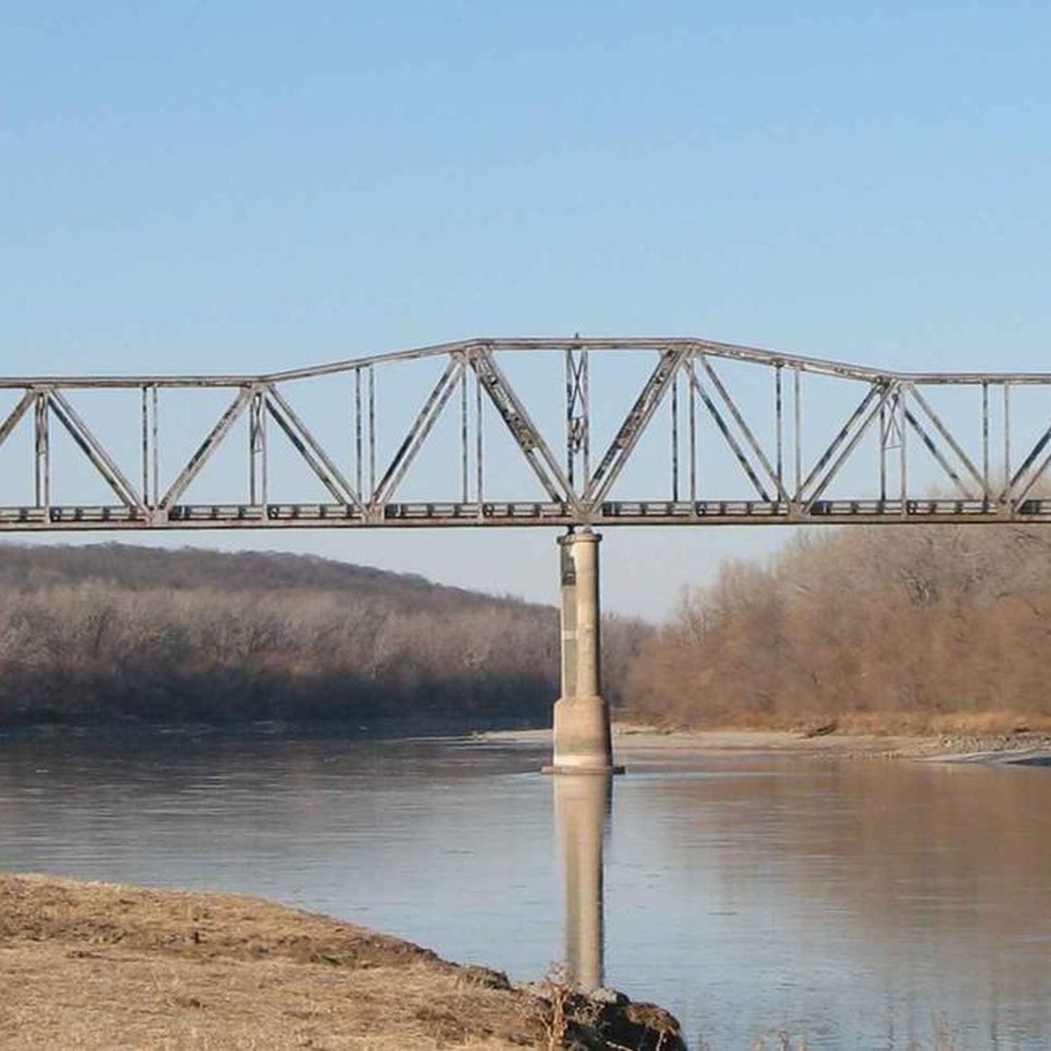
This old railroad bridge reveals the origins of this stretch of trail: It was once part of the country's first transcontinental railroad.
0
0
This pleasant, paved trail runs right past Seymour Smith Park, making it a great option for cycling north or south along the Papillion Creek corridor. Only a little over two miles of the Keystone Trail actually run over the railbed, but you can still see traces of that heritage in pilings, a lingering trestle, and one massive railroad bridge along the trail's length.
0
0

At this spot you cross a nice bridge over West Papio Creek. The water is lined with rushes and tall grasses, which makes the water sometimes a little hard to see from the side, but makes it a popular spot with birds and other wildlife. This is a nice place to slow down and keep an eye out for them!
0
0
Frequently Asked Questions
What kind of terrain can I expect on road cycling routes in Mills County?
Mills County offers a diverse landscape for road cycling. You'll encounter the distinctive Loess Hills, characterized by steep, corrugated hills that provide challenging climbs and panoramic views. In contrast, the Missouri River floodplain offers flatter, more open sections. Routes also traverse woodlands with mature hardwood trees and remnants of native prairies, providing varied scenery.
Are there any family-friendly road cycling options in Mills County?
While many road cycling routes in Mills County feature moderate difficulty due to the Loess Hills, some easier options are available. For a more relaxed experience, consider routes like the Papillion Lake – Halleck Park Arboretum loop from Bellevue Second I Precinct or the Hastings Banner Park – Big Papio Trail loop from Offutt Air Force Base, which are rated as easy. The Wabash Trace Nature Trail, though limestone, is also a popular, peaceful option away from busy roads.
What is the best time of year for road biking in Mills County?
The spring and fall months generally offer the most pleasant conditions for road cycling in Mills County, with milder temperatures and beautiful scenery. Summer can be warm, but early mornings or late afternoons are often suitable. Winter cycling is possible, but be prepared for colder temperatures and potential snow or ice, especially on less-trafficked roads.
Where can I find parking for road cycling routes in Mills County?
Many parks and trailheads throughout Mills County offer parking facilities. For routes that utilize sections of the Wabash Trace Nature Trail, access points in towns like Malvern, Silver City, and Mineola typically have parking available. Larger parks such as Pony Creek Park and Glenwood Archaeological State Preserve also provide parking for visitors.
Are there any long-distance road cycling routes in the area?
Mills County offers several longer road cycling routes for those seeking extended rides. For example, the Keystone Trail – Hastings Banner Park loop from Tregaron Golf covers nearly 70 kilometers, while the Bluestem Prairie Preserve – Hastings Banner Park loop from Offutt Air Force Base is approximately 70 kilometers, winding through varied terrain including prairie remnants.
What are some scenic viewpoints along road cycling routes in Mills County?
The Loess Hills provide numerous opportunities for scenic views. From higher elevations within the Loess Hills, you can often enjoy panoramic vistas of the Missouri River floodplain. Pony Creek Park features a scenic overlook, and Folsom Point Preserve offers sweeping views from its ridges. Mile Hill Lake also has a scenic overlook, providing picturesque views of the lake and surrounding hardwood forest.
Can I find amenities like cafes or accommodation near the cycling routes?
Towns within Mills County, such as Glenwood, Malvern, and Mineola, offer various amenities including cafes, pubs, and accommodation options. These towns are often connected by or are close to popular cycling routes, including the Wabash Trace Nature Trail, making them convenient stops for refreshments or overnight stays.
What makes road cycling in Mills County unique?
Road cycling in Mills County is unique due to its distinctive natural features. The globally rare Loess Hills offer challenging, undulating terrain with significant elevation changes and expansive views, contrasting sharply with the flat, open landscapes of the Missouri River floodplain. The presence of diverse woodlands and native prairie remnants further enhances the scenic variety, providing a rich and varied backdrop for rides.
Are there any specific trails for off-road cycling that connect to road routes?
While this guide focuses on road cycling, the Wabash Trace Nature Trail is a significant off-road option that can complement road routes. This 63-mile former railroad corridor, with its limestone surface, offers a peaceful, traffic-free experience and connects several towns in the county. It provides a great alternative or addition for cyclists looking to vary their terrain.
What do other cyclists say about road biking in Mills County?
The road cycling routes in Mills County are highly regarded by the komoot community, with an average rating of 4.7 stars from over 4 reviews. Cyclists often praise the varied terrain, from the challenging Loess Hills to the tranquil stretches through woodlands and prairies, and the opportunities for scenic views.
Are there any beginner-friendly road cycling routes in Mills County?
Yes, Mills County offers some routes suitable for beginners. While many routes are moderate, options like the Hastings Banner Park – Big Papio Trail loop from Offutt Air Force Base are rated as easy, providing a gentler introduction to road cycling in the region. These routes typically feature less elevation gain and shorter distances.
Can I combine road cycling with other outdoor activities in Mills County?
Absolutely. Mills County's parks and preserves offer a range of outdoor activities that can be combined with road cycling. Pony Creek Park, Glenwood Archaeological State Preserve, and Mile Hill Lake all feature hiking trails. Pony Creek Park also offers camping, making it a good base for multi-day adventures that include both cycling and exploring on foot. For more information on local conservation areas, visit the Mills County Conservation Board website.

Get inspired with the komoot mobile app


Explore more
Browse the best Road cycling routes in other regions.
