Routes

Planner

Features

Updates

App

Login or Signup

Get the App

Login or Signup

Routes
Hikes
United States
Tennessee

Washington County

The best walks and hikes in Washington County

4.4

(14)

153

hikers

15

hikes

Hiking in Washington County, Tennessee, offers a diverse range of outdoor experiences. The region is characterized by its mountainous terrain, including parts of the Cherokee National Forest, and features a mix of dense woodlands, river valleys, and developed linear trails. Elevation gains vary, providing options from gentle, flat paths to more challenging ascents. The landscape supports a variety of natural features, including hills and forested areas, making it suitable for different hiking preferences.

Best hiking trails in Washington County

  • The most popular hiking route is Pinnacle Mountain Fire Tower — Cherokee National Forest, a 9.5 miles (15.3 km) trail that takes about 4 hours 30 minutes to complete, leading to a fire tower with expansive views.
  • Another top favourite among local hikers is Lone Oak Trail, an easy 3.3 miles (5.2 km) path that ascends Buffalo Mountain through forested sections.
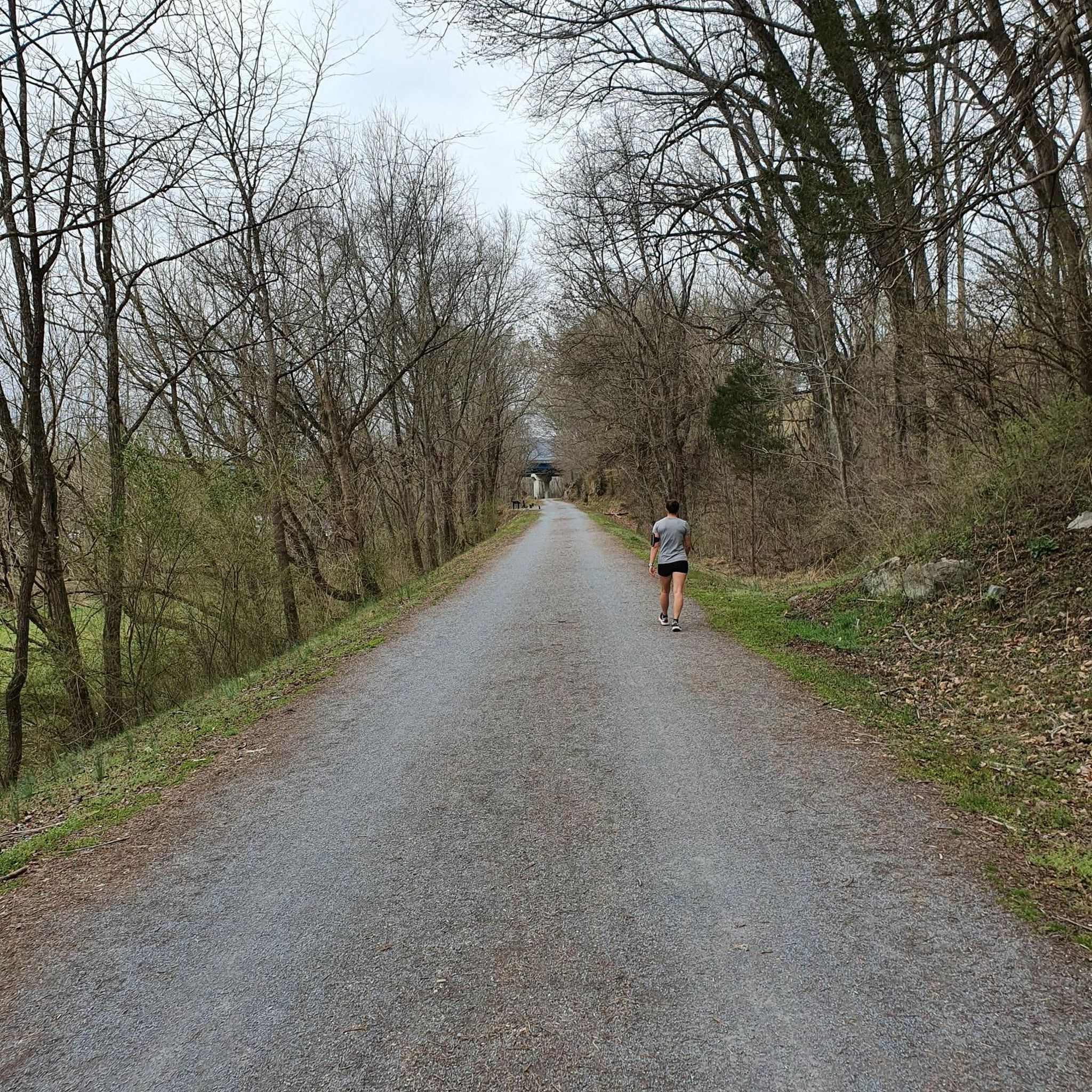
  • Local hikers also love the Tweetsie Trail, a 19.6 miles (31.6 km) trail leading through urban and rural landscapes, often completed in about 8 hours 15 minutes.
  • Hiking in Washington County is defined by forested mountains, linear trails, and local parks. The network offers options for easy strolls, moderate climbs, and difficult long-distance routes.
  • The routes in Washington County are highly rated by the komoot community with an average score of 4.6 stars from over 10 reviews. More than 140 hikers have used komoot to explore Washington County's varied terrain.

Last updated: August 18, 2026

11

hikers

#1.

Buffalo Mountain Tip Top Trail via White Rock Loop and Fork Knob

5.82km

01:55

290m

200m

The Buffalo Mountain Tip Top Trail via White Rock Loop and Fork Knob offers a delightful journey through varied terrain, making it a local favorite for good reason. You'll trek through lush hardwood forests, where wildflowers bloom in spring and fall foliage ignites the hillsides. The trail features a mix of dirt paths, rocky sections, and even some small stream crossings, leading you to the stunning White Rock Overlook with its expansive views over Buffalo Valley and Johnson City. This easy 3.6-mile (5.8 km) hike, with 953 feet (291 metres) of elevation gain, provides a rewarding experience in just under two hours.

Planning your visit to Buffalo Mountain Park is straightforward. The park is very accessible and welcomes leashed dogs, particularly on the White Rock Loop section. Trail markers are generally clear, but keeping an eye on the white blazes is always a good idea, especially after leaf fall. Since this is a popular destination for Buffalo Mountain hiking, consider an early start to enjoy more solitude and secure parking at the trailhead.

This trail system is a testament to the natural beauty of Northeast Tennessee, offering a diverse range of ecosystems from mountain creeks to dense forests. Managed by Johnson City Parks & Recreation, it's a well-cared-for natural asset. You'll notice sections, particularly along the Fork Knob Trail, that show signs of a 2008 wildfire, which has opened up some views but also left behind dead rhododendron and trees, adding a unique character to the landscape.

Navigate with device

Send to Phone

Save

Easy

1

hikers

The ETSU Soccer Field Trail offers a pleasant, easy stroll through the university's athletic complex. You'll walk on well-maintained, likely paved or finely graved paths, enjoying views of the turf and grass soccer fields, surrounded by manicured green spaces and campus landscaping. It's a serene urban escape, perfect for a quick refresh.

This accessible route is ideal for a spontaneous outdoor moment. As it's part of the ETSU Athletic Complex, you can expect convenient access and well-kept surroundings. It's a great option for a short walk whenever you need a break, without needing extensive planning.

At just 0.5 miles (0.9 km) with a mere 11 feet (3 metres) of elevation gain, this easy hike takes only about 13 minutes. It's a notable part of the university's commitment to providing accessible outdoor activity options, offering a quick and fulfilling workout amidst a quiet ambiance within Johnson City.

Easy
guide_signup
Let us show you the way with the komoot mobile app
With a free komoot account, you can easily find, customize, and navigate endless outdoor adventures.

Sign up for free

This easy 0.7-mile hiking loop in David Crockett Birthplace State Park offers scenic creekside views and takes about 18 minutes.

Easy

The Willow Springs Park Loop offers a delightful natural escape within an urban setting, showcasing a successful ecological restoration project. As you walk, you'll pass through shaded willow groves and open grassy areas, with varied native plants and ornamental shrubs. The highlight is Longview Point, which provides panoramic views of the Long Beach skyline and surrounding areas, making it a rewarding, easy stroll.

This 1.0-mile (1.7 km) hike has a gentle 53 feet (16 metres) of elevation gain and takes approximately 26 minutes to complete. Parking is readily available, and the park is dog-friendly, allowing leashed pets on the trails. It's a great option for a quick, low-impact outing, especially after rain when the air is filled with soothing plant aromas.

Willow Springs Park is notable for its historical significance, preserving the site of original artesian springs that once supplied water to early Long Beach. Informational signs along the trail explain the area's history and point out native plant species, adding an educational layer to your visit. It's a peaceful community hub, perfect for families and casual walkers.

Easy

1.24km

00:32

170m

0m

The Cherokee Logging Road offers a refreshing, short hike through the mountainous terrain of Washington County, Tennessee. This easy trail, spanning 0.8 miles (1.2 km) with an elevation gain of 555 feet (169 metres), is a great way to experience the natural beauty of the area, leading you towards the slopes of Cherokee Mountain. You'll likely find yourself on a well-defined, unpaved path, enjoying the forest atmosphere and potential scenic views typical of the Cherokee National Forest.

Planning your visit to the Cherokee Logging Road is straightforward. Located near Jonesborough, Tennessee, this trail is generally accessible for a quick outing. While specific parking details aren't readily available, it's always a good idea to aim for an early start, especially on weekends, to ensure a convenient parking spot and to enjoy the trail during cooler parts of the day. This short duration of about 32 minutes makes it an ideal option for fitting a hike into a busy schedule.

This particular Cherokee Logging Road trail stands out as an easy and quick option compared to some of the more challenging routes in the wider Cherokee National Forest. It's a good choice for families or those new to hiking who want to enjoy the outdoors without committing to a long or strenuous journey. The trail provides a pleasant introduction to the region's landscape, making it a notable spot for a brief escape into nature.

Easy

2.04km

00:34

40m

40m

The Heights Trail offers a delightful urban escape, winding along a paved pathway that traces former railroad corridors and runs alongside White Oak Bayou. You'll experience a dynamic mix of scenery, from charming row homes and historic houses to local businesses and temporary art installations. It's a predominantly flat route, making it an easy 1.3-mile (2.0 km) walk that's perfect for a relaxed outing, with views of the Houston skyline in some areas.

Planning your visit to this easy 34-minute route is straightforward. The trail is well-integrated into the historic Heights neighborhood, providing numerous access points. Street parking is generally available nearby, and its urban setting means it's easily reachable. It's a great option for a casual stroll at any time of day, though mornings are particularly pleasant.

This trail is more than just a recreational path; it's a vital community connector, linking various parks, coffee shops, and restaurants. It serves as a model for trail-oriented development, showcasing how green spaces can integrate with and enhance urban living. You might even spot local wildlife like cardinals, blue jays, and butterflies along the way.

Easy

4.5

(2)

15

hikers

5.24km

01:51

290m

290m

The Lone Oak Trail offers a delightful hiking experience, guiding you through a landscape that tells a story of resilience and recovery. You'll traverse a singletrack path of natural gravel and packed dirt, winding your way up through smaller trees and bushes. The open views from the ridgeline, culminating at the "Tip Top (Buffalo Mountain Highpoint)" overlook, are a true highlight, making the steady climb well worth the effort.

Planning your visit is straightforward; the trailhead is easily accessible, though arriving early is always a good idea to ensure parking, especially on busy days. Remember to bring plenty of water and sun protection, as the trail has less shade in areas still recovering from a past fire. Dogs are welcome to join you on this adventure, and there are picnic tables along the route for convenient rest stops.

This 3.3-mile (5.2 km) easy hike, with its 965 feet (294 metres) of elevation gain, is a fantastic way to experience the natural beauty of Washington County, Tennessee, in just under 2 hours. The trail's unique character, shaped by its recovery from a 2008 fire, provides a distinct perspective on the local ecosystem, offering expansive views that might otherwise be obscured by dense canopy.

Easy

3.0

(1)

1

hikers

31.6km

08:12

200m

200m

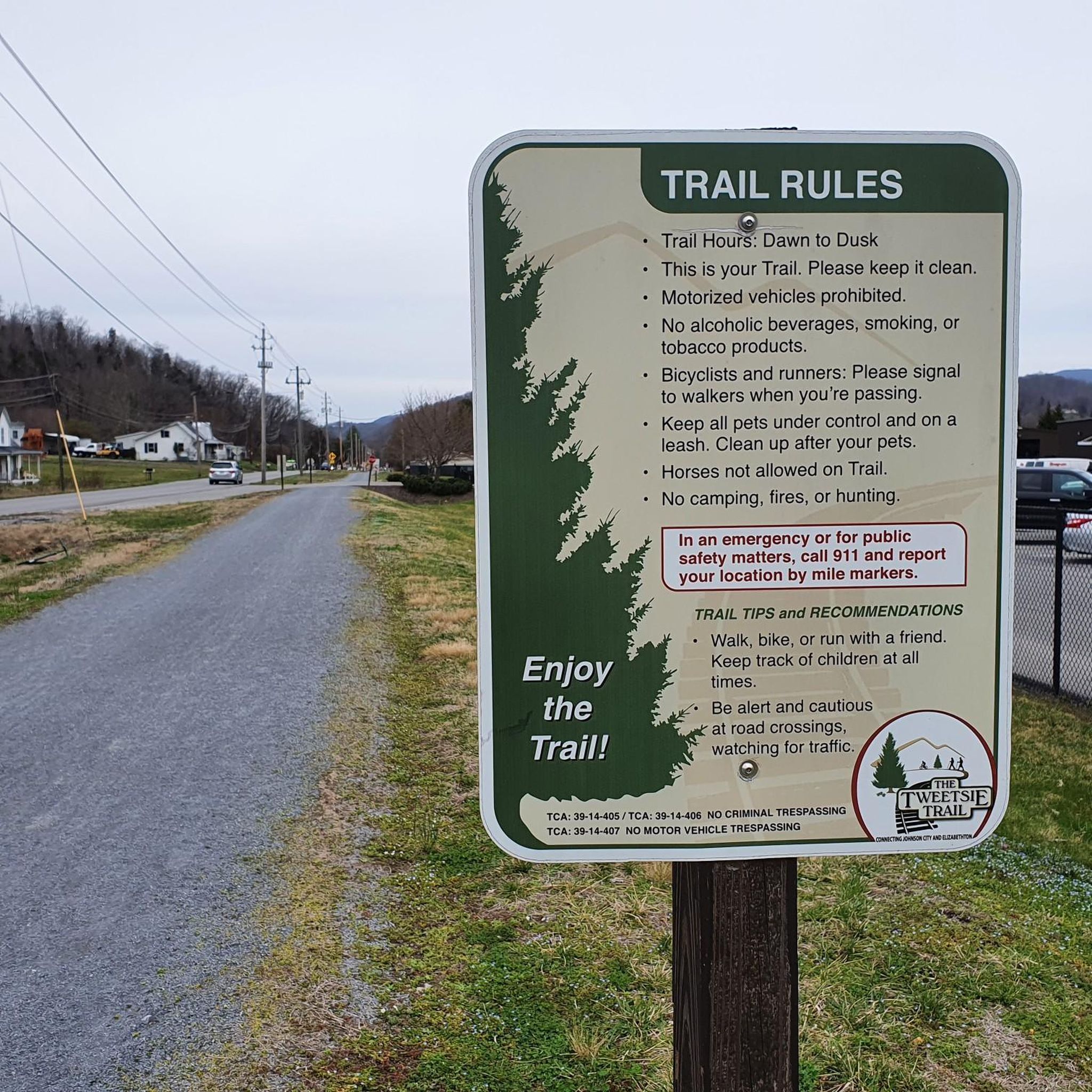
The Tweetsie Trail offers a unique journey through northeastern Tennessee, blending natural beauty with historical significance. As you hike, you'll follow the path of a former railroad, enjoying a mostly flat grade that winds through picturesque pastures, vibrant hardwood forests, and alongside the Watauga River. Keep an eye out for the seven bridges and a notable rock tunnel that add character to this long, immersive route, which is rated difficult due to its 19.6-mile (31.6 km) distance.

Planning your visit to the Tweetsie Trail is straightforward, with accessible trailheads in both Johnson City and Elizabethton. While the trail's 668 feet (204 metres) of elevation gain is gradual, the full 8 hours and 12 minutes duration means you should plan for an early start and carry sufficient supplies. The trail is dog-friendly, provided your pet is on a leash, making it a great option for a long outing with your canine companion.

This trail holds the distinction of being Tennessee's longest rails-to-trails project, named after the

Hard

1

hikers

2.25km

00:34

0m

0m

The Founders Park loop offers a delightful and easy hiking experience right in the heart of Johnson City, perfect for a quick escape into nature. This paved route stretches for 1.4 miles (2.3 km) with a negligible elevation gain of just 14 feet (4 metres), making it incredibly accessible for everyone. As you wander, you'll enjoy expansive green spaces, the soothing sound of a creek, and a unique collection of public art and sculptures that add visual interest to your journey.

Planning your visit to this urban oasis is simple; its downtown location means you're never far from amenities. The entire loop can be completed in about 34 minutes, making it an ideal choice for a short, refreshing walk. It's also a fantastic option if you're looking for dog-friendly trails, as leashed pets are welcome, and you'll find plenty of nearby cafes and shops to explore.

Beyond its natural beauty, Founders Park is a notable community hub, completed in 2014 as part of a stormwater retention project. The park features an amphitheater and a large open-air pavilion, frequently hosting community events, concerts, and festivals. This blend of ecological function, public art, and community gathering space makes it a popular route for families and locals alike.

Easy

The State of Franklin Linear Trail is an easy, paved path that winds through Johnson City, offering a convenient urban escape. You'll experience a mix of local businesses and residential areas, making it a great spot for a casual walk, run, or bike ride. With only 28 feet (8 metres) of elevation gain over 3.1 miles (5.0 km), it's a very accessible route for nearly everyone.

Planning your visit is straightforward, as parking is generally available, particularly near downtown Johnson City. The trail is open year-round, but be mindful of busy road crossings, especially in the southern sections, which may require extra caution. It's a multi-use trail, so you'll share the path with cyclists and other pedestrians.

This trail is notable for its connectivity, linking North to South Johnson City and providing access to the historic C&O Depot. It also connects to the "Downtown Spur" and "Tweetsie Trail Spur," opening up possibilities for longer adventures. Along the route, and especially in the downtown area, you'll find amenities like restaurants, coffee shops, and shopping.

Easy
Sign up for free to see 6 more hikes in Washington County.

Get access to more routes and recommendations from other explorers.

Sign up for free

Already have an account?

Our route recommendations are based on thousands of hikes, rides, and runs completed by other people on komoot.

Start today with a free account

Your next adventure awaits.

Login or Signup

Popular around Washington County
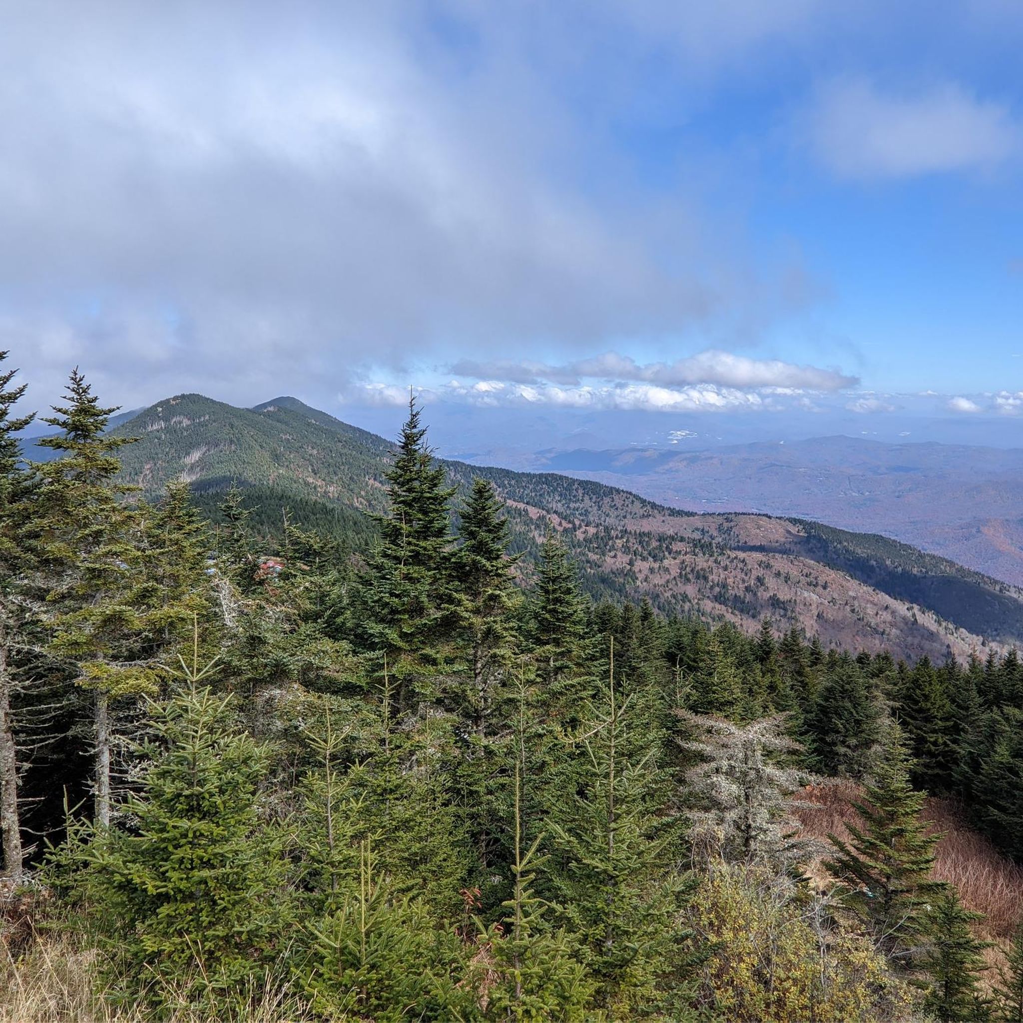
Hiking in Sampson Mountain Wilderness

Hiking around Embreeville

Hiking around Johnson City

Hiking around Jonesborough

Hiking around Fall Branch

MTB Trails in Washington County

Cycling in Washington County

Running Trails in Washington County

Road Cycling Routes in Washington County

Tips from the Community

mtm05005
June 5, 2025, Johnson City

Johnson City is situated at the Appalachian foothills and is a popular destination for hikers. There are several multiuse trails that cut through the city, as well as numerous trails in the nearby hills.

0

0

mtm05005
June 5, 2025, Founders Park

Founders Park is a 5-acre green space located in downtown Johnson City. There are several trails that take you through the park, as well as picnic tables and benches.

0

0

The State of Franklin Linear Trail is a 5 mile mulituse trail. The path is popular with hikers, cyclists and runners. The trail is fully paved, without much elevation gain, so it is not a challenging trail.

0

0

mtm05005
June 5, 2025, C&O Depot

The C&O Depot in Johnson City, Tennessee, originally served as the Carolina, Clinchfield & Ohio Railway station, playing a pivotal role in the city's development as a major rail hub in the early 20th century. Today, the restored building functions as the Johnson City Visitor Center, preserving its historical significance while welcoming travelers to the region.

0

0

Buffalo Mountain Park is a 725-acre nature preserve featuring steep, forested terrain. There are several miles of hiking trails that have great views of the nearby mountains and valleys.

0

0

Matthew
January 30, 2024, Tweetsie Trail

The Tweetsie Trail is an entirely crushed-gravel rail trail traveling from Johnson City through the town of Elizabethton, Tennessee. The trail is fairly new and is super popular for walking, running, and biking. There are a bunch of different trailheads along the way, and the path itself offers access to different parks and connecting trails.

0

0

Matthew
January 30, 2024, Tweetsie Trail

The Tweetsie Trail is an entirely crushed-gravel rail trail traveling from Johnson City through the town of Elizabethton, Tennessee. The trail is fairly new and is super popular for walking, running, and biking. There are a bunch of different trailheads along the way, and the path itself offers access to different parks and connecting trails.

0

0

Buffalo Mountain Park is home to a variety of different trails and visitors. It can be agreed, though, that the highlight of the park is the highpoint of Buffalo Mountain. Regardless of what trail you take, follow signs towards "Tip Top" to find your way to the top of this spectacular mountain top with views of Johnson City in one direction and the mountains of Cherokee National Forest in the other.

1

0

Frequently Asked Questions

What kind of terrain can I expect when hiking in Washington County?

Washington County, Tennessee, features a diverse landscape dominated by mountainous terrain, including parts of the Cherokee National Forest. You'll find a mix of dense woodlands, river valleys, and developed linear trails. Elevation gains vary significantly, offering everything from gentle, flat paths to more challenging ascents through forested areas.

Are there any easy, short hikes suitable for beginners or a quick stroll?

Yes, Washington County offers several easy and relatively short trails. For example, the Founders Park loop — Johnson City is a very gentle 1.4-mile (2.3 km) path with minimal elevation gain, perfect for a relaxed walk. Another good option is the Buffalo Mountain via Lone Oak Trail — Cherokee National Forest, an easy 3.3-mile (5.2 km) path through forested sections.

What are some notable landmarks or points of interest to see while hiking?

Washington County's trails offer access to several interesting landmarks. You can reach Tip Top (Buffalo Mountain Highpoint) for scenic views. The Lone Oak Trail itself is a popular feature, and the historic Main Street in Jonesborough offers a glimpse into the region's past. The Tweetsie Trail is also a significant local landmark, following a historic railway line.

Are there any circular hiking routes in Washington County?

Yes, there are several circular routes available. For instance, the Sunset Point – Buffalo Mountain Park loop from Huckleberry Knob is an easy 3.6-mile (5.8 km) loop. Another moderate option is the White Rock loop from Round Knob, covering about 3.7 miles (6 km).

When is the best time of year to go hiking in Washington County?

The best time for hiking in Washington County is generally during the spring and fall. Spring brings blooming wildflowers and mild temperatures, while autumn offers vibrant fall foliage. Summer can be warm and humid, but shaded forest trails provide relief. Winter hiking is possible, especially on lower elevation trails, but some higher routes might have colder conditions.

What do other hikers enjoy most about the trails in Washington County?

The hiking routes in Washington County are highly rated by the komoot community, with an average score of 4.6 stars. Reviewers often praise the diverse terrain, from forested mountains to linear trails, and the variety of options suitable for different skill levels. The expansive views from points like the Pinnacle Mountain Fire Tower are also frequently highlighted.

Are there any longer or more challenging hikes for experienced hikers?

For those seeking a longer and more challenging experience, the Tweetsie Trail — Johnson City is a difficult 19.6-mile (31.6 km) trail that can take over 8 hours to complete, traversing urban and rural landscapes. Another moderate option with significant elevation gain is the Pinnacle Mountain Fire Tower — Cherokee National Forest, a 9.5-mile (15.3 km) trail leading to a fire tower with expansive views.

Is parking generally available at trailheads in Washington County?

Parking availability varies by trailhead. Many popular trailheads, especially those within the Cherokee National Forest or designated parks like Founders Park, typically offer dedicated parking areas. For specific routes, it's always advisable to check the route details on komoot for information regarding parking facilities near the starting point.

Are there any trails that are less crowded or considered 'hidden gems'?

While popular trails like the Tweetsie Trail can see more activity, Washington County's extensive network of nearly 20 routes includes many quieter options, especially within the Cherokee National Forest. Trails like the Hiking loop from Unicoi offer a moderate experience away from the busiest spots, allowing for a more serene outdoor experience.

Can I find trails near amenities like cafes or shops in Washington County?

Yes, especially for trails located closer to or within urban areas like Johnson City. The Founders Park loop — Johnson City and the State of Franklin Linear Trail — Johnson City are examples of routes that are easily accessible from town centers, where you can find various amenities, including cafes and shops, before or after your hike.

Are there any trails suitable for families with children?

Many of the easy-rated trails in Washington County are suitable for families. The Founders Park loop — Johnson City is particularly family-friendly due to its short distance and flat terrain. The Sunset Point – Buffalo Mountain Park loop from Huckleberry Knob is another easy option that offers a pleasant experience for families.

How many hiking trails are available in Washington County?

Washington County offers a wide selection of hiking opportunities, with nearly 20 distinct routes available on komoot. These trails range in difficulty from easy strolls to challenging long-distance hikes, catering to various preferences and fitness levels.

Most popular routes in Washington County

Easy hikes in Washington County

Most popular attractions in Washington County

Places to see

Store rating

Get inspired with the komoot mobile app

With a free komoot account, you can easily find, customize, and navigate endless outdoor adventures.

or

Join komoot Now

Store rating

Didn’t find what you were looking for?

Check out more Hikes throughout Washington County below and find the perfect route in your destination.

JonesboroughEmbreevilleSampson Mountain WildernessJohnson CityFall Branch

Nearby adventure guides

Things to Do around Jonesborough

Things to Do around Fall Branch

background

Get ready to conquer new peaks

Sign up for Free

Explore
RoutesRoute plannerFeaturesRedeem a voucherHikesMTB TrailsRoad cycling routesBikepackingSitemap
Download the app
Follow Us on Socials

© komoot GmbH

Privacy Policy