The best MTB trails in Maricopa County
4.7
(462)
6,127
riders
422
rides
Mountain biking in Maricopa County offers extensive trail systems across diverse Sonoran Desert landscapes. The region is characterized by rugged mountains, including the McDowell and Estrella ranges, and distinctive red rock formations. Riders can explore hundreds of miles of singletrack, from flowy desert paths to technical routes with significant elevation changes. This area provides a wide array of options for outdoor enthusiasts seeking varied terrain.
Best mountain bike trails in Maricopa County
- The most popular mountain bike trail is Granite Loop - Branding Iron - Watershed - Chuckwagon Loop, a 10.1 miles (16.3 km) trail that takes 1 hour 27 minutes to complete, offering an easy ride through the desert.
- Another top favourite among local mountain bikers is Lower Corona de Loma and Thash Kavid Loop, a moderate 3.4 miles (5.4 km) path. This route provides a scenic experience within the Sonoran Desert environment.
- Local mountain bikers also love the Horseshoe Reservoir and Dam via Forest Road 205, an 8.7 miles (14.1 km) trail leading through desert scenery near Horseshoe Reservoir, often completed in about 42 minutes.
- Mountain biking in Maricopa County is defined by the vast Sonoran Desert, prominent mountain ranges, and unique red rock formations. The extensive network of routes offers options for all ability levels, from easy desert loops to challenging technical singletrack.
- The routes in Maricopa County are highly rated by the komoot community with an average score of 4.6 stars from over 300 reviews. More than 6,000 mountain bikers have used komoot to explore Maricopa County's varied terrain.
Last updated: September 27, 2026
5.0
(1)
17
riders
16.3km
01:27
190m
180m
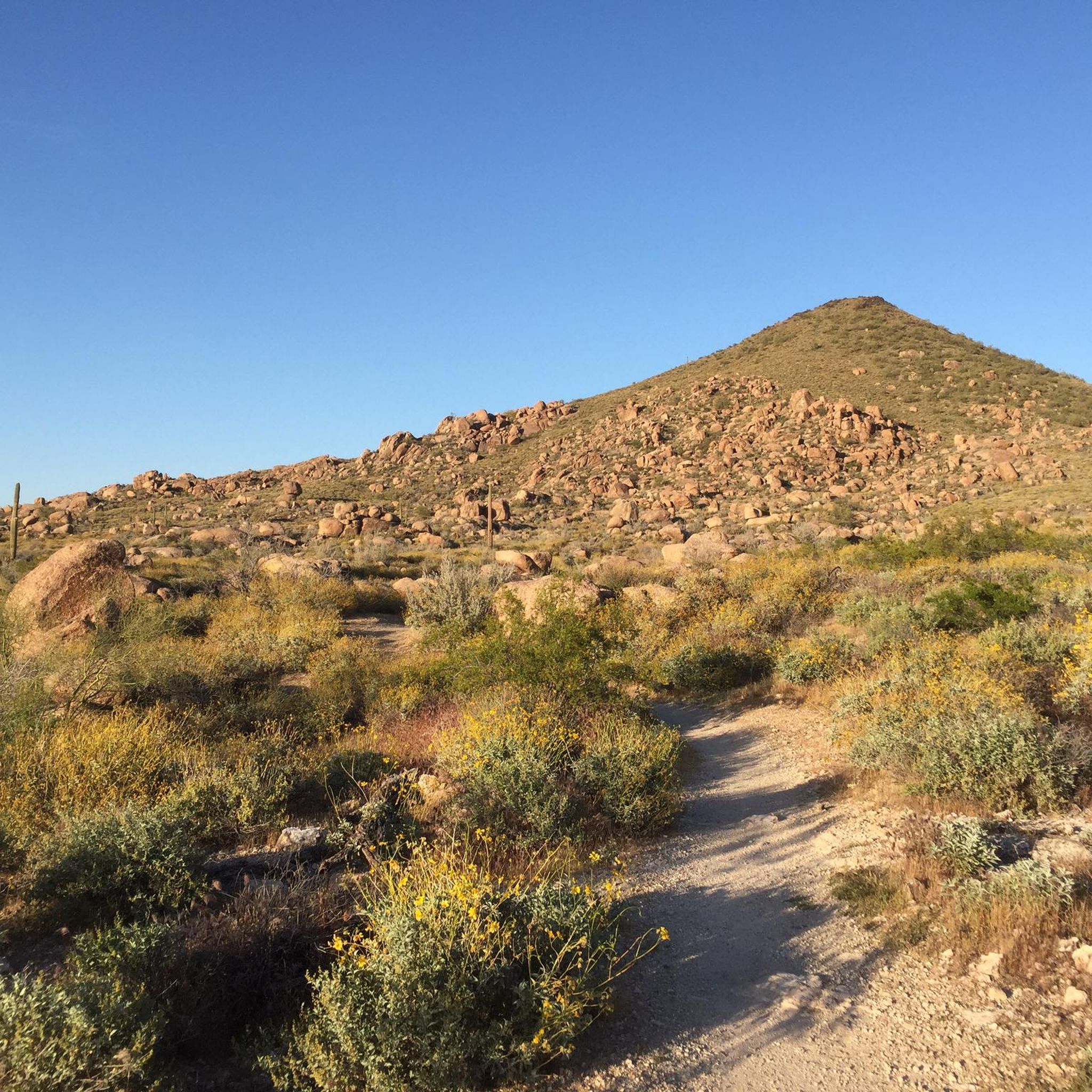
Embark on an easy mountain biking adventure through the Sonoran Desert on the Granite Loop - Branding Iron - Watershed - Chuckwagon Loop. This 10.1-mile (16.3 km) route features rolling and twisty singletrack, offering a varied ride with some technical sections and rock features. You will gain 611 feet (186 metres) in elevation, which you can complete in about 1 hour and 26 minutes. As you ride, you'll encounter winding desert trails, gradual climbs, and descents that contour through washes, all while enjoying views of unique cacti forests and impressive granite formations. Look out for the distinctive Balanced Rock along the way.
The route is easily accessible within the McDowell Sonoran Preserve, making it convenient for a quick ride. Parking is generally available at designated trailheads, so you should find a spot without much trouble. Before heading out, always check local conditions, especially if you plan to ride during warmer months. Remember to carry plenty of water to stay hydrated throughout your mountain biking experience.
This trail offers a fantastic opportunity to explore the diverse Arizona desert landscape, showcasing the unique ecosystem of the Sonoran Desert. You will ride through areas with abundant cacti forests and enjoy spectacular views of granite formations and the surrounding mountains, including the Tonto National Forest. The varied terrain, from singletrack to washes, provides a dynamic experience that highlights the natural beauty of the preserve.
3
riders
5.43km
00:29
60m
60m
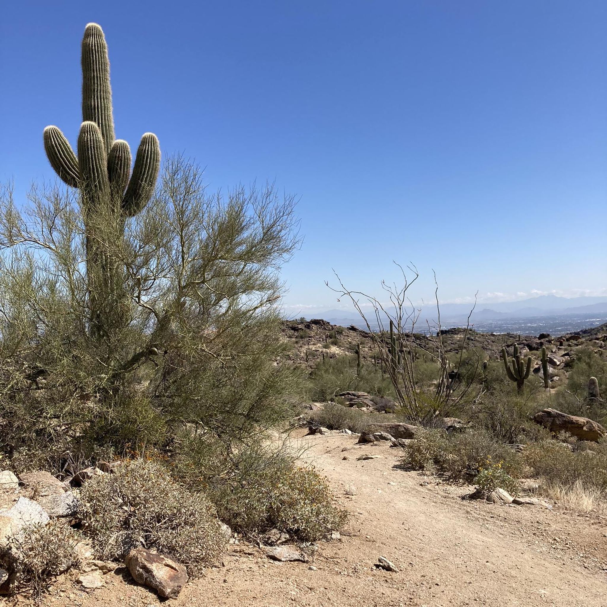
The Lower Corona de Loma and Thash Kavid Loop offers a dynamic mountain biking experience in Phoenix's South Mountain Preserve. You'll navigate the challenging, rocky sections of Lower Corona de Loma, which features tight switchbacks and ridgeline views, before transitioning to the more forgiving, flowy singletrack of Thash Kavid. Expect classic desert scenery, including saguaro cacti, throughout this diverse route.
This moderate 3.4-mile (5.4 km) mountain bike loop, with 190 feet (58 metres) of elevation gain, can be completed in about 28 minutes. While Lower Corona de Loma demands technical skill and might require carrying your bike in spots, Thash Kavid provides a smoother, more accessible ride. It's a great option for riders looking to test their skills on varied terrain without a huge time commitment.
This trail is notable for combining two distinct riding styles within a single route, offering both technical challenge and cross-country flow. The Lower Corona de Loma section is often highlighted for its adventurous feel and solitude, while Thash Kavid is a popular multi-use trail. This blend makes the loop an engaging ride that can sharpen your technical abilities.

14.1km
00:42
90m
560m
Embark on an easy mountain biking adventure along Forest Road 205, leading you to the serene Horseshoe Reservoir and Dam. This 8.7-mile (14.1 km) route offers classic Arizona desert landscapes, where you'll pedal past wild grasses and enjoy views of distant mountain ranges. You'll gain a gentle 297 feet (90 metres) in elevation, making it a relaxed ride that typically takes around 42 minutes to complete. As you ride, keep an eye out for the Verde River and the unique sight of the dam, which can form a waterfall when water is released. The trail provides a remote desert experience, perfect for escaping the city bustle and enjoying the quiet. You'll navigate an unpaved dirt and gravel road, encountering some loose sections that add to the adventure. This journey promises a peaceful escape into nature.
To reach the Horseshoe Reservoir and Dam, you'll start on Forest Road 205. Be aware that while the first two miles are paved, the road transitions into an unmaintained, unpaved dirt and gravel surface for approximately 11 miles leading up to the reservoir. This varied terrain, including loose dirt and gravel, means you should be prepared with appropriate bike handling skills. The route is ideal for those seeking quiet recreation and serene desert views, so plan your visit during cooler parts of the day or year for the most comfortable experience.
This trail offers a unique glimpse into the Tonto National Forest, showcasing a remote desert environment. You might notice evidence of past fires with burned trees in certain areas, adding to the rugged character of the landscape. The Horseshoe Reservoir itself is a quiet haven, providing a peaceful escape from crowds, while the historically significant dam is a notable landmark. This route is a great choice if you're looking for a mountain bike trail that combines natural beauty with a sense of solitude near the reservoir.
4.8
(13)
105
riders
22.2km
01:57
230m
230m
The Desert Classic Trail offers a true taste of Sonoran Desert mountain biking, winding through varied terrain from hardpack to sandy washes. You'll encounter fun ups and downs, with rolling elevation changes that keep the 13.8-mile (22.2 km) route engaging without any sustained, brutal climbs. Keep an eye out for iconic desert flora and expansive views, particularly towards the Helipad on the western side, which are especially vibrant during wildflower season.
To start your ride, head to the Pima Canyon trailhead, which provides parking, restrooms, and water. This is a very popular trail, so plan to share the path with other riders and hikers, especially on weekends. Given the desert environment, always carry plenty of water, regardless of the season, and consider riding in the cooler parts of the day or year.
This route is considered a
5.0
(1)
105
riders
24.5km
02:08
230m
230m
Get ready for a classic Sonoran Desert mountain biking experience on the Pemberton Trail Loop. This moderate route spans 15.2 miles (24.5 km) and features a total elevation gain of 757 feet (231 metres), typically taking around 2 hours and 7 minutes to complete. You will ride through landscapes dotted with iconic saguaros and unique rock outcroppings, enjoying a fun 'roller coaster feel' on mostly singletrack. As you climb, you will be treated to expansive views of the McDowell Mountains and the Verde River Valley, particularly stunning during sunrise or sunset.
The Pemberton Trail Loop is easily accessible from multiple points within McDowell Mountain Regional Park, making it convenient to start your ride. You can bring your Class 1 pedal-assist e-bike, as they are permitted on this route, offering more options for enjoying the desert. Consider riding early in the morning or late afternoon for the best light and cooler temperatures, especially if you want to catch those stunning sunrise or sunset views. The trail is well-signed, ensuring a straightforward navigation experience.
This loop is a popular choice for mountain bikers seeking a rewarding desert adventure. A unique feature along the way is Jackass Junction, a designated rest stop where you can take a break. During the summer months, McDowell Mountain Park occasionally offers special moonlight rides on this trail, providing a truly unique night riding experience under the desert sky.
5.0
(2)
72
riders
15.8km
01:42
430m
430m
The Mormon Loop and National Trail offers a demanding mountain biking experience through the iconic Sonoran Desert landscape, complete with towering Saguaro cacti and impressive rock formations. This moderate 9.8-mile (15.8 km) loop features a significant 1413 feet (431 metres) of elevation gain, typically taking about 1 hour and 42 minutes to complete. You'll encounter everything from rocky climbs and descents to technical features like "the waterfall" and sandy patches near Fat Man's Pass, making it a true test of skill.
Planning your ride means preparing for a popular trail, especially on weekends. The route is very exposed to the sun, so an early start is highly recommended to beat the heat, particularly during warmer seasons. Always bring ample water, as there are no resupply points along the way, and be ready for a challenging, technical ride.
This trail system, often called the "SoMo Rolling Pin," is a favorite training ground for advanced mountain biking in Phoenix, known for its diverse terrain and technical challenges. Riders are treated to stunning views of the Phoenix skyline from viewpoints like Mormon Lookout, making the effort worthwhile. It's a prime example of the challenging trails available in the South Mountain Preserve.
4.8
(6)
44
riders
23.8km
01:58
110m
110m
Wind your way through the stunning Sonoran Desert on the Apache Wash and Brawling Badger Loop, an easy 14.8-mile (23.8 km) mountain biking route that offers a delightful mix of hard-packed dirt, gravely sections, and occasional sandy washes. With only 367 feet (112 metres) of elevation gain, you'll cruise past iconic saguaros and vibrant cactus gardens, especially picturesque in the spring. This loop is known for its fast straights and curves, providing an engaging ride that can be completed in just under two hours.
Accessing the trail is straightforward, with ample parking and bathrooms available at the Apache Wash Trailhead, though remember to bring your own water as there's none on site. Since this is a multi-use path, you'll share it with hikers and equestrians, so be mindful and yield when necessary. It's wise to plan your visit outside of the monsoon season and avoid riding on wet trails to preserve their condition.
This loop is an excellent choice for beginners looking to build confidence on desert terrain, or for more experienced riders seeking a relaxed, scenic outing. It's often combined with other trails like Esplanade and Cliff Walk for a longer adventure, showcasing the diverse landscapes of the Phoenix Sonoran Preserve. The well-maintained and clearly marked paths make navigation simple, allowing you to focus on the beautiful desert vistas.
5.0
(3)
37
riders
10.8km
00:55
60m
60m
The Apache Wash Loop offers a quintessential Sonoran Desert mountain biking experience, perfect for those new to the sport or seeking a relaxed ride. You'll navigate fun singletrack winding past iconic saguaros, prickly pear, and barrel cacti, with expansive views of the desert landscape. While generally smooth, expect some gravely sections, occasional rock croppings, and sandy dips into washes that add a bit of spice to the ride.
This easy 6.7-mile (10.8 km) loop, with a gentle 207 feet (63 metres) of elevation gain, is easily accessible from the Apache Wash trailhead, which has convenient parking and restrooms. It's a popular multi-use trail, so be prepared to share the path with hikers and equestrians. Plan your ride to avoid the monsoon season, when washes can become impassable, and always bring ample water.
Beyond being a great standalone ride, the Apache Wash Loop serves as an excellent gateway to a broader network of trails, including Sidewinder and Ocotillo, allowing you to extend your adventure. It's particularly noted as a confidence-building route, making it one of the best mountain bike routes in the area for skill development and enjoying the desert's natural features.
32
riders
36.9km
03:10
620m
620m
Embark on the Cave Creek Cactus Classic Race loop, a mountain biking adventure through the Sonoran Desert. This moderate route spans 22.9 miles (36.9 km) and challenges you with 2034 feet (620 metres) of elevation gain, typically taking about 3 hours and 9 minutes to complete. You'll navigate technical singletrack, rocky climbs, and exciting descents, all while surrounded by the unique desert landscape within the Spur Cross Ranch Conservation Area and Cave Creek Regional Park. Keep an eye out for the Overton Trail Viewpoint, which offers wide-open views of the scenic wild west. This trail promises a rewarding experience for riders seeking a diverse and demanding desert ride.
When planning your visit, remember that this route demands both skill and endurance, so come prepared. It's crucial to be self-sufficient and carry plenty of water, as the desert environment offers limited easy exits. Parking is generally available at the various trailheads located within the conservation area and regional park, making access straightforward. Consider starting your ride early to avoid the midday heat, especially during warmer months, and ensure you have enough daylight to complete the loop comfortably.
The Cave Creek Cactus Classic Race loop stands out for its journey through the historic Spur Cross Conservation Area, where you can ride past the ruins of the old Spur Cross Dude Ranch. This area is rich in natural beauty, showcasing the rugged Arizona desert with its distinctive flora and fauna. The trail's challenging nature and scenic vistas make it a notable option for mountain bikers looking to explore the unique environment of the region. It offers a true taste of desert riding, combining physical challenge with historical and natural intrigue.
5.0
(2)
33
riders
17.9km
01:37
270m
270m
Embark on the Estrella Competitive Long Loop for an easy mountain biking adventure through the classic Arizona desert. This route offers a mix of singletrack and doubletrack, with the backside of the Estrellas providing some fun, twisty sections. You will cover 11.1 miles (17.9 km) and gain 872 feet (266 metres) in elevation, typically taking about 1 hour and 37 minutes to complete. Expect rugged and rocky terrain, featuring some steep climbs, drops, and fast corners as you ride.
Before you head out, be aware that there is a drive-in fee to enter Estrella Mountain Regional Park to access the trails. It is a good idea to check the current park entrance fees ahead of time. As you navigate the route, prepare for sections with loose rocks and sand, which can make some turns a bit more challenging. Planning your visit during cooler parts of the day is often best for desert riding.
This loop provides expansive views of the surrounding mountains and the remote desert landscape. It is a great way to experience the unique environment of Estrella Mountain Regional Park. You might even catch distant city lights as the sun begins to set, adding a special touch to your ride.
Get access to more routes and recommendations from other explorers.
Already have an account?
Our route recommendations are based on thousands of hikes, rides, and runs completed by other people on komoot.
Start today with a free account
Your next adventure awaits.
Popular around Maricopa County

Other adventures in Maricopa County


Tips from the Community

December trail running at its best! Well marked, pleasant hikers, and views that cheer on the reason to the run.
0
0


Really useful trail head with water and toilet facilities.
0
0
Fast and fun, well worth including!
0
0

The Granite Mountain Loop offers spectacular views along the way. This particular viewpoint can be found by taking a small spur trail off of the main trail. The viewpoint looks out into Tonto National Forest.
0
0

If you venture onto a smaller trail from the Granite Mountain Loop, you'll be treated to breathtaking views of the Tonto National Forest. It's a great stopping spot to take a break and savor the scenery, with plenty of rocks available for seating.
0
0
The Pima Canyon Trailhead is one of the most popular trailheads for the South Mountain Preserve. There are a bunch of different trails that start/finish in the parking lot (including the National Trail), and there are a bunch of different loop and route options starting from here. There are restrooms, trail maps, and adequate parking at this trailhead.
0
0

Not an easy trail but not impossible either, it fits perfectly with a blue rating. Some might struggle with the climb, or the rocks, but most should be able to ride this trail if they pick their lines carefully. It's also the first stage of the Cave Creek Cactus Classic mountain bike race, so if you are interested in racing you can test yourself on a competitive trail.
0
0
Frequently Asked Questions
How many mountain bike trails are available in Maricopa County?
Maricopa County offers a vast network of mountain biking opportunities, with over 400 routes available on komoot. These trails cater to all skill levels, from easy desert rides to challenging technical routes across diverse Sonoran Desert landscapes.
What is the best time of year to go mountain biking in Maricopa County?
Thanks to its warm climate, Maricopa County is an ideal destination for mountain biking year-round. However, the cooler months from fall through spring (October to April) are generally preferred for more comfortable riding conditions, avoiding the intense summer heat.
Are there mountain bike trails suitable for beginners in Maricopa County?
Yes, Maricopa County has numerous trails perfect for beginners. Approximately 140 easy routes are available. A great option for an easy ride through the desert is the Granite Loop - Branding Iron - Watershed - Chuckwagon Loop, which is 10.1 miles long.
Where can I find challenging mountain bike trails in Maricopa County?
For experienced riders seeking a challenge, Maricopa County offers over 130 difficult routes. Areas like Estrella Mountain Regional Park and Gold Canyon are known for their technical sections, steep climbs, and rocky terrain. The Cave Creek Cactus Classic Race loop is a demanding 22.9-mile route with significant elevation gain.
Are there any loop mountain bike trails in Maricopa County?
Many mountain bike trails in Maricopa County are designed as loops, offering varied scenery without retracing your path. Popular loop options include the Pemberton Trail Loop in McDowell Mountain Regional Park, a moderate 15.2-mile ride, and the Apache Wash and Brawling Badger Loop, an easy 14.8-mile trail.
What kind of terrain can I expect on mountain bike trails in Maricopa County?
Mountain biking in Maricopa County primarily takes you through the stunning Sonoran Desert. You'll encounter diverse terrain including flowy singletrack, rugged mountains, distinctive red rock formations, and sometimes rocky sections. Trails often feature unique desert flora like saguaros and offer scenic vistas of the surrounding landscape.
What do other mountain bikers enjoy most about riding in Maricopa County?
The mountain biking experience in Maricopa County is highly rated by the komoot community, with an average score of 4.6 stars from over 300 reviews. Riders frequently praise the extensive network of trails, the unique Sonoran Desert scenery, and the variety of routes available for all skill levels.
Are there any family-friendly mountain bike trails in Maricopa County?
Yes, Maricopa County Parks system provides welcoming amenities and kid-friendly activities, making it suitable for families. Many easy and moderate trails are great for family outings. The Horseshoe Reservoir and Dam via Forest Road 205 offers an easy 8.7-mile ride through desert scenery.
What natural attractions can I see near the mountain bike trails in Maricopa County?
Maricopa County is rich in natural beauty. While mountain biking, you can explore areas near the iconic Papago Park Red Rock Formations, or ride through the vast McDowell Sonoran Preserve. Lake Pleasant Regional Park also offers water activities alongside trails. The Sonoran Desert itself is a major attraction, with unique flora and wildlife.
Are there any long-distance mountain bike trails in Maricopa County?
For those looking for longer rides, Maricopa County has several options. A significant portion of the 800-mile Arizona Trail runs through the county, offering extensive opportunities for long-distance mountain biking. The Desert Classic Trail is another popular choice, spanning 13.8 miles of easy terrain.
Are there mountain bike trails near Phoenix in Maricopa County?
Yes, many excellent mountain bike trails are easily accessible from Phoenix. South Mountain Park and Preserve is a popular spot offering breathtaking views. McDowell Mountain Regional Park and Usery Mountain Regional Park are also within a reasonable drive, providing extensive trail systems close to the city.
What are some less crowded mountain bike trails in Maricopa County?
While popular parks can get busy, exploring trails in areas like White Tank Mountain Regional Park or the Spur Cross Ranch Conservation Area might offer a more secluded experience. The Estrella Competitive Long Loop, though part of a competitive track, can offer a less crowded experience on weekdays.
Most popular routes in Maricopa County
Most popular attractions in Maricopa County

Get inspired with the komoot mobile app


Didn’t find what you were looking for?
Check out more MTB trails throughout Maricopa County below and find the perfect route in your destination.
Explore more
Browse the best MTB trails in other regions.
