The best running trails in Cheshire County
104
runners
43
runs
Jogging in Cheshire County offers diverse landscapes for runners, characterized by extensive rail trails, forested parks, and riverine paths. The region features a mix of terrain, from the relatively flat and accessible surfaces of former railroad lines to more challenging, uneven paths with elevation changes in its state parks. These natural spaces provide varied running experiences through forests, past water features, and across rolling hills.
Best jogging routes in Cheshire County
- The most popular jogging route is Cheshire Recreational Rail Trail, a 13.8 miles (22.2 km) trail that takes about 2 hours 39 minutes to complete. This route offers a long, relatively flat path through varied scenery, connecting several towns.
- Another top favourite among local runners is Wantastiquet Mountain Trail, a difficult 3.8 miles (6.2 km) path. This trail provides significant elevation gain and offers views of the Connecticut River and surrounding forests.
- Local runners also love the Kilburn Loop, a 3.0 miles (4.8 km) trail leading around Kilburn Pond with scenic forest views, often completed in about 31 minutes.
- Jogging in Cheshire County is defined by rail trails, dense woodlands, and river valleys. The network offers options for different ability levels, from easy loops to more challenging mountain trails.
- More than 100 runners have used komoot to explore Cheshire County's varied terrain.
Last updated: October 10, 2026
7
runners
7.13km
01:13
490m
490m
If you're looking for a challenging jogging route, the Dublin Trail delivers a demanding experience over 4.4 miles (7.1 km). You'll navigate heavily-worn, rocky, and rooted terrain, with steep sections that often require hands-on scrambling. As you ascend, you'll be treated to beautiful valley views and scattered viewpoints, all building up to the panoramic vistas from the Mount Monadnock Summit. This difficult route involves a significant 1606 feet (489 metres) of elevation gain, typically taking around 1 hour and 13 minutes to complete. It's a true calf-burner, offering a less crowded path to the top of this iconic peak.
Before you head out, be prepared for strenuous conditions on the Dublin Trail. While experienced trail runners might tackle sections, the steep and rocky nature of the route means it's often considered more of a hike. Ensure you have appropriate footwear for the rooted and rocky terrain. Always check Monadnock State Park guidelines for current information on parking and access before your visit.
The Dublin Trail stands out as a less-traveled option to reach the summit of Mount Monadnock, often referred to as the "mountain that stands alone." This route provides a unique perspective on the region's natural beauty, allowing you to experience the demanding ascent with fewer crowds. It's a rewarding choice for those who appreciate a challenging climb and the satisfaction of earning expansive views from a renowned New England peak.
4
runners
6.19km
01:04
290m
290m
Embark on a challenging jogging adventure along the Wantastiquet Mountain Trail, a difficult 3.8-mile (6.2 km) route that climbs 964 feet (294 metres). This journey, typically completed in about 1 hour and 4 minutes, rewards your effort with expansive vistas. As you jog upwards, you will pass several mid-mountain viewpoints before reaching a striking rock outcrop. From this spot, you can take in panoramic views of the Connecticut River Valley, the town of Brattleboro, and Vermont's Green Mountains. Look closely, and you might even identify distant ski areas like Mount Snow, Stratton, and Bromley from the View of Vermont from Wantastiquet Mountain Stone Post. The trail also winds through peaceful forests, offering a varied natural experience as you tackle its steady uphill climb, steep sections, and uneven surfaces.
To begin your outing, access the trail conveniently from the Wantastiquet–Monadnock Trailhead. While there are no specific warnings to note, you should prepare for a consistent ascent. This route is a popular choice for outdoor enthusiasts, especially those who appreciate dramatic views that are still quite accessible. Plan your visit to allow ample time to enjoy the scenery from the summit.
This trail is nestled within the Wantastiquet Mountain Natural Area, making it a significant feature of the local landscape. It stands out as a rewarding option for experienced joggers seeking a substantial climb and impressive overlooks. The combination of a vigorous workout and the sweeping views across the region makes this route a notable destination for those exploring the area.

4
runners
6.46km
01:12
540m
540m
If you're looking for a challenging jogging route, the Marlboro Trail delivers a tough ascent to the iconic Mount Monadnock Summit. This difficult 4.0 miles (6.5 km) route will have you gaining a significant 1769 feet (539 metres) of elevation. You can expect varied terrain as you push towards the top, with the entire journey taking around 1 hour and 12 minutes. The effort is well worth it for the expansive views you'll find at the summit, offering a true sense of accomplishment.
Before you head out, be prepared for potentially wet conditions on the trail, especially after rainfall. It's a good idea to wear appropriate waterproof footwear to keep your feet dry and comfortable throughout your jogging experience. Always check the current weather forecast before starting your journey to ensure safe conditions. Planning your visit around drier periods can enhance your overall experience on this demanding route.
This route is located within Monadnock State Park, an area renowned for its natural beauty and challenging hiking opportunities. Mount Monadnock itself is a prominent New Hampshire peak, known for its exposed summit and panoramic vistas. The trail offers a direct and strenuous path to the top, making it a popular choice for those seeking a rigorous workout and rewarding views of the surrounding landscape.
2
runners
22.2km
02:39
150m
150m
Embark on the Cheshire Recreational Rail Trail for a challenging jogging experience that takes you through diverse New Hampshire landscapes. This difficult route spans 13.8 miles (22.2 km) and involves a total elevation gain of 502 feet (153 metres), typically taking about 2 hours and 39 minutes to complete. As you jog, you will pass through dense wooded areas, alongside natural rock walls, and past serene ponds, with occasional glimpses of Mount Monadnock and the impressive stone arch bridge over the Ashuelot River in Keene.
When planning your visit, be aware that while much of the trail is relatively flat, the northern sections, especially north of Keene, present a more rugged challenge. You might encounter rougher terrain, larger rocks, and areas prone to flooding or erosion, along with some steep inclines. Parking is generally available in the towns situated along the route, such as Keene, which also offers convenient amenities like coffee shops and restaurants for a pre or post-jog stop.
The Cheshire Recreational Rail Trail follows a historic railway corridor, offering a unique blend of natural beauty and local heritage. You will pass through charming towns like Troy, where an old railroad depot stands as a reminder of its past, and Fitzwilliam, home to the Depot General Store. This trail provides a substantial workout while allowing you to explore the scenic and historical fabric of the region.
9.74km
01:00
30m
30m
Embark on a moderate jogging experience along the Fort Hill Recreational Rail Trail, a 6.1 miles (9.7 km) route that offers varied terrain and scenic views. As you jog, you will gain 101 feet (31 metres) in elevation, typically completing the journey in about 1 hour. The trail follows the east bank of the Connecticut River, providing picturesque glimpses of the water and surrounding landscape, with surfaces ranging from packed earth to gravel and sand.
When planning your visit, be aware that the trail's mixed surfaces can include rutted areas, which might affect your jogging rhythm. During summer months, some sections may feel overgrown due to lush vegetation, so consider this when choosing your attire. There are no specific warnings regarding closures or permits, but checking local conditions before you head out is always a good idea.
This route stands out for its blend of natural beauty and historical elements. Keep an eye out for old telegraph poles that line parts of the path, hinting at its past as a communication corridor. Further north, you will encounter an impressive, albeit derelict, truss bridge, a unique landmark that adds character to your jogging adventure.
1
runners
4.85km
00:32
50m
50m
Lace up your shoes for an easy jogging experience on the Kilburn Loop, a scenic route that winds around the picturesque Kilburn Pond. This 3.0-mile (4.8 km) trail offers a refreshing outing, taking you through attractive hemlock, beech, oak, and pine forests. You will gain a gentle 175 feet (53 metres) in elevation, making it a perfect choice for a quick 31-minute run. Enjoy views of tranquil wetlands and beaver ponds as you move along the path. In late spring, you might spot thickets of mountain laurel blooming, or plan your visit for autumn to witness vibrant fall foliage.
Planning your visit to the Kilburn Loop is straightforward, as the trail is open year-round, welcoming joggers in any season. You can easily access the route from the Kilburn Trailhead, where parking is generally available for your convenience. If you like to bring your canine companion along, you will be pleased to know that dogs are permitted on this trail. This makes it a flexible option for a spontaneous run or a planned outing with your pet. Consider visiting during the cooler parts of the day in summer, or enjoy the crisp air during spring and autumn.
This loop is nestled within Pisgah State Park, offering you a chance to explore one of its largest bodies of water, Kilburn Pond. The diverse forest types you encounter, from hemlock to oak, contribute to the rich natural environment of the area. Keep an eye out for the subtle signs of wildlife, particularly around the beaver ponds and wetlands. The trail's accessibility and natural beauty make it a notable option for a quick escape into nature within the park.
3.90km
00:26
80m
80m
Jog along the picturesque Connecticut River on the Wantastiquet Mountain Natural Area River Trail, where continuous water views accompany you. This easy 2.4-mile (3.9 km) route follows an old dirt road, offering a softer surface underfoot than paved paths. You will experience a gentle ascent of 268 feet (82 metres) over approximately 25 minutes, making it a perfect choice for a relaxed outing. The riverside setting creates a visually appealing backdrop for your run.
This highly accessible trail is suitable for families and even strollers, making it an inclusive option for a quick escape into nature. You will find it easy to navigate, and there are no specific permits or fees mentioned for this particular section. Consider visiting during daylight hours to best enjoy the river scenery and the natural surroundings.
The Wantastiquet Mountain Natural Area River Trail is a popular choice for easy jogging in the area, known for its pleasant atmosphere. While enjoyable on its own, it also serves as a gateway, connecting you to a larger network of trails within the Wantastiquet Mountain Natural Area. If you are looking to extend your run or explore more challenging routes, you have onward options available.
4.32km
00:33
80m
80m
Start your jogging adventure on the Goose Pond loop, an easy 2.7 miles (4.3 km) route through the scenic Greater Goose Pond Forest. You will gain 276 feet (84 metres) of elevation, making it a refreshing 33-minute outing. The trail winds around the beautiful Goose Pond, offering peaceful views of the water and surrounding woodlands, perfect for a tranquil jog.
Accessing the Goose Pond loop is straightforward, with generally accessible trailhead parking available. The trailhead parking is generally accessible, providing an easy start to your journey. Always check local conditions before you go, especially during different seasons, to ensure a smooth visit. This preparation helps you avoid any unexpected issues and fully enjoy your time on the trail.
This route is nestled within the expansive Greater Goose Pond Forest, providing a quiet escape from daily life. It offers a great option for a quick, refreshing run when you need to clear your head. The natural setting around Goose Pond makes it a notable spot for outdoor activity in the region.
3.15km
00:21
30m
30m
Lace up for an easy jogging experience on the Gilson Pond Remote Campsites Loop, a scenic route nestled within a natural, forested environment. This 2.0-mile (3.1 km) loop offers a quick escape, with gentle terrain and only 88 feet (27 metres) of elevation gain, making it perfect for a refreshing 21-minute run. As you move, you'll catch serene glimpses of Gilson Pond, providing a peaceful backdrop to your activity.
Planning your visit is straightforward, with parking readily available at Monadnock State Park. Remember that pets are not permitted anywhere in the park, including on this trail, so plan accordingly. The route is well-marked, with the remote campsites themselves indicated by yellow disks and blue blaze markers, ensuring you can easily navigate your way.
This loop offers a unique opportunity to explore the base of Mount Monadnock, immersing you in the region's characteristic woodland. While the trail is generally easy, be aware of some varied and uneven surfaces that add a touch of natural challenge. It's a great way to connect with nature and enjoy a quick, invigorating jog in a tranquil setting.
2.70km
00:23
90m
90m
Prepare for a challenging jogging experience on the Anne Stokes Loop Trail, a difficult route covering 1.7 miles (2.7 km) with a significant 301 feet (92 metres) of elevation gain. This loop, which takes about 23 minutes to complete, winds through varied and rugged terrain, offering a true test for experienced trail runners. As you jog, you will pass through beautiful wooded areas, including a serene hemlock forest. Keep an eye out for fine views of the surrounding mountains and valleys, especially from the scenic Indian Pond overlook. The path features steep, rocky sections that can be slick, so be ready for an engaging run.
When planning your visit to the Anne Stokes Loop Trail, remember that parking is conveniently available near the historic Madame Sherri House ruins. From there, the trailhead is just a short walk away. This difficult route is best suited for experienced trail runners due to its demanding nature. Be aware that the steep, rocky areas can become particularly slick during wet weather, so choose your jogging days carefully. Starting earlier in the day might offer cooler temperatures and fewer people on the path. Always check local conditions before heading out to ensure a safe and enjoyable run.
What truly sets this trail apart is its unique historical context within the Madame Sherri Forest. The route's proximity to the captivating ruins of Madame Sherri's 'castle' adds a distinctive element to your jogging adventure. This blend of natural beauty and historical intrigue makes the Anne Stokes Loop Trail more than just a workout; it is an exploration. The trail is a rewarding option if you are looking for a challenging run with a touch of local history.
Get access to more routes and recommendations from other explorers.
Already have an account?
Our route recommendations are based on thousands of hikes, rides, and runs completed by other people on komoot.
Start today with a free account
Your next adventure awaits.
Popular around Cheshire County

Running Trails in Bear Mountain State Forest
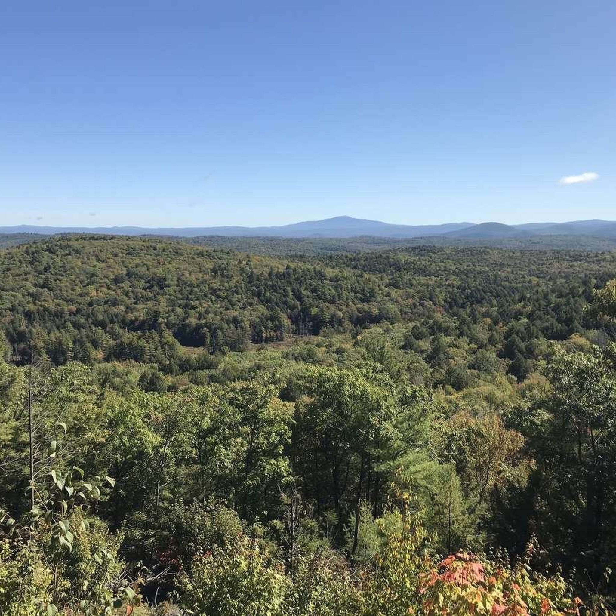
Running Trails in Pisgah State Park
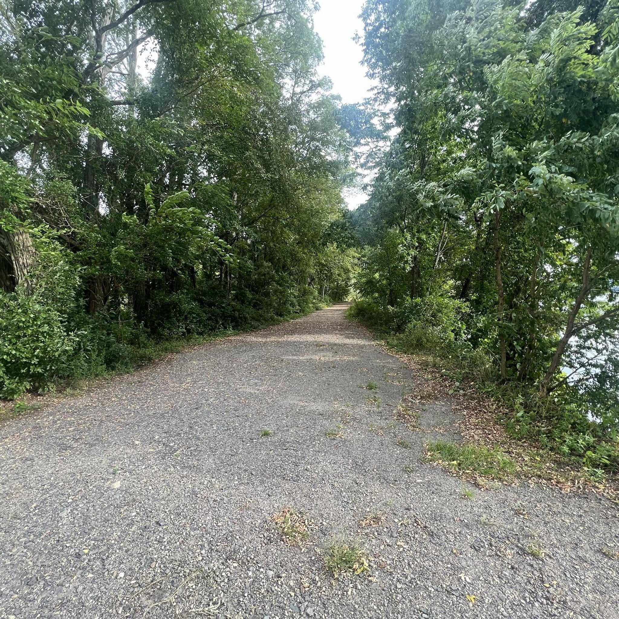
Running Trails around Hinsdale

Running Trails in Monadnock State Park

Running Trails around Winchester

Running Trails around Troy

Running Trails around West Swanzey

Running Trails around Marlborough

Running Trails in Annett State Forest

Running Trails around Jaffrey
Other adventures in Cheshire County

Tips from the Community


Nice, quiet spot by Gilson Pond. Good area for a break in a shady spot. There are beautiful views of the woodlands across the water.
1
0
Mount Monadnock is the highest point in Cheshire County and the most popular peak in New Hampshire. It gives great views of the surrounding mountains. There are many paths that get you to the summit, so there should be a route that suits everyone's ability.
1
0

The pond is great for swimming and the edge is lined with large stones that are perfect for scrambling, picnicking, and enjoying the water.
0
0
Trailhead with parking that lets you choose whether to take the paths that bring you east to Pisgah State Forest or west to Daniels Mountain. In the high season it can get busy, so make sure to get there early to get a parking spot.
0
0
Goose Pond Trail encircles the body of water with the same name. There are multiple spots where you can stop to enjoy a view of the pond.
0
0
Goose Pond is a beautiful body of water in Goose Pond Forest. There are great views of the water from the trail that circles it.
0
0
The Cheshire Rail Trail is a 42-mile long multiuse trail. It passes through beautiful wood land. It is completely off-road, so it is a great place for a peaceful run.
1
0
Frequently Asked Questions
How many running routes are available in Cheshire County?
Cheshire County offers a wide variety of running experiences, with over 40 routes documented on komoot. These range from easy loops to challenging mountain trails, catering to all fitness levels.
Are there any easy or family-friendly running paths in Cheshire County?
Yes, Cheshire County has several easy and family-friendly options. The region's extensive rail trails, such as sections of the Cheshire Recreational Rail Trail, offer relatively flat surfaces suitable for all ages. Additionally, the Gilson Pond Remote Campsites Loop in Monadnock State Park is an easy 2.0-mile route with gentle terrain.
What kind of terrain can I expect on running trails in Cheshire County?
You'll find a diverse range of terrain. Many routes, particularly the rail trails like the Fort Hill Recreational Rail Trail, are relatively flat with gravel or dirt surfaces. For those seeking more challenge, trails in parks like Monadnock State Park, such as the Dublin Trail, feature significant elevation changes and uneven paths.
Are there any circular running routes in the area?
Yes, several circular routes are available for runners. The Kilburn Loop in Pisgah State Park is a popular 3.0-mile option around Kilburn Pond, offering scenic forest and water views. Another great choice is the Parker and Lost Farm Trail Loop, which provides a moderate 3.8-mile run.
Can I bring my dog on the running trails in Cheshire County?
Many trails in Cheshire County are dog-friendly, but it's always best to check specific park or trail regulations before heading out. Generally, dogs are welcome on leash on rail trails and in many state parks. For example, the Wantastiquet Mountain Natural Area River Trail is a great option for running with your canine companion.
What natural features or landmarks can I see while running in Cheshire County?
Cheshire County's trails offer stunning natural beauty and interesting landmarks. You can enjoy views of the Connecticut River from trails like the Wantastiquet Mountain Trail, or experience the serene beauty of ponds like Kilburn Pond on the Kilburn Loop. For panoramic vistas, consider trails leading towards Mount Monadnock Summit. You might also encounter lakes such as Lily Pond or Spofford Lake near some routes.
Is public transport available to access running trailheads?
While some trailheads might be accessible via local public transport routes in larger towns like Keene, many of Cheshire County's more remote trails and state parks are best reached by car. It's advisable to check local bus schedules for specific towns if you plan to rely on public transport for access to trails like the Cheshire Rail Trail.
Are there any permits required for jogging on trails in Cheshire County?
Generally, individual joggers do not require specific permits for most public trails, including the rail trails. However, state parks like Monadnock State Park may have entrance fees or parking fees, especially during peak seasons. It's always a good idea to check the specific park's website for the most current information on fees or regulations before your visit.
What is the best time of year to go running in Cheshire County?
Cheshire County offers great running opportunities year-round. Spring and fall provide pleasant temperatures and beautiful scenery, with vibrant foliage in autumn. Summer is also popular, though it can be warm, making early morning or late afternoon runs ideal. Winter running is possible on many trails, especially the flatter rail trails, but requires appropriate gear for snow and ice.
Are there places to eat or stay near the running routes?
Yes, many towns connected by the rail trails or located near state parks offer amenities. Keene, for instance, has various cafes, pubs, and accommodation options close to sections of the Cheshire Rail Trail and Ashuelot Rail Trail. Smaller towns like Fitzwilliam, Troy, and Walpole also provide local establishments where you can refuel or find lodging after your run.
How long are the running routes in Cheshire County?
The running routes in Cheshire County vary significantly in length. You can find shorter loops like the Gilson Pond Remote Campsites Loop at 2.0 miles (3.1 km), perfect for a quick run. For longer distances, the Cheshire Recreational Rail Trail offers extended sections, with one popular segment being 13.8 miles (22.2 km).
Most popular routes in Cheshire County
Most popular attractions in Cheshire County

Get inspired with the komoot mobile app


Didn’t find what you were looking for?
Check out more Running Trails & Routes throughout Cheshire County below and find the perfect route in your destination.
Explore more
Browse the best Running Trails & Routes in other regions.
