The best walks and hikes in Ashland County
4.6
(8)
137
hikers
12
hikes
Hiking in Ashland County leads through the varied landscapes of northern Wisconsin, characterized by the dense woodlands of the Chequamegon-Nicolet National Forest. The terrain features routes that follow shorelines, pass waterfalls, and navigate rolling forest paths. The area's trail network includes sections of the long-distance North Country Trail, offering a mix of accessible walks and more demanding hikes.
Best hiking trails in Ashland County
- The most popular hiking route is Morgan Falls and St. Peter's Dome Trail, a 3.0…
Last updated: August 18, 2026
5.0
(1)
19
hikers
4.88km
01:23
110m
100m
Easy hike. Great for any fitness level. Easily-accessible paths. Suitable for all skill levels.
13
hikers
5.06km
01:18
20m
20m
Easy hike. Great for any fitness level. Easily-accessible paths. Suitable for all skill levels.

Sign up for free
1.49km
00:25
30m
10m
Easy hike. Great for any fitness level. Easily-accessible paths. Suitable for all skill levels.
1
hikers
1.20km
00:19
20m
0m
Easy hike. Great for any fitness level. Easily-accessible paths. Suitable for all skill levels.
4.0
(2)
21
hikers
6.02km
01:40
110m
110m
Easy hike. Great for any fitness level. Easily-accessible paths. Suitable for all skill levels.
4.8
(5)
43
hikers
2.81km
00:46
40m
40m
Easy hike. Great for any fitness level. Easily-accessible paths. Suitable for all skill levels.
14
hikers
5.83km
01:30
30m
30m
Easy hike. Great for any fitness level. Easily-accessible paths. Suitable for all skill levels.
7
hikers
10.6km
02:42
30m
30m
Moderate hike. Good fitness required. Easily-accessible paths. Suitable for all skill levels.
7
hikers
3.88km
00:59
10m
10m
Easy hike. Great for any fitness level. Easily-accessible paths. Suitable for all skill levels.
6
hikers
5.99km
01:37
80m
80m
Easy hike. Great for any fitness level. Easily-accessible paths. Suitable for all skill levels.
Get access to more routes and recommendations from other explorers.
Sign up for free
Already have an account?
Our route recommendations are based on thousands of hikes, rides, and runs completed by other people on komoot.
Start today with a free account
Your next adventure awaits.
Login or Signup



Tips from the Community

Brownstone Falls in Wisconsin's Copper Falls State Park is a captivating gem, boasting a picturesque waterfall enveloped by striking reddish-brown rock formations. Despite its modest 30-foot height, the surroundings impart a grandeur that captivates.
0
0

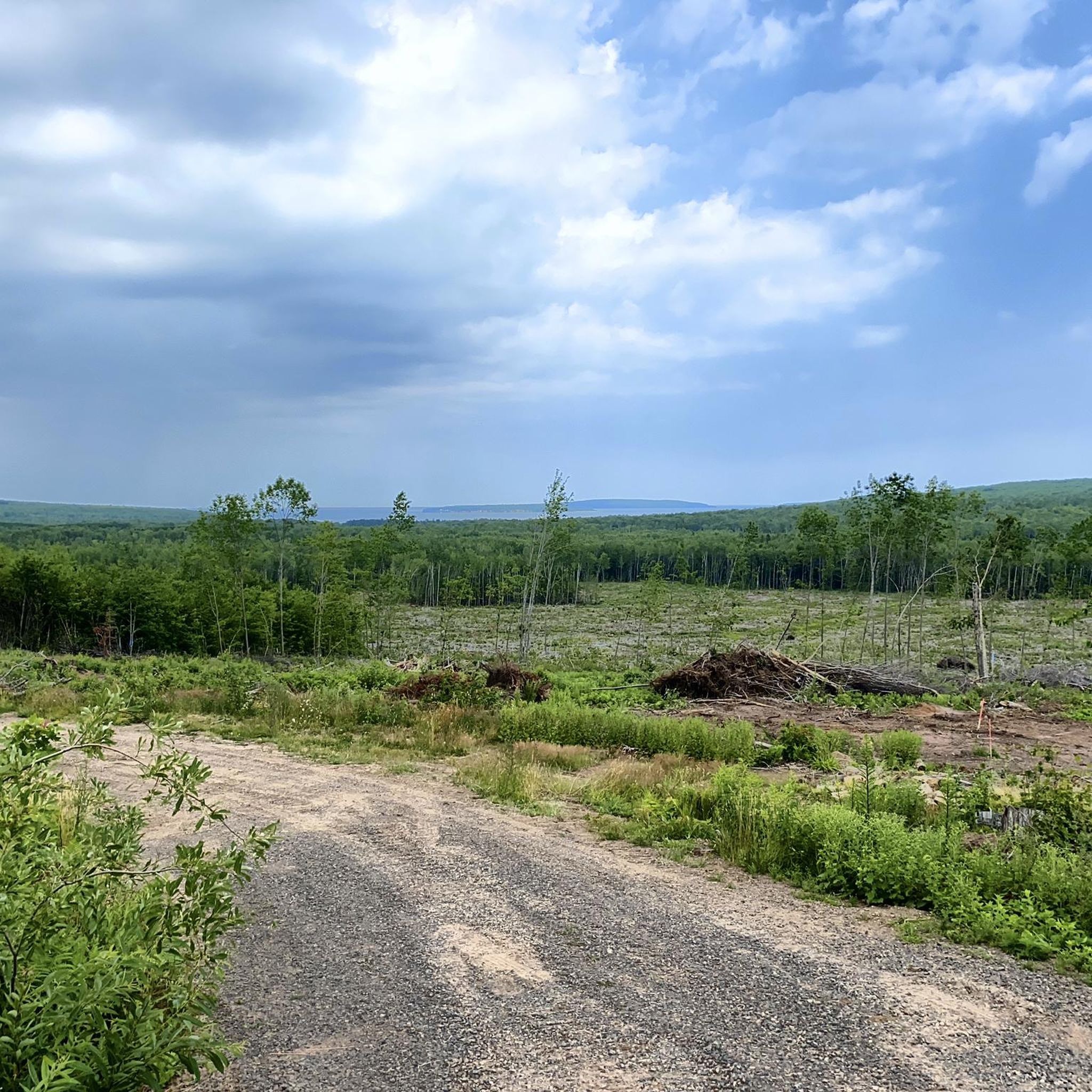
On a good day you can see all the way to Lake Superior from the summit. This is a fantastic hike in the autumn when the leaves are changing. The trail is more of a traditional hiking path with rocks and roots than the first gravel segment towards Morgan Falls.
0
0
Here you can splash around in the shallow water or climb up the rocks by the falls. The trail is shaded and easy to get to. This is the perfect hike for small children.
0
0
The trail to Morgan Falls is well-maintained and sports scenic wooden bridges over Morgan Creek. There may be a parking fee. Be sure to bring bug spray for the mosquitos off of Beaver Pond!
0
0

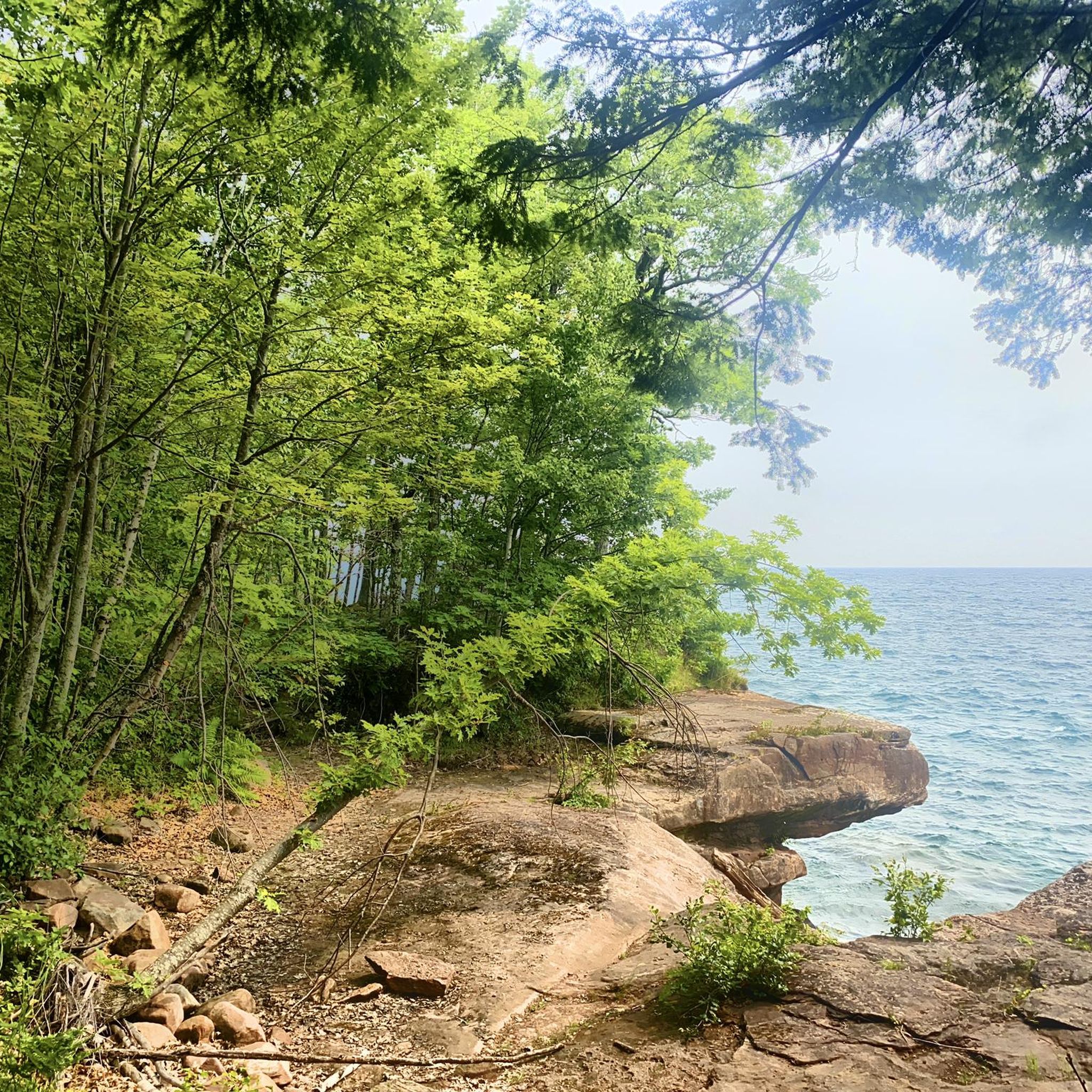
Although there are many spectacular views all along the shoreline of Madeline Island, this one is worthy of pointing out because it is easily accessible with a short walk in Big Bay State Park.
4
0
Although there are many spectacular views all along the shoreline of Madeline Island, this one is worthy of pointing out because it is easily accessible with a short walk in Big Bay State Park.
2
0
Frequently Asked Questions
Are there any easy, family-friendly hikes in Ashland County?
Yes, the area offers several accessible trails perfect for families. A great option is the Brownstone Falls view loop from Mellen, a short walk of about 1.7 miles (2.8 km) that leads to a scenic waterfall viewpoint. It's a manageable and rewarding outing for hikers of all ages.
Can I bring my dog on the hiking trails?
Generally, dogs are welcome on trails in the Chequamegon-Nicolet National Forest, but they must be kept on a leash and under your control. Always check specific park regulations before you go. Trails like the Black Lake loop offer a great opportunity for a walk with your canine companion through the forest.
Where can I find hikes that feature waterfalls?
Ashland County is known for its beautiful waterfalls. The Morgan Falls Trailhead – Morgan Falls loop from Self-Service Pay Station is a popular choice, offering a relatively easy path directly to the stunning Morgan Falls. The trail is well-maintained, making the falls accessible to most hikers.
Are there any challenging, long-distance hikes for experienced hikers?
Yes, for those seeking a serious challenge, the region includes difficult sections of the North Country Trail. The Lake Three via North Country Trail is a demanding trek of over 19 miles (31 km) that takes you through remote and rugged forest terrain, rewarding you with solitude and pristine nature.
What are the most scenic viewpoints on hikes in Ashland County?
For a spectacular panoramic view, the climb to St. Peter's Dome is a must. The Morgan Falls and St Peter's Dome Trail leads to a granite outcrop offering expansive views over the Chequamegon-Nicolet National Forest. The effort to reach the top is well worth it for the breathtaking scenery.
Are there any good circular or loop trails available?
Absolutely. If you prefer to end your hike where you started without backtracking, there are several loop options. The Big Bay Lagoon loop from Red Cliff is a wonderful choice that takes you along the water, offering a pleasant and varied walk of about 3.6 miles (5.8 km).
What kind of terrain can I expect on the trails?
The terrain in Ashland County is quite varied. You'll find everything from gentle, well-maintained paths along shorelines to rugged, rolling forest trails with significant elevation changes. Many routes, like the Hiking loop from O'Brien South Shore, navigate through the dense woodlands characteristic of the Chequamegon-Nicolet National Forest.
What do other hikers say about the trails in Ashland County?
The area is highly rated by the komoot community, with an average score of 4.9 stars. Hikers often praise the well-marked trails, the beauty of the dense forests, and the impressive waterfalls. The mix of accessible walks and more remote, challenging hikes is frequently mentioned as a major highlight.
Are the hiking trails in Ashland County free to access?
Many trails are free, but some areas, particularly within national forests or state parks, may require a day-use fee or a vehicle pass for parking at the trailhead. For example, trailheads for routes like the North Country Trail often have self-service pay stations. It's always a good idea to have some cash on hand.
What is a good hike for a full day of exploring?
For a longer day out on the trail, consider the North Country Trail — Swedish Settlement to Porcupine Lake Trailhead. This 11.6-mile (18.7 km) section offers an immersive experience in the remote backcountry of the national forest, perfect for a full day of dedicated hiking.
Are there any trails that are good for shoreline or lakeside hiking?
Yes, you can find beautiful hikes that follow the water's edge. The Barrier Beach loop from O'Brien South Shore is a moderate hike of about 6.4 miles (10.3 km) that offers lovely views along the shoreline, combining forest paths with open, sandy stretches.
Most popular attractions in Ashland County

Get inspired with the komoot mobile app


Didn’t find what you were looking for?
Check out more Hikes throughout Ashland County below and find the perfect route in your destination.
Explore more
Browse the best Hikes in other regions.
