1.
Mountainbike loop from Río Majada
16.7km
01:18
170m
170m
Easy mountain bike ride. Great for any fitness level. Suitable for all skill levels.
View route
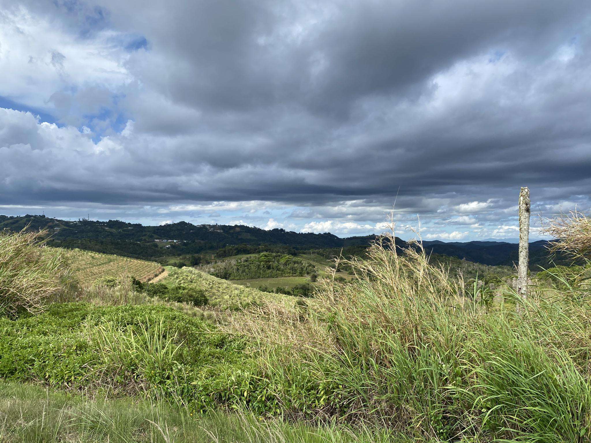
By Fede from komoot
·
Updated May 30, 2026
If you've ever tried to plan mountain biking in Salinas Municipio, you know how quickly the sheer number of routes can become overwhelming. It's tough to tell which trails are genuinely worth your time and effort, and which are just filler. That's where we come in: our komoot community has ridden, reviewed, and rated these routes, giving us the inside track on what's truly special. We've sifted through the options to bring you a curated shortlist, saving you the guesswork.
Mountain biking in Salinas Municipio offers a unique blend of experiences. You'll find everything from dry coastal areas to more elevated terrain, with plenty of hills and singletracks winding through areas with some tree cover. It's a region that truly caters to all skill levels, from easy loops to demanding climbs, all set against the backdrop of Puerto Rico's southern coast.
If you only do one ride, make it the challenging El Torito loop from Aguirre, a popular 46.5 miles (74.9 km) route that delivers a serious workout and big rewards. For something a bit more moderate but still incredibly scenic, we highly recommend the Monte Brujo loop from Cerro Garau, a local favorite covering 24.8 miles (39.9 km). With more than 100 mountain bikers already exploring Salinas Municipio with komoot, you're in good company. Get out there and discover your next favorite trail!
Trail | Distance | Elevation | Difficulty |
|---|---|---|---|
| Mountainbike loop from Río Majada | 16.7 km | 170 m | Easy |
| Monte Brujo loop from Servidumbre Escénica Montes Oscuros | 70.4 km | 410 m | Hard |
| Mountainbike loop from Servidumbre Escénica Montes Oscuros | 31.2 km | 160 m | Easy |
| Playa La Ochenta – Puente de los Poleos (Nº 21) loop from Barrio Pueblo | 34.2 km | 100 m | Moderate |
| Monte Brujo loop from Cerro Garau | 39.9 km | 610 m | Moderate |
| Piedra de Degetau – Cerro El Indio loop from Algarrobo | 60.7 km | 1,250 m | Hard |
| Mountainbike loop from Aguirre | 29.9 km | 140 m | Easy |
| El Torito loop from Reserva Natural de Investigación Estuarina Bahía de Jobos | 74.9 km | 1,330 m | Hard |
Sign up to see all 8 routes
Sign up for free16.7km
01:18
170m
170m
Easy mountain bike ride. Great for any fitness level. Suitable for all skill levels.
View route
70.4km
05:15
410m
410m
Hard mountain bike ride. Very good fitness required. Suitable for all skill levels.
View route
31.2km
01:54
160m
160m
Easy mountain bike ride. Great for any fitness level. Suitable for all skill levels.
View route

34.2km
02:09
100m
100m
Moderate mountain bike ride. Good fitness required. Suitable for all skill levels.
View route
39.9km
03:27
610m
610m
Moderate mountain bike ride. Good fitness required. Suitable for all skill levels.
View route
60.7km
04:21
1,250m
1,250m
Hard mountain bike ride. Very good fitness required. Suitable for all skill levels.
View route
29.9km
01:53
140m
140m
Easy mountain bike ride. Great for any fitness level. Suitable for all skill levels.
View route
74.9km
05:15
1,330m
1,330m
Hard mountain bike ride. Very good fitness required. Suitable for all skill levels.
View route
Get access to more routes and recommendations from other explorers.
Already have an account?
Salinas Municipio offers a diverse range of mountain biking experiences, from dry coastal areas to more elevated terrain. You'll find a mix of singletracks and routes catering to various skill levels. The region's dry climate means minimal rainfall, providing consistent riding conditions, often with about 30% tree cover for shade.
Yes, there are several easy mountain bike trails. For instance, the Mountainbike loop from Río Majada is an easy 10.4-mile (16.7 km) route that takes about 1 hour 18 minutes to complete. Another easy option is the Mountainbike loop from Aguirre, which covers 18.6 miles (29.9 km).
For experienced riders seeking a challenge, the El Torito loop from Aguirre is a difficult 46.5-mile (74.9 km) trail with significant elevation gain, typically taking over 5 hours. Another demanding option is the Monte Brujo loop from Servidumbre Escénica Montes Oscuros, a difficult 43.8-mile (70.5 km) route.
Absolutely. The Monte Brujo loop from Cerro Garau is a popular moderate trail covering 24.8 miles (39.9 km), offering a balanced ride through varied terrain. Another moderate option is the Cerro La Guásima loop from Cayey, which is 23.5 miles (37.8 km) long.
Salinas Municipio experiences a dry climate with minimal rainfall, making it suitable for mountain biking year-round. However, the dry season generally offers the most consistent and pleasant riding conditions.
Yes, the region offers several interesting natural features. You can explore Piedras del Collado, also known as 'Las Tetas de Cayey,' a distinctive geological formation and natural reserve. Salinas Bay is also nearby, offering water-based activities and a boardwalk. While not directly on trails, the Albergue Olímpico and its summer water park are also regional attractions.
The mountain bike routes in Salinas Municipio are highly rated by the komoot community, with an average score of 4.5 stars. Riders often praise the diverse landscapes, varied singletracks, and the range of options available for different ability levels.
Many of the mountain bike routes in Salinas Municipio are designed as loops, offering convenient starting and ending points. Examples include the Mountainbike loop from Río Majada and the Monte Brujo loop from Cerro Garau.
Trail distances vary significantly, catering to different endurance levels. You can find shorter loops around 10 miles (16 km), such as the Mountainbike loop from Río Majada, up to longer, more challenging routes like the El Torito loop from Aguirre, which is 46.5 miles (74.9 km).
While specific family-friendly routes are not detailed, the presence of easy-grade trails suggests options for families. It's advisable to check the difficulty and length of individual routes, such as the easy Mountainbike loop from Río Majada, to ensure they match your family's skill level.
Regulations regarding dogs on mountain bike trails can vary. It's always best to check local signage or contact the relevant park authorities for specific rules on bringing dogs, especially in natural reserves or designated trail areas.
Yes, many routes in Salinas Municipio feature singletracks. Areas like Salinas Gravity Park are known for AM Enduro trails, and Salinas Downhill offers specific downhill sections. Trails like 'Las Calabazas MTB' also provide singletrack loops with ups and downhills.
While specific parking facilities are not detailed for every trailhead, it is common for popular mountain biking areas to have designated parking. It's recommended to research parking options for your chosen trailhead in advance, especially for well-known routes like 'Los Pinchos' or areas around Salinas Gravity Park.

Browse the best MTB trails in other regions.


